Headlines
- All eyes are on a system in the tropical Atlantic
- It is not clear whether this system will ultimately develop as it tracks toward the Caribbean Sea
- Elsewhere the tropics are quiet, but there are hints this could change in a week or so
Focusing today on the Central Atlantic
The most likely candidate for the Atlantic basin’s next named storm—it would be Francine—remains a tropical wave over the Central Atlantic Ocean. As of Thursday afternoon, the National Hurricane Center continues to pin a 40 percent chance on this system becoming a tropical depression or storm in the next seven days.
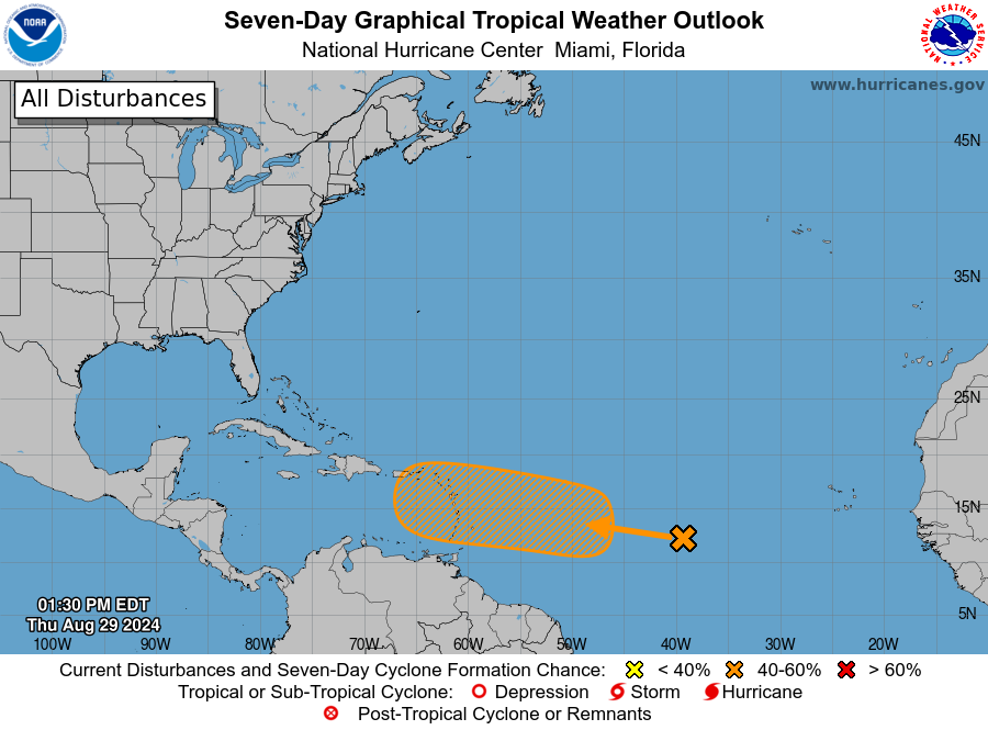
Honestly, we have a lot more questions about this system than answers. And if you’re wondering what impacts this will have after it gets into the Caribbean Sea, or downrange to the United States or Mexico, the short answer is stay tuned. It could never get off the ground, or it could eventually become a tropical system that moves into the Gulf of Mexico. We don’t know, and that’s the bottom line.
So the rest of this update will focus on what we do know. As it presently exists the system is a disorganized mass of showers and thunderstorms. However, over the next several days, it should find supportive atmospheric conditions as it approaches the Caribbean Sea. Once it passes the Leeward Islands, some development is possible. It probably would be slow.
Will it develop?
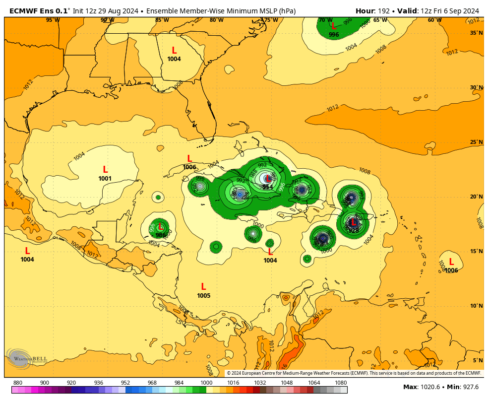
So will it? I like the National Hurricane Center odds of about 40 percent. Not all of our operational models bring the system to depression or tropical storm strength over the next week, and although there is some support in the ensembles, it is not super robust. For example, here is what the 12z ensemble forecast of the European model looks like from today. Some of the members show development, but this is far from a consensus.
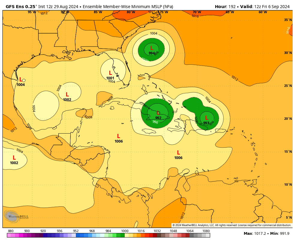
If we look at the GFS ensemble forecast for the same time period, there is even less support for anything beyond a very weak tropical storm.
So why are we paying so much attention to this system? It is because we’re now at the end of August, with September on the horizon; and the Atlantic seas are blazing hot. If a storm like this gets going, it will be difficult to stop, in terms of intensification. So yes, any tropical system moving toward the Caribbean Sea is going to catch our eye at this time of year. Especially when there’s not much else happening in the tropics unless we really squint.
In this case, we just need to watch and see what happens over the next couple of days. This system could develop and become Francine, or it could fizzle out. If it does form, it might eventually move toward the Gulf of Mexico, or turn northward before hand. We just don’t know, and won’t know, for awhile now.
There continues to be hints in the models that, regardless of what happens with this system, the tropics are going to start lighting up quite a bit in about a week or so. For now, we’re going to have to sit back and see what happens.
So basically we are guaranteed to get another hurricane hitting Houston in September? Especially with high pressure guiding everything to us?
I would think there are no absolute guarantees-
Two questions. First, in the two figures in this post, is there a corridor of low pressure leading from Caribbean into the Gulf? Second, are the lowest pressures in these figures in the Caribbean and Gulf ?
So, I’m watching closely because I have a trip to St Lucia Sunday-Friday. Do I understand correctly that the first few days may be soggy, but the main areas of potential development are north and west of St Lucia? Just wondering if you still think I should be good for this trip! Thanks again for answering earlier!