In brief: The Gulf tropical disturbance will come ashore in Texas later today, unlikely to develop at all, but bringing some locally heavy downpours at times to Houston and Lake Charles. A tropical wave next week in the Atlantic may (or may not) develop. And today’s flooding risk is highest near and southwest of Kansas City.
Gulf tropical disturbance
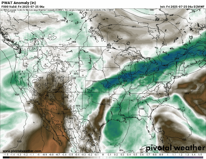
The disturbance in the Gulf that’s been carrying a 10 percent risk the last few days is at the end of the road. It will crash ashore in Texas today, bringing some downpours to the Houston area.
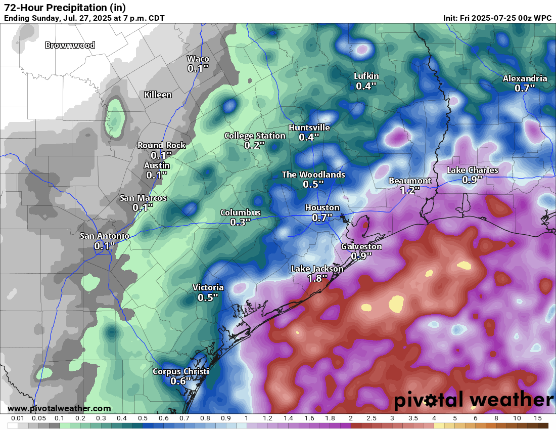
Overall, this should be a manageable event, but perhaps one or two places will see some street flooding concerns crop up from Houston through Beaumont into Lake Charles.
Interestingly, this system is going to continue to race west across Texas. Some of the added atmospheric moisture from it may get tired up within the monsoon pattern out West, which could lead to some enhanced moisture for New Mexico, Colorado, Arizona, and Utah.
Otherwise, assuming nothing major changes, we’ll close the book on this one today.
What’s next in the tropics?
Well, it appears that we’re going to have our first true item to watch in the Atlantic next week. The system this past weekend only sort of counted. Next up, we’re watching models (and some of the usual social media suspects) get a little worked up about a tropical wave expected to emerge in the Atlantic next week.
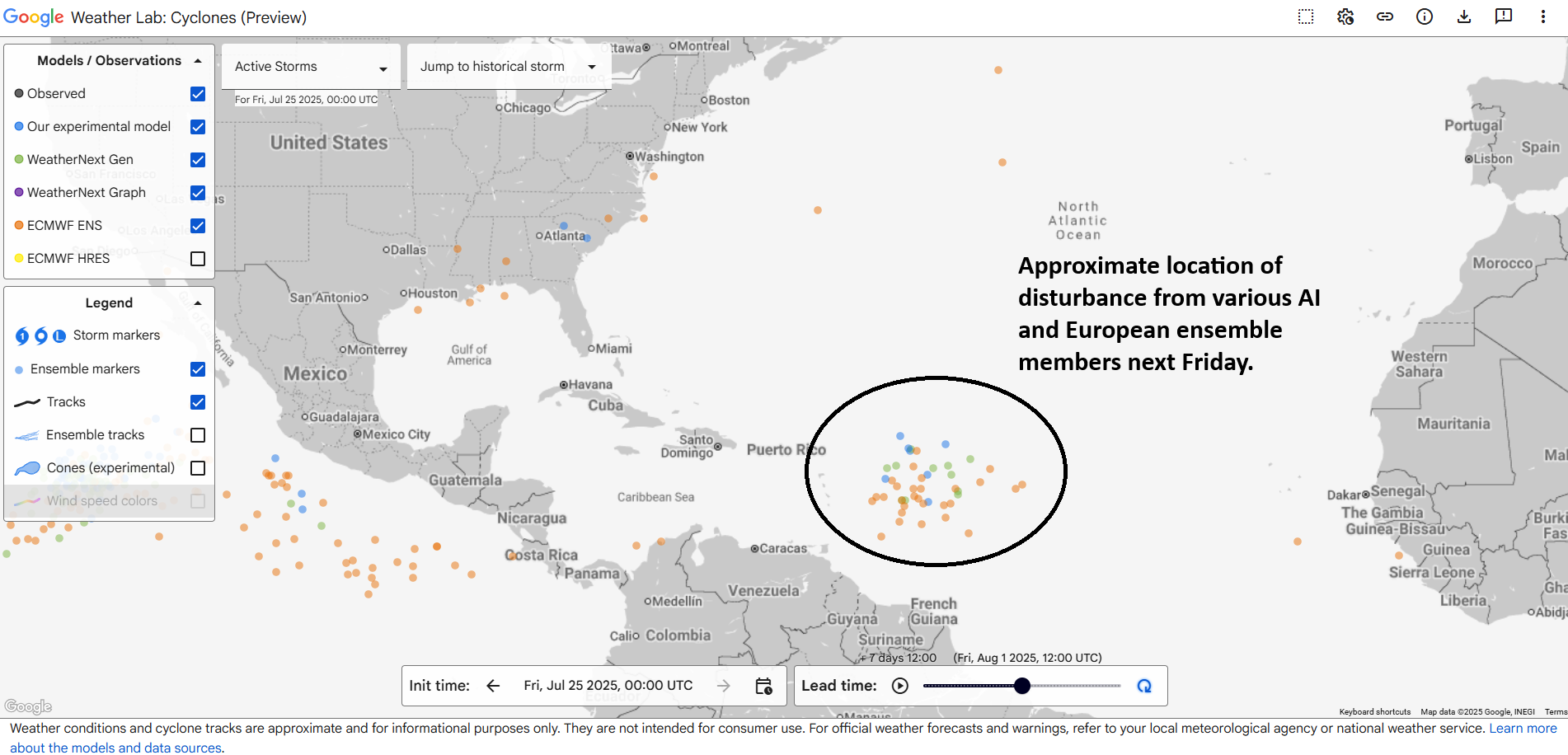
So, ok, that’s actually not terrible agreement for a 7 day forecast for a nascent wave that hasn’t developed yet. Where is this disturbance now? Wayyyyyy over Africa.
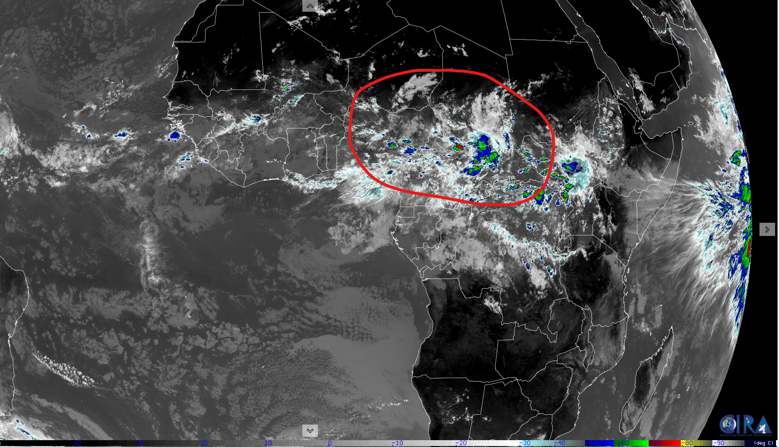
This thing has 2,000 miles of land yet to traverse before it even emerges in the Atlantic. And then from there, it’s got about 7 more days to get to the Caribbean. So, we’re at least 10 days out from something making it to the islands, let alone to the U.S. or elsewhere in the Western Hemisphere. So what can we say today? Models are latching onto a disturbance that has at least some chance to develop as it traverses the Atlantic later next week. But it’s far too soon to speculate on anything else, and thus, not worth hypothesizing or fantasizing about what may happen in 14 or more days.
Bottom line: We’ll keep watching and leave the rampant speculation to others.
Flooding risk focuses on Kansas and Missouri
Some parts of Missouri and Kansas on either side of Kansas City saw anywhere from 4 to 6 inches of rain yesterday, with even some higher radar estimates. Those same areas are now in a moderate risk (3/4) today for excessive rainfall and flooding.
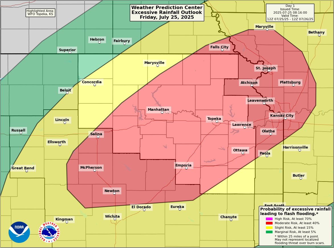
Flash flood warnings are already ongoing in some of these areas, including for the southeast half of the KC Metro. An additional 2 to 5 inches is possible in spots through the day today.
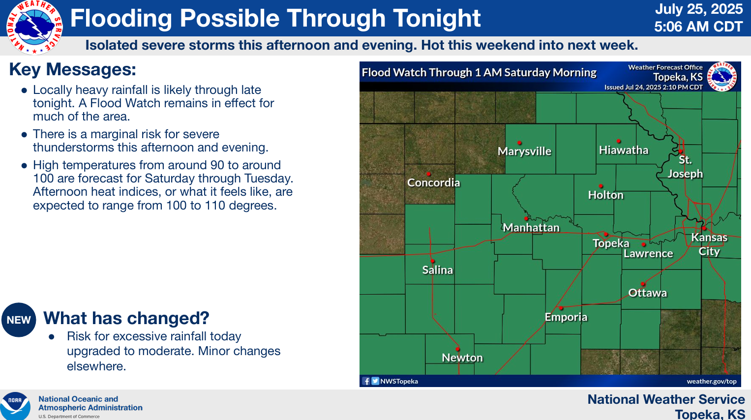
Showers and storms will wax and wane through the day.