Headlines
- Tropical development remains possible next week just east of the Caribbean islands.
- No signs of anything imminently bad or significant yet, but it’ll be the primary area to watch.
- The Gulf Coast will get soaked through next week with at least some low-end risk that something could try to form in the Gulf later next week.
- An additional system or two will be possible heading into the week of the 12th, but details are minimal right now.
Atlantic to awaken
Even before Ernesto exited on August 20th, it was apparent that we were headed into a somewhat lengthy lull in tropical action in the Atlantic basin. The signs of the nap ending are continuing to stack up as we head toward next week. Let’s be clear right away: This doesn’t mean that things are going to go crazy all of a sudden (though one can’t rule that out this year), nor does it necessarily mean there’s an imminent threat to anyone. But there will be more noise than we’ve seen since Ernesto.
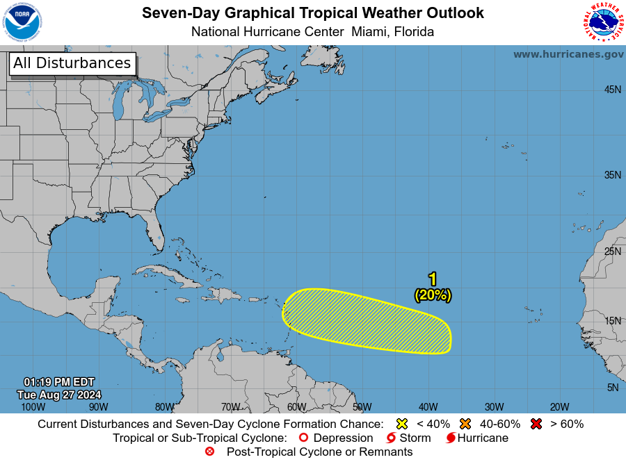
An area of interest got identified yesterday by the National Hurricane Center with odds of 20 percent for development over the next week. Those aren’t especially high, but as we’ve seen from storms this year, they all started from generally low probability points. I personally think the chance over the next five days is close to zero, with chances rapidly increasing on days six to seven, so I would expect this potential to increase tomorrow and Thursday.
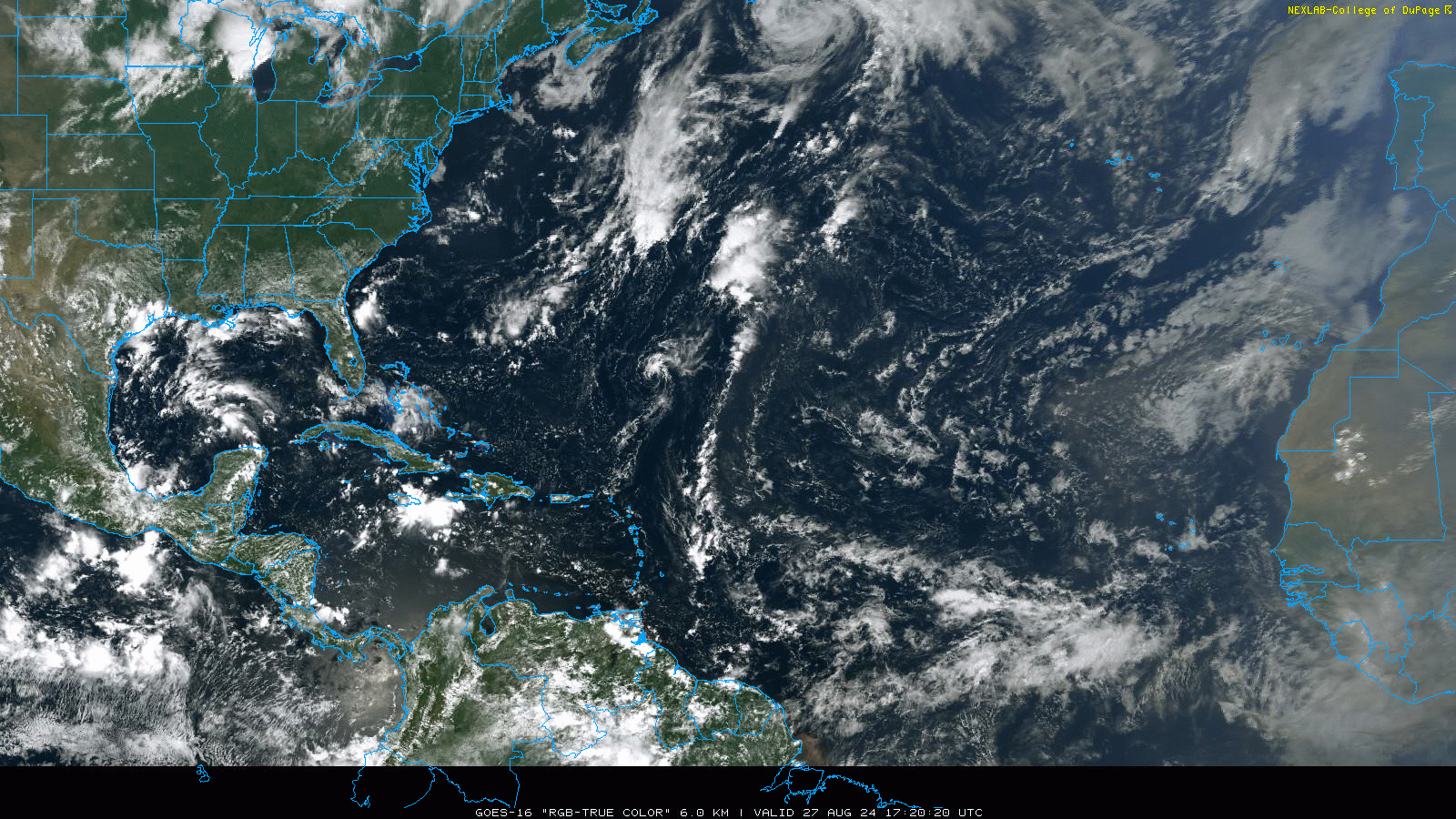
The area of note is from the mass of clouds in the Atlantic between the Caribbean and Africa, just southwest of the Cabo Verde Islands off Africa right now.
This doesn’t look like much at this time, which is sort of the point. Any development from this area is going to be sluggish over the next five days or so, which is why I’m not particularly keen on anything here until next week.
But, support within modeling for this area to eventually develop continues to sustain today. Overnight runs of the European ensemble model and GFS ensemble model show at least marginal support for something to develop just east of the islands early next week. This may get off the ground slowly, but it should get off the ground. Looking at the GFS ensemble from this morning, you can see a decent signal for below average sea level pressure just east of the islands next Tuesday.
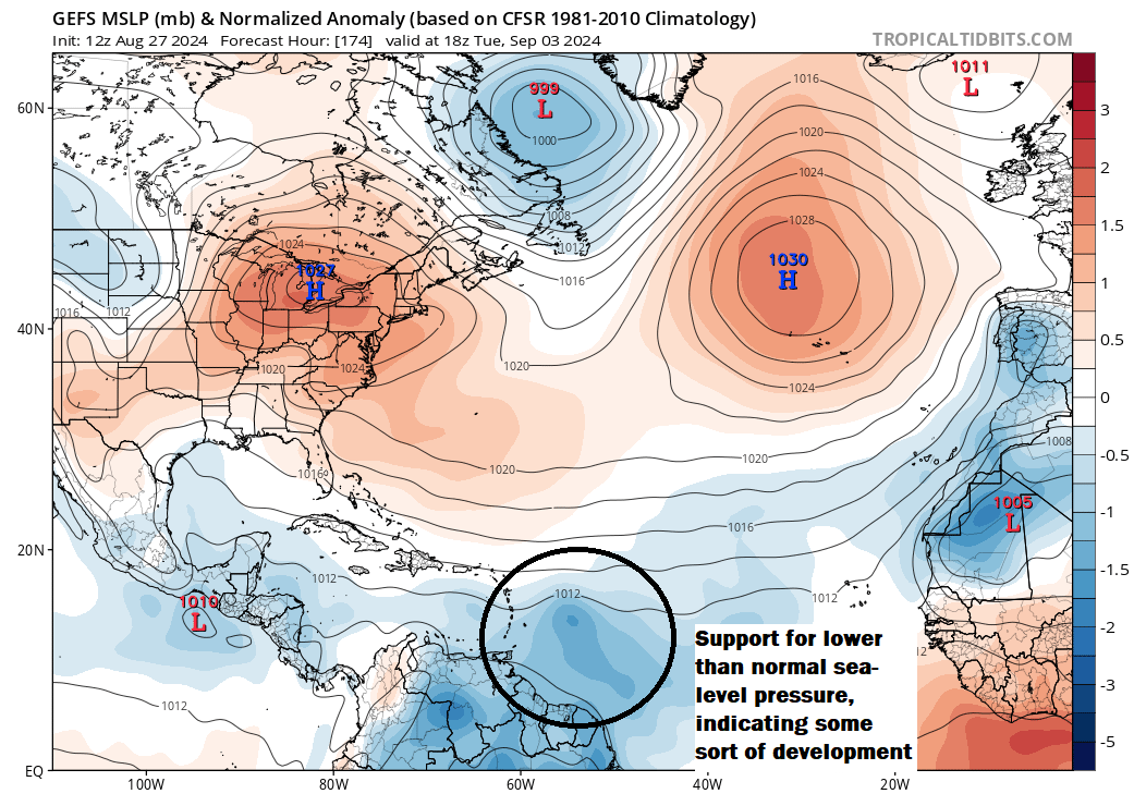
This doesn’t mean a big storm or even a well-organized storm. But it’s a signal that adds to other signals that supports development.
From here, where would this go? Great question. There seem to be mixed signals today in modeling in terms of exact details on where high pressure will establish and move in the Atlantic next week. So, much like yesterday, I don’t want to overspeculate on where this could end up going. Just know that we continue to see potential next week just east of the islands, and those in the islands should monitor the progress of this forecast.
Gulf soaker
Meanwhile, looking farther west, the Gulf continues to look unsettled well into next week. While there is very little signal for anything specific, just the fact that we have a lot of moisture, thunderstorm chances, and little movement means we’ll be seeing a lot of festering in the Gulf next week. We’ve got disturbances, stalled fronts, and more just sort of sitting there. It remains more of a curiosity than a concern at this point, but it will be an area I’d watch later next week out of an abundance of caution.
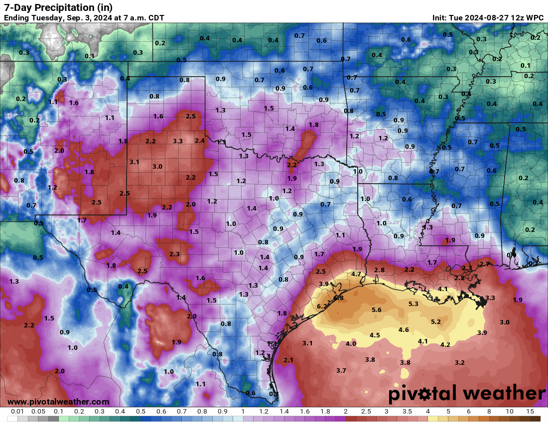
Regardless, the Gulf Coast will get soaked into next week. We could see as much as 4 to 8 inches or even more in spots between about Matagorda Bay and New Orleans. Coastal locations are most likely to see the heaviest rainfall. While flooding may not be a serious concern initially, after repeated rounds of rain, we could hear more about flooding risks in this area. We’ll continue to babysit things to be safe.
Beyond next week
After the Gulf disturbance and the system east of the islands, we’ve got one or two other waves emerging off Africa with some signals in the modeling showing up today. Nothing imminent or particularly likely, but this would make some sense. Regardless, expect things to get busier after next week.
Going on a vacation next week to the Panama City area in Florida. Should I be worried?
I wouldn’t worry, but I’d keep plugged in in case something changes.
For Houston, there seems to be significant wind shear forecast in the Gulf by the ensembles around September 7. The climate weekly model shows higher than average wind shear for the rest of the month. Is this good news in regards to less chance of another hurricane strike here?
Theoretically it would be, but I’m also not sure I’d be overly trusting of the wind shear forecasts this far in advance.
How reliable is the CFSv2? I found it did pretty good last season. It showed a very dry Caribbean last season and outside Idalia, no storms formed there.
What about that little low system in the middle of the Atlantic that looks like a small tropical storm? It has been going for a few days and seems to be getting better defined despite wind shear. Could it develop?
No signal for it to do so at this point, but you never know if you could sneak out a subtropical storm or something.
You advertise as no HYPE but that’s what you are. Preach FEAR FESR FEAR……Blah blah blah 😑
What?
You can’t please everyone. I personally appreciate the coverage here and on Space City Weather.
I really truly don’t see how any of the article that you commented on (or any of the articles remotely recently) proclaim anything remotely close to fear. It is all statistical analyses of possibilities and probabilities.
This has inspired me to create my own weather blog. Every day I will write that the weather will be all sunshine and rainbows. I will not let accuracy, science, or probability get in the way of positivity!
????????????????? Hey, you’re on the wrong channel, this ain’t the democrat convention. You must have butt-changed your remote.
You might want to sober up before posting.
Probably more of a question for the Q&A but how long does a typical (if there is such a thing) model run take? I mean we’re probably talking hours by the time they get through their various iterations. Is it possible that storms such as Beryl may outrun the ability of useful predictions? Thanks.
Is there going to be low pressure all over the Gulf, plus a tropical system entering the Caribbean, all immediately on the heels of the above predicted Gulf Soaker?
I have planned travel to St Lucia next week from Sunday-Friday? Thoughts about this?
You should be fine I would think.