In brief: The tropical wave in the eastern Atlantic continues to slowly consolidate. Development odds remain elevated over the next week, but there’s a pretty significant difference between most ensemble guidance and operational guidance versus yesterday that raises some questions. Worth continuing to monitor in the islands.
East Atlantic tropical wave
Another day, another update on the tropical wave we’ve been discussing since last week that’s still at least a couple days from even developing.
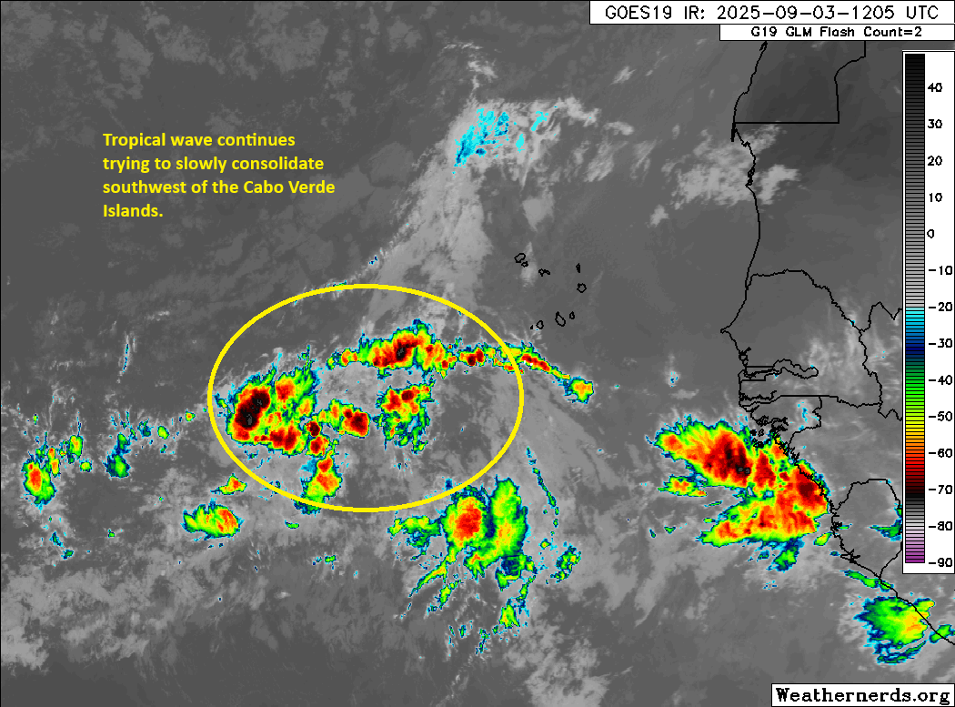
The wave looks marginally better than it did 24 hours ago; it’s a little more consolidated at least. But it remains far from really *doing* anything yet. I imagine it will approach Invest level by tonight or tomorrow, as models show further consolidation of the disturbance up around 10,000 feet altitude. All that said, my impression of the ensemble modeling this morning is that support has actually dropped a bit with respect to development. Fewer European ensemble members are developing the system, fewer of the Google Deep Mind AI ensemble members are doing so also. In other words, ensemble model support for this, broadly, seems to be stagnating. The NHC odds remain at 70 percent, and that seems fair for now.
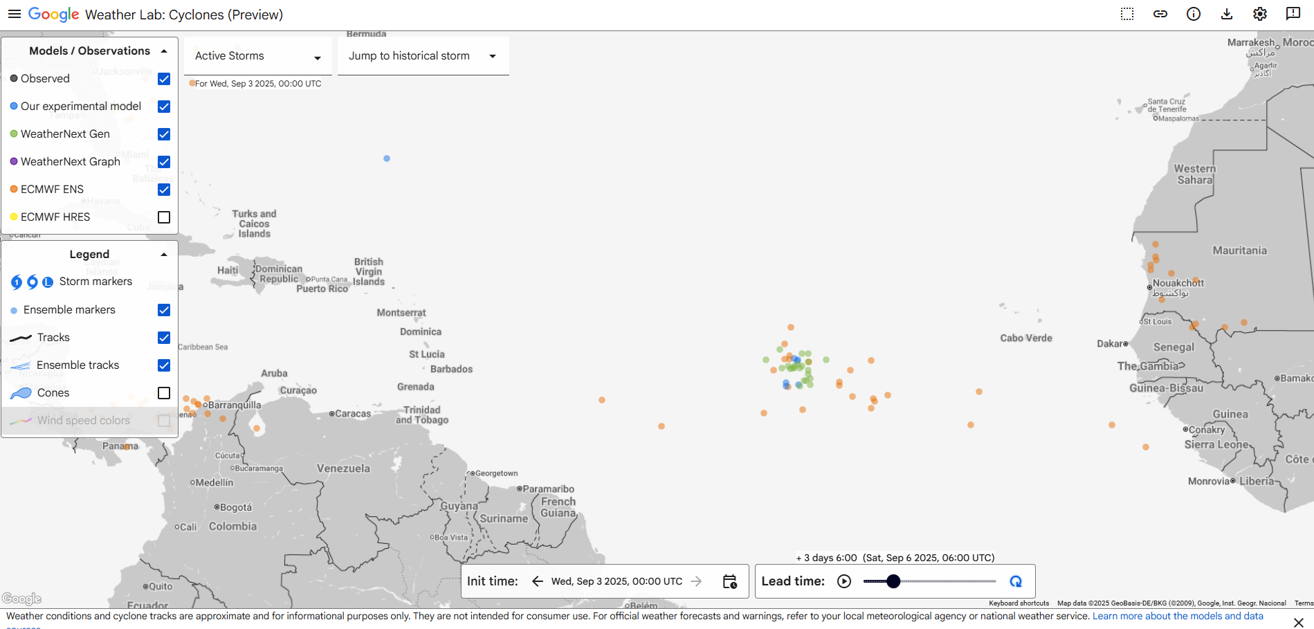
I emphasize the ensemble modeling above. Interestingly, if you look at last night’s European operational model, it actually does show it developing and developing aggressively too. Other operational models do too, the GFS less so, the ICON more so. We often preach not to pay much mind to the operational model guidance, and in this case it would also be wise to be skeptical. If you look at the current 5-day out forecast from the European operational model over the last several days, you can see how the model has waxed and waned.
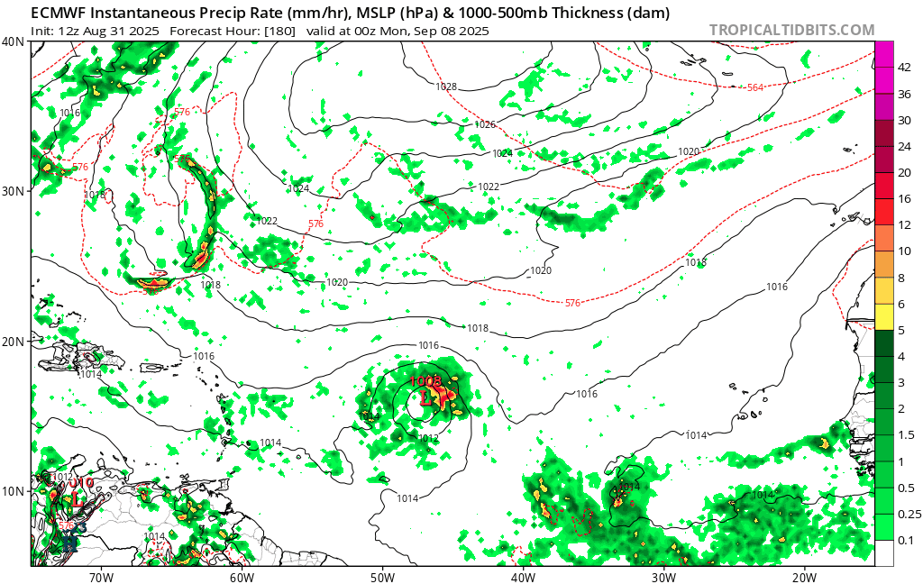
There’s a chance here that this is a smaller storm (the Euro solution in particular reminds me of what we’d call a “microcane,” or an especially small hurricane) and the higher resolution operational models are going to be more apt to “see” intensification happening rather than the AI ensembles. In my experience, storms like that have a window to do what the operational modeling says they’ll do. And if they miss the window, you can forget development. I really think this one is a tricky call. Kind of a fascinating case meteorologically too. We’ll know in a couple days whether this is a legitimate concern for the islands, but for now it makes sense to just check in each day for the latest.
Beyond the islands, it seems this gets picked up and absorbed by a trough off the East Coast. But it’s too early to speculate too much there. Right now, we just need to figure out whether this thing can even get off the ground.
Going to cut it a bit short today with a pretty full schedule today. But there isn’t much else of note in the tropics at least. More tomorrow!