In brief: Hurricane Erin is getting stronger again, and it may reach major hurricane status as it passes by the Carolinas and brings impactful storm surge to the Outer Banks. We also take a look at what is coming next in the Atlantic, and we are cautiously optimistic about things heading into September.
Hurricane Erin status
As of 11 am ET this morning, Hurricane Erin has continued to regain some of its former strength. The system now has sustained winds of 110 mph and a central pressure of 941 mb. Additionally, its eye has a better appearance on satellite which is another indication of better organization. The storm has about a day, or a day and a half to intensify further before wind shear should start to work on it. Confidence remains high in the track forecast, with Erin set to split the difference between the US mainland and Bermuda before moving out to sea later this week.
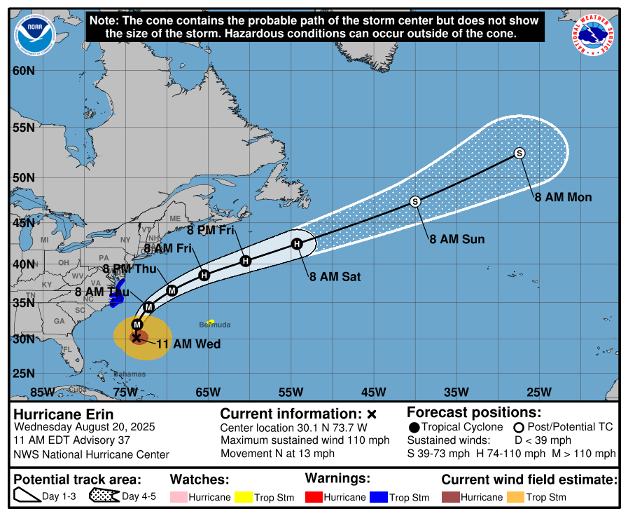
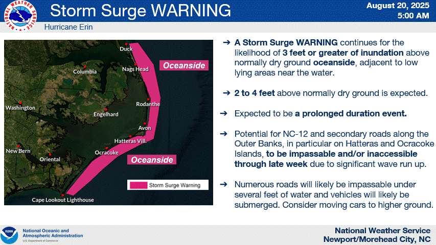
Storm surge along the Carolinas will build over the next day, with inundations of 2 to 4 feet above normally dry ground expected. This surge should be most impactful for the low-lying Outer Banks area, leading to numerous roads becoming impassable. Additional concerns include significant beach erosion, and sand being washed onto roads. Tropical Storm Warnings are in effect for coastal areas of North Carolina and Virginia.
A Tropical Storm Watch is also in effect for the island of Bermuda, where there could be high winds and dangerous surf and rip currents.
All that being said, we’ve largely been fortunate with Erin, being that it was such a powerful storm that got close to many landmasses but never directly threatened a landfall. We’ll be glad to put this system in the books over the next couple of days.
What’s next?
With the forecast for Hurricane Erin well in hand, it’s time to look ahead to what is coming next in the Atlantic season. Now that we’ve had the season’s first hurricane (and major, and Category 5 storm) it seems clear that the Atlantic tropics are open for business. We are now firmly in the most frenetic time of the year for Atlantic activity, the period from mid-August through mid-October.
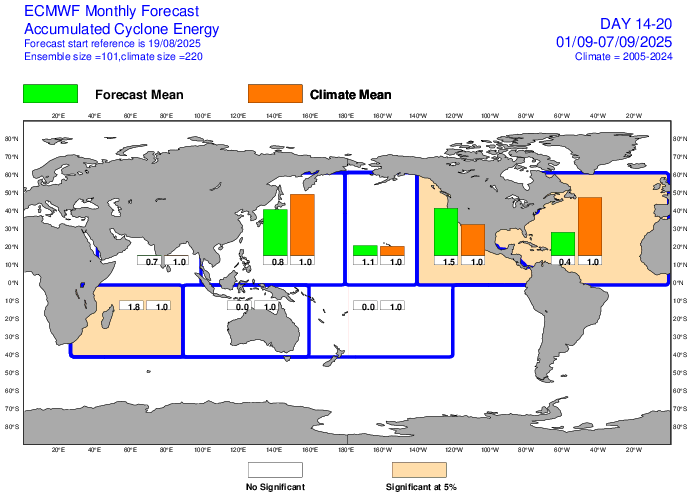
But for the rest of August, at least, the tropics look pretty tame. I don’t want to manifest anything and I am certainly not tempting Mother Nature, but I like the setup for the rest of the month. Moreover, when we peek ahead at conditions for early September, there just is not too much evidence that things are going to start sizzling any time soon. For example, here’s the latest sub-seasonal forecast from the ECMWF model for the first week of September. As you can see, it is predicting just 40 percent of normal activity in the Atlantic basin. Of course such models are far from perfect, but you would rather see such forecasts than the alternative.
With that said, let’s take a look at what we’ve got going out there.
Central Atlantic disturbance
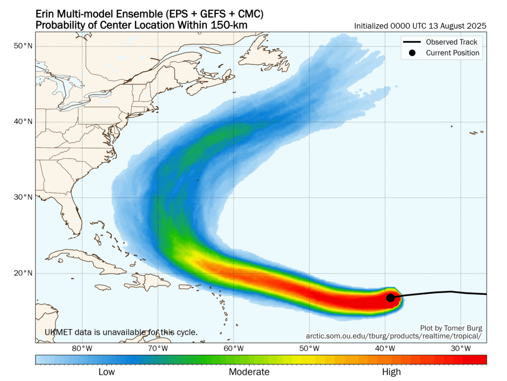
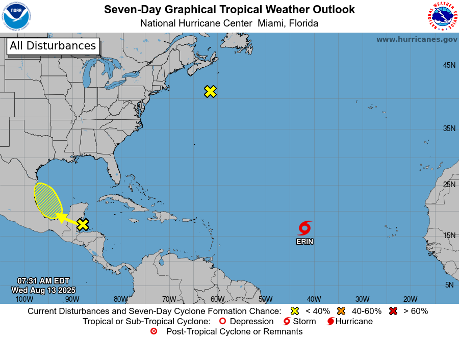
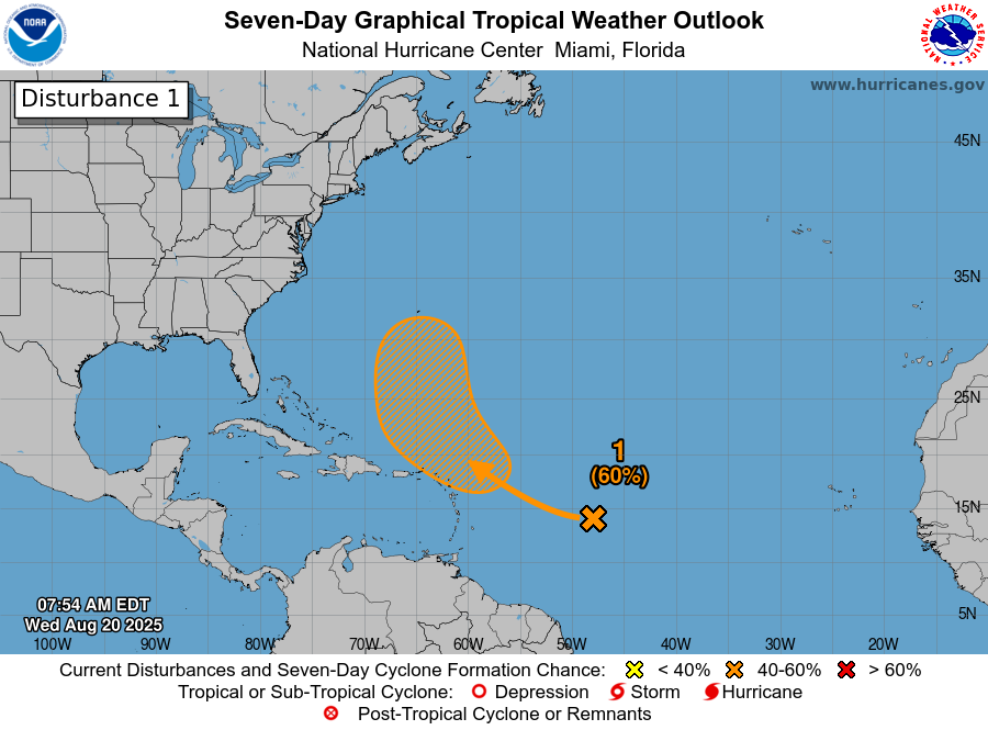
This tropical wave continues to propagate westward, and is edging closer to the Caribbean Sea. As of this morning, the National Hurricane Center gives the system a 60 percent chance of becoming a tropical storm or depression over the next week.
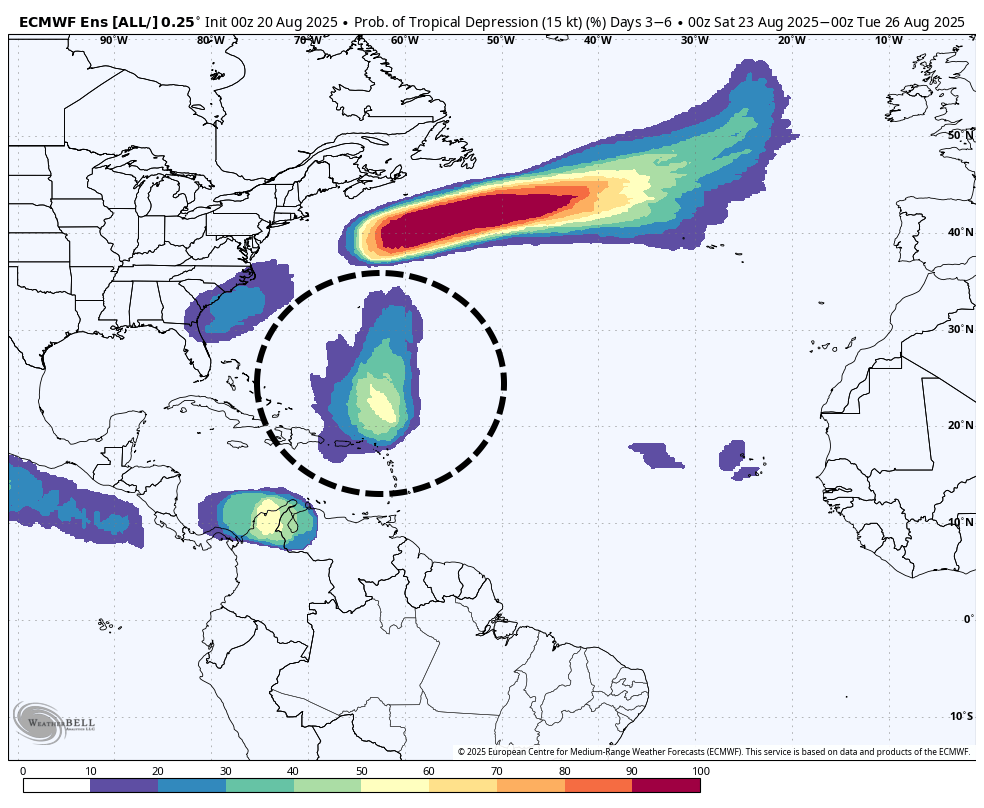
There are a variety of solutions for this system, which is natural since there is no clearly (or even poorly) defined center of circulation this morning. This makes it more difficult for models to latch onto a center and project it forward. Generally, however, most of our model solutions bring the storm northwestward, likely missing a majority, if not all of the Caribbean Islands. The image below shows the cluster of outcomes from the European model ensemble, and as you can see this is probably a fish storm.
The other thing to note is that if the storm does come closer to the Caribbean islands, including Puerto Rico, it likely is to be weaker (perhaps not even a depression) than if it recurves northward more quickly. The bottom line is that the upper-end intensity of this storm does not look all that high, and if it does get strong it’s probably going to miss land entirely. So we’ll watch it, but not with too much concern.
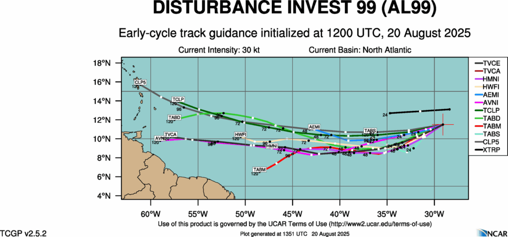
Invest 99L
The system behind that one actually got tagged as an “area of investigation,” but I’m not overly enthused about its prospects either. We can probably expect this wave to meander westward across the Atlantic and it may eventually move into the Caribbean Sea. As Matt noted yesterday these waves can be tricky, because they spend days doing nothing and then find a favorable patch of atmosphere and organize quickly. But for now there is virtually nothing, zilch, and nada in our models to indicate this will happen with 99L. So we’ll keep an eye on it, partly because beyond this there’s not much else expected to happen over the next 10 days.
Which is a great place to be in late August.