In brief: Today we run down the storms that are impacting portions of the country. We have an update in Alaska, where a remnant typhoon caused horrific damage in rural western parts of the state. Major flooding is again impacting Pagosa Spring, CO this morning, even higher than this weekend’s flood. California continues to receive lots of rain and snow and even some severe weather. And the East Coast nor’easter is exiting. The tropics are of no consequence for now, but we will watch the Caribbean next week.
Storm updates
Alaska
Starting today in Alaska. We have not discussed Alaska much, not for any nefarious reasons; we just have had limited time and space to work with here. But parts of western Alaska are reeling from the remnants of Typhoon Halong that devastated some rural communities over the weekend.
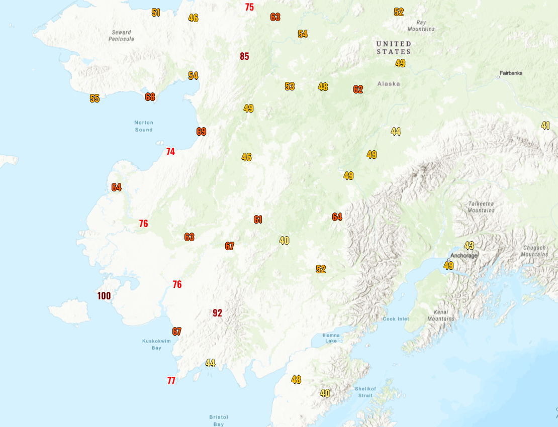
This isn’t the first time Alaska has been hammered by typhoon remnants. A somewhat broader event in 2022 from the remnants of Merbok caused widespread damage. But this storm broke some storm surge records by feet in parts of Alaska.
Alan Gerard has a good summary of the storm and some of the meteorology and forecast details (including asking the question about whether a lack of upper air weather balloon data due to budget cuts and staffing cuts within NOAA hindered the forecast at all). Read more at Balanced Weather.
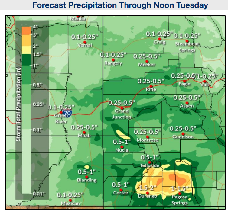
Colorado
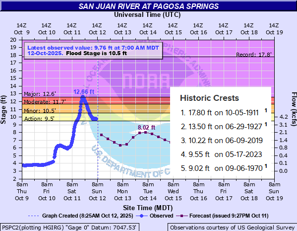
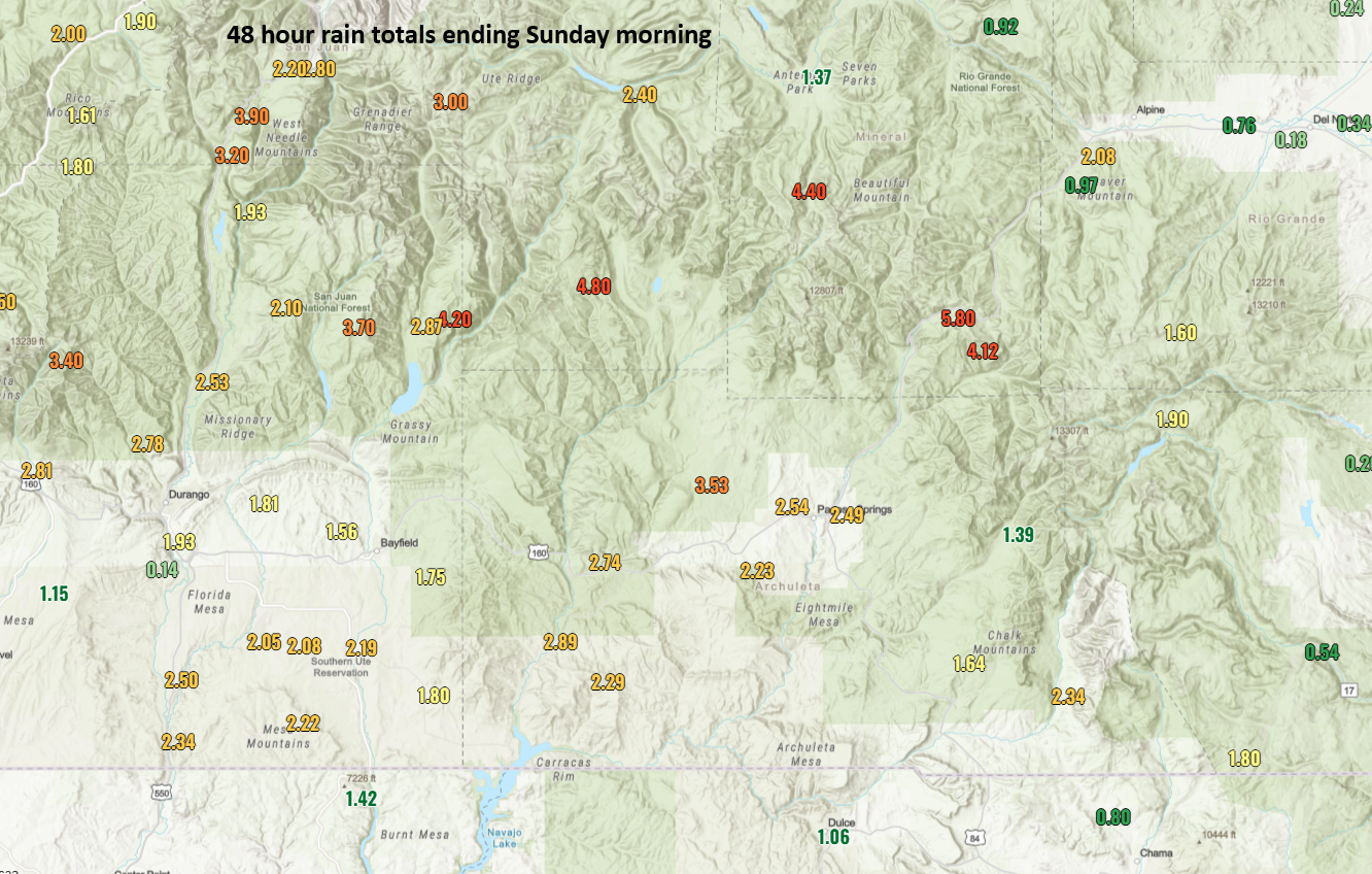
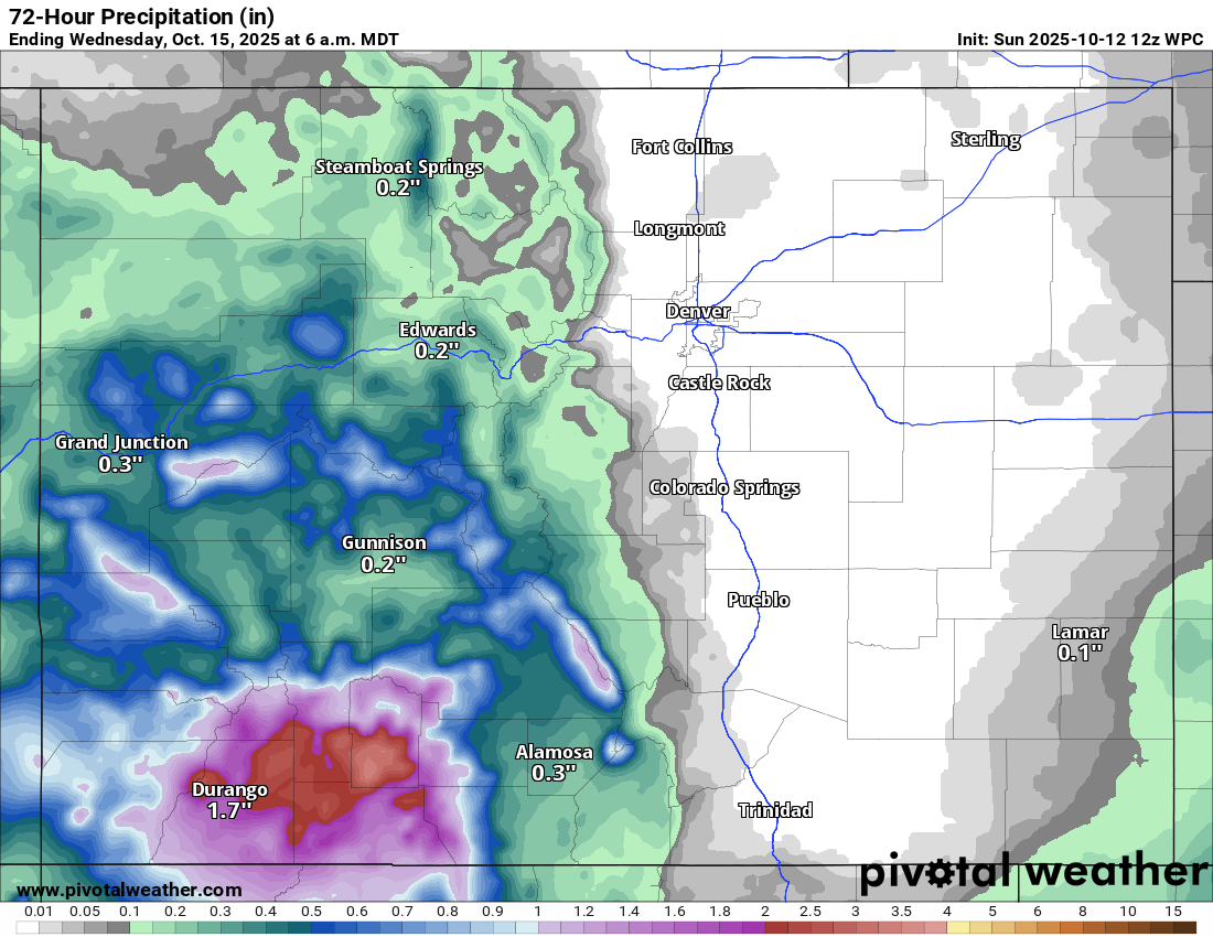
The San Juan River at Pagosa Springs is back up in major flood stage this morning, running about 0.1 to 0.2 feet above levels it hit this past weekend when it caused extensive flooding.
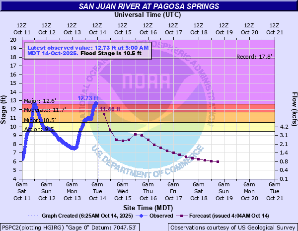
This is the third highest stage on record there, pushing this weekend to fourth highest. Rain totals above Pagosa Springs are nearly 7 inches since this weekend, which has allowed for this degree of flooding, prompting evacuations — again — in downtown Pagosa. More details on impacts from the flooding at the Colorado Sun.
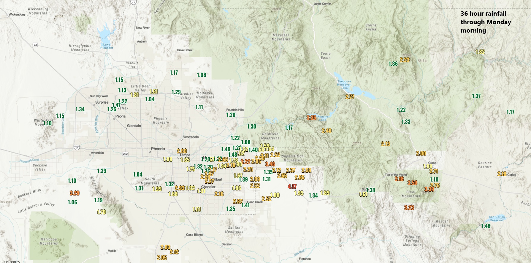
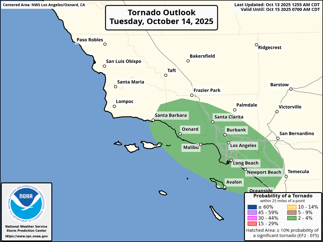
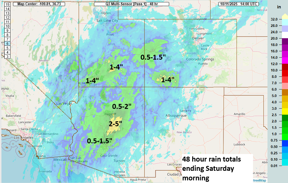
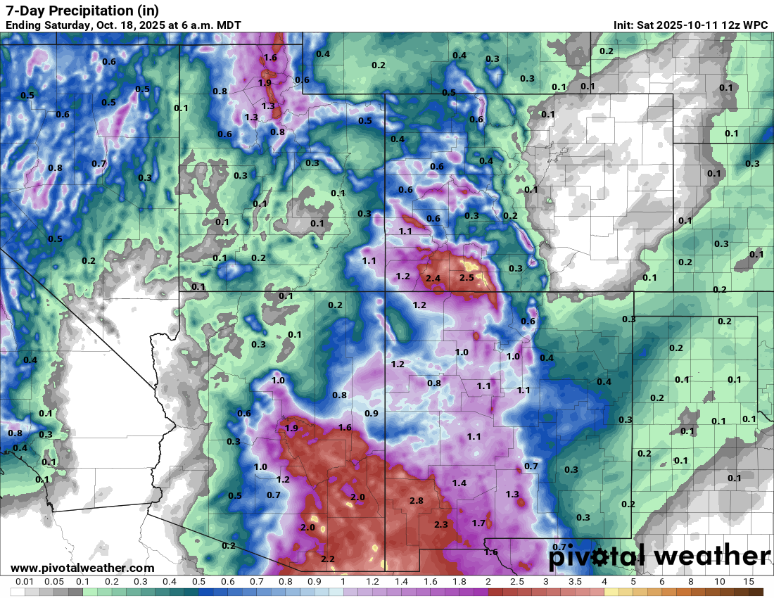
California
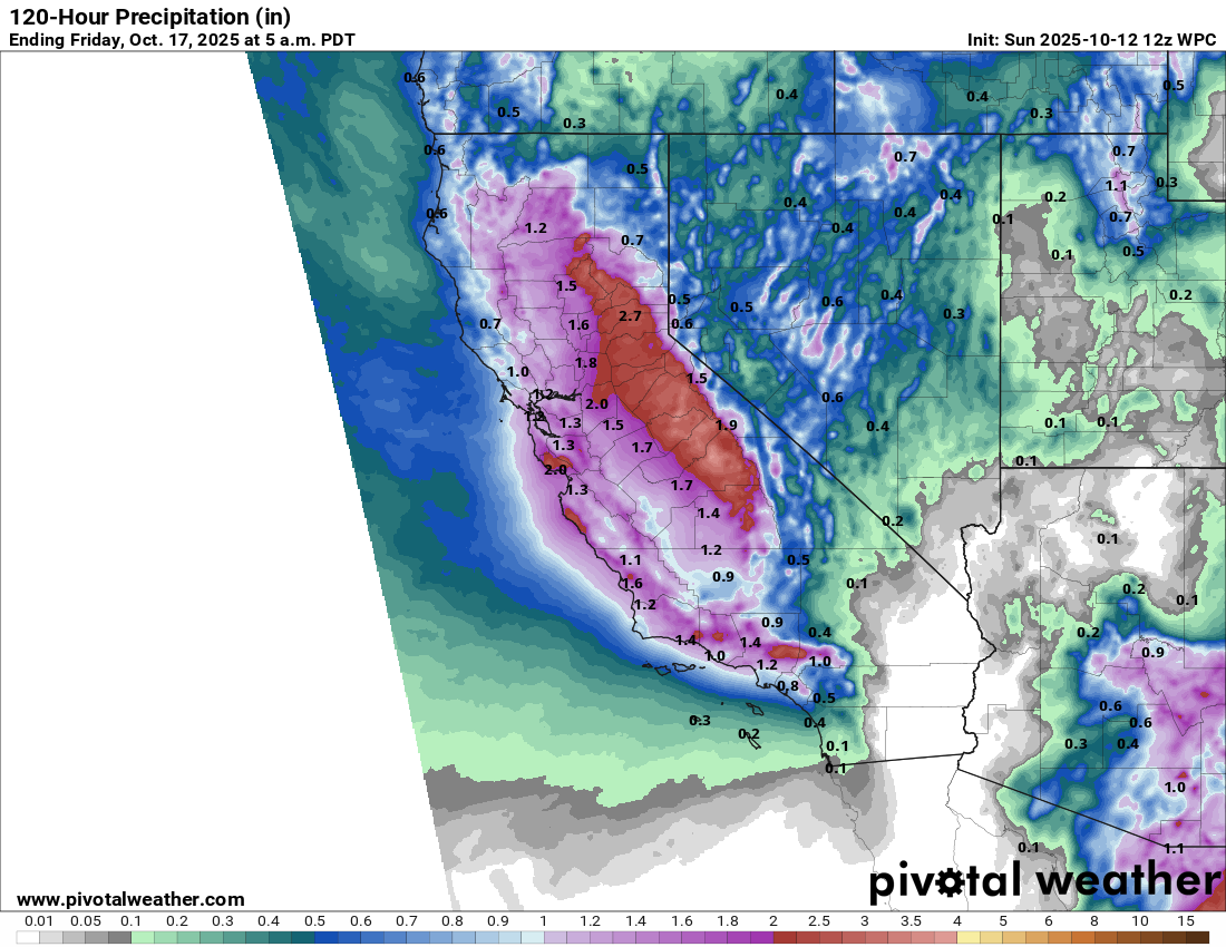
We had at least one tornado warning in San Luis Obispo County overnight, but a squall line offshore approaching the Los Angeles area this morning could cause additional strong to severe storms.
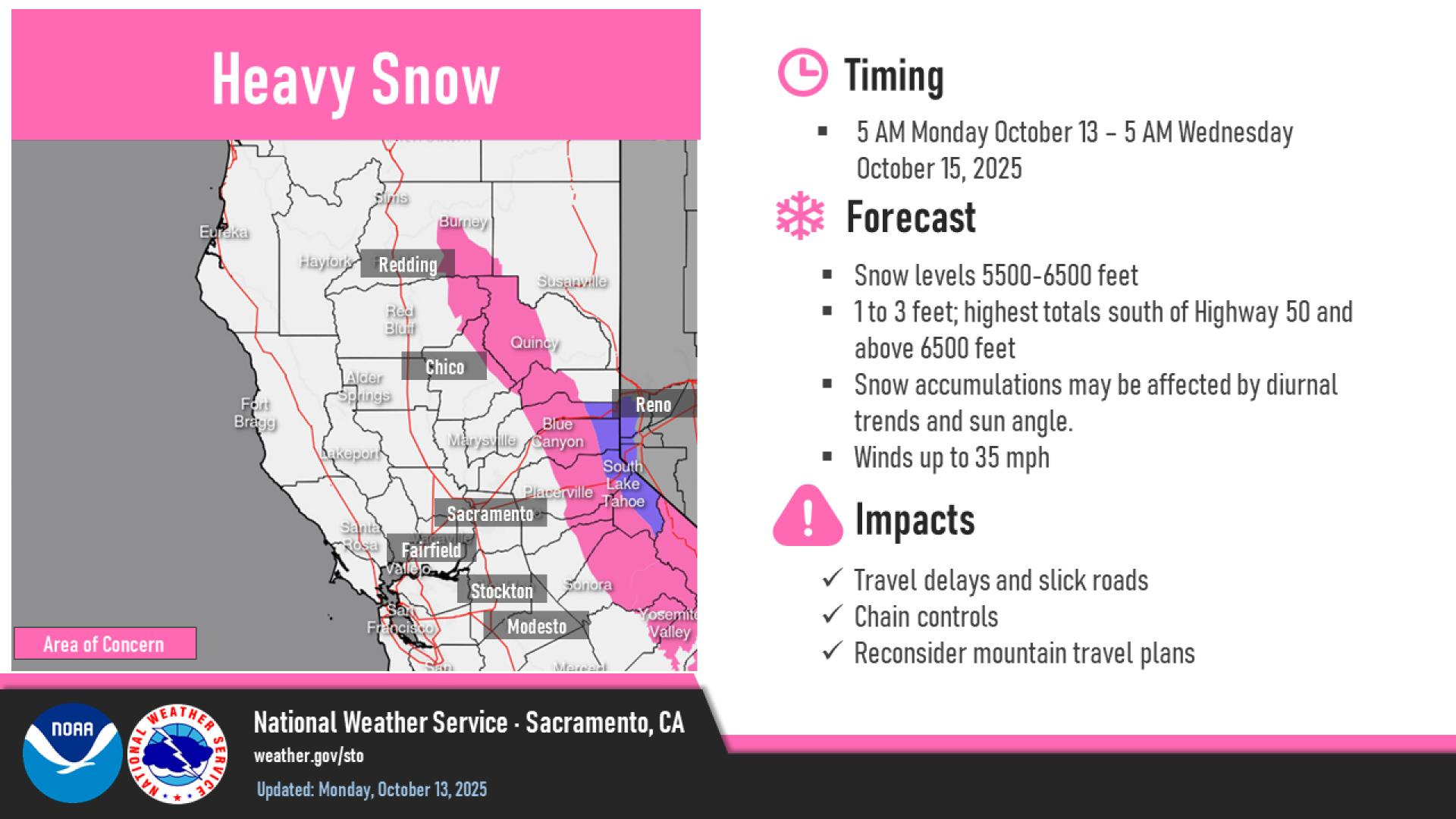
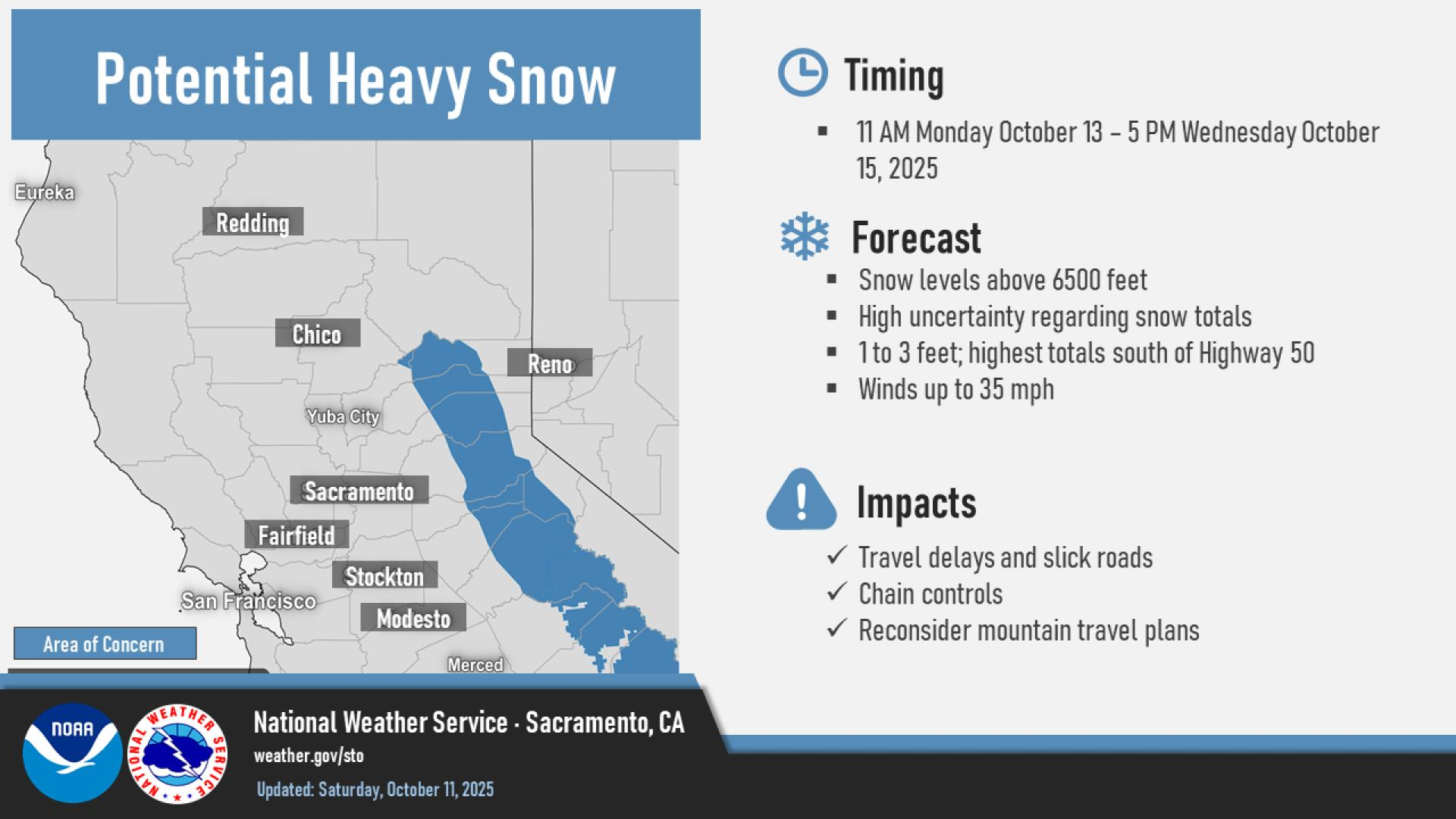
Heavy rain and snow continue elsewhere in the state, with the Sierra likely getting a very healthy early season snow.
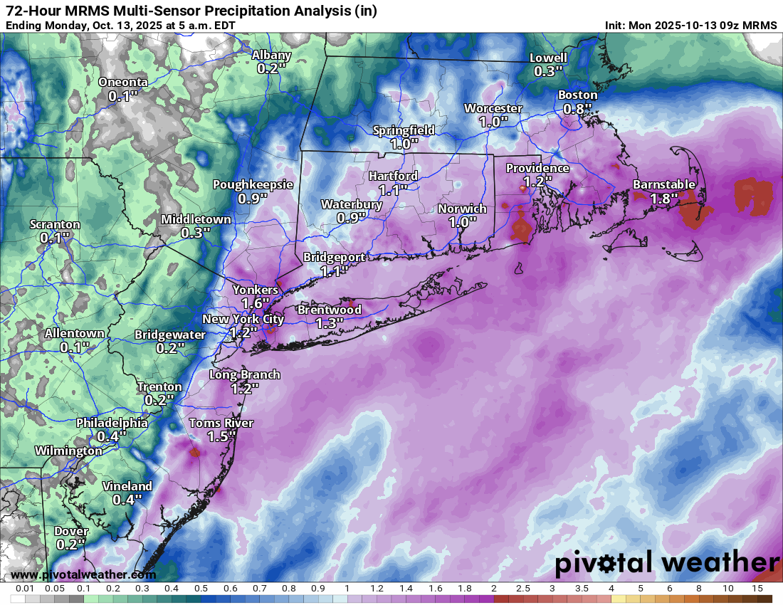
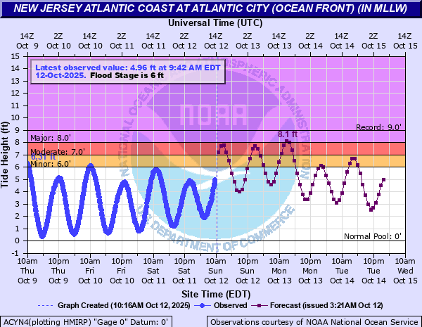
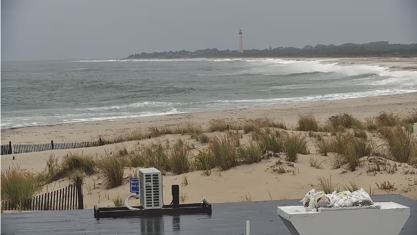
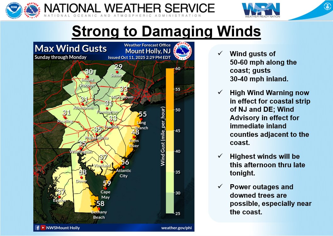
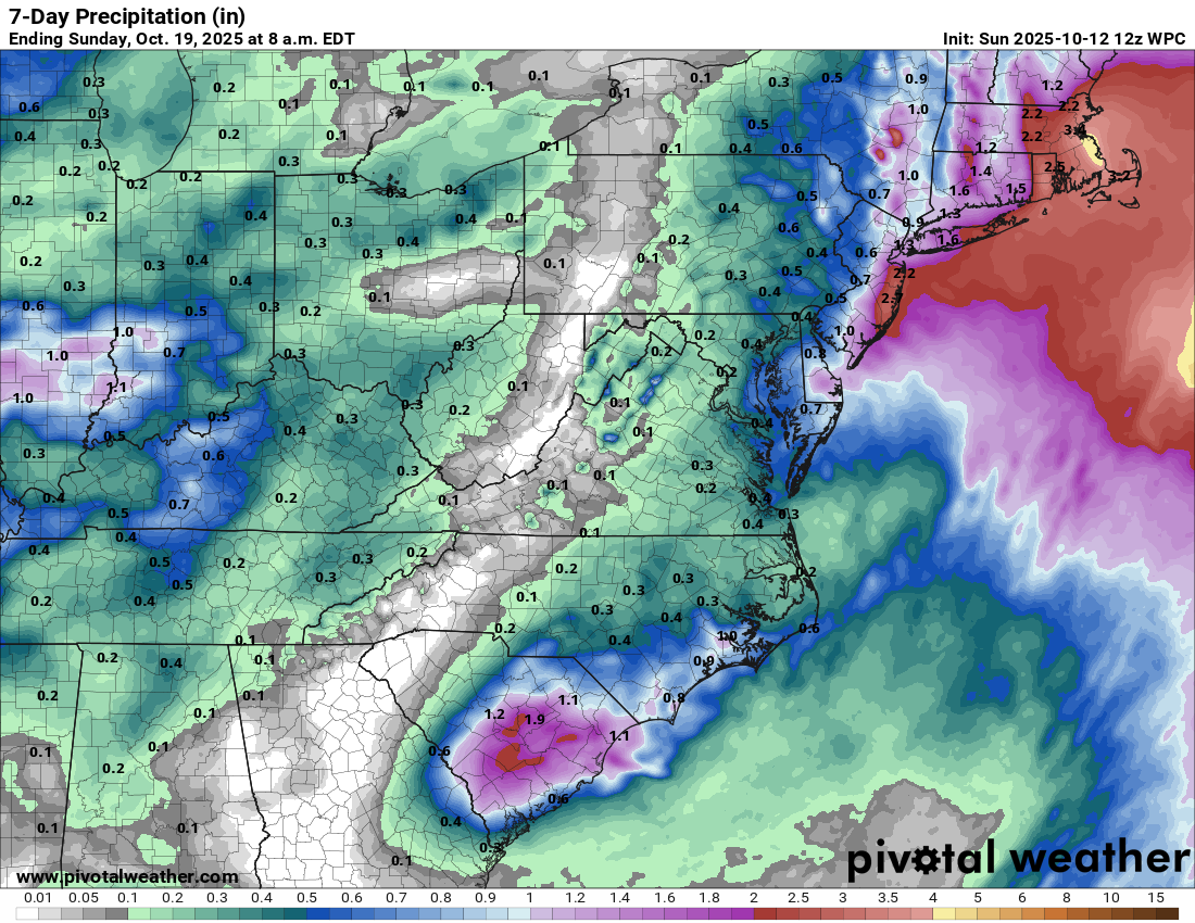
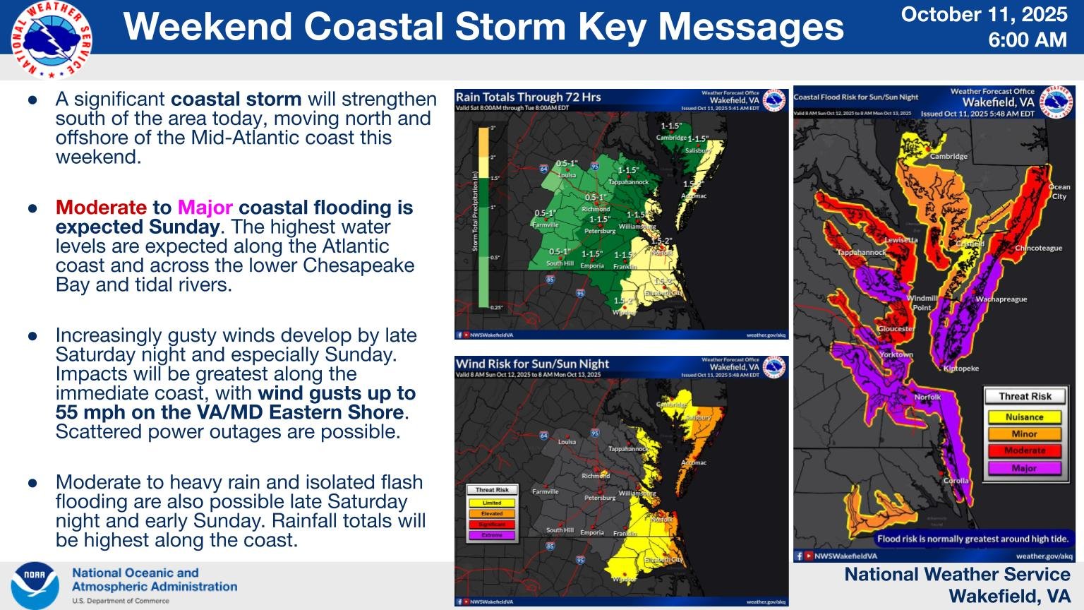
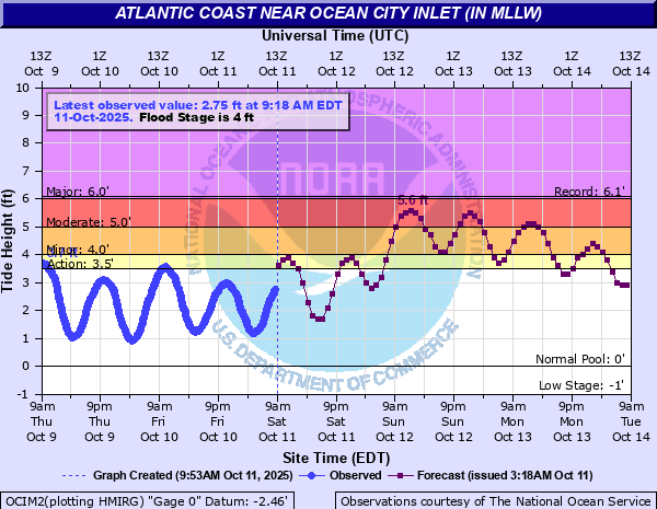
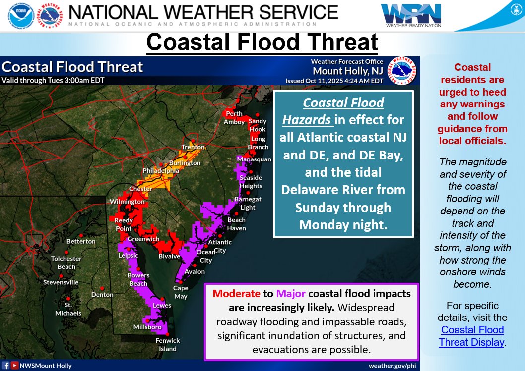
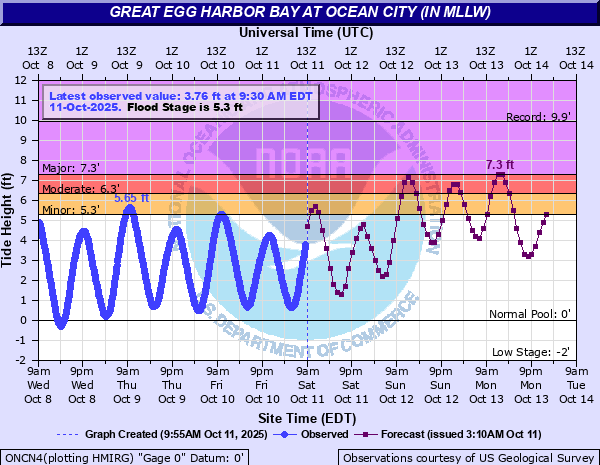
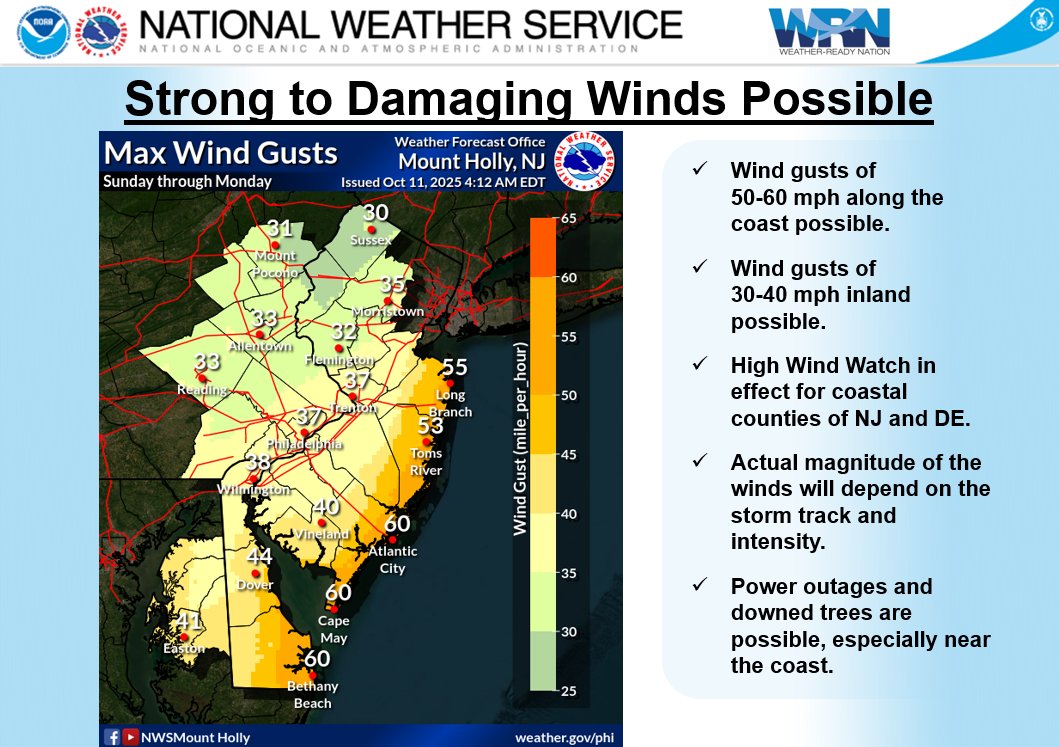
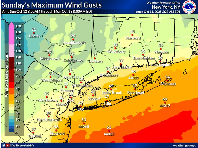
East coast nor’easter
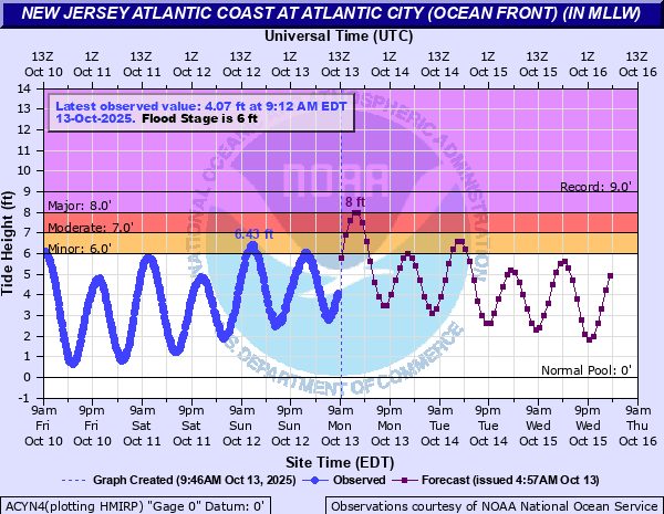
Most tidal gauges are now back below flood levels or are expected to experience minor flooding only today. Overall, tides may have underachieved some in this storm, but they still caused substantial damage.
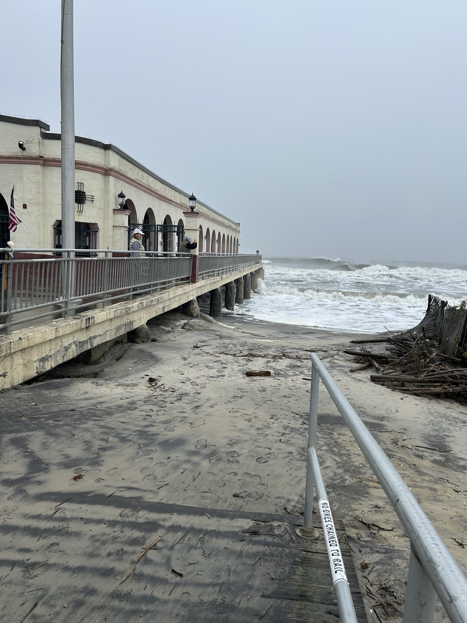
Tidal levels in parts of NJ have not been this high since Sandy in 2012, though that brought significantly higher tides and waves. Still, this was able to do a number on vulnerable beaches. And at least 3 people have been killed as a result of the storm, including a freak, tragic incident in New York City.
Tropics
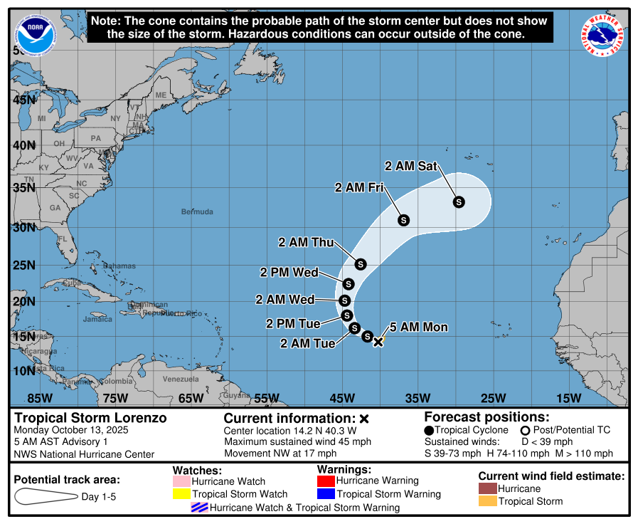
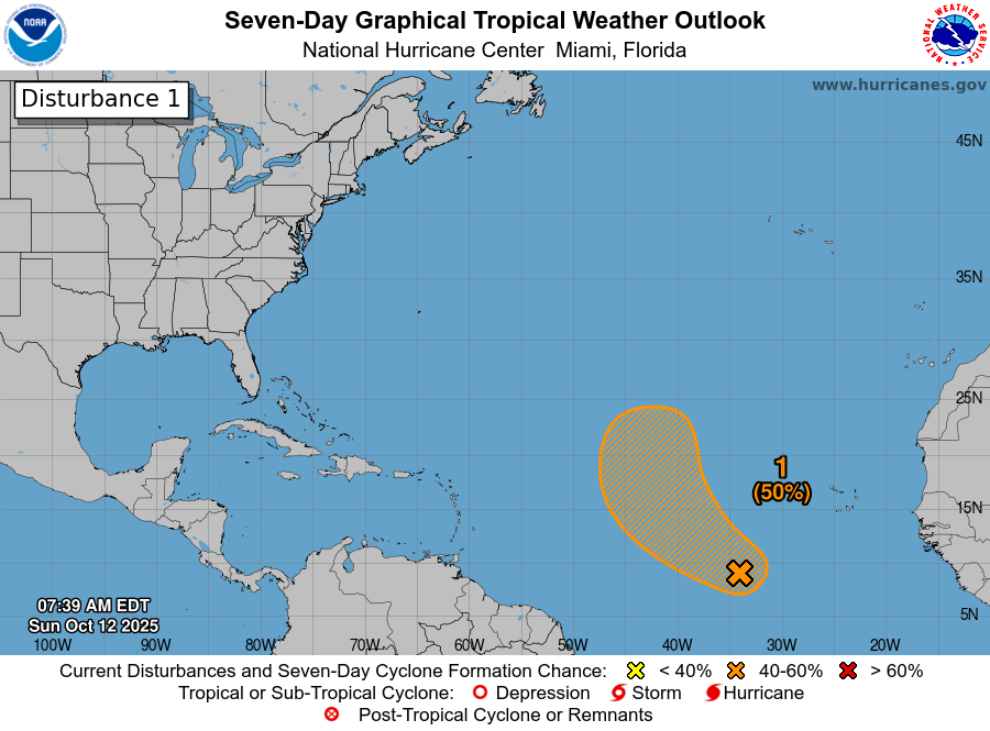
Lorenzo remains a non-issue this morning, as it will continue to meander in the open Atlantic, and as noted yesterday, it may do some funky maneuvering out there.
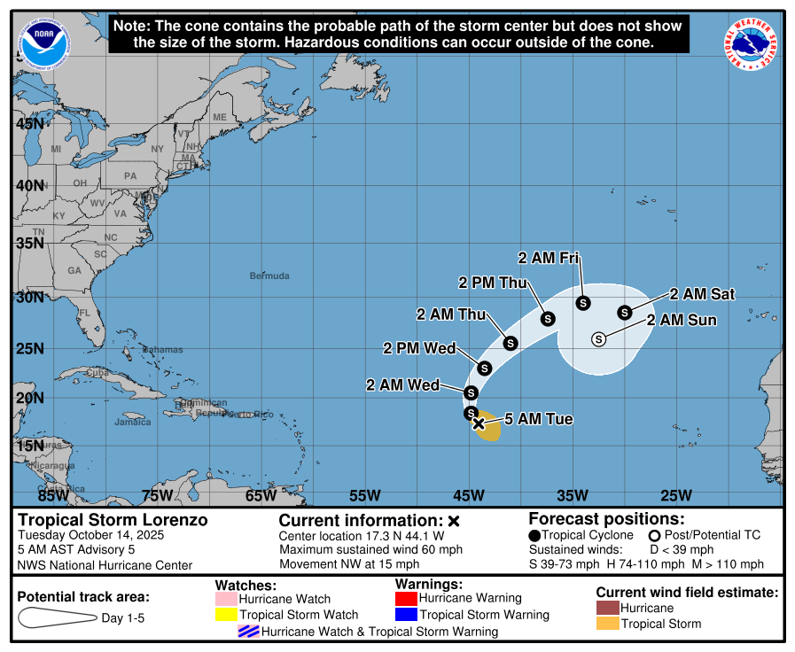
There’s always one.
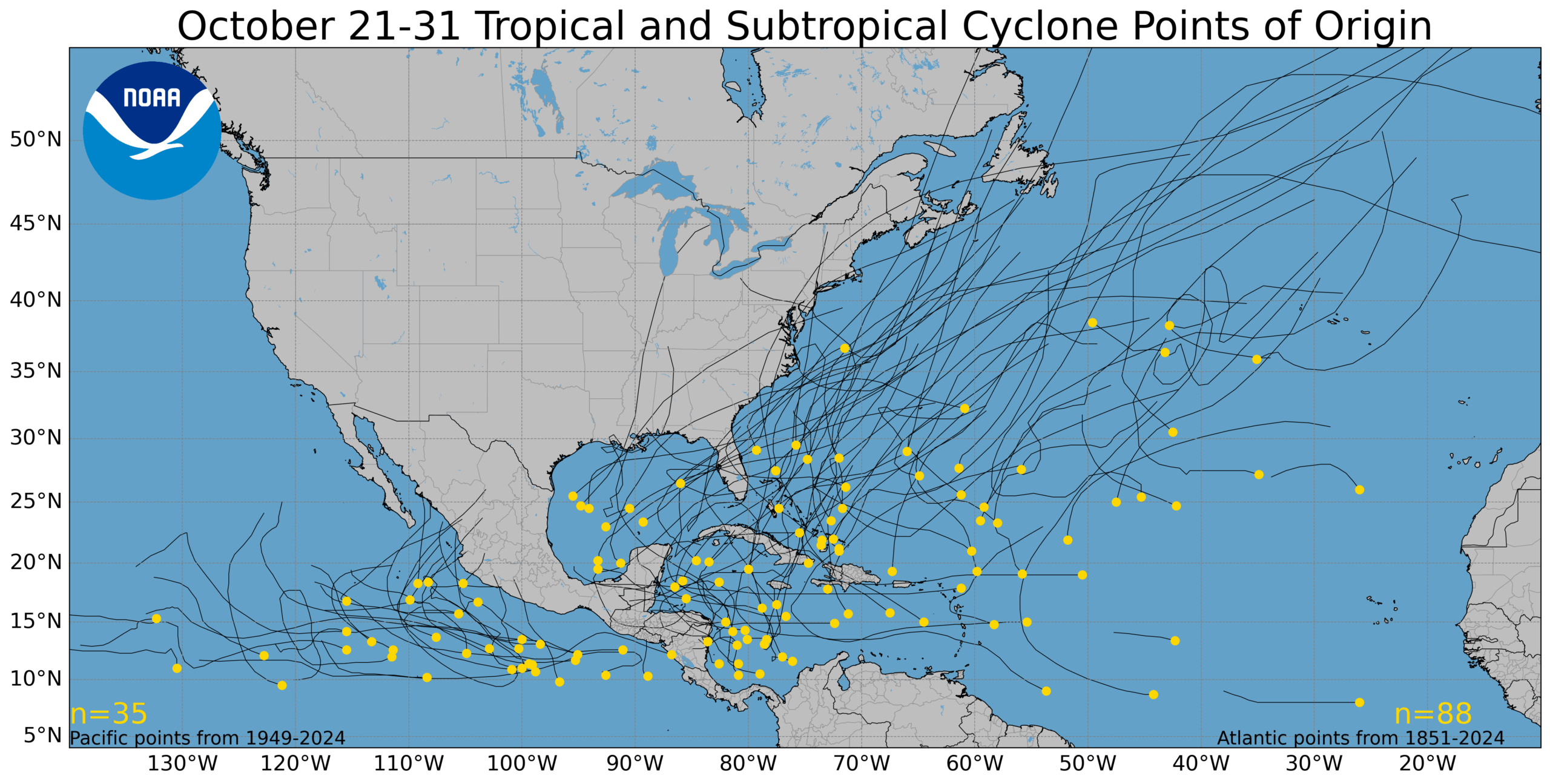
Meanwhile, we continue to see signs that there may finally be something in the Caribbean worth watching. Models have been up and down on this area for the better part of a month now, and it finally seems like we may have something. A tropical wave tracking west across the Atlantic won’t develop, but as it arrives in the southern Caribbean next week, it will have a chance to begin trying to organize.
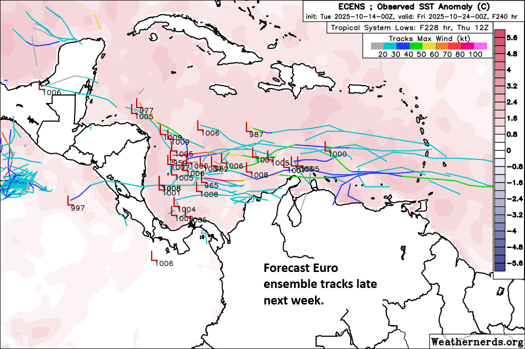
Will it happen? How strong will it get? Will it go into Central America or turn back north toward Jamaica, Cuba, or the East Coast? It’s too soon to say much of anything, especially “will it happen.” For now it remains it a late period curiosity like you’d find at a museum. Observe, don’t touch, and study it a bit closer for a few more days.