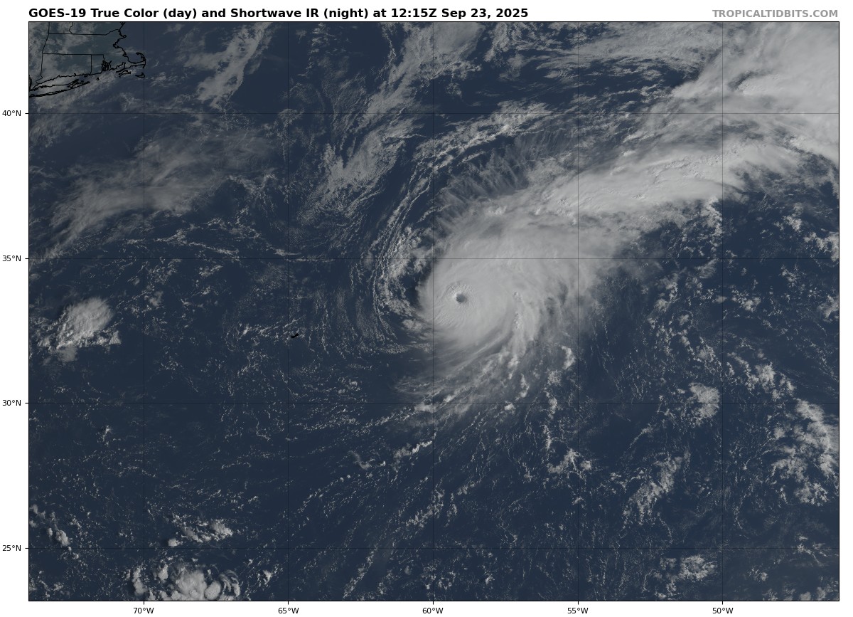
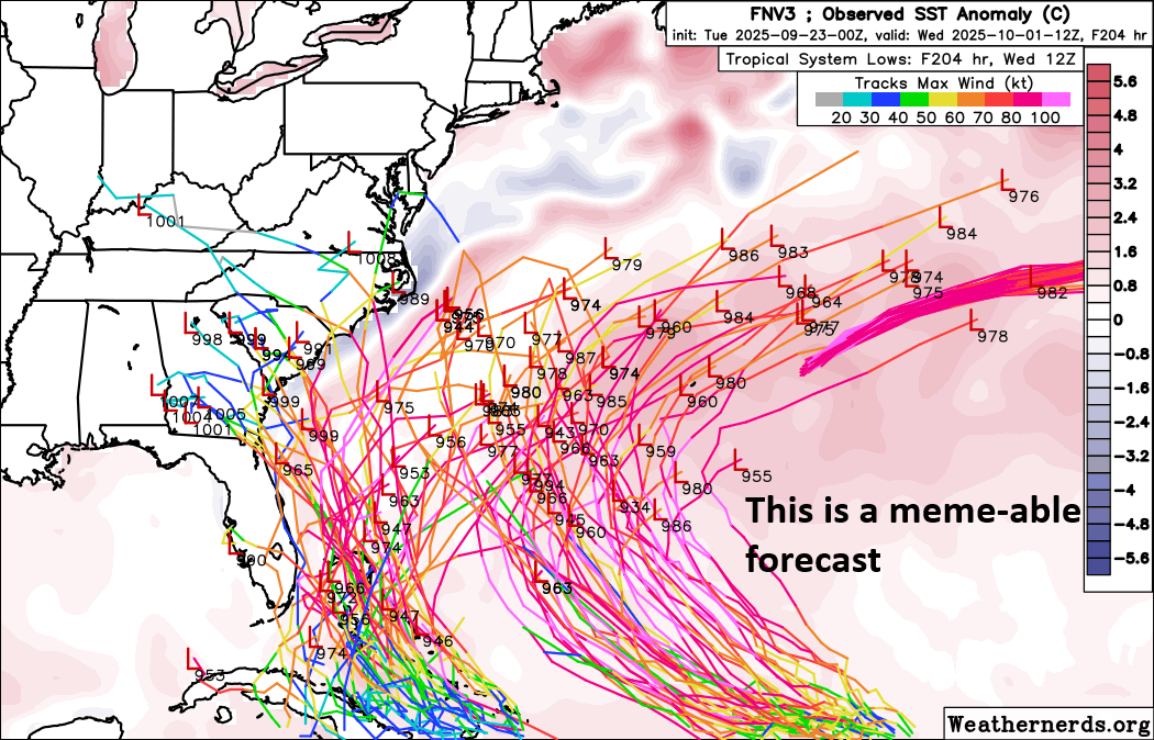
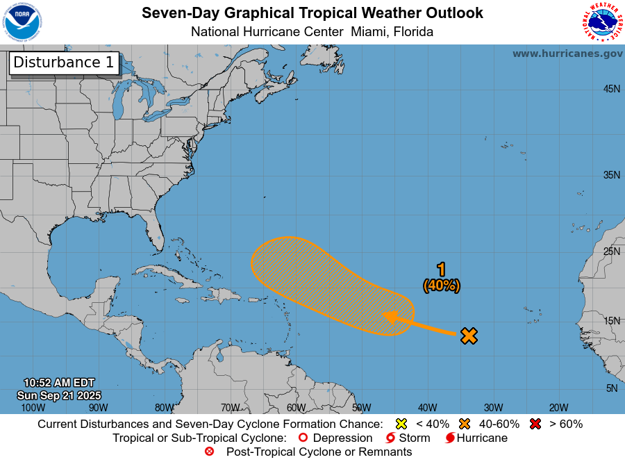
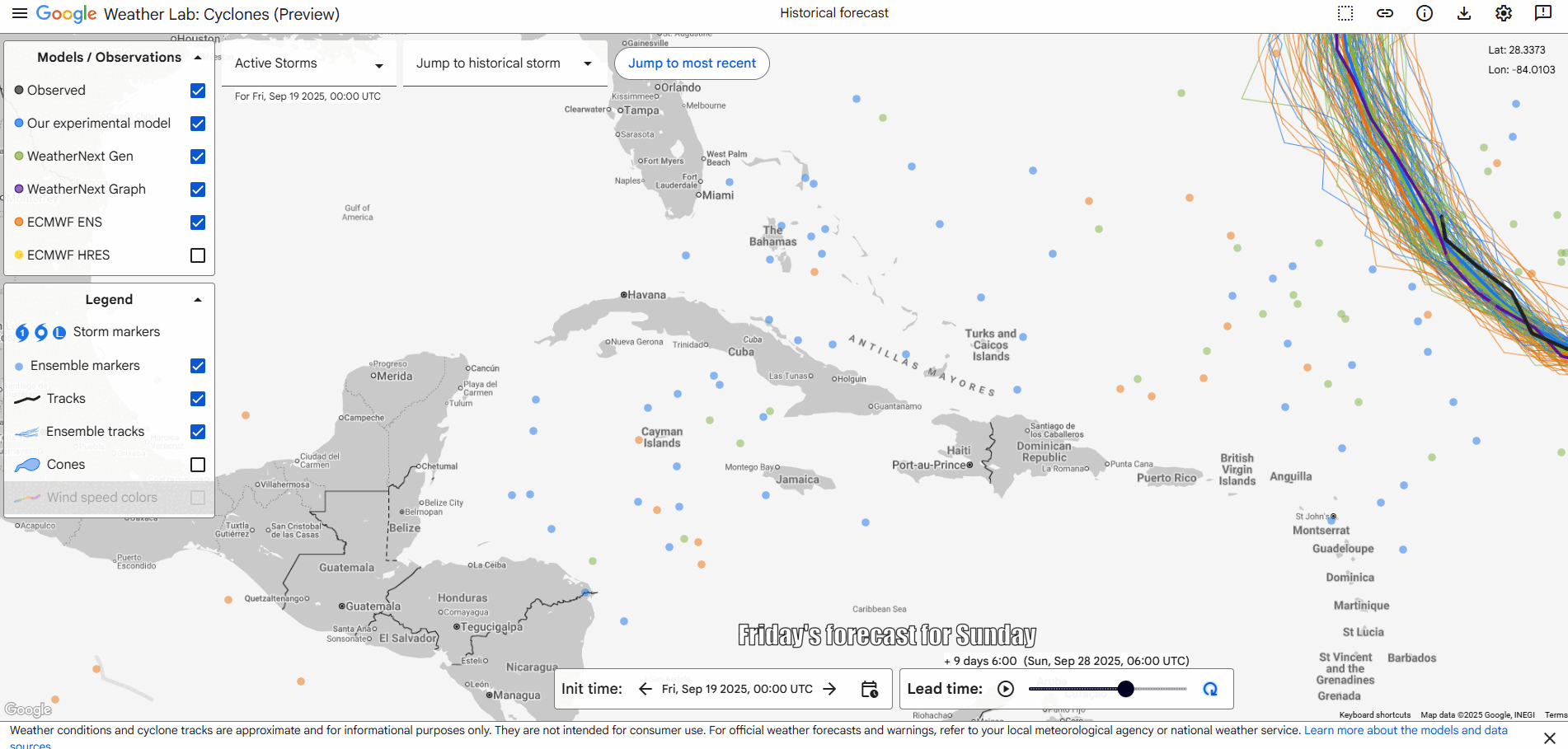
In brief: The Atlantic Invests 93L and 94L will continue giving forecasters fits in the coming days as their proximity to one another, their sensitivity to how well organized one or the other gets, and their proximity to land will play a role in everything that ultimately happens. With so many moving parts, it’s tough to define a narrative of potential outcomes right now, so we walk through what we know and more importantly what we do not.
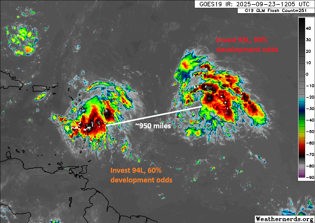
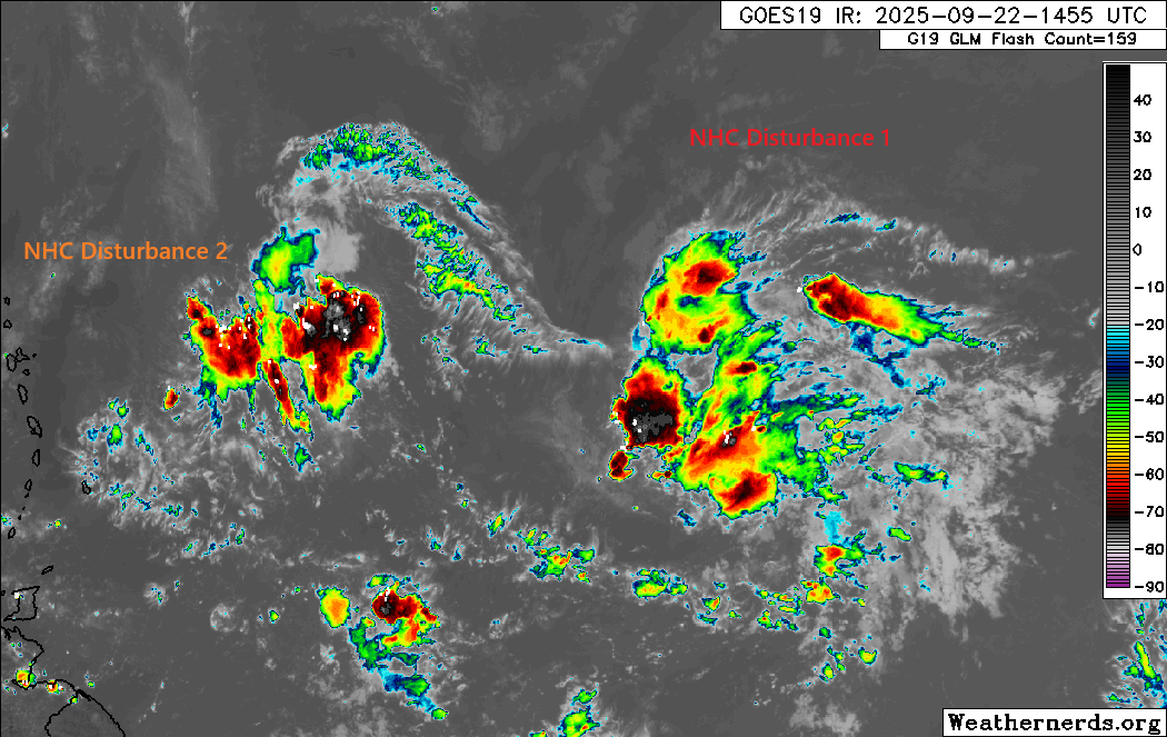
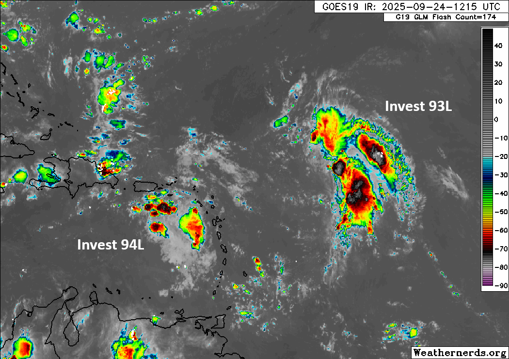
Twin Invests 93L and 94L
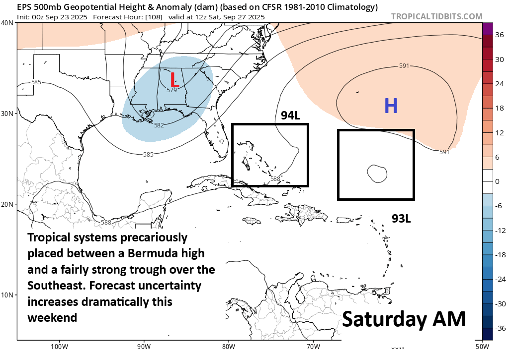
Both Invest 93L and 94L have high chances of developing in the coming days. And the situation has grown no less complicated.
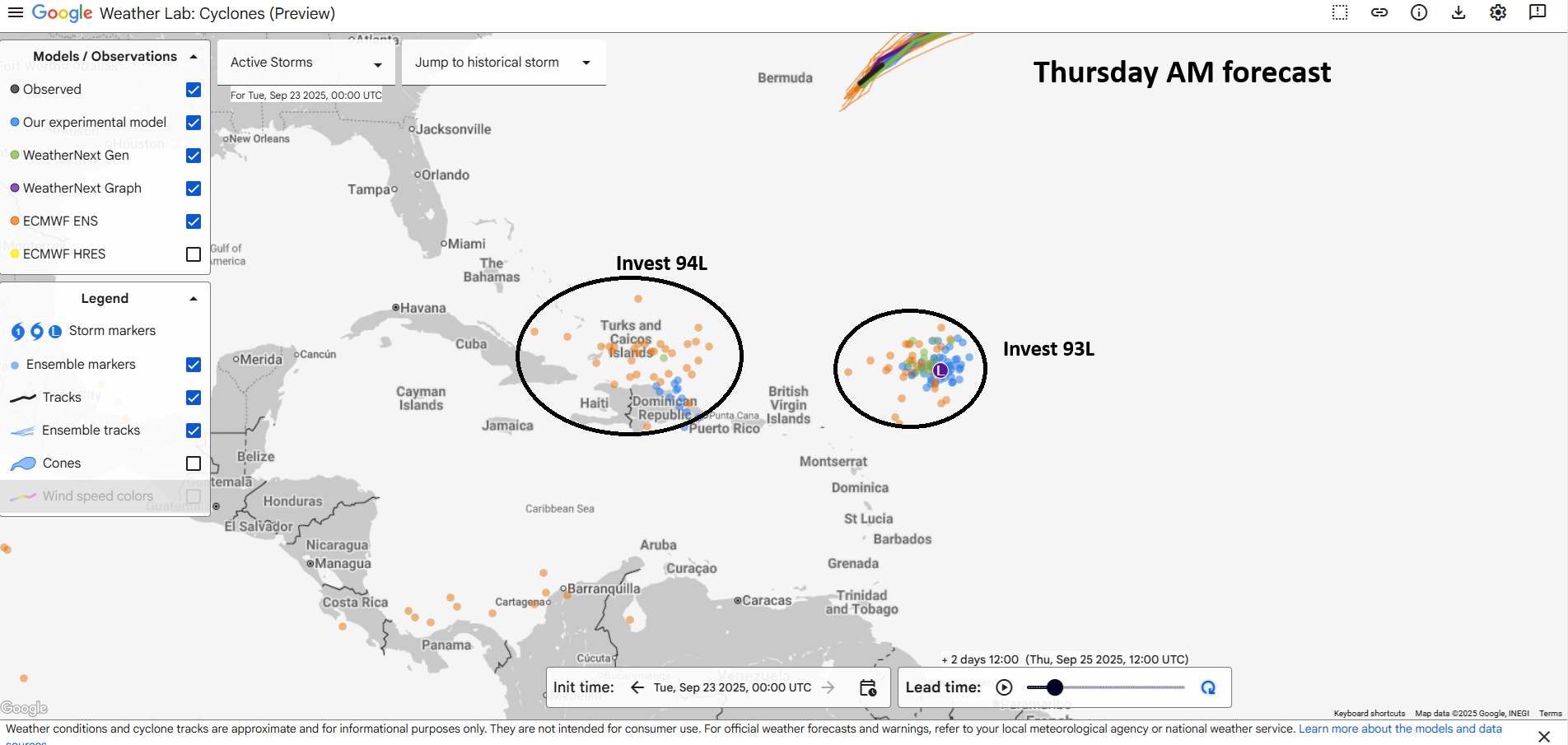
The first thing I can say with some confidence about all this is that we are looking at a somewhat lengthy process here. We may be watching these systems for the next week. While Invest 93L seems likely to not be a land threat (though it could tease Bermuda), it may ultimately help influence Invest 94L, which could be a land threat on the Southeast or Mid-Atlantic coasts.
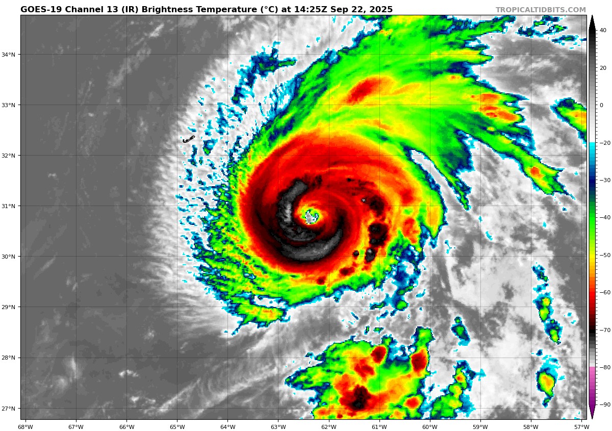
Invest 93L
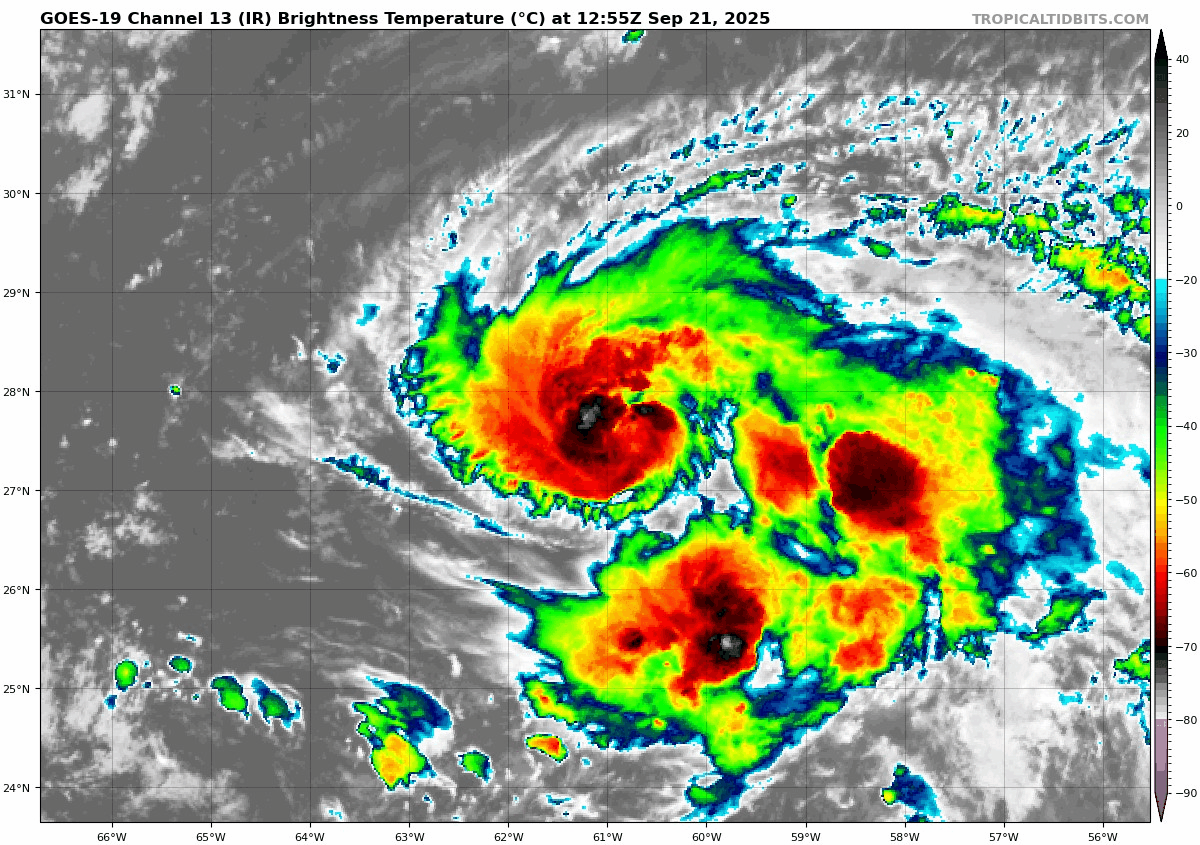
First off, Invest 93L is the better looking of the two this morning, and all along it has been the more likely of the two to develop. Still, we’re not there yet. It seems 93L is dealing with the broader circulation on the backside of Gabrielle, as well as a pocket of wind shear impinging on its southwest flank. It’s just not in an optimal location at this particular moment, so we’re probably still a day or two away from this getting together into something more formal.
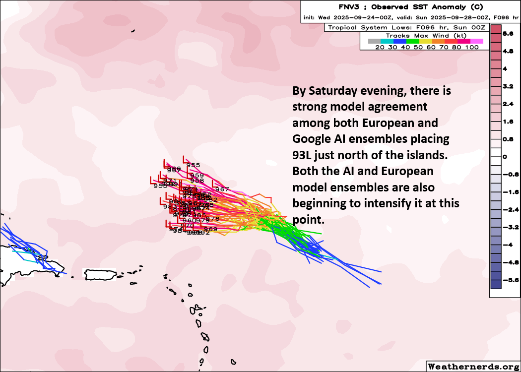
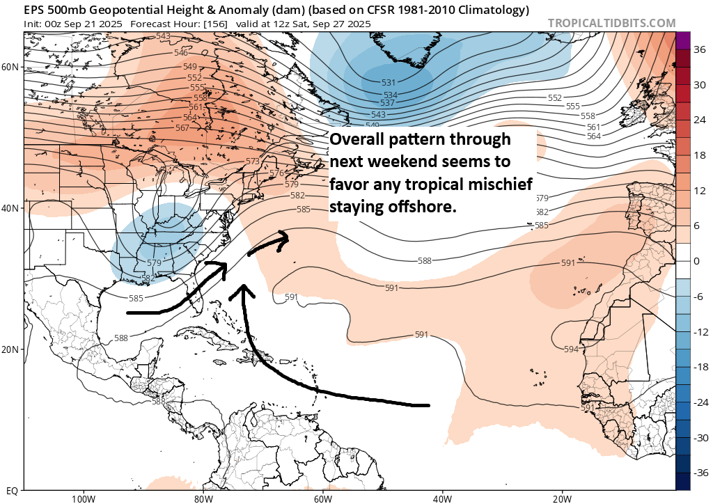
So that’s in about 84 hours. Beyond this point, the general idea is that 93L should continue off to the northwest before turning northward near or southwest of Bermuda. The only real unanswered question with 93L is whether it ultimately threatens Bermuda. Models keep it southwest of the island, so depending on how well developed, how strong, and how close it comes to the island will determine how significant the impacts are. Suffice to say, interests in Bermuda should monitor the progress of 93L.
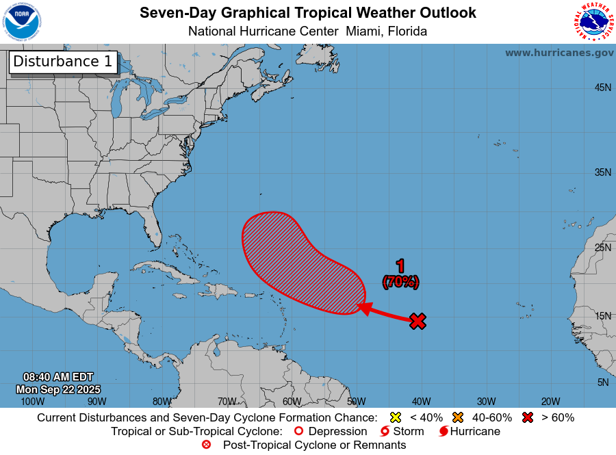
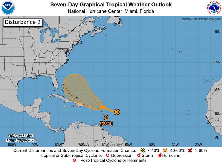
Invest 94L
Meanwhile, the same cannot be said about Invest 94L. There is virtually nothing we really can say about Invest 94L with any strong confidence one way or another. The spread by Sunday morning in ensemble members with 94L is much wider and the intensity is a good deal lower than 93L at that point. So there is going to inherently be more uncertainty on location because it will probably be a somewhat sloppy system.
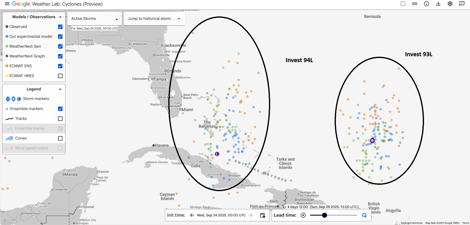
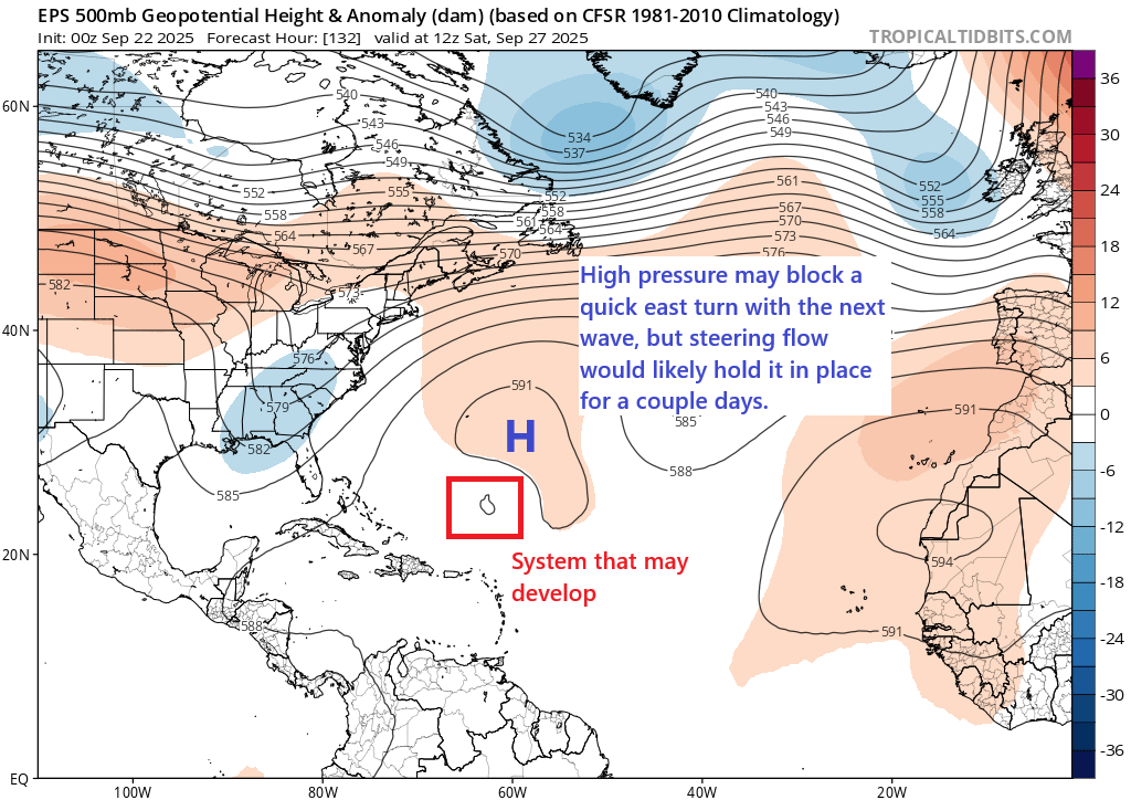
In theory, the track of Invest 94L should be more longitudinal in nature by the time we get to Sunday or Monday. Low pressure over Appalachia, high pressure near Bermuda, and a general south to north upper air pattern would theoretically allow 94L to track north or north-northwest by then. But this is partially where Invest 93L’s potential input on this outcome begins to come into play. If 93L is well-developed, it could force 94L to remain buried in the Bahamas for a couple days, could force it to remain weak, or it could even absorb it completely (the 00z GFS model showed this). If 93L struggles, then almost all bets are off.
By the time you get to midweek next week, there is just an enormous spread of possible outcomes with 94L.
Twinvestment advice
If you live in Bermuda, the Bahamas, or on the East Coast between Florida and New England, you will want to continue to follow this forecast each day. I really cannot emphasize enough how uncertain it is. When you get two systems like this close together, weird things can happen. Anything from a significant land impact to much ado about nothing remains in play. Stay tuned.
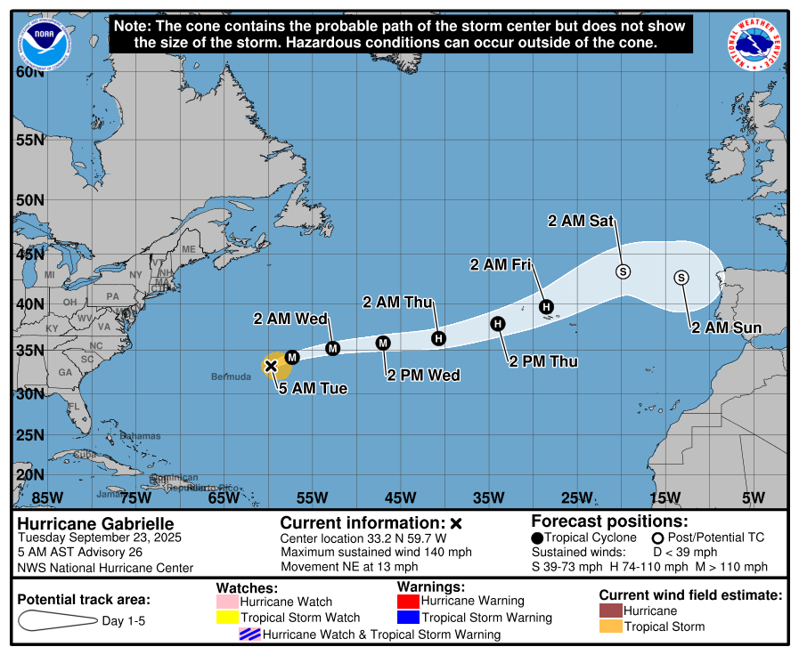
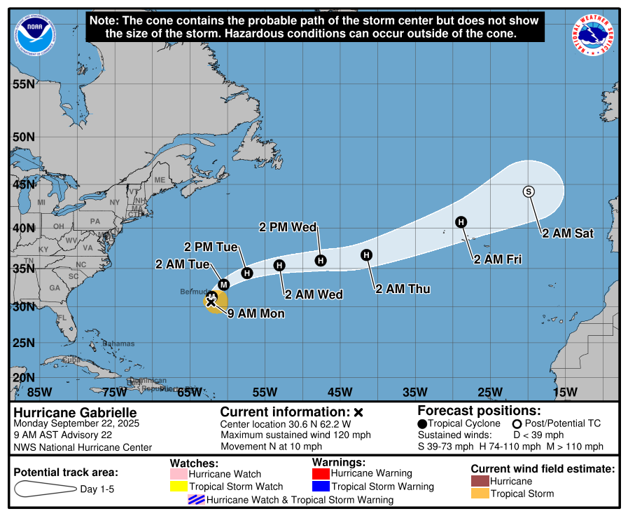
Hurricane Gabrielle
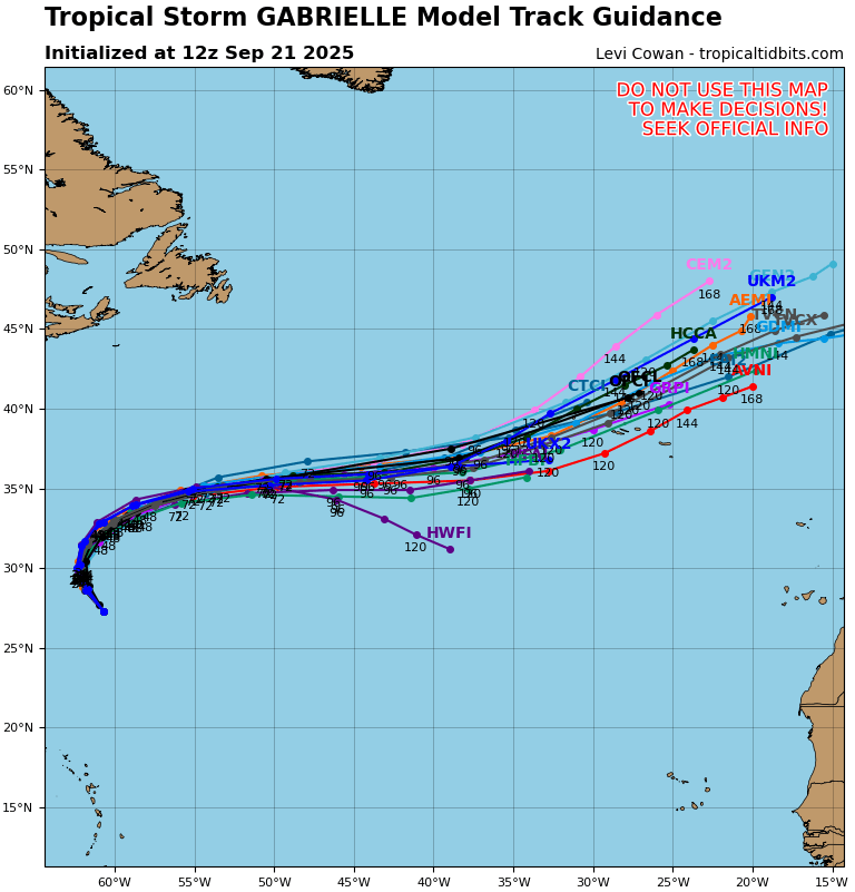
Elsewhere, Hurricane Gabrielle remains a major category 3 storm today as it tracks toward the Azores Islands, where a hurricane warning has been issued.
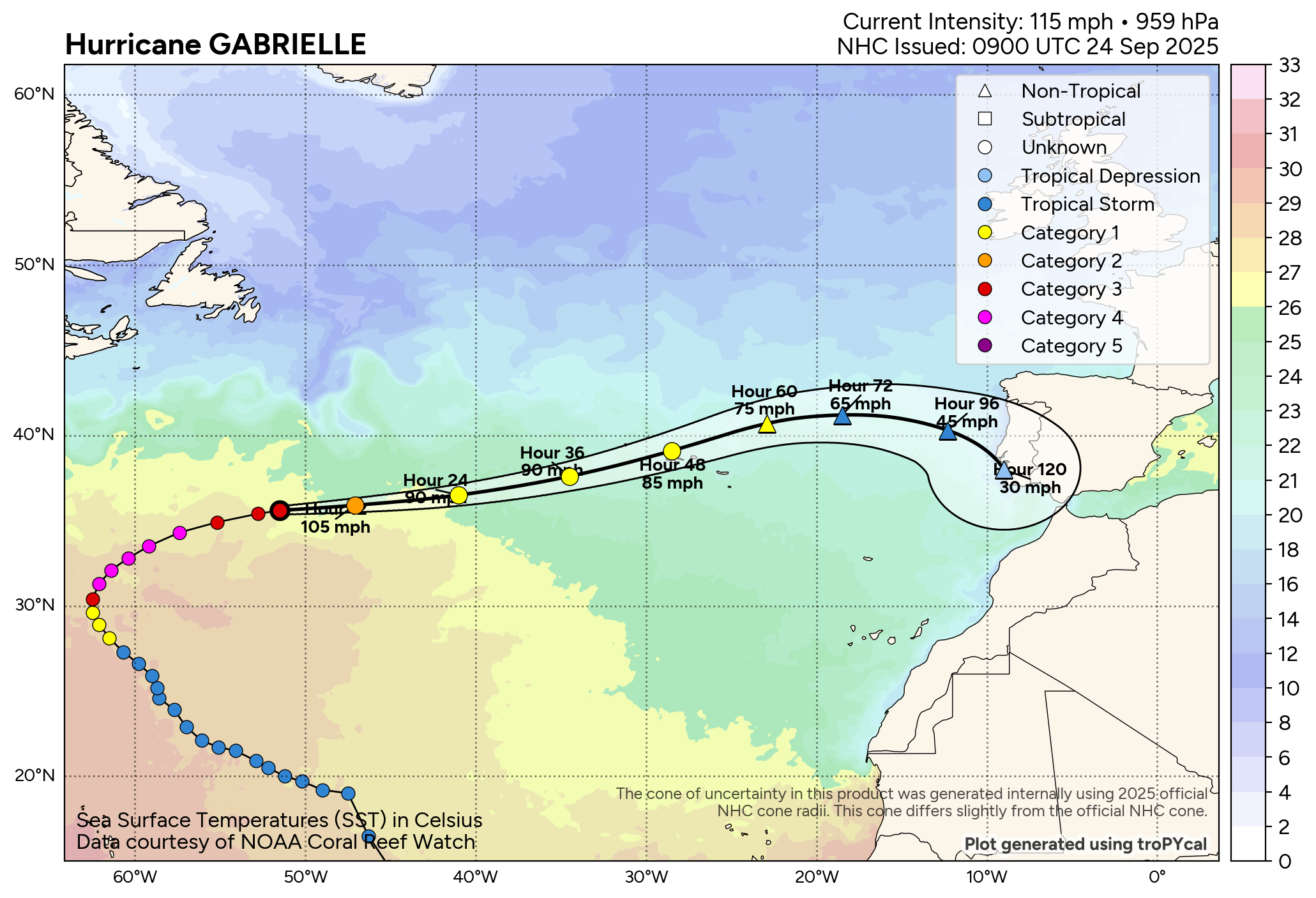
Gabrielle should cross through the islands tomorrow night delivering hurricane impacts. As it continues to move over cooler water, it will likely steadily weaken. That said, it will also get a jet stream “boost” as it passes the islands, allowing for hurricane-force winds to continue there. Hence the hurricane warnings. Gabrielle will fully lose tropical characteristics after it passes the Azores and approaches the Iberian Peninsula this weekend as a remnant low.
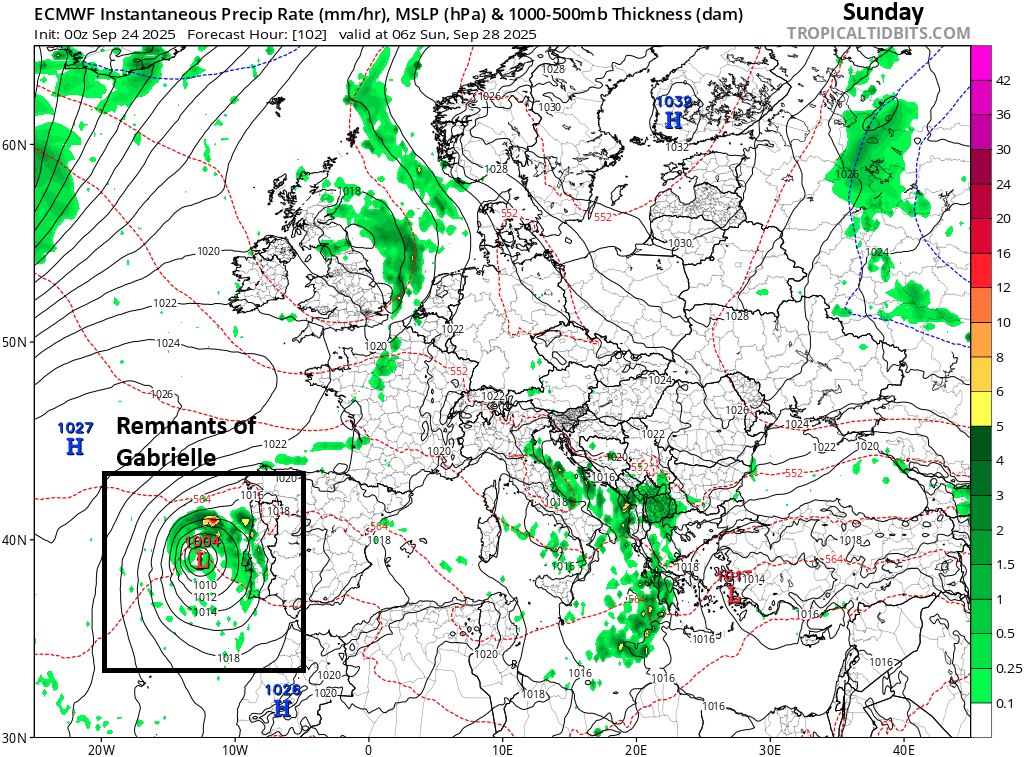
It will still be capable of bringing some gusty winds and rain to Portugal or Spain, but the current forecast track does keep the strongest conditions offshore right now, with the system tracking into the Gulf of Cadiz and near the Strait of Gibraltar. Still, probably something worth watching for Portugal at least! Rain would be welcome, especially in the northern half of Portugal which is experiencing a serious drought.