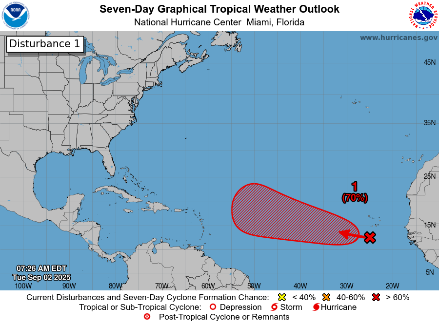
Today is the 20th anniversary of Hurricane Katrina’s landfall in Louisiana. Many reflections are being written, including our own Eric Berger’s over at Space City Weather.
I don’t think we need to rehash the storm specifics, but if you’re a younger weather enthusiast reading this or you do not know the story as well as you wish, I can offer up a few reading recommendations.
I think everyone should read “Five Days at Memorial,” by Sheri Fink because it showcases the best and worst of humanity in a terrible situation, and the author does such a good job of placing the reader in the moment. That was truly a gripping book, non-fiction that reads at times like a thriller. Douglas Brinkley’s “The Great Deluge” is more like a tick tock account of how things unfolded and sets up the facts in a digestible manner. I also recommend “After the Flood,” by Gary Rivlin who did a ton of on the ground reporting in the wake of Katrina. Lastly, “Katrina: A History 1915-2015,” by Andy Horowitz ties together the very important issues of race, class, and reality that you absolutely cannot ignore when talking about Katrina.
I think there’s something to be said about forethought, planning, decision-making (deliberate and otherwise) and disaster, and reflecting on the 20th anniversary of Katrina is as good a time as any to tie that to the present day. We’ll do this again in a couple weeks on the 125th anniversary of the 1900 Galveston Storm.
Andrew Rumbach of the Urban Institute (who also writes a good publication called Place+Resilience on Substack) put together (with his colleagues) an interesting graphic that shows the last 20 years of disasters on the Gulf Coast. While Katrina was uniquely devastating, it was not a unique problem. According to their research, “disasters in the Gulf Coast since 2005 have caused $365 billion in property damage, accounting for 62 percent of all disaster losses in the US.” Just 10% of the country accounts for 62% of disaster losses. The entire report is worth your time, but while there are glimmers of positives in here the overall reality is quite sobering. I write this from Houston, Texas where disasters are on our minds frequently.
One point the article makes is that for every dollar spent by the government on hazard mitigation, the savings from avoided damages is about six dollars. So, with FEMA’s $13.5 billion in hazard mitigation funding to Gulf Coast counties, the damage avoided should be north of $80 billion, a not inconsequential number. Of course, when the total damage is over $350 billion, it makes the 80 seem less meaningful. But the message is pretty clear, and it has been for ages: Hazard mitigation is a wise investment. It’s not politically sexy to come out and say you’re going to run on a platform that will spend X billion dollars to mitigate problems that have not yet occurred. But it would be smart. A six-to-one return on investment is pretty good. Everyone wants to solve problems, but no one wants to pay to do it. And it’s a problem we have seen firsthand today.
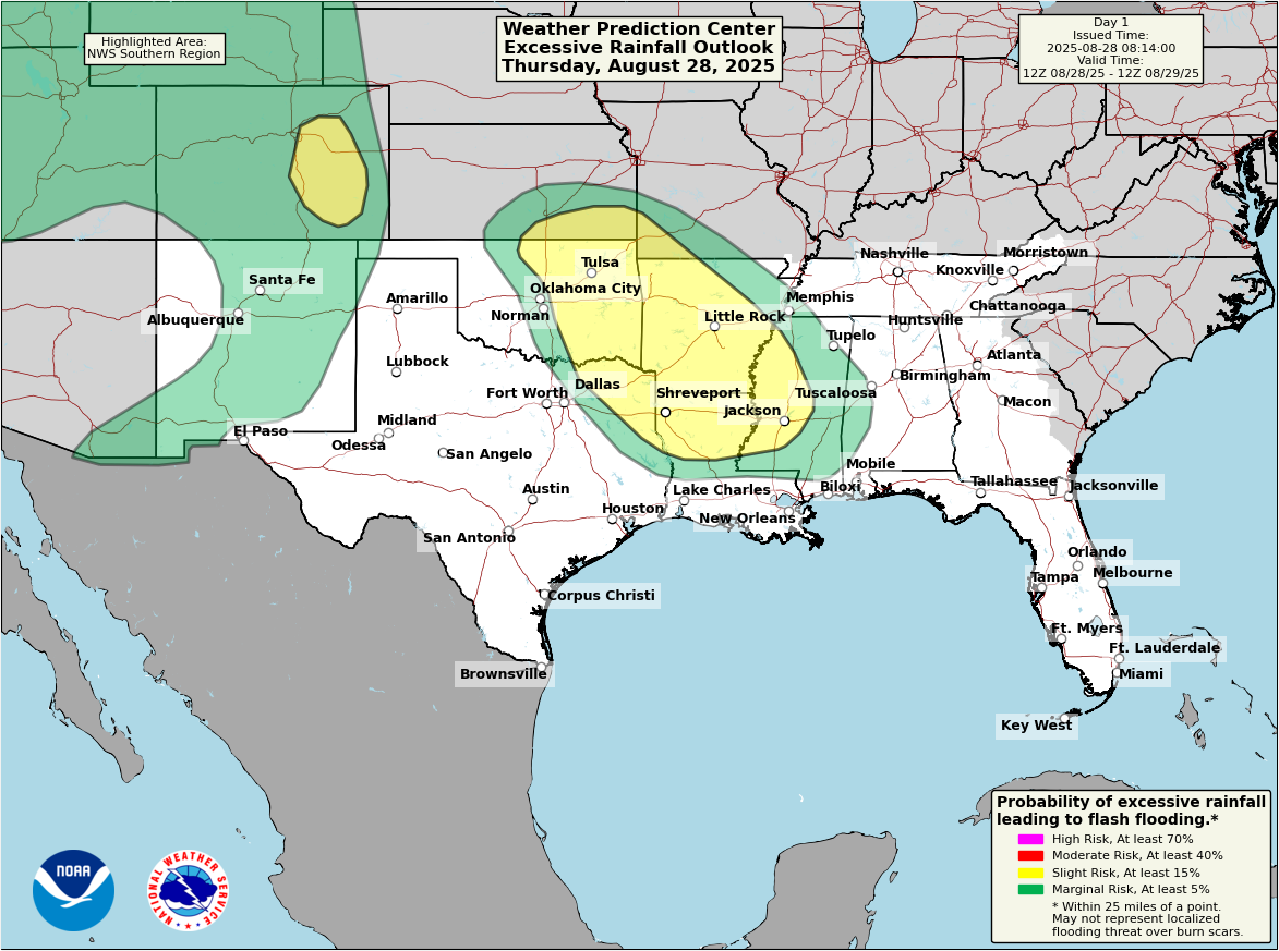
While there have been discussions about the historic Hill Country flooding in Texas last month, and there have been some pretty standard linkages made to climate change, the reality is that this was not an unprecedented event. There is a reason the area is known as “Flash Flood Alley.” So with that in mind, it would seem obvious that foresight would go a long way here. I mean, the same kind of event happened in a similar area less than 40 years ago in 1987. This paragraph from the excellent and sobering Texas Tribune article says it all and should jump off the page smashing cymbals together when you read it.
After the 1987 flood, river gauges were installed to provide real-time information to forecasters and emergency managers. But as the years passed, political will and funding for flood warning infrastructure diminished. An effort to get flood sirens never came to fruition; local governments were repeatedly passed over for grants by the state; and the county eliminated its own flood protection tax.
When you read, it’s striking how short-sighted some of the elected officials in Kerr County seem to have been over the years.
“The thought of our beautiful Kerr County having these damn sirens going off in the middle of night, I’m going to have to start drinking again to put up with y’all,” then-County Commissioner Buster Baldwin said at a 2016 meeting.
Even after this event, there are residents in this area that are still so vehemently anti-tax that they don’t want to see any tax increase to fund warning sirens or alert systems that they feel the camps should provide. There’s clearly a disconnect here between some residents’ priorities and the reality of where they live. Even in the wake of such tragedy. I’m not here to rag on people, but it’s completely obvious that there are ways to mitigate the problem that make fiscal sense. All too often the solution is to either put a band-aid on the problem or lick your wounds and move on. This isn’t 1850. Disasters today are less failures of imagination or “acts of God” than they are societal shortcomings. More can and should be done.
The Washington Post did an investigation into an RV Park on the Guadalupe River where 37 people died last month. When lobbying to upgrade the park, the company that owned the property assured officials that they’d have an hour or two heads up on flooding and could safely evacuate the park. The developer even referred to himself as a “poor man’s weatherman,” which feels laughably condescending when considering a decision like this. The local government allowed the company to upgrade the RV Park ***in the floodway*** of the Guadalupe River. This was in 2021, four years after Hurricane Harvey exposed how much property in Houston had been built in floodways or reservoir flood pools. Again, not an unknown problem. Yet, according to the investigation, the RV Park ownership said “in a statement that the severity of the flooding on July 4 could not have been anticipated and that failures in public warning systems meant they had little advance notice.” That seems misleading at best.
The reality is that many places we choose to live in are disaster-prone because they’re often beautiful. Oceans, rivers, forested mountains. All of these places have a draw, but they also come with risk, and in some cases a lot of risk. In many ways, as Robert Paterson from the University of Texas says, “disasters are a human choice.” After these events, the blame game gets played, and in many cases now, people will blame made-up nefarious forces instead of focusing their blame on the people that often deserve the scrutiny. It’s pretty obvious that here in Texas at least, where regulation is frequently viewed as a four-letter word, we often let local governments make decisions they are not equipped to make. There needs to be some structure in place so partially avoidable disasters, like the Hill Country flood can be mitigated. I think it’s important to recognize the uncomfortable fact that a catastrophic flood occurring in the middle of the night will almost always have a bad outcome. It will always be difficult, if not impossible to get to a mythical “zero” figure in terms of damage or loss of life. Nor should we necessarily strive for that. But in reality, some thoughtful mitigation and/or regulation is better than saying something was an unavoidable disaster.
This problem is not confined to Hill Country in Texas. It’s not a problem exclusively to a red state or a blue state. This is a national challenge. We could talk about how San Antonio plans to address flooding after a deadly flash flood event earlier this summer. We could talk about how West Virginia is just now coming around to studying flooding and mitigation on Kanawha River, nearly 10 years after catastrophic flooding there. 17 years after Hurricane Ike, we’re discussing modern Galveston flood protection, the Ike Dike, and it’s still a plan on paper. The Galveston Seawall’s core structure was built in less than 10 years and began only 2 years after the great 1900 storm. And on and on and on. In the 20 years since Katrina, we’ve learned a lot but I’m not quite sure we’ve learned enough.