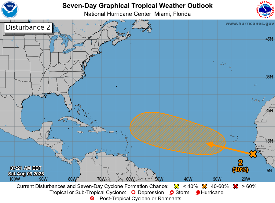
In brief: Invest 97L will be the tropical disturbance to watch this week as it marches across the Atlantic. It’s far too soon to say with any certainty how things will play out, but we discuss some of the complicating factors involved in the forecast below. Also, flooding in Milwaukee yesterday and this morning, as we watch a higher-end flash flood risk in southeast Kansas and parts of Missouri.
Good morning. Today we’ll dive back in on the next disturbance, now tagged Invest 97L. Invest 96L in the open central Atlantic is not a concern, so we’ll skip that one today. Plus, another moderate risk (3/4) of flash flooding today, this time in Missouri and Kansas.
Invest 97L
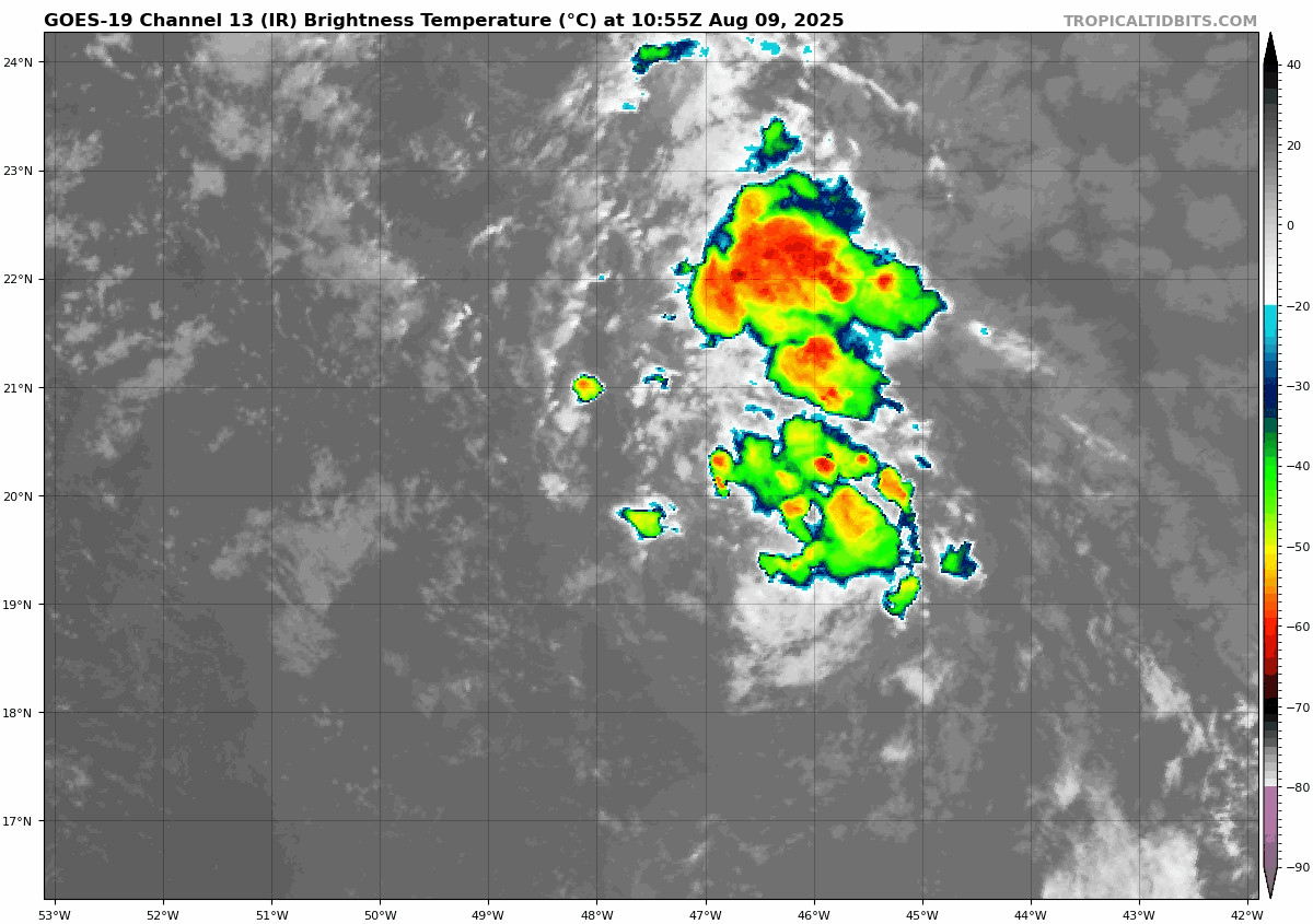
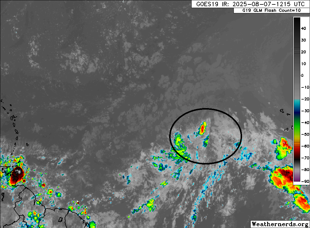
First off, the tropical wave emerging off Africa is now known as Invest 97L. This has been given a 30 percent chance of developing over the next 2 days but an 80 percent chance over the next week.
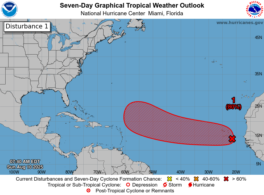
We’re now seeing Invest 97L gradually cross the Cabo Verde Islands. This is by far the healthiest looking tropical wave we’ve seen off Africa this summer.
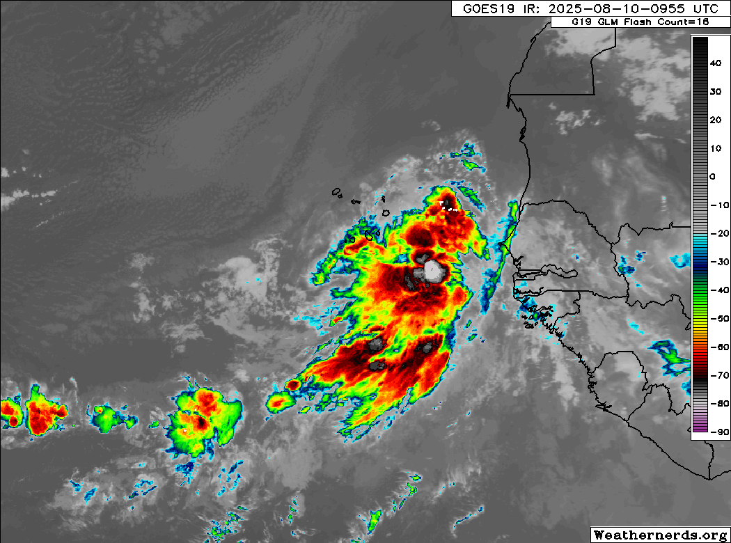
Several of the recent tropical waves we’ve seen emerge off Africa have lacked thunderstorms. Invest 97L does not have that issue, and it seems to be spreading some heavy rain across the Cabo Verde Islands today.
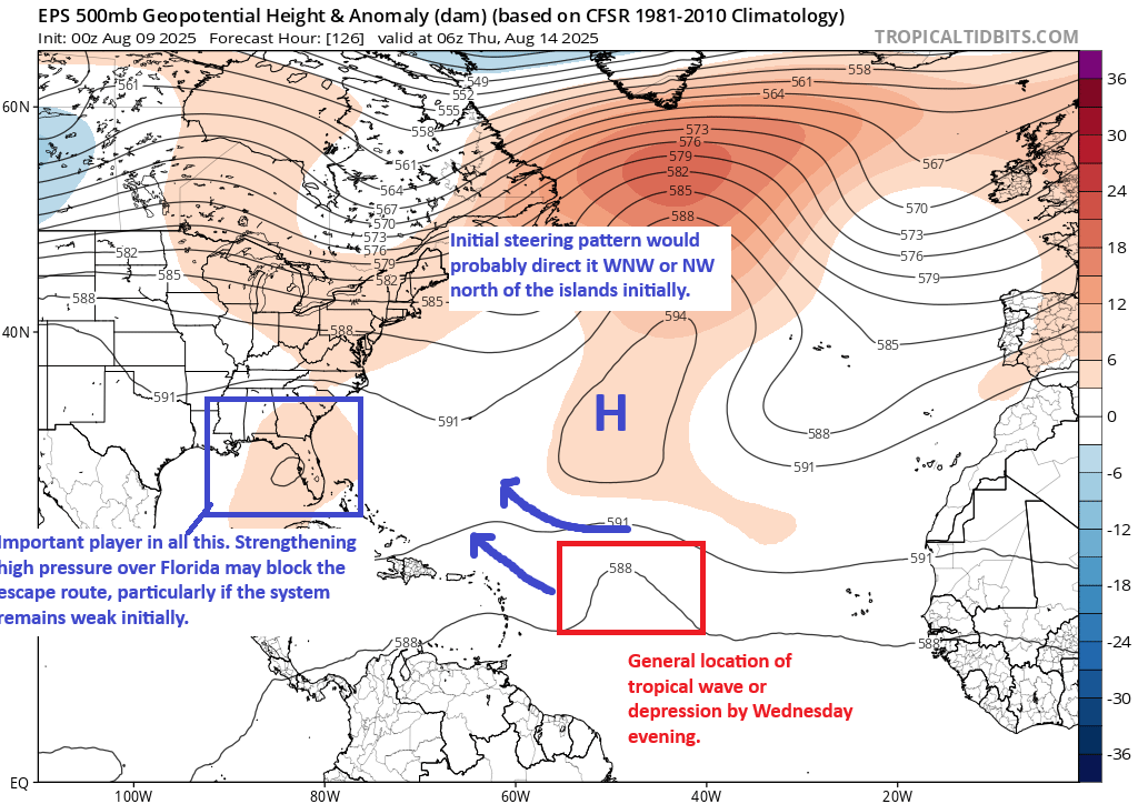
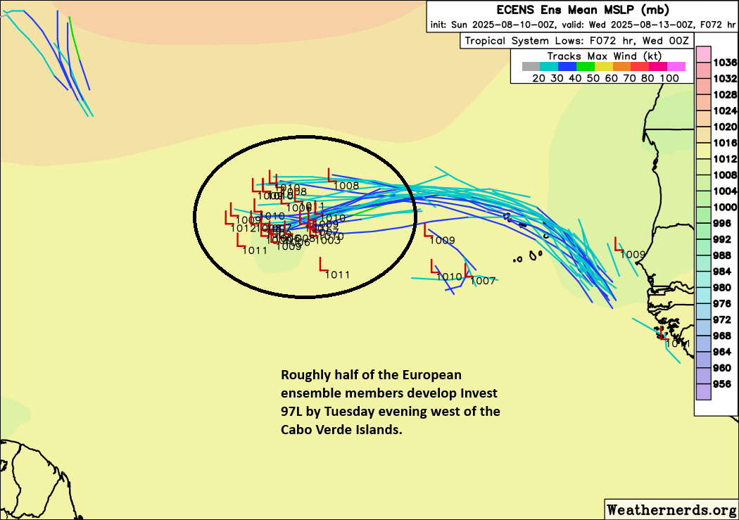
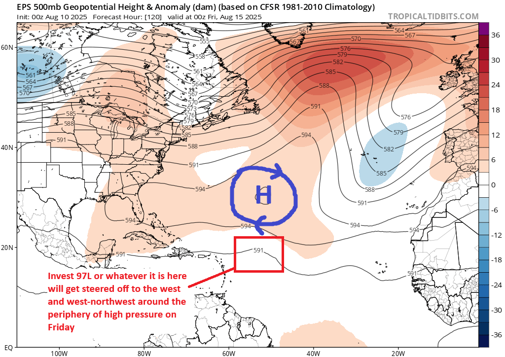
Over the next 2 to 3 days, we will see the wave gradually consolidate west of the Cabo Verde Islands and also a little farther to the north. Generally speaking, we should see a consolidated tropical wave attempting to become a depression in about 2 to 3 days, somewhere west of the Cabo Verde Islands and along 15 to 18°N latitude.
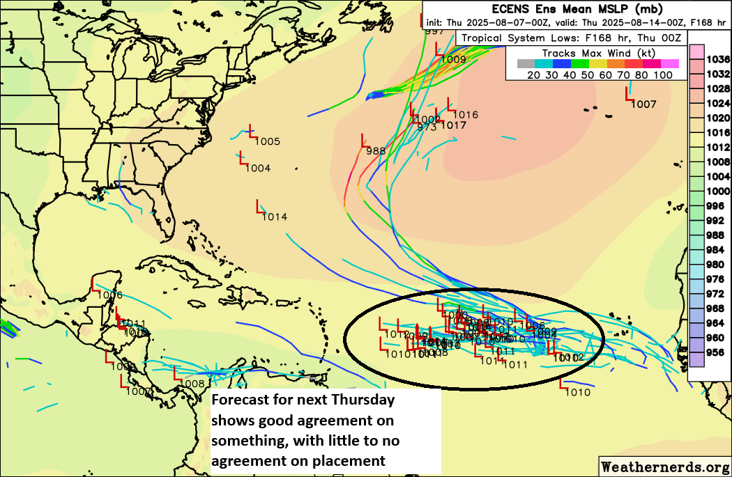
Things are fairly straightforward between day 3 and day 5. The disturbance should end up around 500 to 700 miles east northeast of the Leeward Islands by the time we get to later Thursday. From this point, the track forecast gets very, very complicated. To try and sift through this mess, let’s do what we did yesterday and look at the upper pattern. Beginning on Thursday, we can see high pressure still in control to the north of 97L, which should continue to direct it west or west-northwest across the Atlantic. At this point, I would still watch this closely in the northern Leeward Islands, Puerto Rico, and the Virgin Islands.
As the weekend arrives, the high pressure system in the Atlantic will begin to evolve. For one, it should weaken. As this happens, this will allow 97L to begin to gain some latitude. This is historically a situation where we often see storms intensify, gain latitude, and turn out to sea, possibly threatening Bermuda on the way. But the upper pattern isn’t exactly that straightforward with this one it seems. At least not sitting here a week from then.
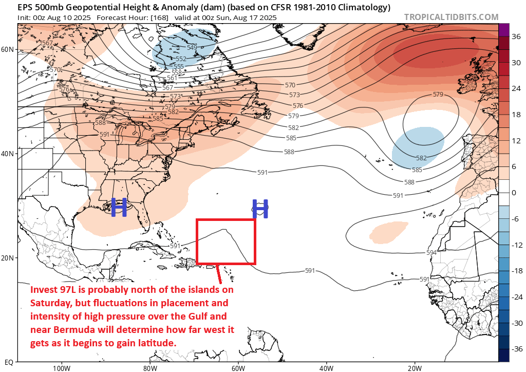
Initially, yes, look for 97L to play by the historical rules of the majority of storms in this situation and start turning more northwest. But there are signs that high pressure near Africa and the Canary Islands will try to build west across the Atlantic early next week. If that happens, that may narrow the escape route for 97L out to sea or at least keep it going more northwest than due north.
So, it remains very complicated. The betting odds would still favor this system turning north and eventually out to sea. However, those odds remain low confidence. Folks from Florida and the Bahamas up the East Coast into Atlantic Canada and Bermuda should still be monitoring this system.
Other things we can say? The intensity of the system will matter, as a weaker one would be more apt to stay farther south, perhaps becoming more of a landfall threat later. A stronger system earlier may be more apt to curve back out to sea more easily. The exact latitude this thing establishes will make a difference too. All these things are connected, and none of them are quite figured out just yet. Look for some gradual clarity on who, if anyone is at relative higher risk over the next 2 to 3 days.
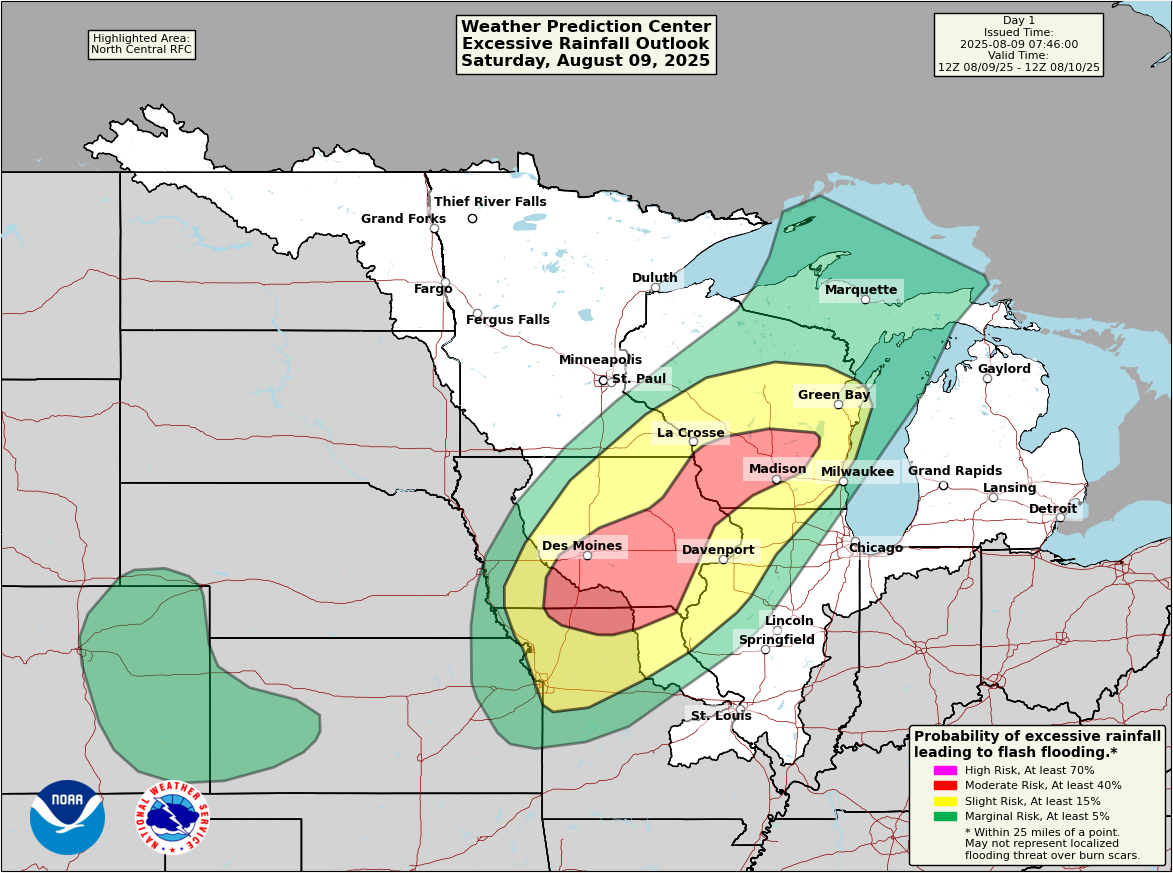
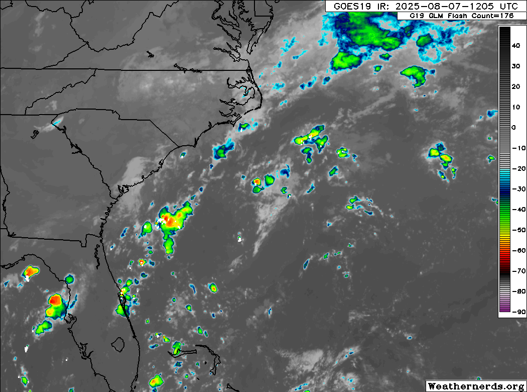
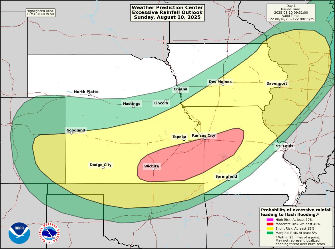
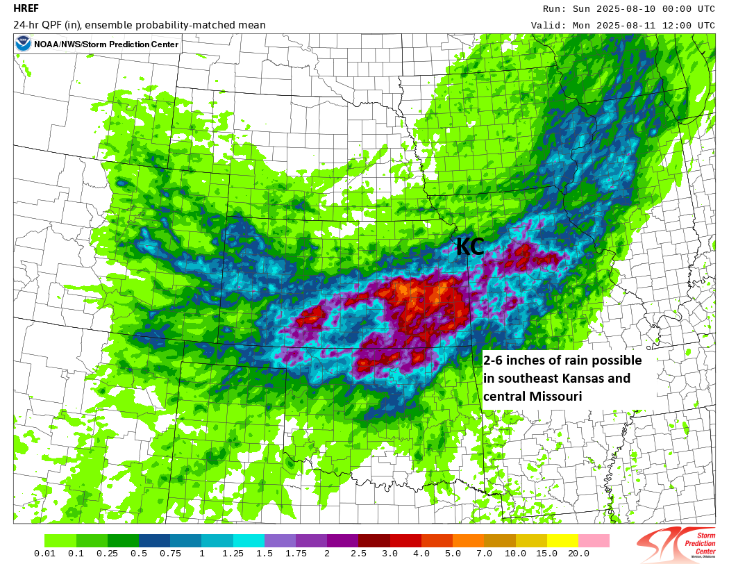
Flash flooding risks persist
Another day, another moderate risk of flash flooding.
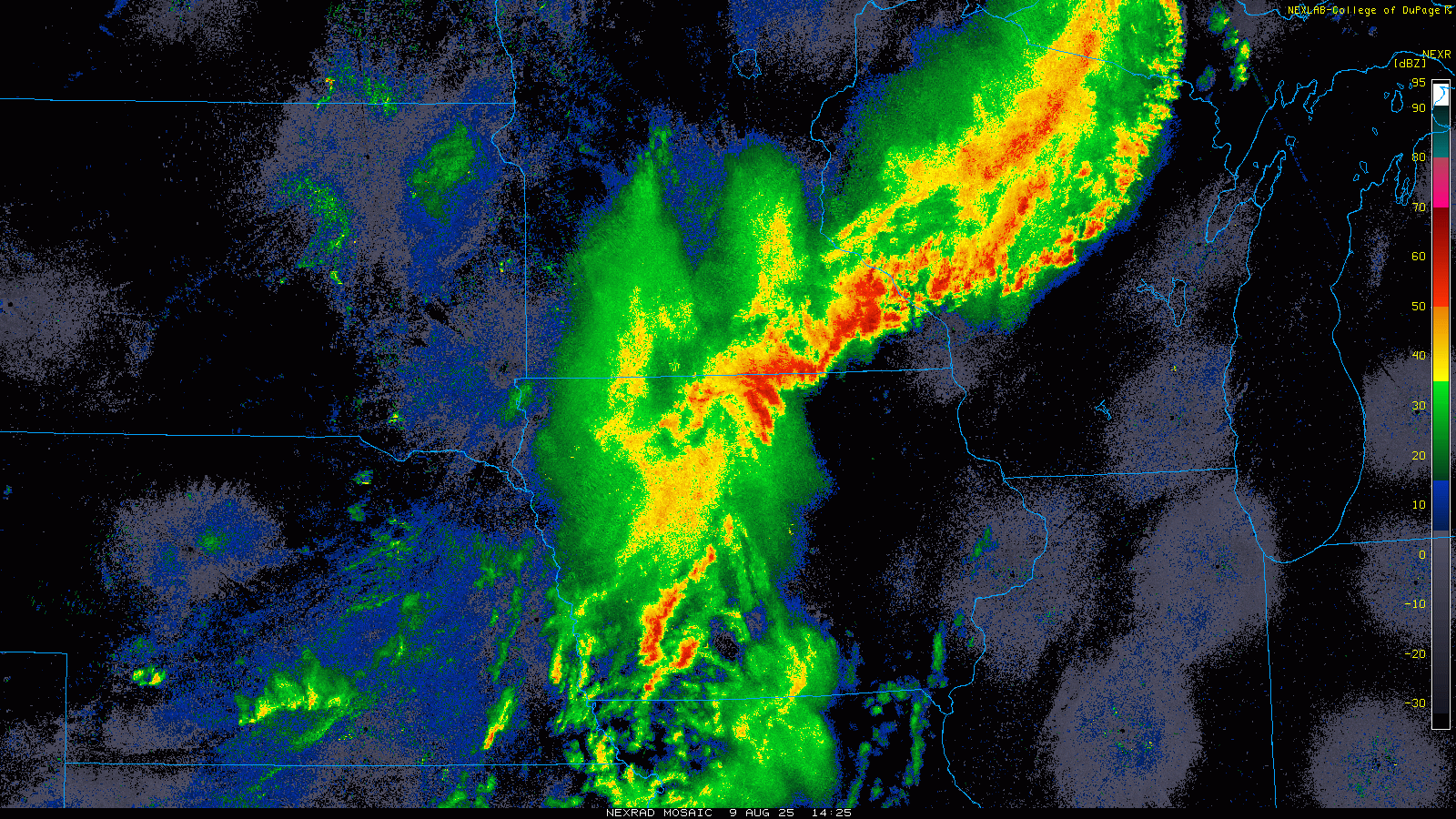
Yesterday’s rainfall was impressive, but it ended up a little farther northeast than expected. Some gauges near Milwaukee have received over 10 inches of rainfall since yesterday morning, with another round of heavy rain pushing in as I type this. The rain ended the Wisconsin State Fair a day early.
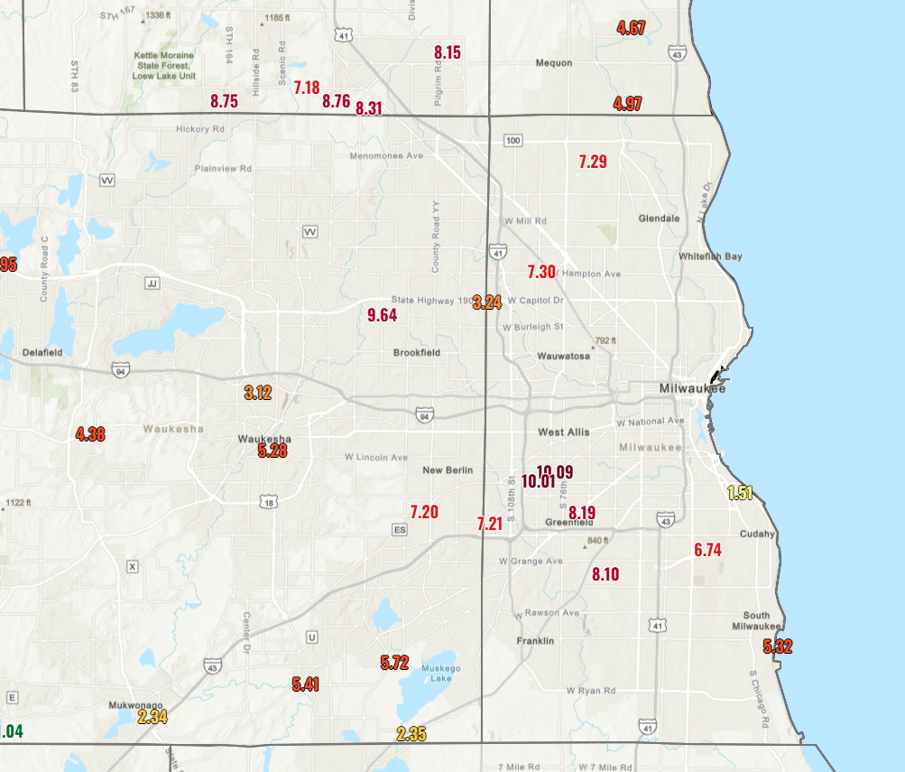
It would seem an additional 1 to 3 inches of rain is possible there this morning, with some additional rain chances later today.
Meanwhile, in the moderate risk area, a line of thunderstorms is crossing Kansas and the KC metro now. Additional heavy rain development seems likely this afternoon and evening, especially south and east of I-35.
Flash flooding risk continues tomorrow just off to the east of today’s risk area.