In brief: The Atlantic remains quiet, so today we look at recent pre-July activity and assess the odds of a weak disturbance forming next week in the southwest Gulf.
Quick note: Colorado State updated their seasonal hurricane outlook with no changes in expectations today. You can see the full update here.
Would anyone care to hazard a guess as to the last time we got to the end of June with no tropical storms having formed in the Atlantic? Anyone? No? Okay.
2014.
Suffice to say, the May-June storm story has been one of busy-ness the last several years, indeed the last decade. At least in terms of named storms happening.
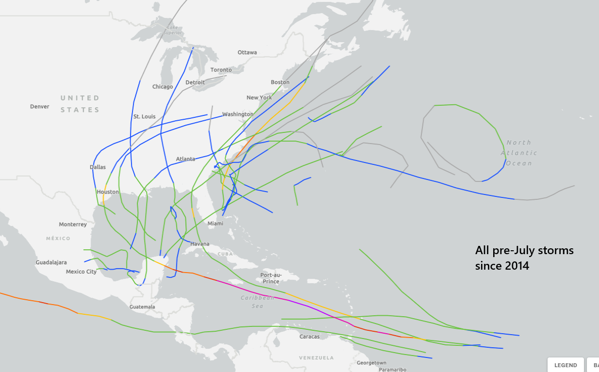
Other than Beryl last year, most Atlantic systems this time of year are weaker. Beryl was an exceptional case that tapped into a favorable atmosphere and rocket fuel waters. In general, most of these early season outcomes are sloppier, more rain and flooding than wind and surge, and mostly infrequent. Some of the cases in recent years were borderline storms at best. Some may have been missed in the pre-satellite era. So, despite the increases in activity in recent years, it may just be that we’re seeing more of the real risk than we had previously presumed.
Whatever the case, we’ve got about 19 days left in the month. We have weather model data that covers about 14 to 15 of those, and no reliable modeling is showing any serious threat at this time. Maybe this will be the year that breaks the 11-year streak.
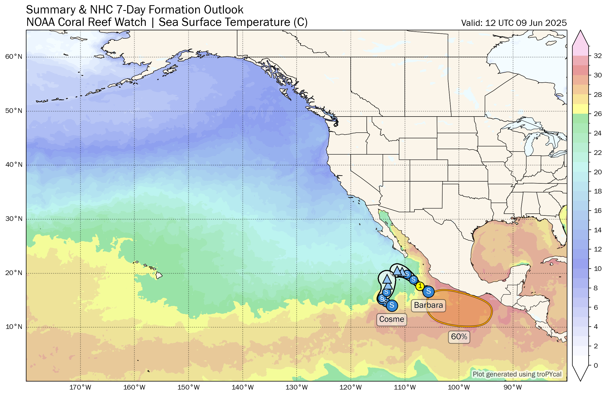
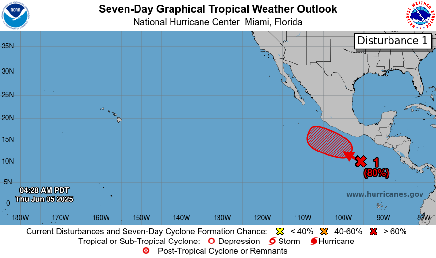
One area to watch next week, I guess
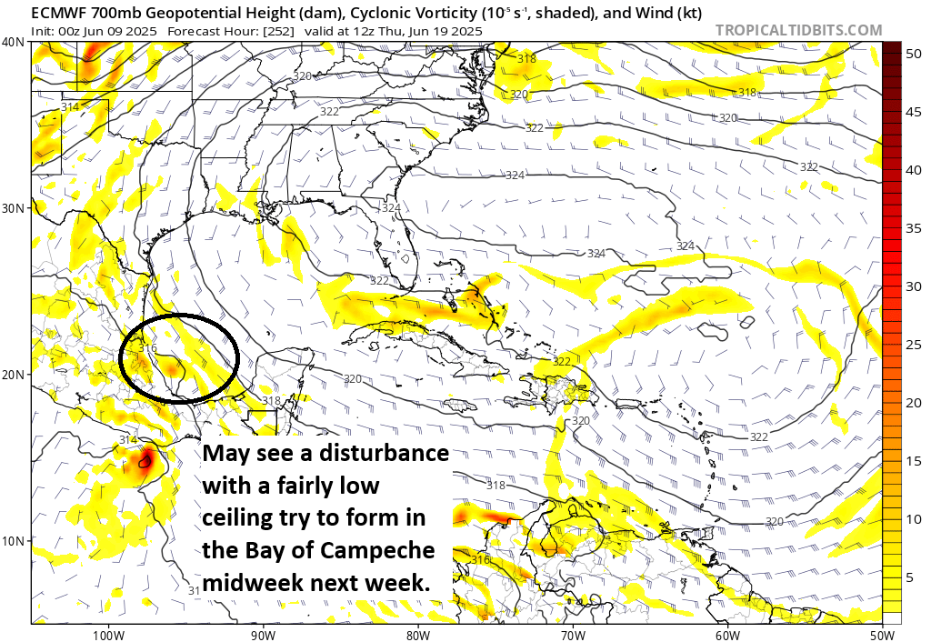
There is one very, very low probability candidate for development, and that remains next week in the western half of the Bay of Campeche. The window for anything to develop looks narrow; the proximity to land is a problem. But we do see at least some hints of a disturbance there.
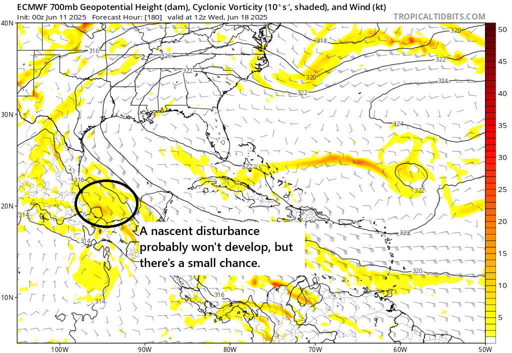
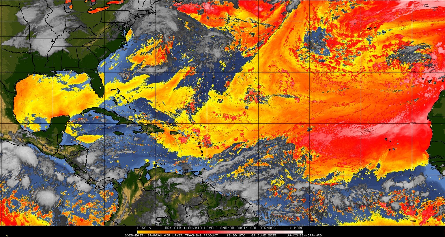
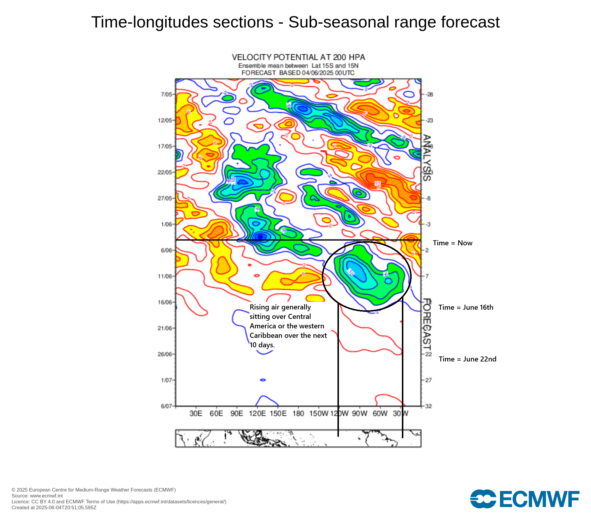
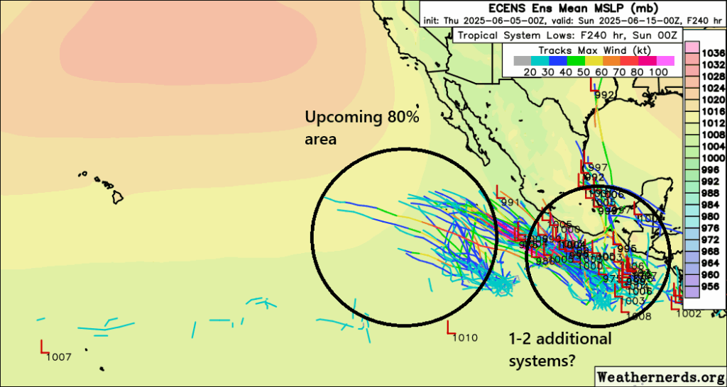
The Pacific remains busy with another storm or two possible there over the next week. Around midweek next week, there have been fairly consistent hints in model guidance that a disturbance would sort of pinwheel out of the southwest Caribbean into the southwest Gulf of Mexico or Bay of Campeche and come ashore in Mexico around next Wednesday or Thursday. Realistically, this is almost certainly going to run out of time over water before it has a chance to develop, but the odds are slightly greater than zero.
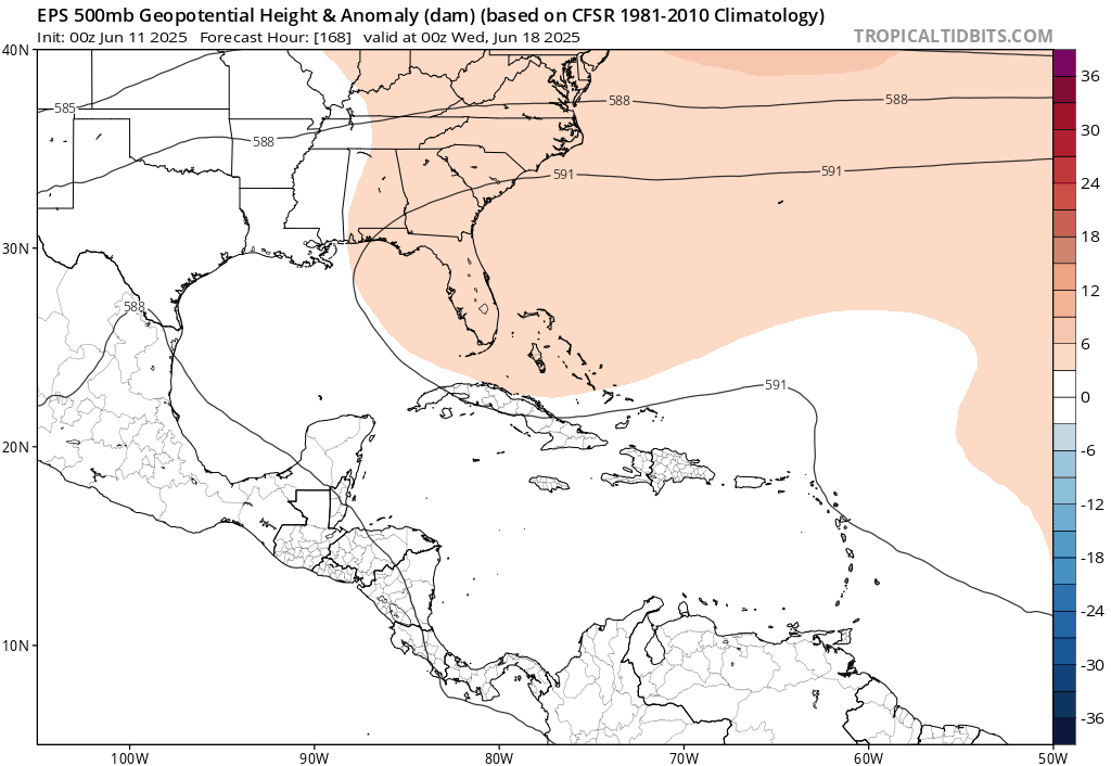
It does appear that high pressure building west across the Gulf (seen in the expanding reddish colors above) will push this disturbance quickly inland in Mexico and probably keep the moisture out of Texas as well.
In summary: There’s almost certainly nothing to worry about here.
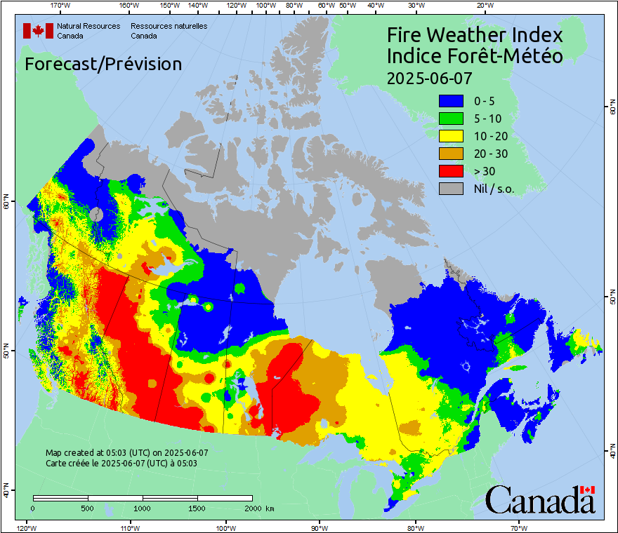
And aside from that, the Atlantic is quieter than the bats of the Colorado Rockies.