Headlines
- Major Thanksgiving Day/Friday storm possible in the Eastern U.S., with snow possible in the interior or Ontario.
- Cold air mass follows into the weekend.
- Surge of mid-winter cold follows next Sunday into the first week of December, primarily for the Midwest, Great Lakes, and Northeast.
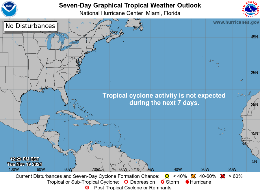
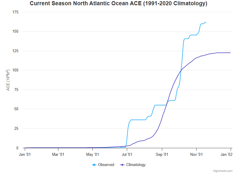
With hurricane season now behind us, it’s time to talk about winter. And if you live in the eastern two-thirds of the country, you’re going to see a pretty impressive dose of it incoming after Thanksgiving.
Active weather to kick off the week
The weather map today shows a continued pattern allowing for moisture in the West with several feet of snow coming to the Sierra Nevada. A major warm up is going to occur in the South-Central U.S., while colder air exits the Northeast.
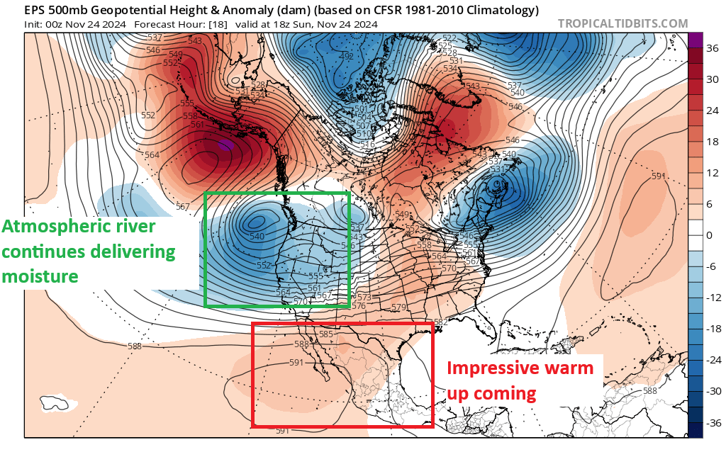
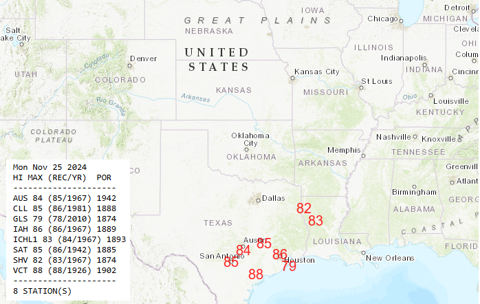
In fact, Monday will see record highs possible across southeastern Texas, including for Austin, San Antonio, and Houston, as well into Shreveport. Most of these records were set back in 1967, which would have been late in that year’s Thanksgiving weekend.
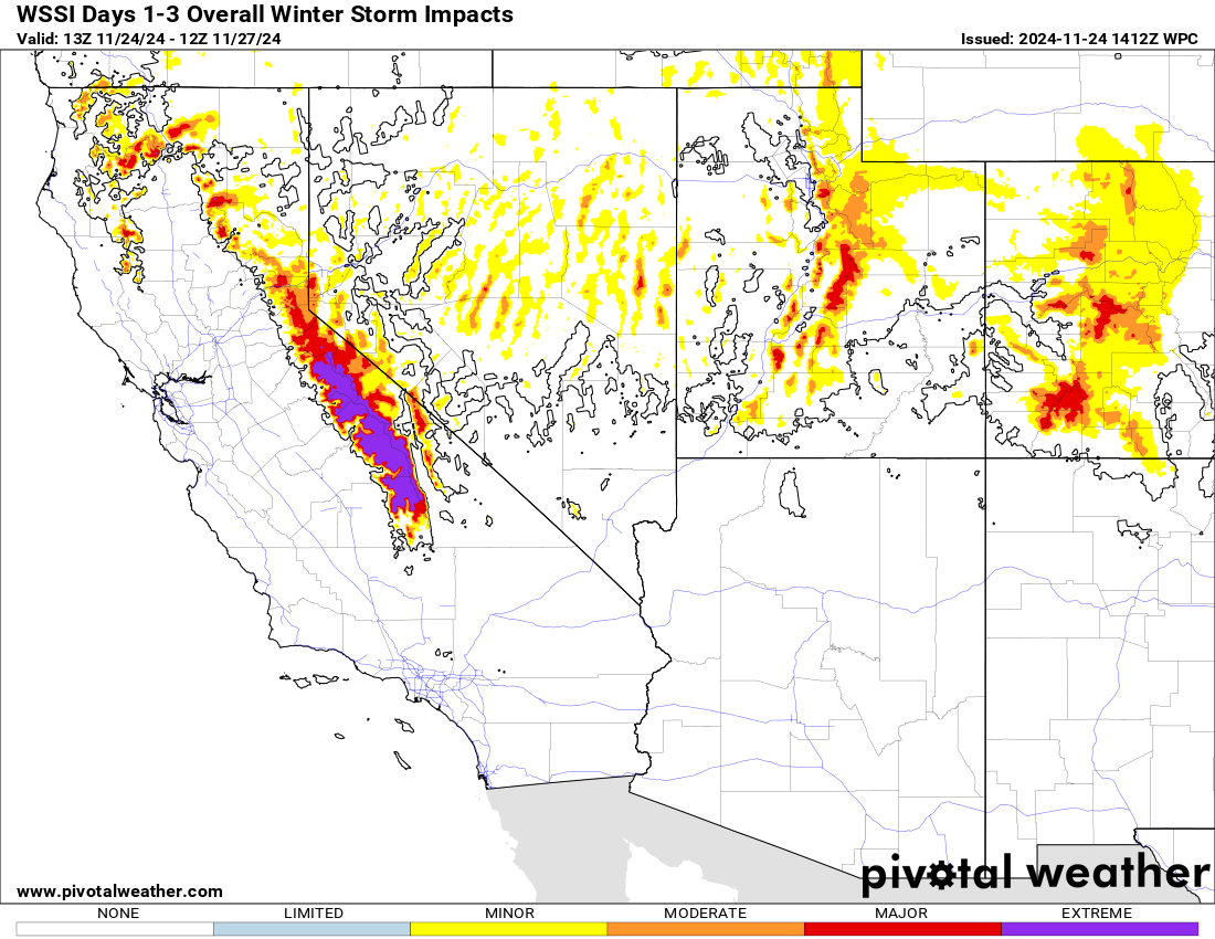
The snow forecast in California will be in feet, and “extreme” winter weather conditions are expected in the Sierra. As much as 7 feet of snow may fall at the highest elevations, giving California a big jump start on their water year snowpack.
First wave of cold
One cold front will sweep across the country Wednesday and Thursday, ushering in cooler temperatures on Thanksgiving Day and Black Friday.
The first wave of cold is likely to come with a winter storm in the Eastern US, followed by lake effect snow as well. There is a great deal of uncertainty as to where heavier snow may fall on Thanksgiving Day and Friday, but portions of Ontario, interior northern New England, and Upstate New York would be firmly in the potential.
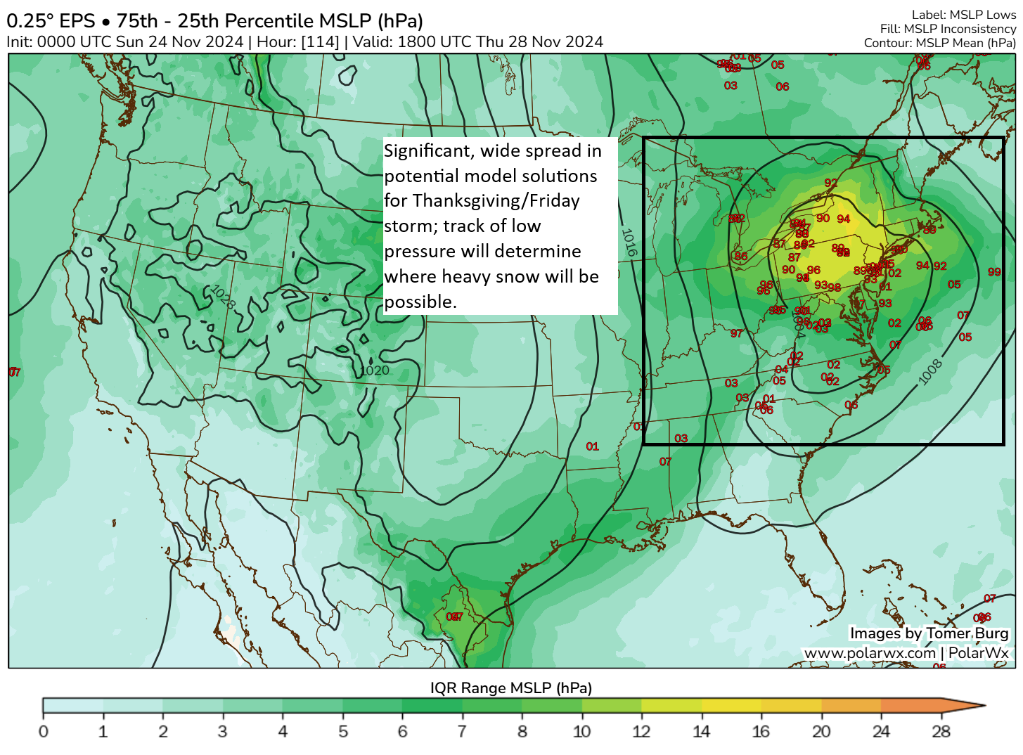
But for a 5-day out forecast, this is a really significant spread in possibilities. A track toward the Mid-Atlantic would keep the heavier snow firmly in place for portions of New York and perhaps Pennsylvania too. A track over Upstate New York would probably push the heavier snow back into Ontario. Either way, Thanksgiving Day travel in the Northeast and eastern Great Lakes will likely be impeded by this system. Start planning now.
Second wave of cold; the real deal
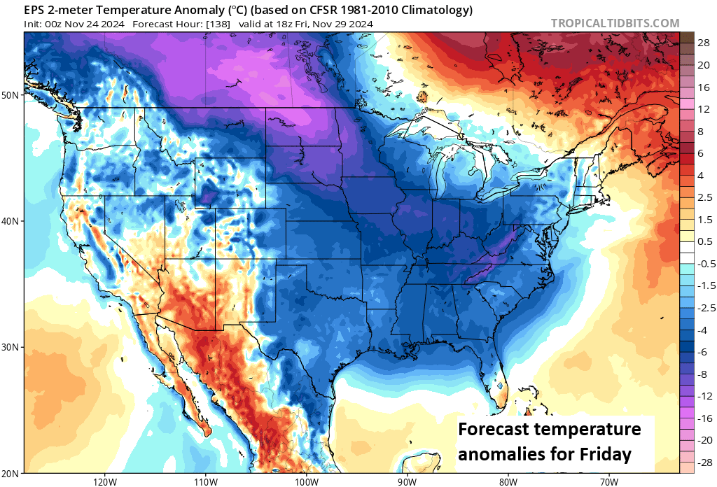
For those looking for winter air, you will get your wish after Friday or Saturday. A second surge of cold air, almost direct from Siberia is going to plunge into the Great Lakes and Midwest. This will usher in the coldest air since last winter, along with all the stuff that comes with it: Biting wind chills, potential for major lake effect snow, and at least a chance of additional snows here or there. For folks in Texas, it will turn colder but not nearly to the levels we’ve seen at times the last few winters. This cold is primarily directed into the Midwest and Northeast.
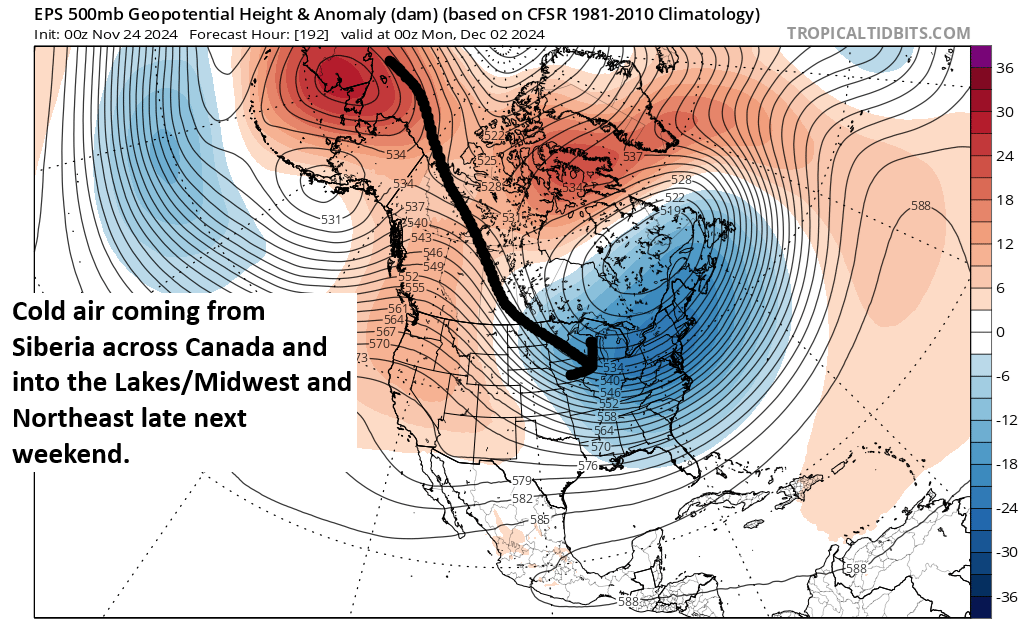
What does this translate to? We’re likely talking about highs in the 20s in Chicago and lows in the single digits or low teens. Similar temperatures would occur elsewhere in the Great Lakes and Midwest, so places like Cleveland, Detroit, Indy, and Minneapolis would all experience mid-winter type cold. Bottom line? Winter is coming.
Beyond that, December will probably see a bit of a warm-up after the first week, but it may take some time to dislodge the cold. Either way, November is going to go out with a bang across the Eastern U.S.