Headlines
- Tropical development is likely in the western Caribbean later this week or weekend.
- Potential exists for some higher end development initially with heavy rainfall a threat in Central America.
- From here, a several day ramble across the southwest Caribbean, a track northeast through the Antilles, or an eventually track north and northeast toward Florida are all possibilities.
- Interests in Central America, specifically Honduras, Belize, and Nicaragua, as well as in Cuba, the Greater Antilles, and Florida should monitor this system going forward.
Next storm up could be problematic
The next name on the tropical storm list is Sara, and we may see that one by the weekend. I will warn you right out of the gate that this system, assuming it develops, will have a fairly high ceiling in the first few days, and there are model solutions that eventually bring it north toward Florida. It is far, far too early to speculate on exactly what this will ultimately do, but unfortunately if you live on the west coast of Florida you should be monitoring future updates on this.
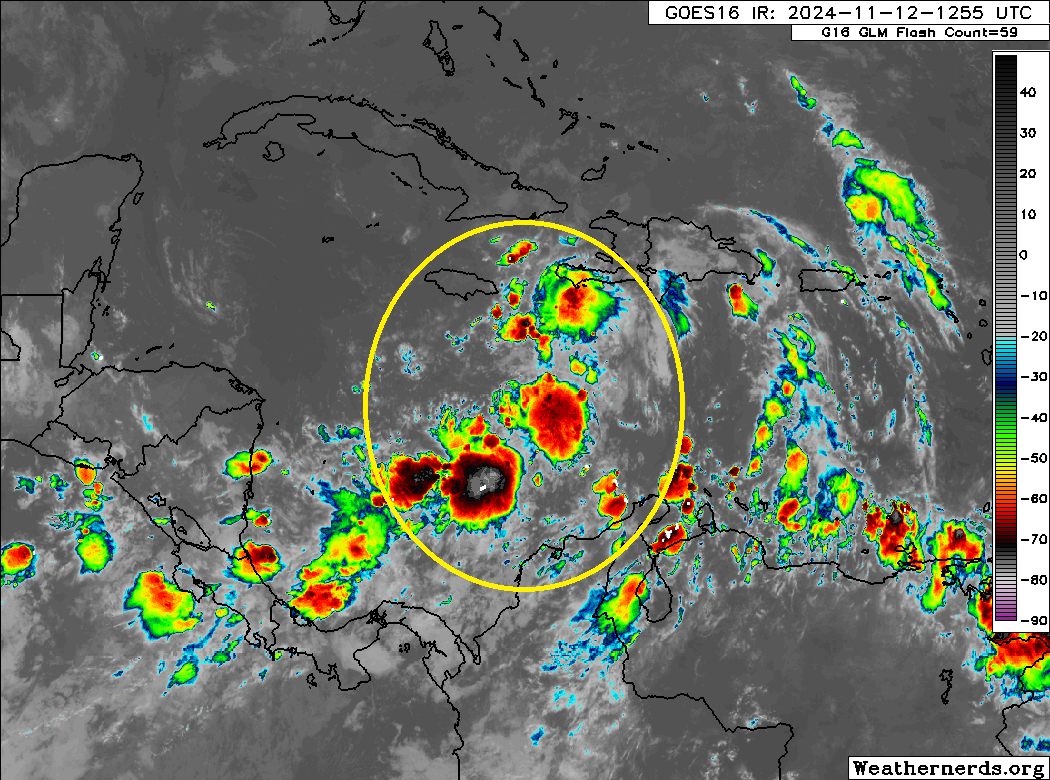
Right now, the system is still just a tropical wave. I would suspect this gets Invest status later today or tomorrow morning.
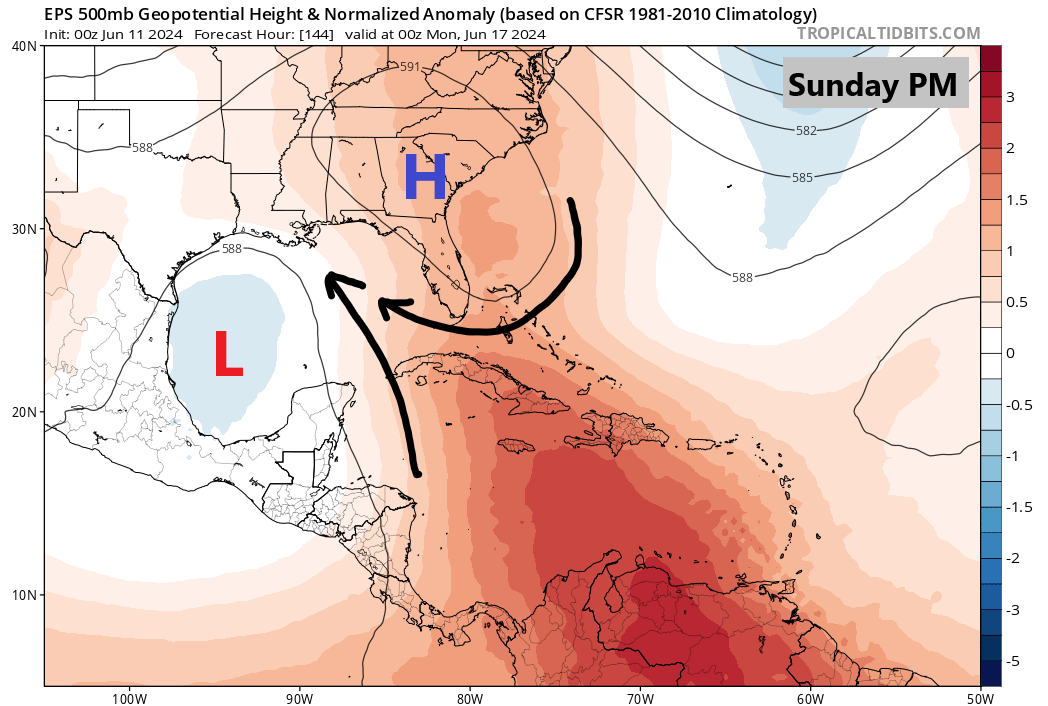
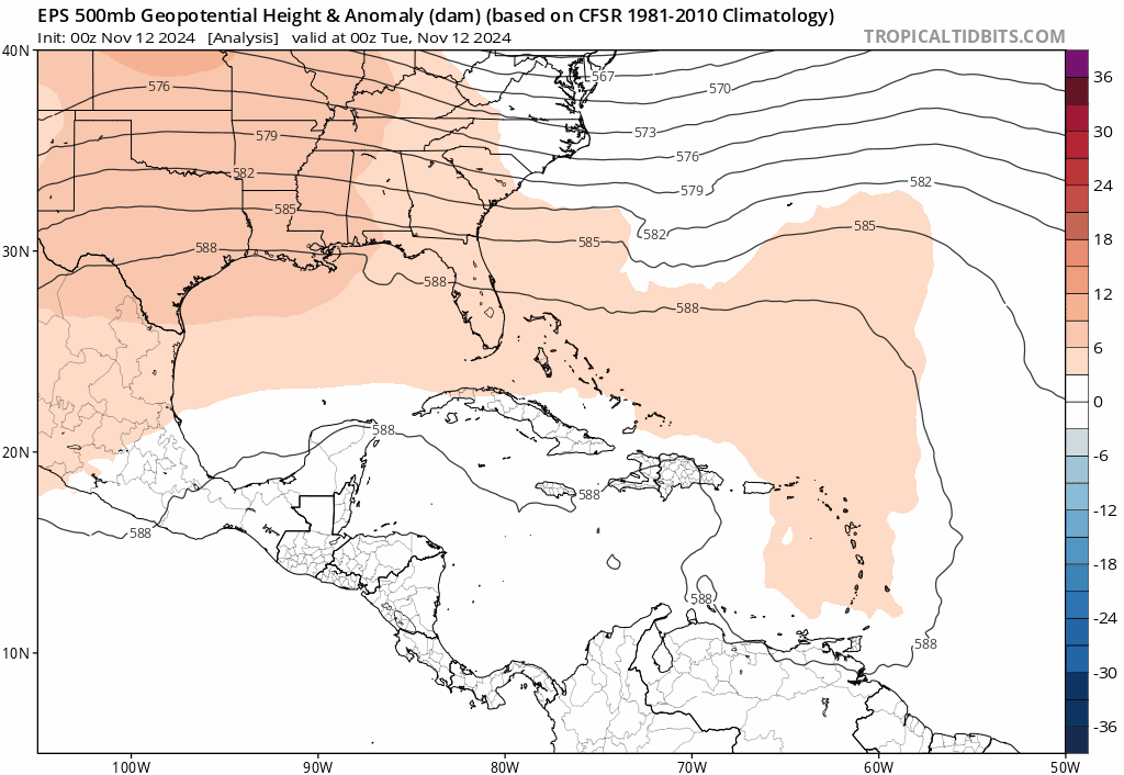
The environment over the next couple days as this area comes west will be fairly pristine for tropical development. With an abnormally strong ridge of high pressure over the Eastern U.S., this will promote generally low wind shear. A weak trough of low pressure in the upper atmosphere will erode that ridge, but it will be too soon to “pick up” this tropical wave and carry it away to the northeast. The ridge should rebuild itself and at least for the first several days of its life cycle, whatever becomes of this wave is likely to meander around the western Caribbean.
Once that little trough, or what we call a “short wave” merges with a stronger trough off the East Coast (blue at the end of the loop above), the question will become whether or not its strong enough to “capture” the Caribbean system and force it northeast away from Central America and into the Atlantic. Odds of this happening don’t seem terribly high, but we should know in a couple days if this is a realistic possibility.
If that doesn’t happen, then we are probably looking at some potentially serious problems in the southwest Caribbean, either via a strengthening storm and/or a significant rainfall event for Honduras, Nicaragua, or Belize.
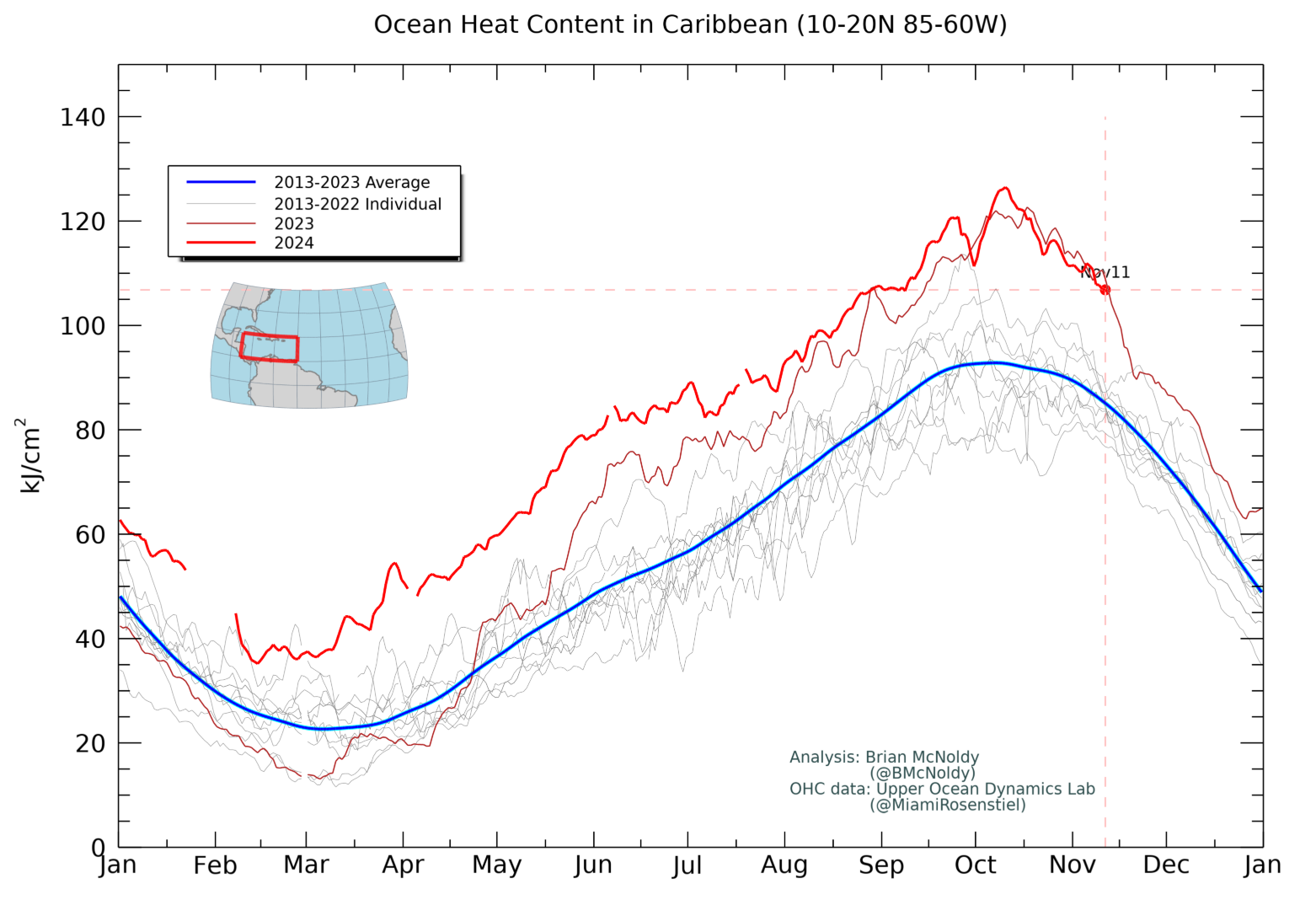
The sea-surface temperature environment in the western Caribbean is potent for November, near 2023’s record and well above normal for even September. In other words, there will be plenty of fuel available for development.
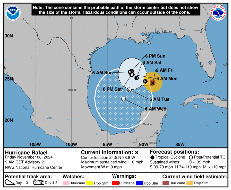
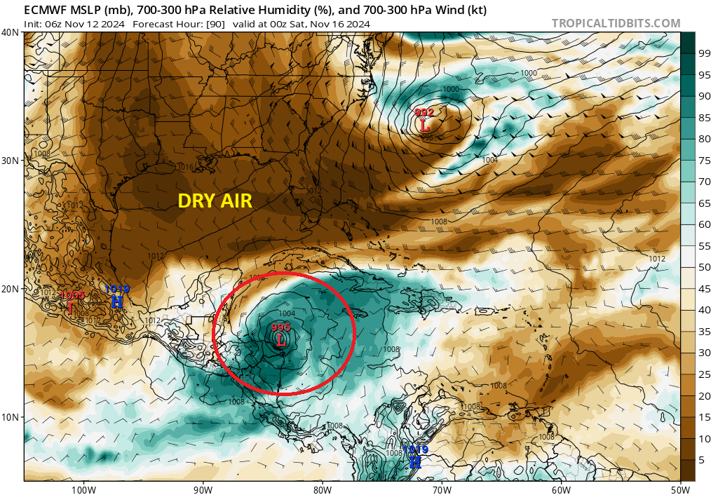
If there’s a negative for development, it may be the amount of dry air available over the Gulf. By the time we get to this weekend, a substantial push of drier air in the wake of a cold front will infiltrate almost the entire Gulf of Mexico. If this system can close itself off and insulate against the dry air, it’s not a problem. But much like Rafael, if left at all exposed, it could eventually just get choked off from moisture allowing it to essentially self-destruct. There’s a wide variation in potential outcomes here.
So how could Florida be at risk? If this gets left behind and just festers in the western Caribbean, it could eventually get drawn north next week, which could pose a threat to the Florida coast. That’s a week or more away, so no one can really speak confidently on this topic. But it would be wise to continue monitoring the situation with this storm in the coming days.
So bottom line? A system is likely to develop later this week. There are many plausible options for development, but one thing is certain: There will likely be very good conditions for development in the early days late this week. From there, a meandering rain producer in Central America, a quick exit northeast across the Antilles, or an eventually track north and northeast into Florida are all plausible options on the table right now. We will continue to watch things.