Headlines
- Rafael will continue west and eventually turn southwest, steered by high pressure over Florida and the northeast Gulf.
- Rafael unlikely to cause serious land problems at this point for Mexico or the U.S. Gulf Coast.
- Higher tides are likely for Texas and perhaps Louisiana, but as we explain below, they will fall well short of levels seen during Alberto earlier this season.
Hurricane Rafael doing some unique things for November
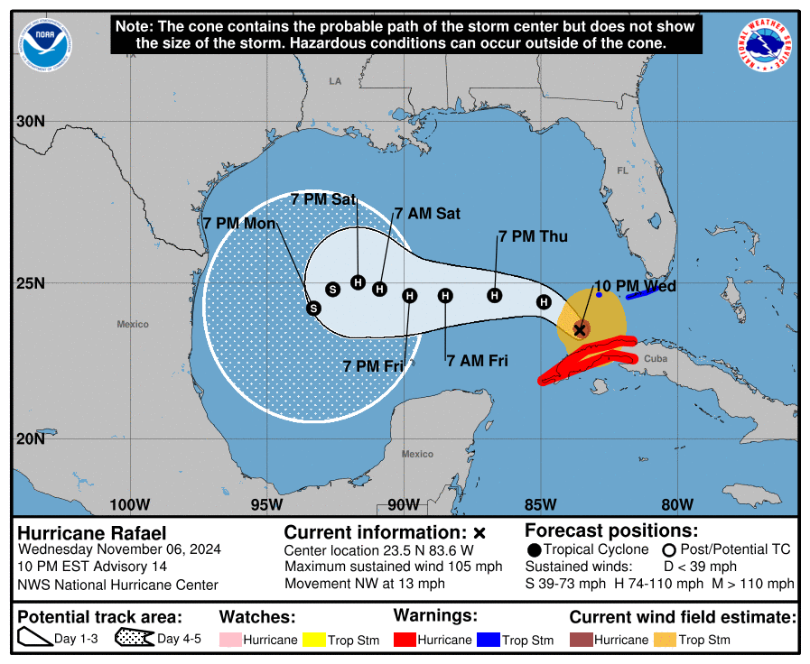
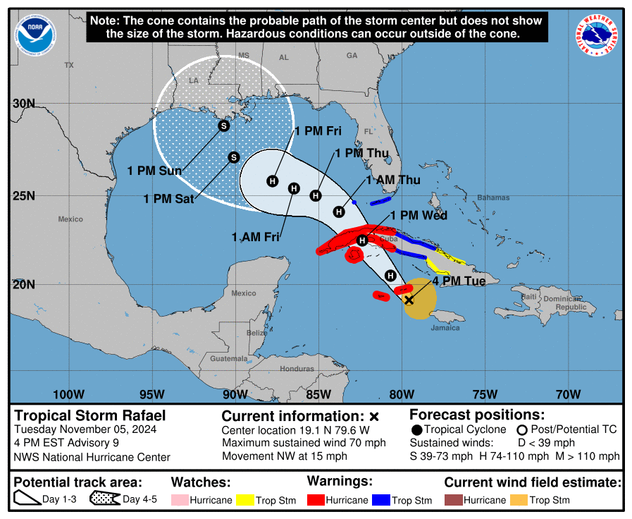
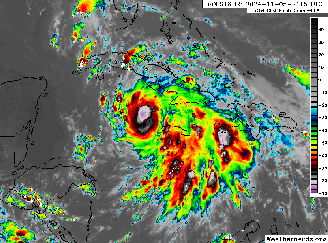
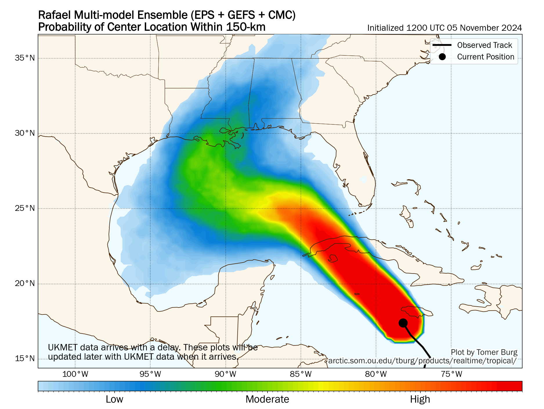
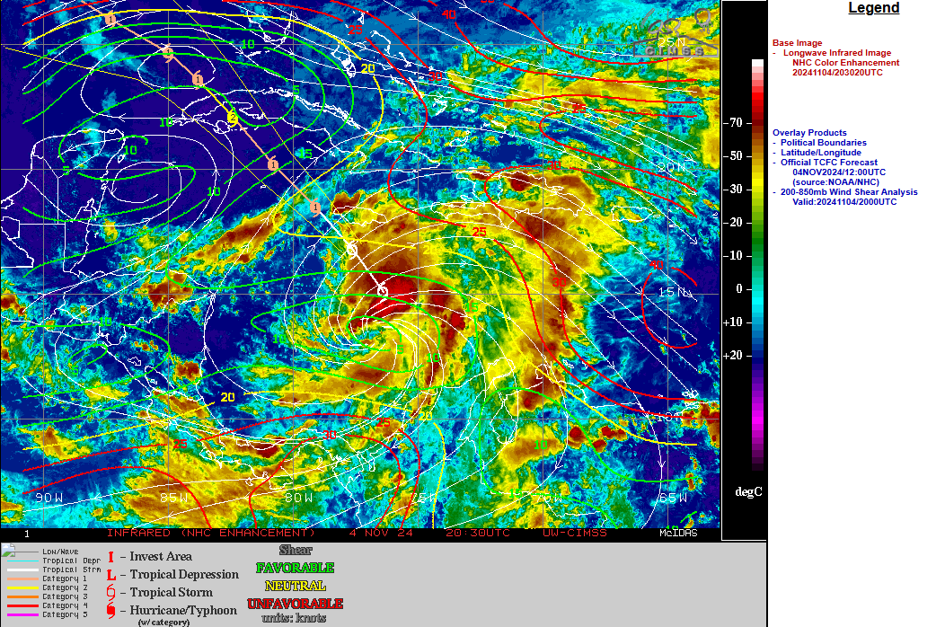
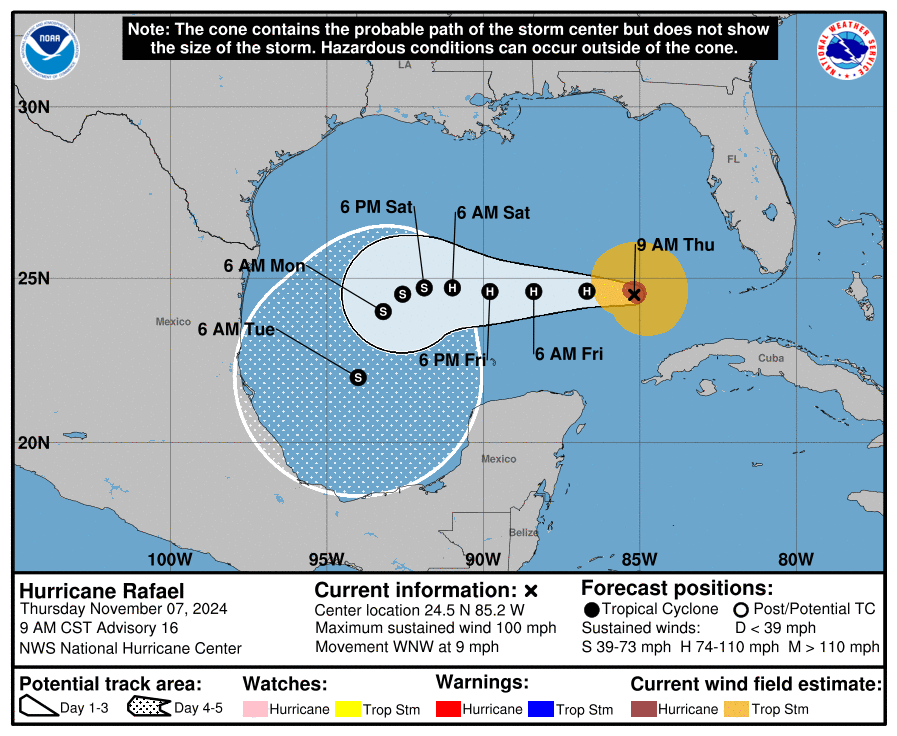
Hurricane Rafael is motoring along this morning in the Gulf of Mexico off to the west and west northwest.
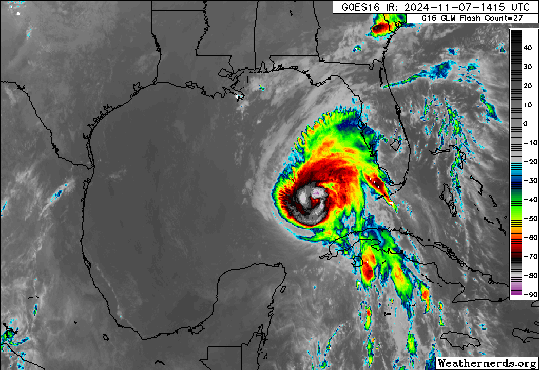
Rafael is a category 2 hurricane with 100 mph winds, down a bit from its peak on approach to Cuba yesterday. It will likely hold steady or gradually weaken in the next couple days as it tracks west.
A storm tracking west in the Gulf is not uncommon. However it is virtually unheard of in November.
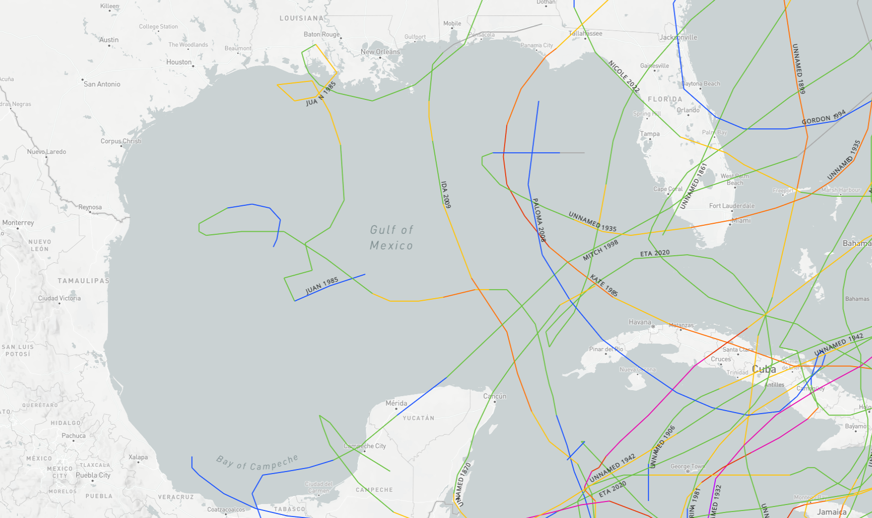
Only Hurricane Jeanne in 1980 tracked west in the Gulf in November, and interestingly, it followed a very similar path to Rafael, just farther west of Cuba and then died off before getting to Texas or Mexico. Hurricane Juan in 1985 also had a noteworthy track in that it did several loops over the northern Gulf before eventually making a final landfall near Pensacola. But most Gulf storms in November come due north or track northeast out of Central America as weakened systems. Rafael will definitely be a historically noteworthy system.
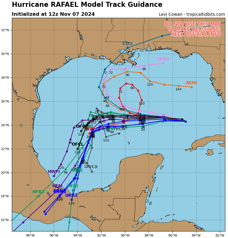
Model guidance is actually in decent agreement today that Rafael will track due west and then inexplicably southwest into the Bay of Campeche. I want to tackle two questions here. First, what in the <redacted> is happening here? Second, someone asked why this storm is not as concerning as Tropical Storm Alberto, which did something kinda sorta similar back in June and caused some considerable coastal flooding on the Texas coast. The two questions are somewhat related.
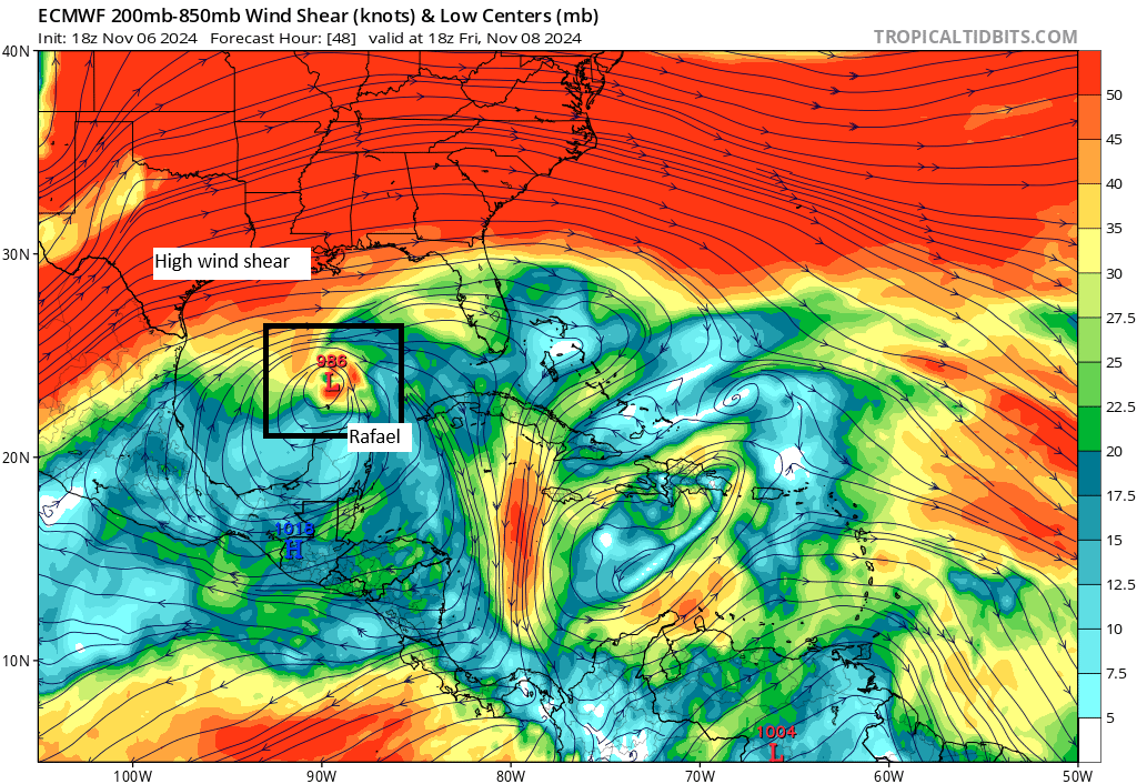
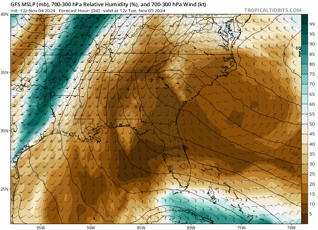
So, the what is fairly simple to explain. If we look at a map of the upper air pattern, or what will steer Rafael at 48 hours when that turn to the southwest begins, we see high pressure over Florida and the Southeast pushing Rafael to the west.
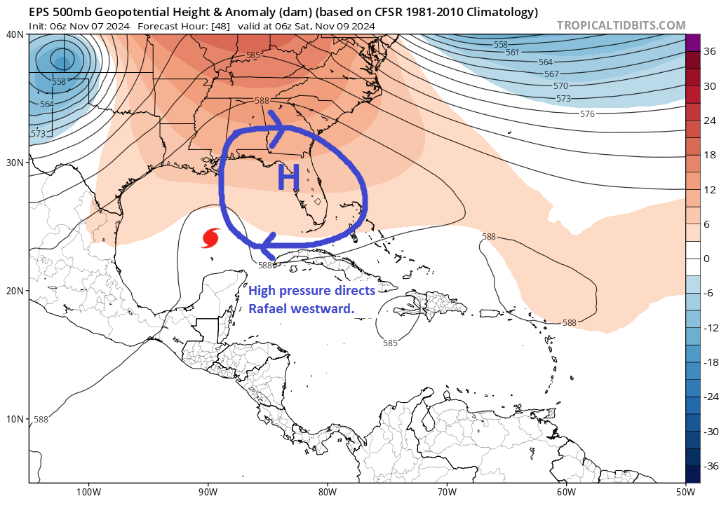
By Monday morning, the high pressure center has moved east of Florida, but it has also kind of strung itself out more. This imparts more of a northeast to southwest type of motion on Rafael. Keep in mind that during this time, Rafael will continue to slowly weaken, so it will also become more susceptible to these steering currents as well, making it easier to sort of “bully” the system into the Bay of Campeche.
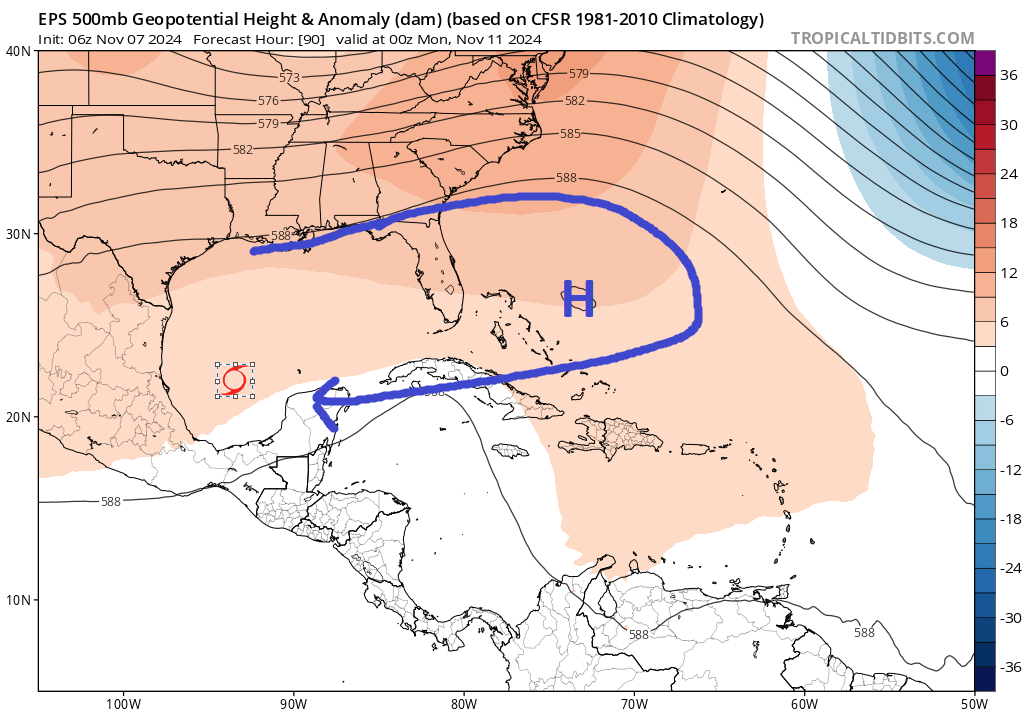
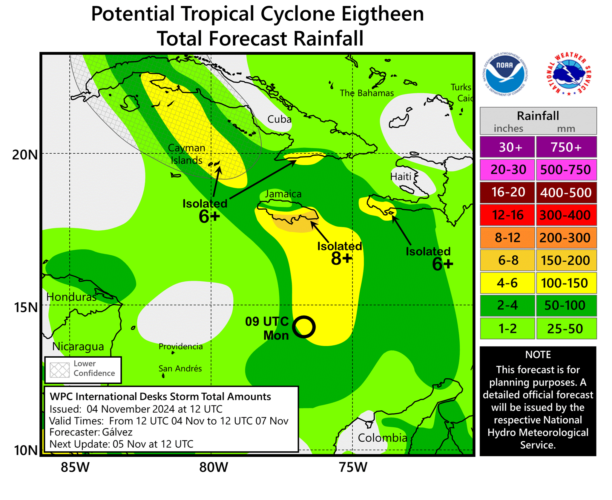
Is this a threat to Mexico? It seems like it won’t be a real serious threat, but it at least bears some watching to make sure everything behaves as expected.
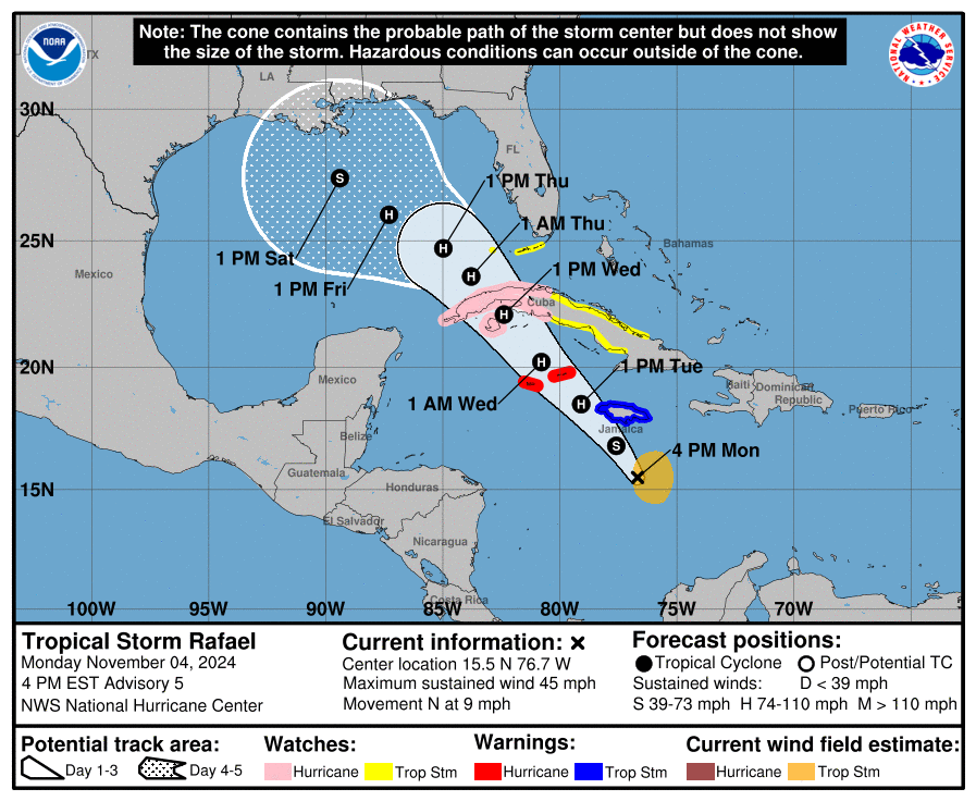
So this leads us to the second question: Why is this storm not really a major flooding concern for Texas, whereas Alberto was back in June. Here’s what the upper air pattern looked like for that event.
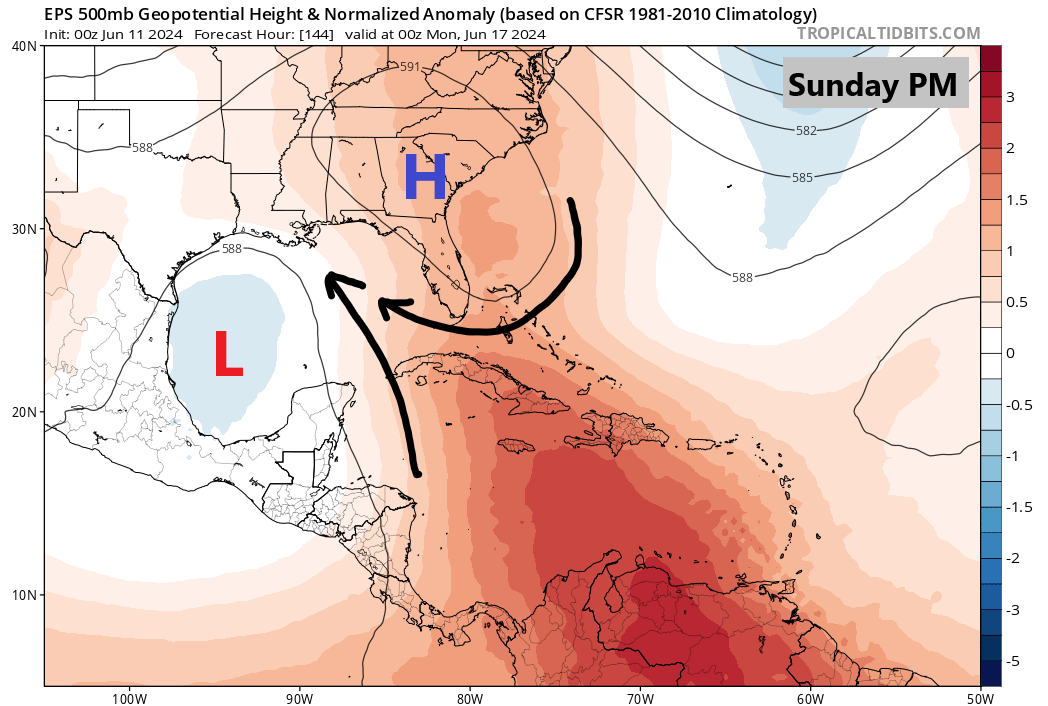
During Alberto, high pressure to the northeast of the Gulf, combined with low pressure in the southwest Gulf led to a broad, strong pressure gradient flow across the entirety of the Gulf. That is what we call a long “fetch,” meaning moisture and waves had an opportunity to pile up in the western Gulf eventually. That led to coastal flooding in Texas and Louisiana. In Rafael’s case, we have the system in the southwest Gulf, but it’s a bit smaller. We also lack high pressure to the north that would enhance Gulf moisture and fetch. Will tides increase on the Gulf Coast? Probably. Will they reach Alberto levels? Almost certainly not. So this is why we aren’t especially concerned about coastal flooding.
Rafael will hopefully be a meaningless blurb by Monday, but we’ll see. Meanwhile. another weak system has a slight chance to develop north of the islands heading into next week. At this point, we don’t view that as a particularly serious concern.