We’re off to a fairly volatile start to spring in Texas, and the risks are not really coming via thunderstorms but rather via wildfire risk. For the third time in less than 2 weeks, there is a “critical” wildfire risk in Texas (as well as Oklahoma) today. This means the threat of wildfires is about as bad as it gets for some of these areas.
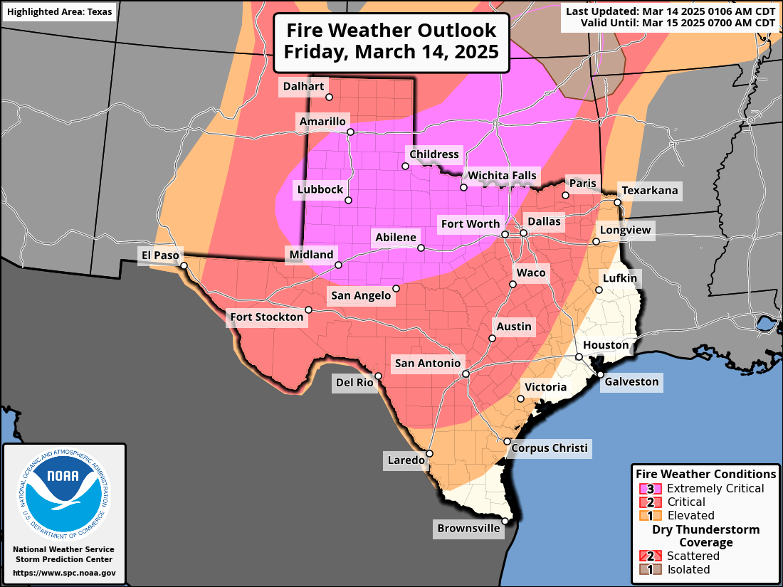
Not all of Texas is included in this risk, but much of the western half of the state, as well as North Texas into Oklahoma are there. The combination of dry ground, expanding drought, low humidity, and strong winds will make for a dangerous wildfire risk in those parts of the southern Plains.
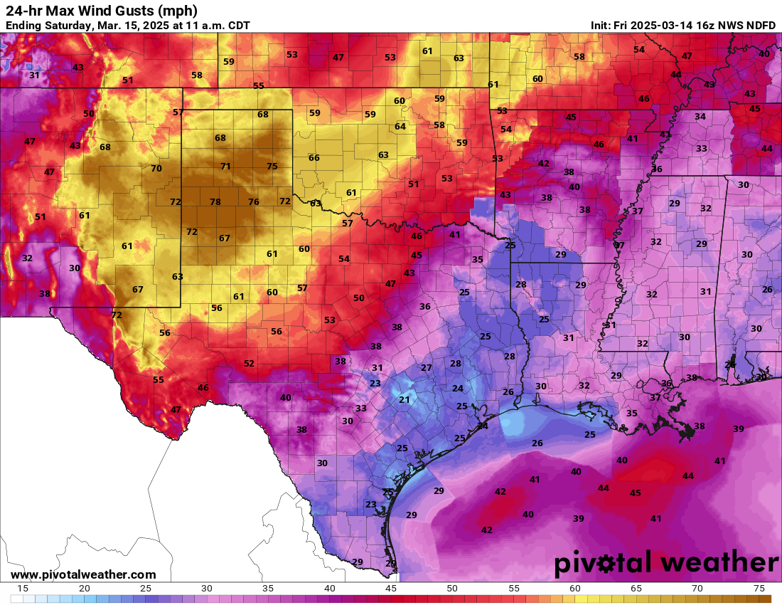
Wind gusts of 40 to 80 mph are likely this morning and afternoon, especially in the Texas Panhandle, the Caprock, perhaps the Hill Country and North Texas to the west of Dallas-Fort Worth through Wichita Falls and up into parts of Oklahoma. In fact, winds have already gusted to 81 mph in Amarillo and 83 mph in Lubbock today. Those winds will be hospitable to rapid fire spread should something get started, hence the concern. Additionally, winds that strong will be capable of producing some non-thunderstorm wind damage on their own west of I-35.
Additional fire risks will follow in the days ahead, including tomorrow, Sunday, Monday, and Tuesday, especially in west Texas and eastern New Mexico.
How did we get here?
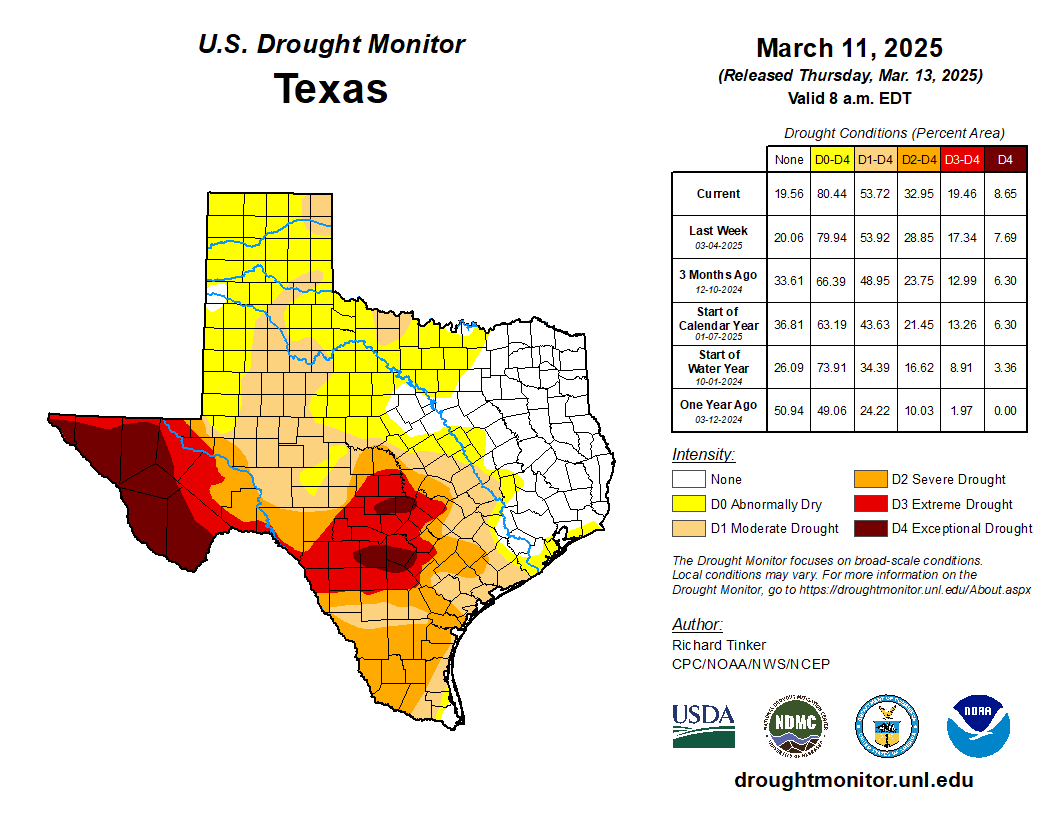
Texas has been in and drought as it often is, but in recent years it sure feels like we’ve been “in” drought more than out of it. Since the start of 2025, Texas has struggled mightily in the rainfall department. With the exception of the Piney Woods and parts of Southeast Texas near Houston, it has been a very, very dry start to the year.

Lubbock, Midland, and El Paso are all having top 15 driest starts to a year, with El Paso seeing less than a tenth of an inch of rainfall so far in 2025. Wichita Falls, Abilene, and San Angelo are all having very dry starts to a year, though not historically so. This has allowed for expansion of drought since the beginning of year, with the beginning stages of a rapid onset drought in the last 10 days or so.
The recent bump in windy, dry storms has helped accelerate this process. According to an early March forecast update from the National Interagency Fire Center, “Confidence is increasing in a high impact spring fire season across the southern Great Plains. The expected weather pattern and its impacts to the fire environment are of major concern, and at least weekly high-end wind events are plausible through March and April.”
What’s to come?
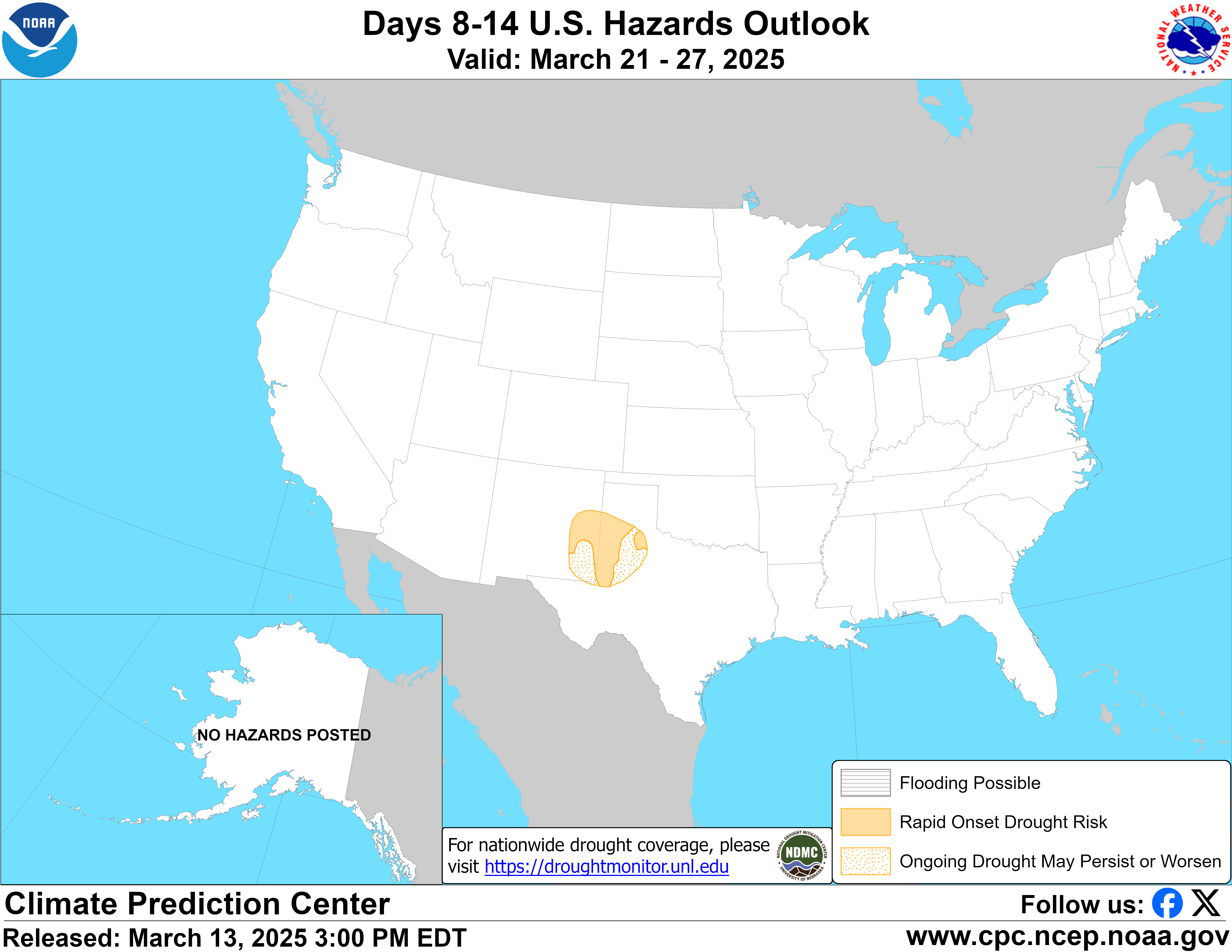
It would appear that after this weekend’s event, we have another one (albeit less intense) coming around midweek next week, followed by perhaps another one next weekend. In fact, the 8 to 14 day hazard outlook from NOAA’s Climate Prediction Center suggests worsening drought over the next 2 weeks in west Texas and New Mexico.
The next two weeks suggest near to below average precipitation in Texas, New Mexico, and Oklahoma as well, with some areas likely to remain quite dry. This is not uncommon in a La Niña event, even one that’s winding down. But this is a rather significant event for a generally minor La Niña. Perhaps things can alleviate some later this spring or by summer. Otherwise, it could be a long, painfully hot, problematic summer in the southern Plains.