Headlines
- Milton has returned to category 5 intensity and increased in size by 33 percent since this morning.
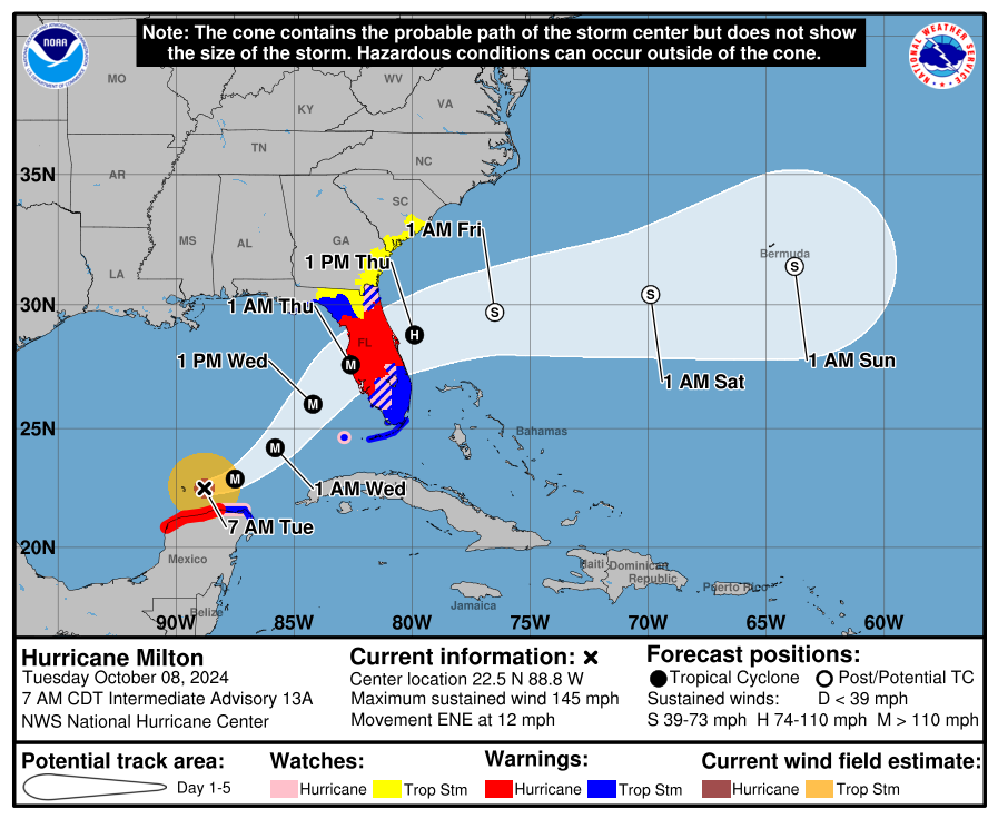
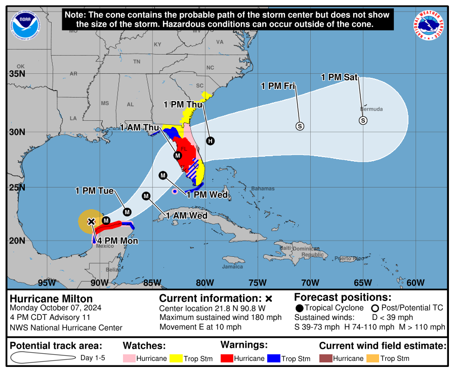
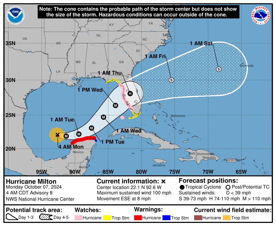
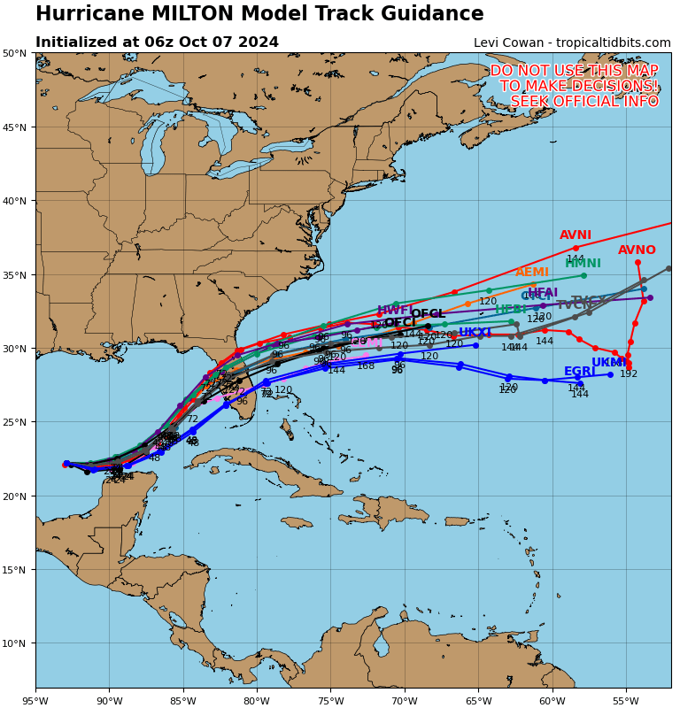
- Landfall is still expected late tomorrow night on Florida’s west coast. Some track adjustments were made perhaps nudging it a bit to the south today.
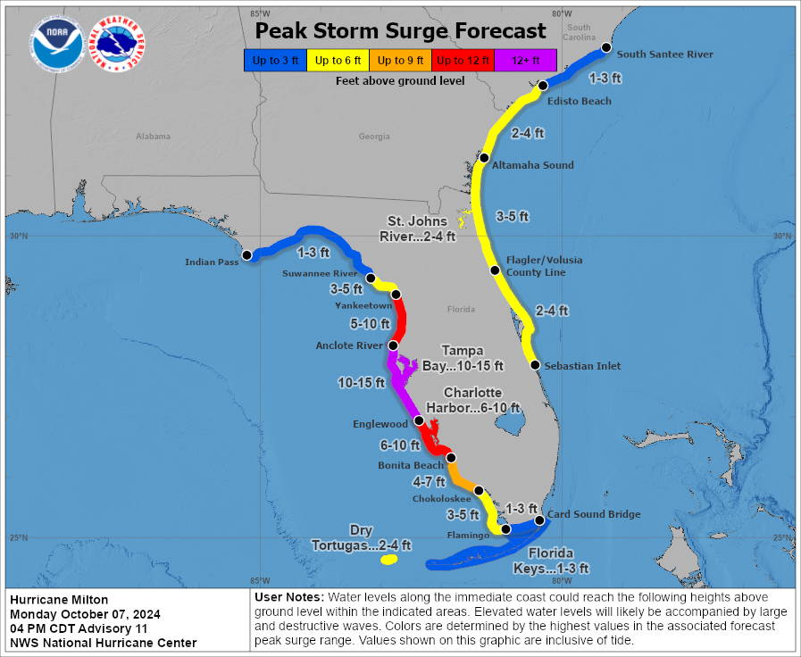
- Surge remains the biggest concern with terrible surge expected between Sarasota and Port Charlotte and very bad surge, still just under Ian levels south of there through Fort Myers. But it’s getting a bit too close for comfort.
- Tampa’s surge impacts will depend on the exact track of the storm, which remains tenuous.
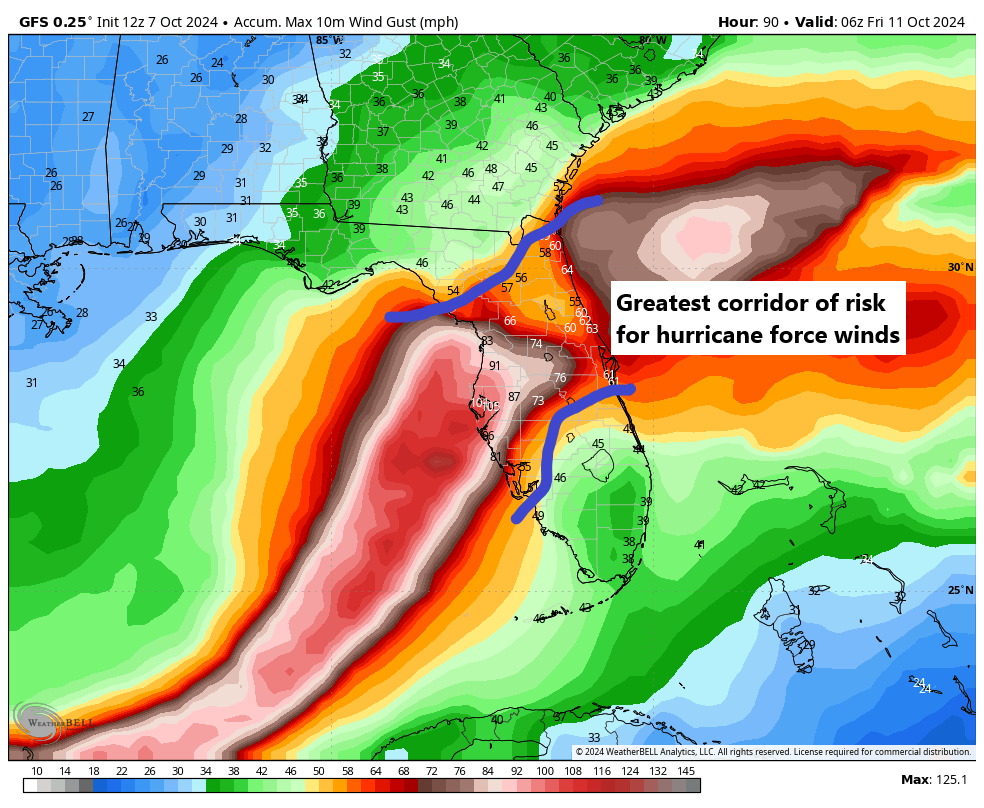
- Strong winds will pound the coast and inland areas as well with widespread power outages likely, particularly near and north of the center.
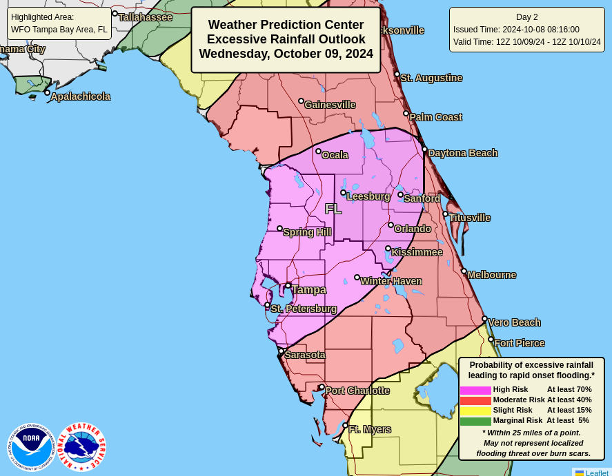
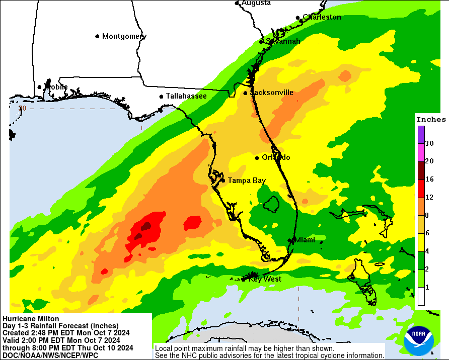
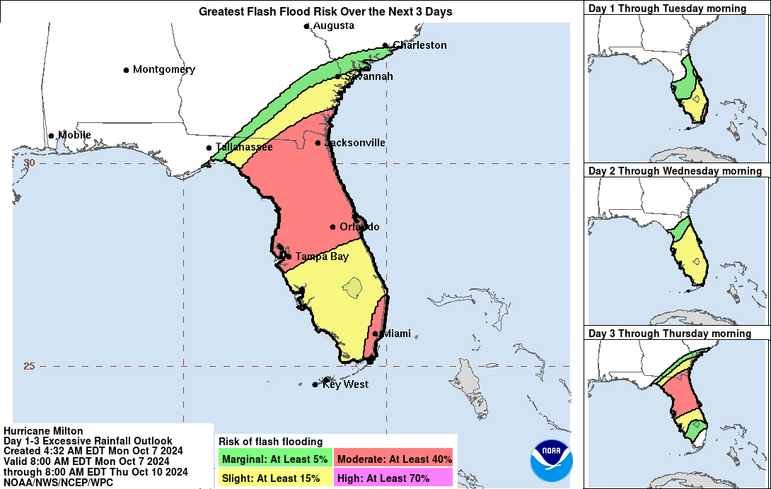
- Flooding rains will fall along and north of the center’s track, right along the I-4 corridor where up to 12 to 16 inches of rain may occur.
- East coast locations will see impacts as well with hurricane warnings now posted from the First Coast through the Space Coast to the Treasure Coast.
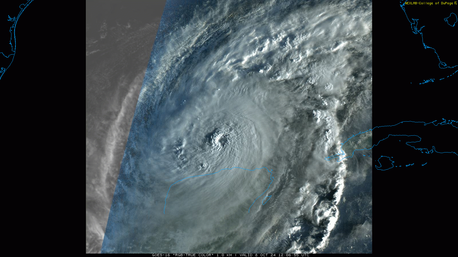
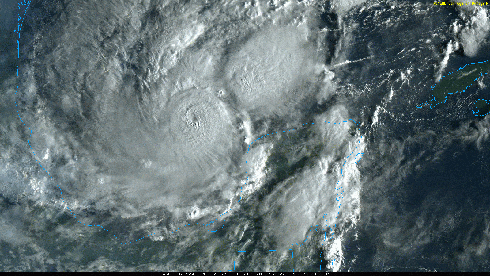
Hurricane Milton has fluctuated back upwards this afternoon, and it has once again attained category 5 intensity.
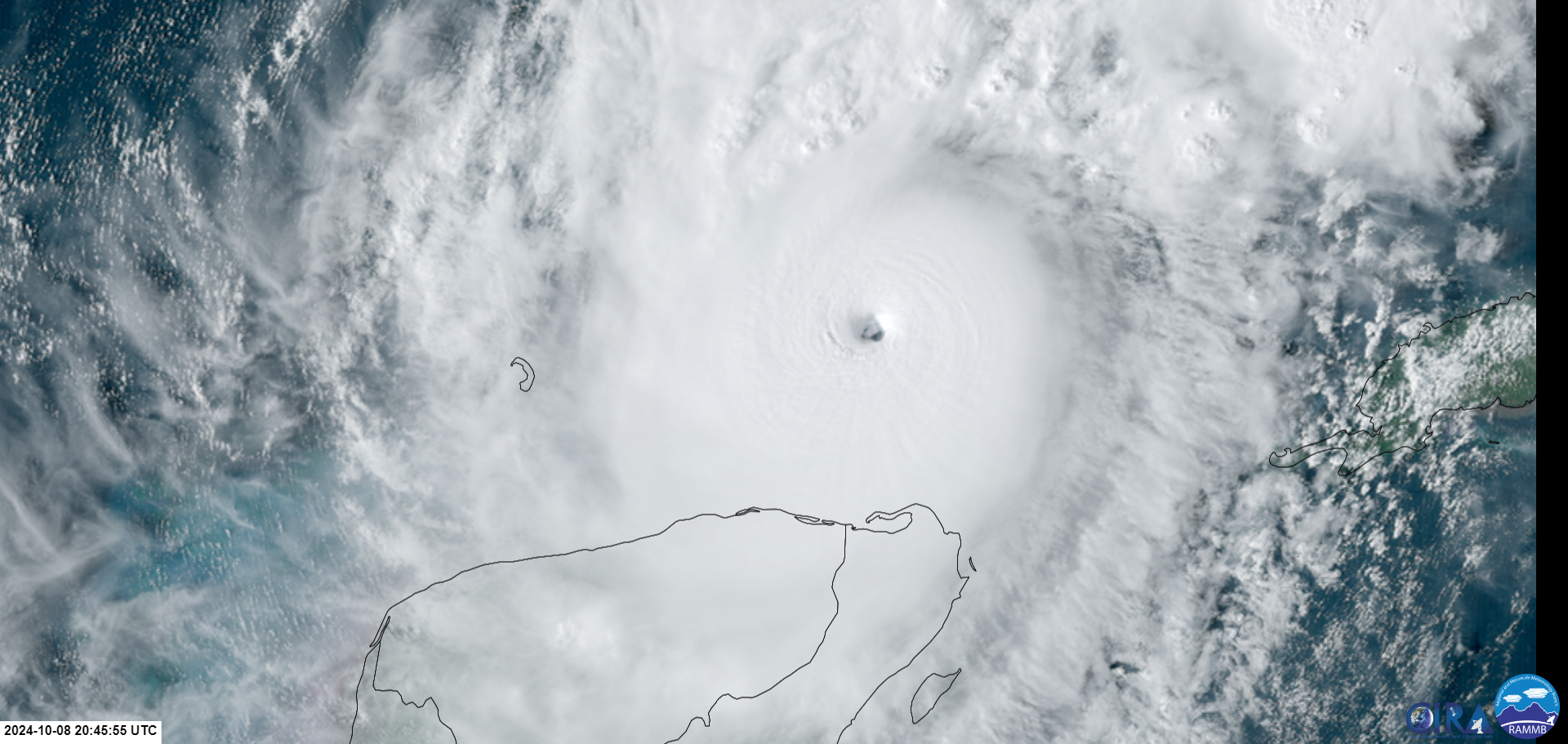
Maximum sustained winds are in a small area near the center as strong as 165 mph now. Hurricane-force winds extend out 30 miles from the center, and tropical storm force winds extend out 140 miles. This is now about 33 percent larger in size than it was this morning and 75 percent larger than yesterday. This was why we were concerned. Milton is now a formidable storm in terms of size as well. And it will grow further before landfall tomorrow night.
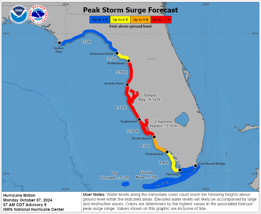
There was potentially (and I say potentially VERY cautiously here) good news for Tampa Bay today. Milton wobbled off track some to the southeast. This has now shifted the track guidance somewhat to the south. While this may be good news for Tampa ultimately, it is not good news for places like Sarasota or Venice or possibly Charlotte Harbor. Those areas may now be closer to maximum storm surge. Charlotte Harbor for instance has seen its maximum potential storm surge increase from 6 to 10 to 8 to 12 feet. This is now at Ian levels in some spots there. Surge of 8 to 12 feet is now also expected as far south as Bonita Beach. This is shy of Ian levels, but it’s getting a little more uncomfortable.
If you live south of Venice and north of Naples, have yourself ready to bolt tomorrow morning toward Miami if this thing keeps nudging southward. It is getting a bit more uncomfortably close than hoped.
For Tampa, you just need to watch and hope for the best now. It remains entirely possible that Milton comes back north some, in which case a Tampa Bay landfall and catastrophic surge is even more in play. It’s just simply too close for comfort still.
For everyone on the Florida west coast south of Clearwater, this will be a pretty rough storm in terms of wind and surge. If you have not evacuated and are in a zone ordered to do so, please reconsider, and please check on anyone who may not be able to evacuate or is being stubborn about it. Surge is the deadliest concern. In most cases, hiding from the wind will be the best course of action elsewhere.
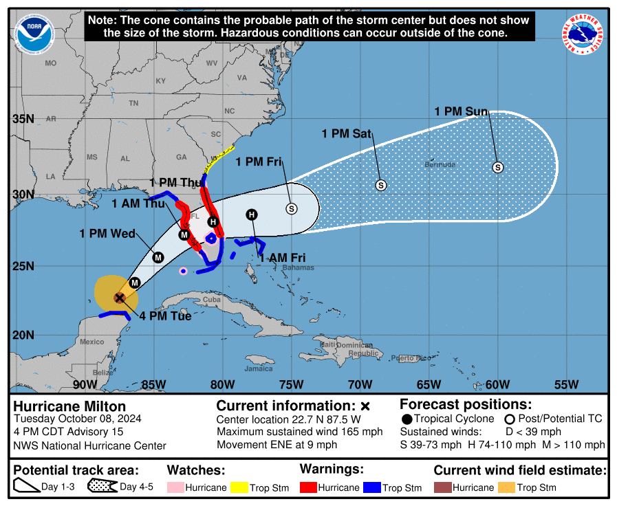
Hurricane warnings have been expanded today to include all of St. Lucie County. Hurricane watches have been hoisted southward to the Palm Beach County line. Tropical storm warnings now include the Bahamas, all of South Florida, and much of the Georgia coast. Storm surge warnings have also been expanded accordingly, and there’s now the expectation of a 3 to 5 foot surge from Sebastian Inlet north to near Jacksonville. If Milton’s track slips farther south, this surge would also slip farther south, so folks from Palm Beach County up through St. Lucie County should be monitoring trends closely.
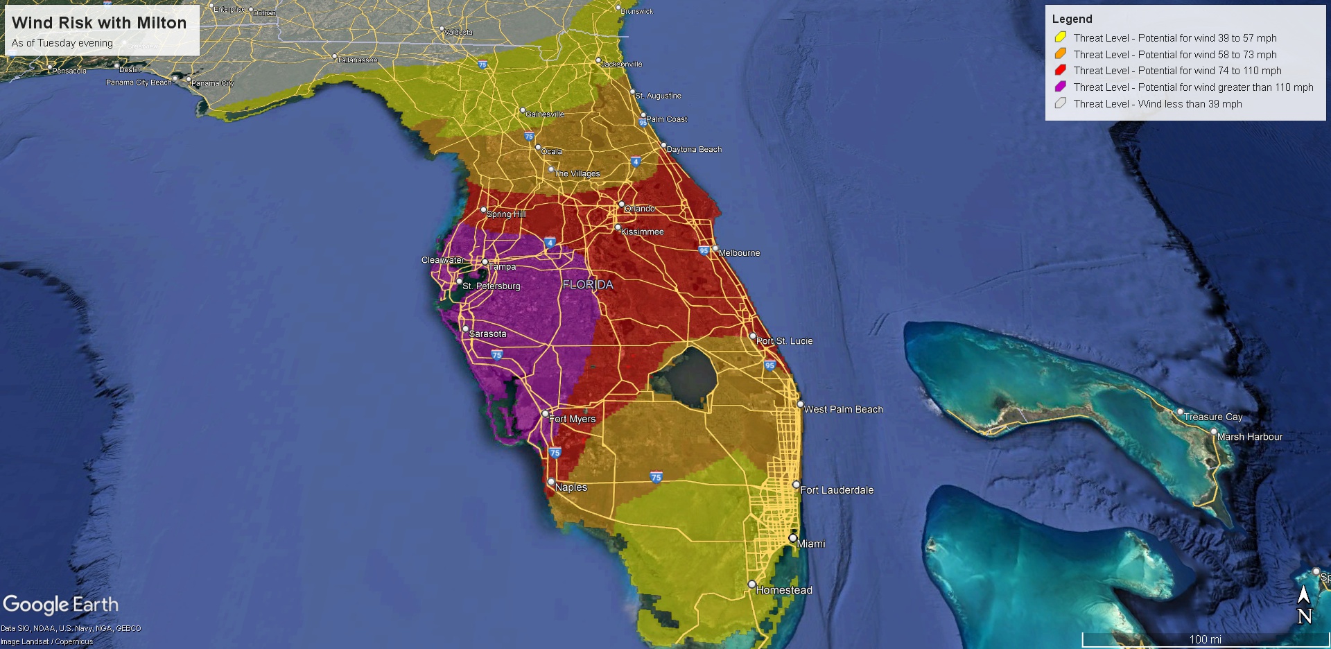
We get a lot of questions about wind risk for XYZ. Consider this map (which you can enlarge) a reasonable worst case scenario for what peak winds could be at a given location.
The south side of the storm will be primarily surge and some wind. The north side of the storm will be wind, some surge, and torrential rainfall. A high risk of flooding continues to be in effect tomorrow in Florida along and north of I-4.
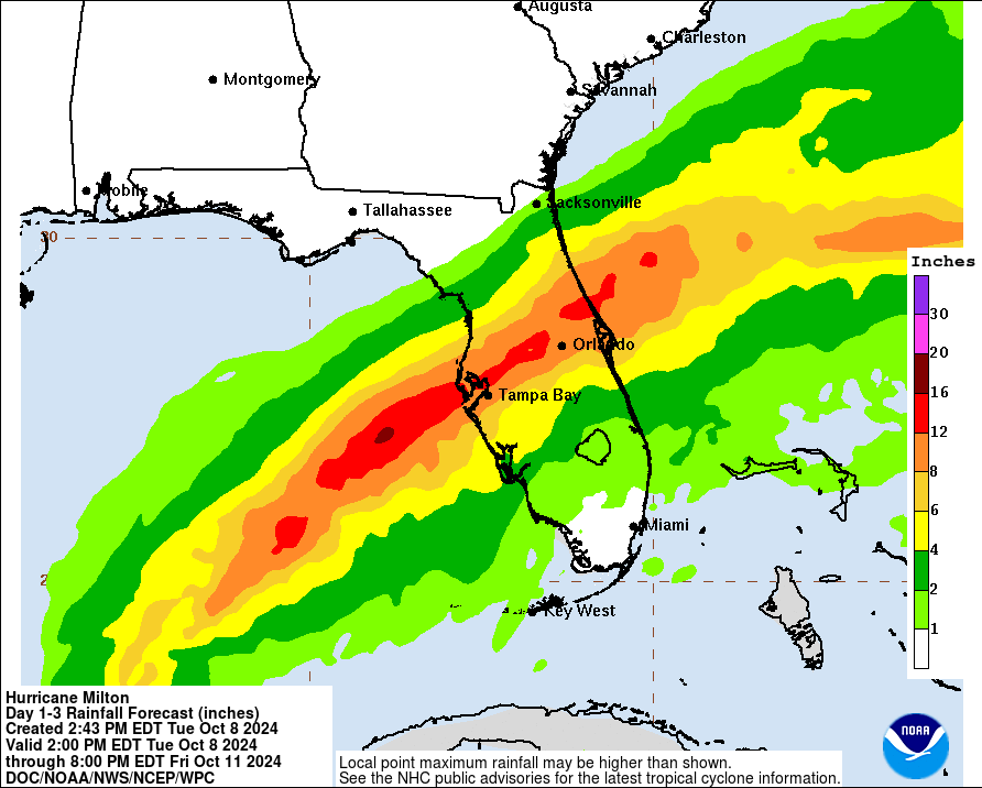
This has slipped a bit south since this morning also, and now the heaviest rain risks align with the I-4 corridor almost perfectly. Any further southward adjustment will take the heavy rain farther south also.
And of course, isolated tornadoes are always possible with storms of this size and intensity.
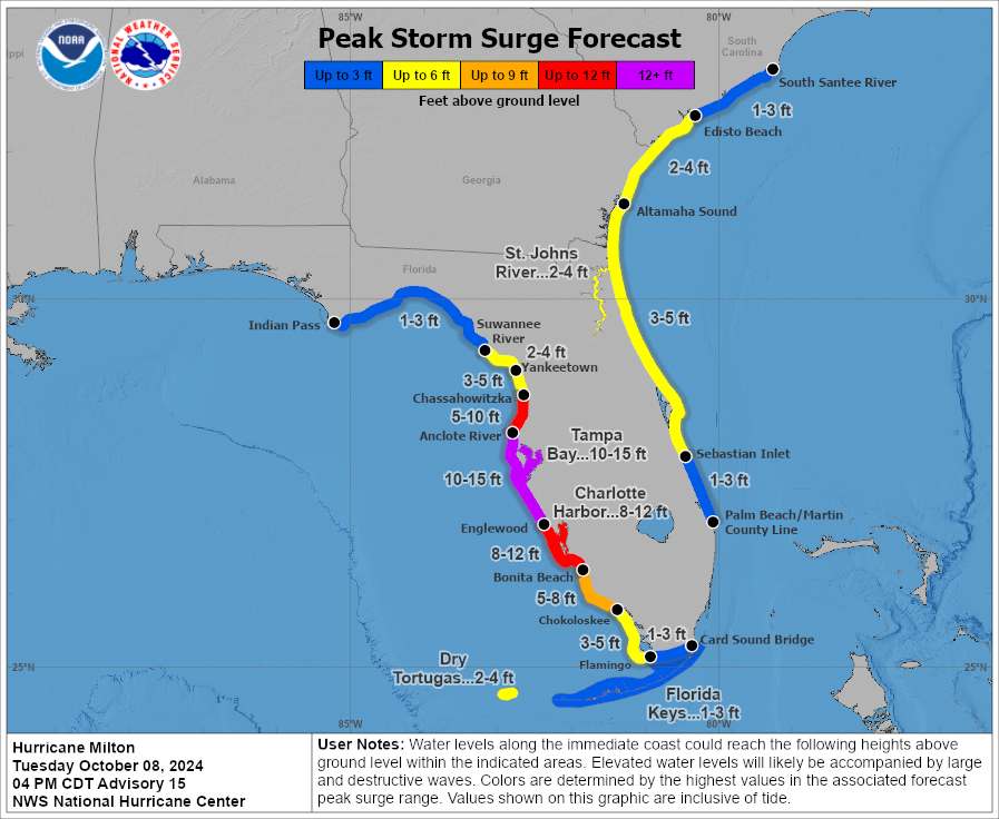
The bottom line: A complex, multi-hazard storm is headed to Florida. It will impact the west coast hardest but it won’t spare the east coast entirely. The biggest concern is storm surge, which is likely to be worst between Sarasota and Fort Myers. For areas south it’s still shy of Ian levels, but it’s nudging ever closer. For areas between Sarasota and Cape Coral, it will likely be worse than Ian. Again, this is a dangerous, historic storm, and it’s one that you should not stick around to observe and ride out if that’s possible. We will update again tomorrow morning or late tonight if the track shifts significantly.