(11 PM ET update): The 11 PM ET advisory is out with few changes. No forecast changes have been made, and no intensity changes have been made.
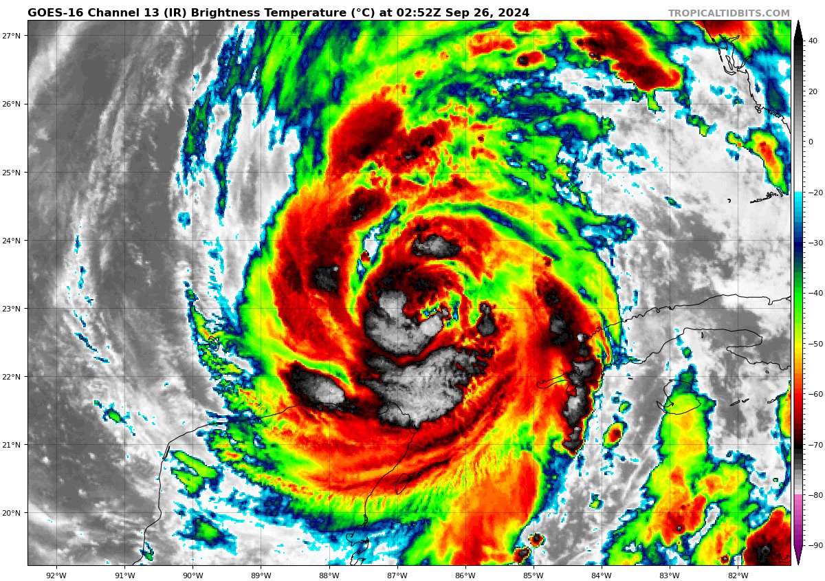
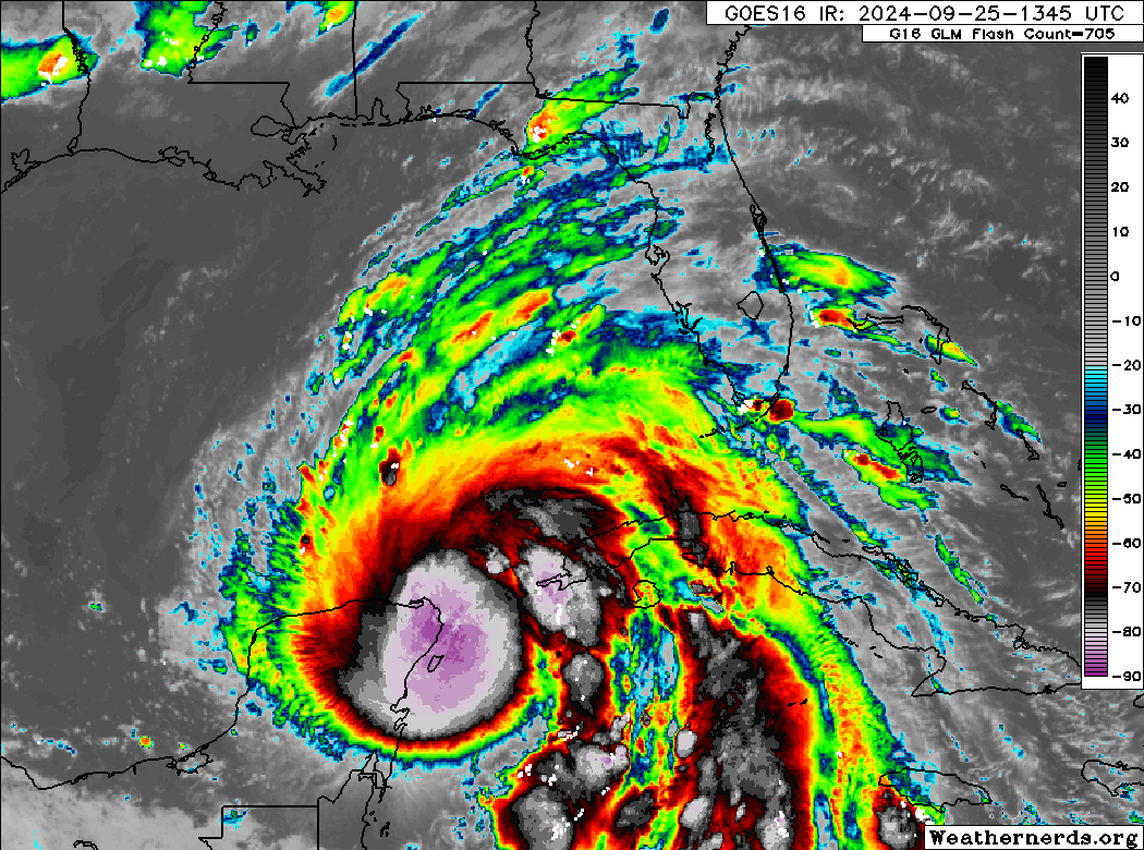
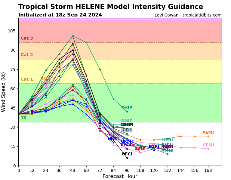
Helene is still organizing, and it seems that the size of Helene is acting to keep that intensification steady for now. As the system hits the ultra warm water in the Gulf and a more favorable environment internally, it will likely strengthen at a steady, faster pace tomorrow before making landfall tomorrow night.
There have been no notable changes to the surge or rainfall forecasts unfortunately. We’ll have an update in the morning.
Previous post follows…
Changes since this morning
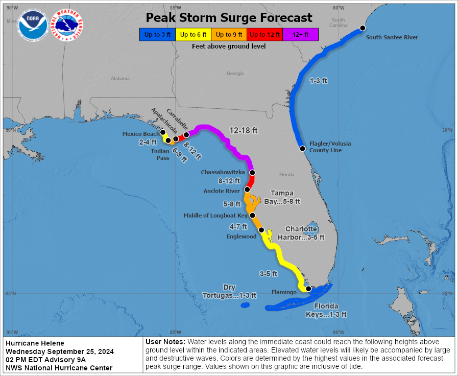
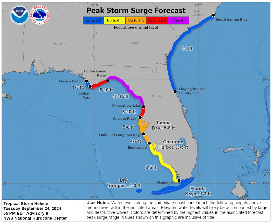
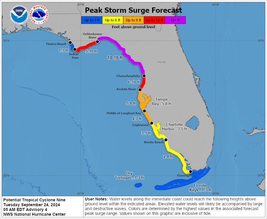
- Storm surge forecasts have been increased on the Florida coast with a surge as high as 20 feet expected between Carrabelle and the Suwannee River.
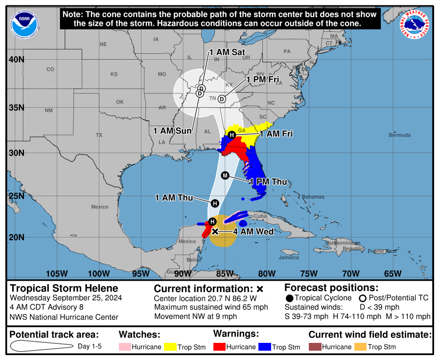
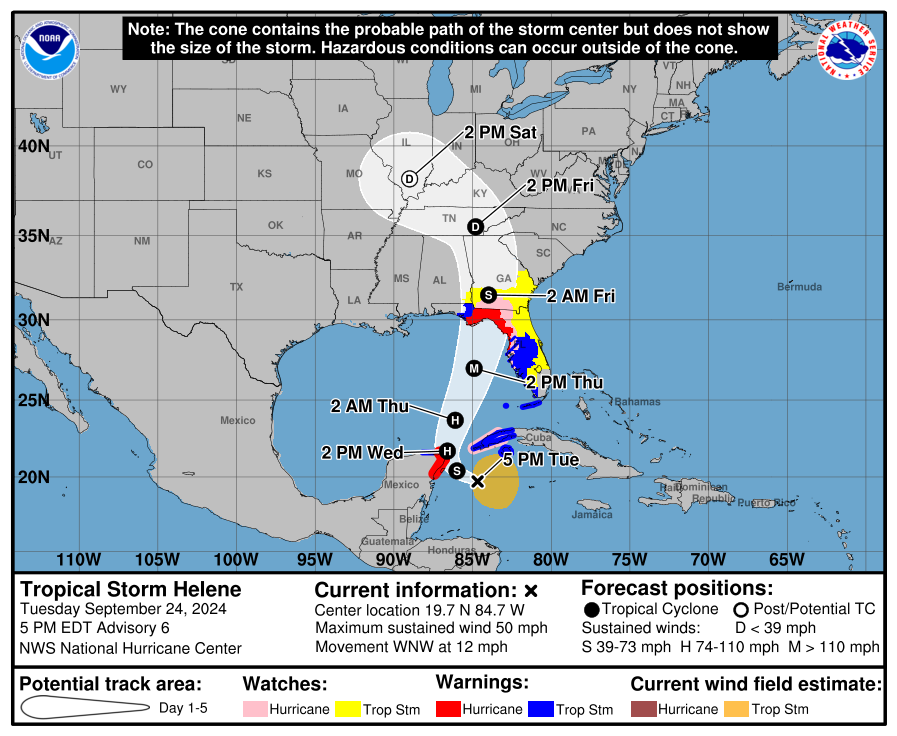
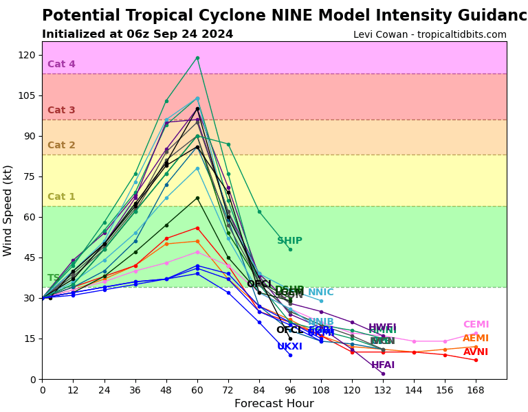
- Helene is expected to be a category 4 storm at landfall.
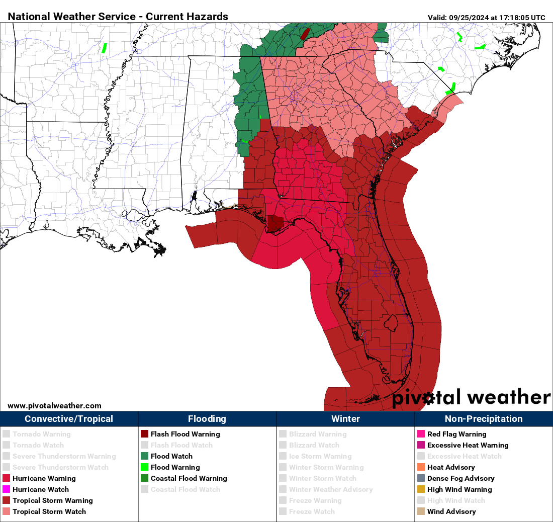
- The high risk of flooding has been expanded tomorrow in both the Carolinas and in Georgia/Florida.
- Tropical Storm Warnings are now posted for the rest of Georgia, all of South Carolina, and portions of western North Carolina and Tennessee.
- Helene is likely to be the modern storm of record for Florida’s Big Bend Region and possibly some other areas.
This blog is committed to no-hype because of storms like Helene. This one merits your full attention and full preparedness if you are anywhere in the area that will be affected by the storm. This includes all of Florida except the far western Panhandle, all of Georgia, eastern Alabama, almost all of South Carolina, western North Carolina, and Tennessee. We cannot stress this enough. Follow the advice of local officials. This is almost certainly going to be a major storm, and most of the data suggests that this will be a catastrophic storm in several places.
There’s no way we can cover all the elements of this storm, but we’ll try.
Storm surge
The storm surge forecast is, frankly, hideous. The forecast surge values, should they verify, will be worse than any modern storm has brought to the area between Tampa Bay and Apalachee Bay.
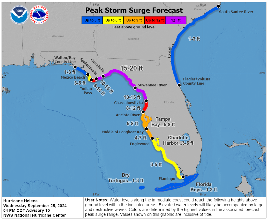
The surge will be worse than Idalia all across the Big Bend Region, Apalachee Bay, the Nature Coast, and Tampa Bay. It will probably be the new benchmark for modern storms in this region. The surge will drop off dramatically to the west of where the center comes ashore, so folks in Panama City and Mexico Beach will only see a minor surge from this, with a huge escalation near and to the east of where the eye comes ashore. If these forecasts verify, this will be unsurvivable type surge in the region east of Carrabelle through about Cedar Key. I cannot stress enough how serious the storm surge from Helene may be.
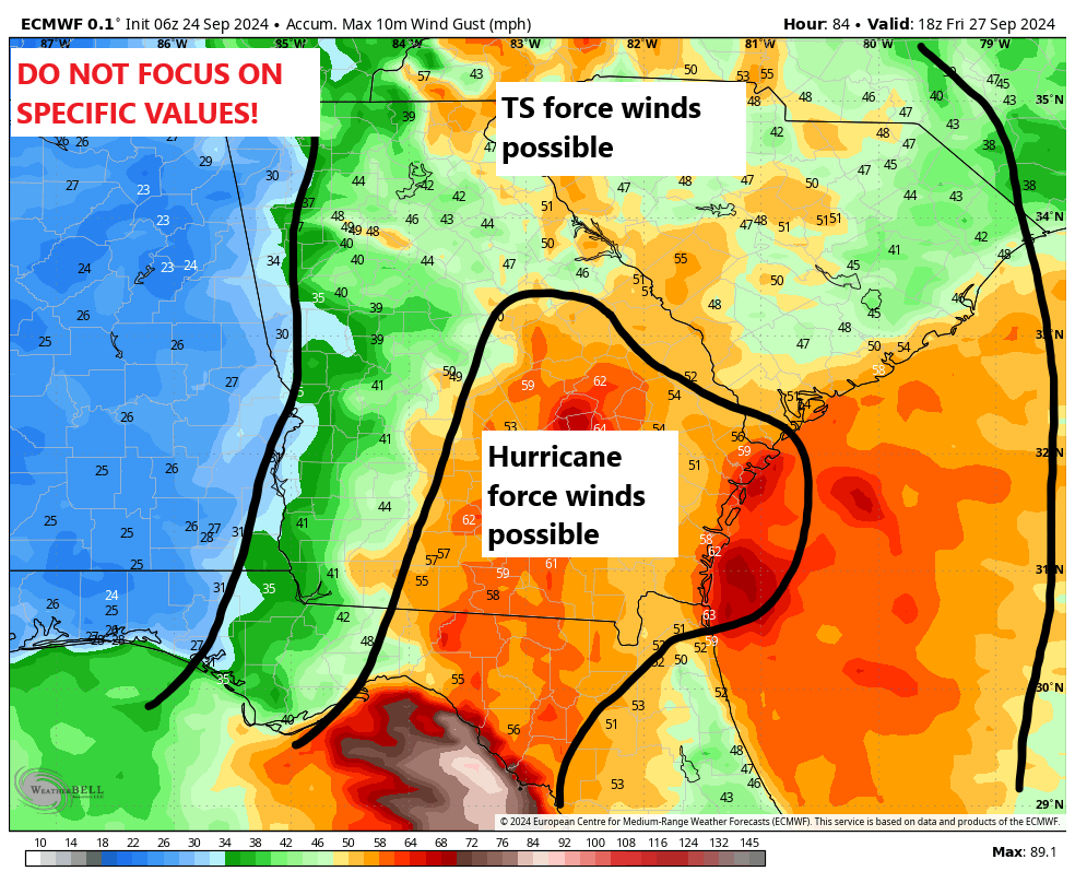
Wind
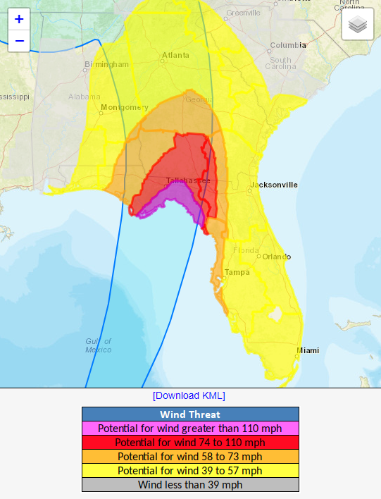
Obviously with a cat 4 hurricane expected, there will be catastrophic wind at the immediate coast. But with Helene’s acceleration north, the wind will spread far inland.
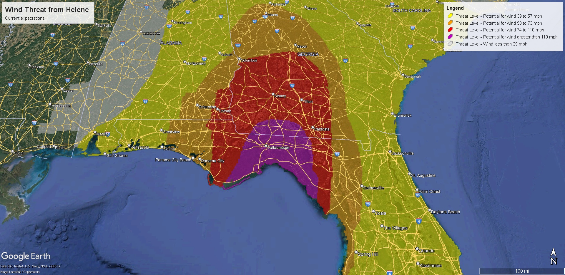
We expect hurricane force winds to get deep into Georgia. The exact track will be critical in determining if Tallahassee sees catastrophic damaging winds or something more manageable. It will be close. It will probably be less close in Valdosta, GA which could see gusts in excess of 100 mph. Those winds will slowly decelerate deeper into Georgia, but hurricane force winds could get as far north as Macon. Strong tropical storm winds will impact metro Atlanta, especially on the south side and perhaps creeping close to Athens. Tropical storm force winds will be an issue deep into South Carolina and western North Carolina, as well as eastern Tennessee. There will be widespread wind damage and widespread, likely significant power disruption. This is a very bad looking storm.
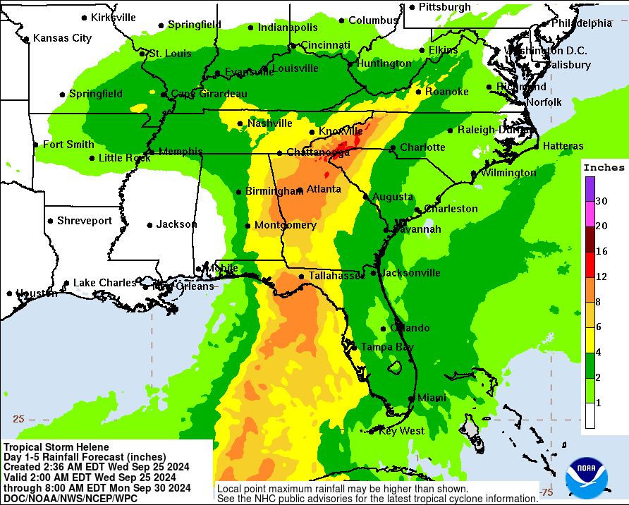
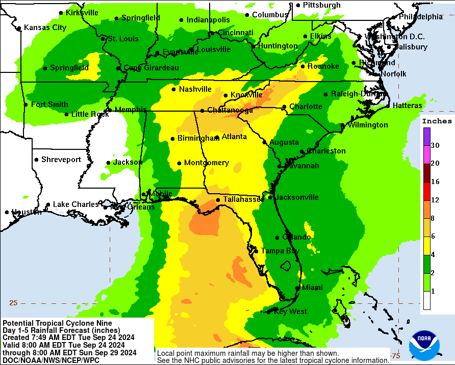
Rain & flooding
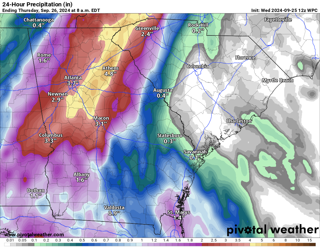
We continue to see a high risk of excessive rain leading to flash flooding, possibly catastrophic flash flooding in two areas tomorrow. First is where Helene comes ashore in Florida, which will see substantial rain — what you would expect from a landfalling category 4 storm.
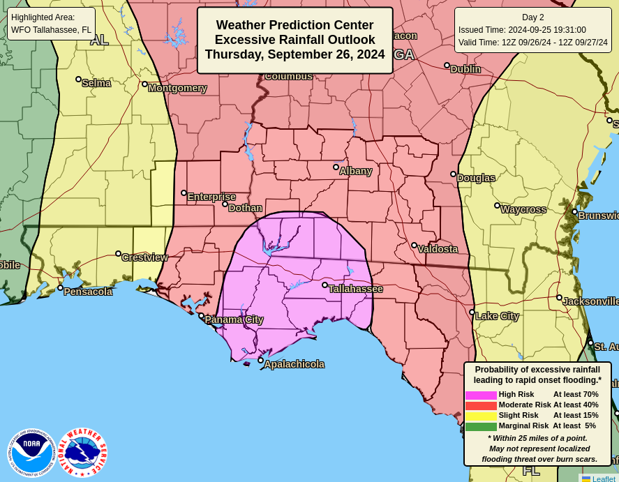
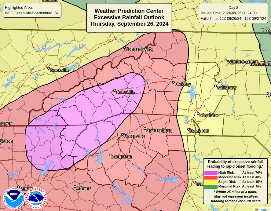
The storm will dump heavy rain and produce widespread flash flooding across Georgia, eastern Alabama and portions of South Carolina as well. But when the storm interacts with the Appalachians, that’s when severe flooding issues could creep up. The high risk was expanded south into metro Atlanta, especially north and east of the city. And it continues through Asheville, NC, including much of Upstate South Carolina north and west of Greenville-Spartanburg. Portions of the Smokeys will also be impacted.
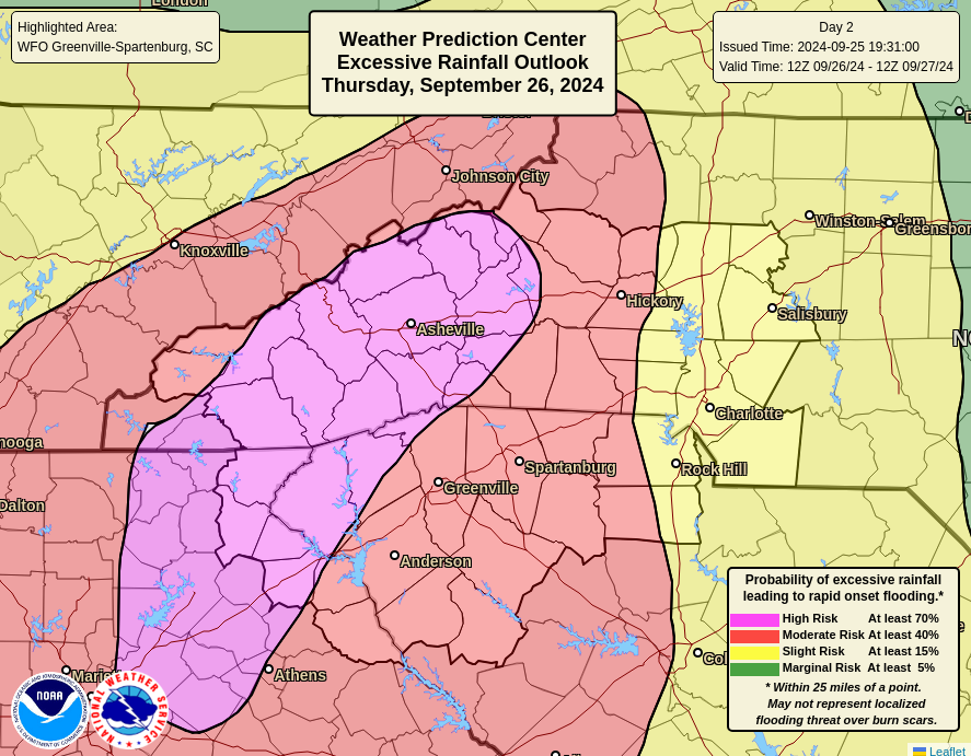
The interaction of terrain with a hurricane can produce copious amounts of rain leading to destructive flooding and landslides, and that’s the concern in Appalachia. Again, I cannot stress enough how serious an event this may be in those areas. It’s a much different hazard than storm surge but extremely dangerous just the same.
Tornadoes
Isolated tornadoes are likely anywhere east of Helene’s center, so be aware of that risk in the Florida Peninsula, the Jacksonville area, and much of eastern Georgia and the Carolinas.
Again, we strongly encourage you to follow local officials, follow local media, and do everything possible to get out of harm’s way. This is not a storm you want to roll the dice on. We’ll update this post later this evening with any relevant new info. Look for a full post again in the morning.