Headlines
- After flooding and strong winds in North Carolina, we look at why PTC 8 never became Tropical Storm Helene.
- Caribbean mischief is likely next week with details TBD. But it’s clear something is probably going to try and develop.
How does an unnamed storm behave so much like a tropical storm?
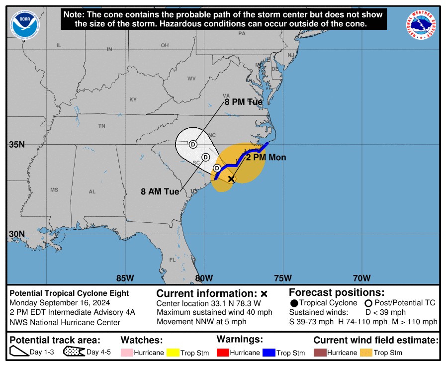
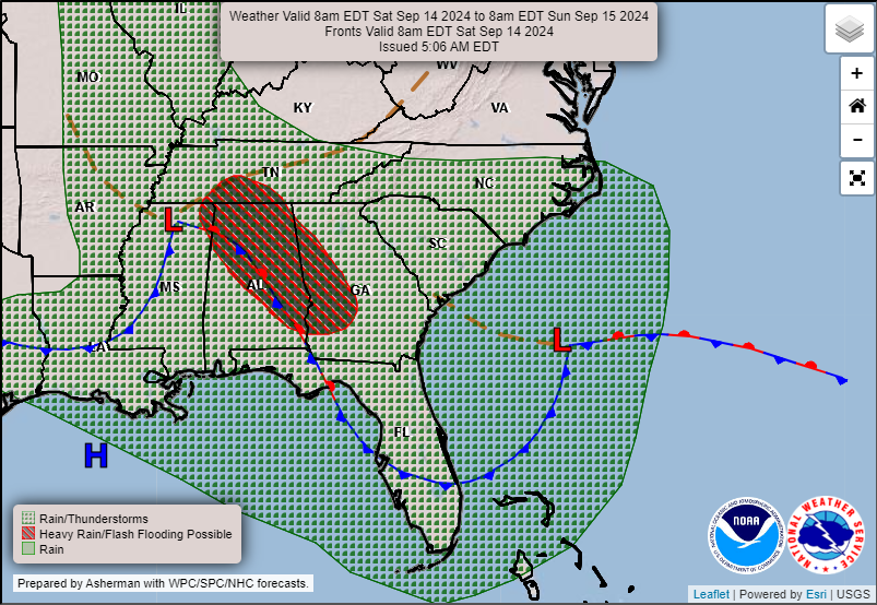
Cleanup is underway in North Carolina after yesterday’s deluge from an unnamed potential tropical cyclone. We’ve gotten some questions as to how a storm with very obvious tropical storm conditions goes unnamed? Well, the point of the “Potential Tropical Cyclone” designation is to account for the fact that a certain system may not meet the technical requirements to be classified as tropical in nature or, alternatively, it may be close enough to land and unformed yet that it requires watches and warnings. The Carolinas needed watches and warnings for sure yesterday, and thus the PTC designation met the former definition that it fell short on account of technicalities.
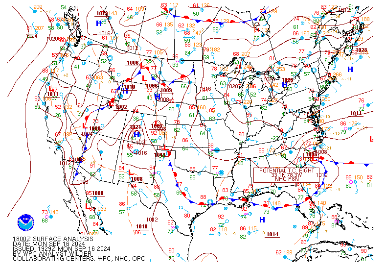
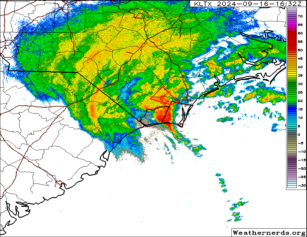
In this specific case, PTC 8 was a cyclone, but it was not tropical in nature. It had fronts nearby, a rather clear designation of a non-tropical storm. This was more akin to a nor’easter type storm that we frequently see in the fall, winter, and spring months on the East Coast. Still, the impacts were virtually identical to a tropical storm and to most people that is likely what they assume they were hit with yesterday in North Carolina. The PTC products work in that respect as intended. However, there is still some inherent clunkiness in communicating the situation, which is why we tend to focus almost exclusively on impacts. For PTC 8, we had noted even late last week that this was going to probably be a rain and windmaker for the Carolinas, and even though the coverage of total rainfall was a bit surprising, for the most part this played out as expected.
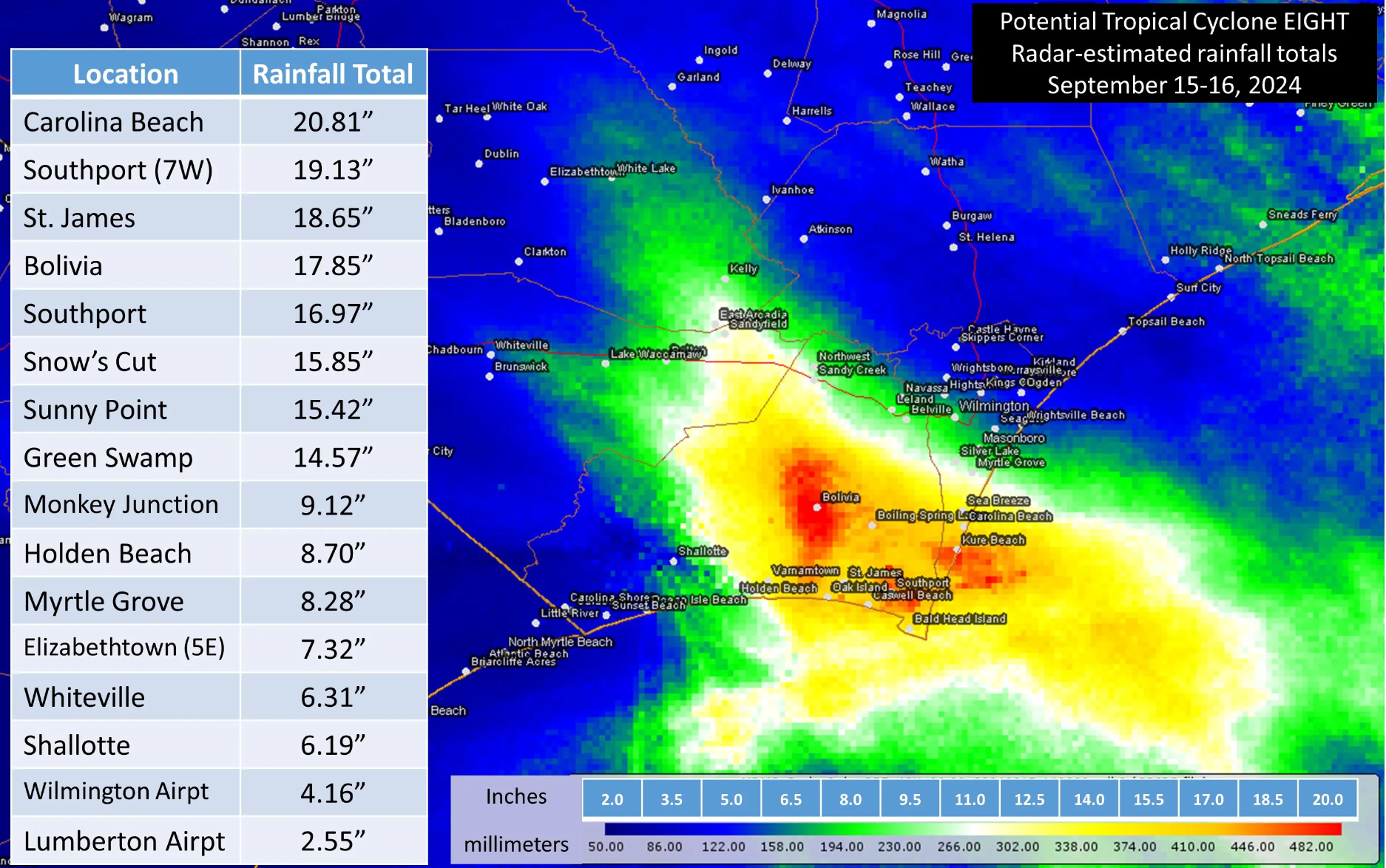
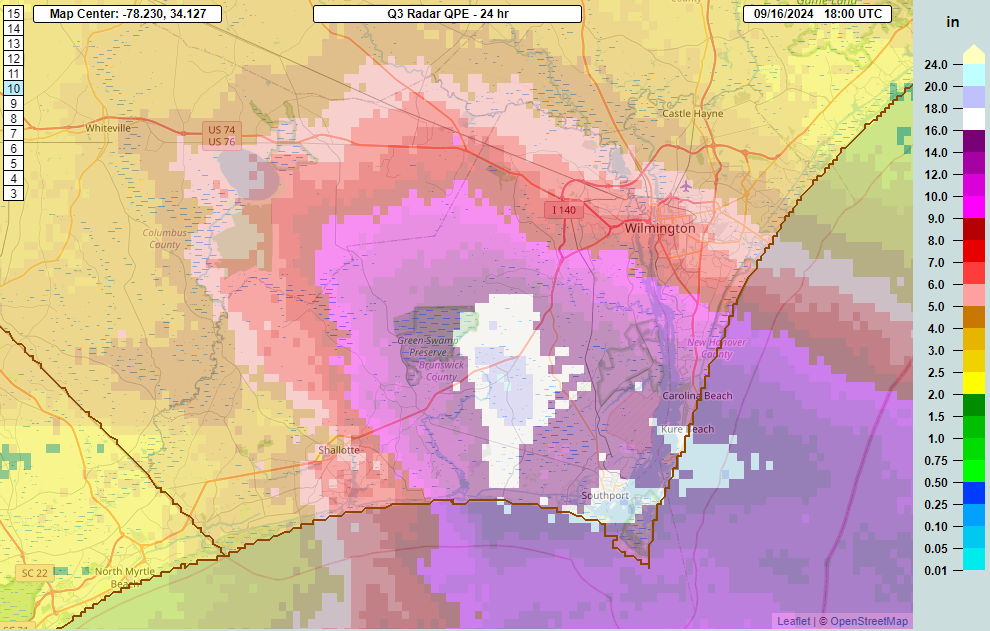
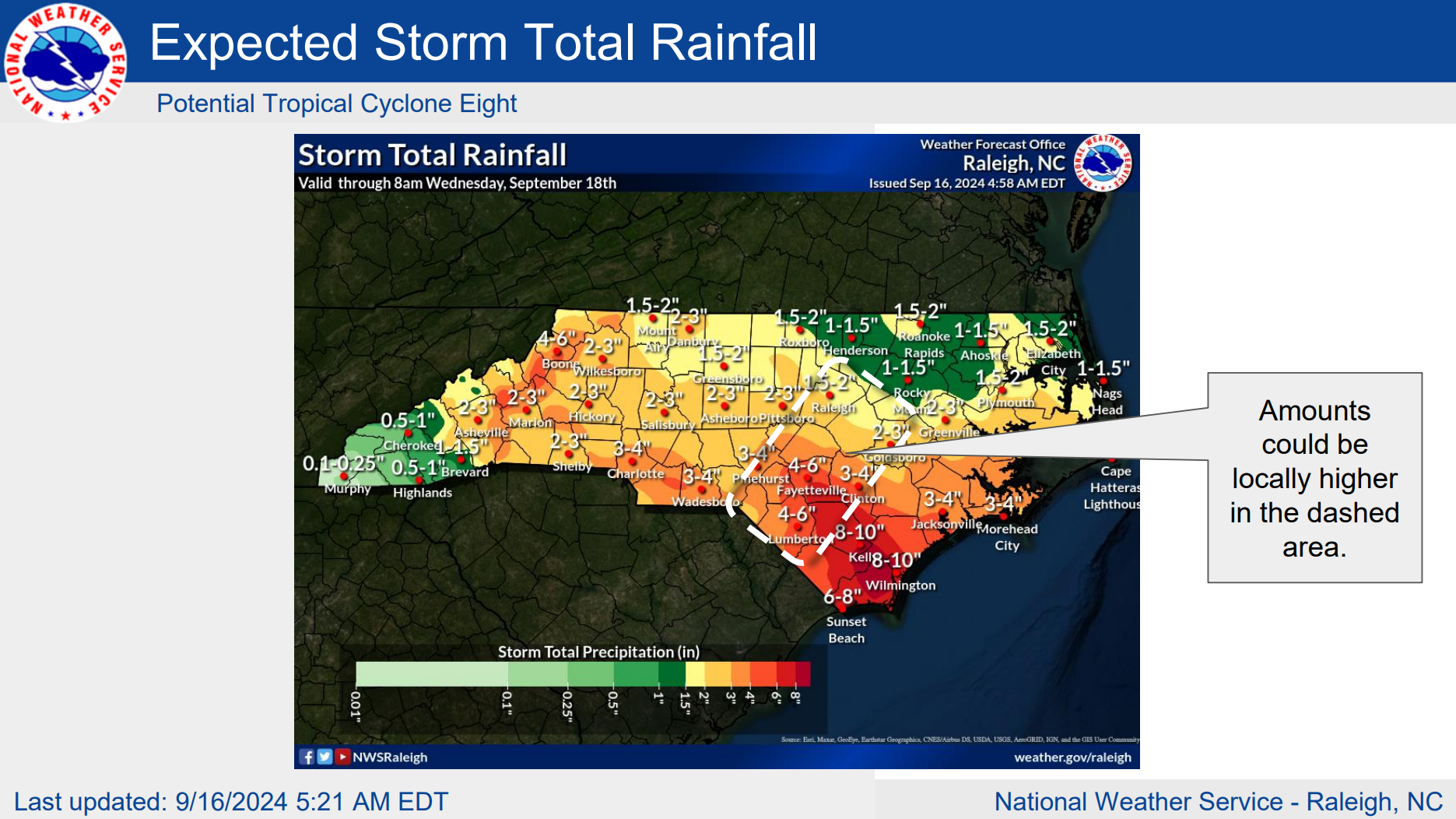
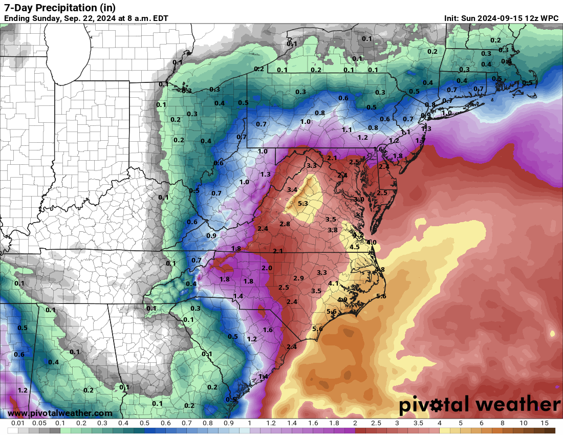
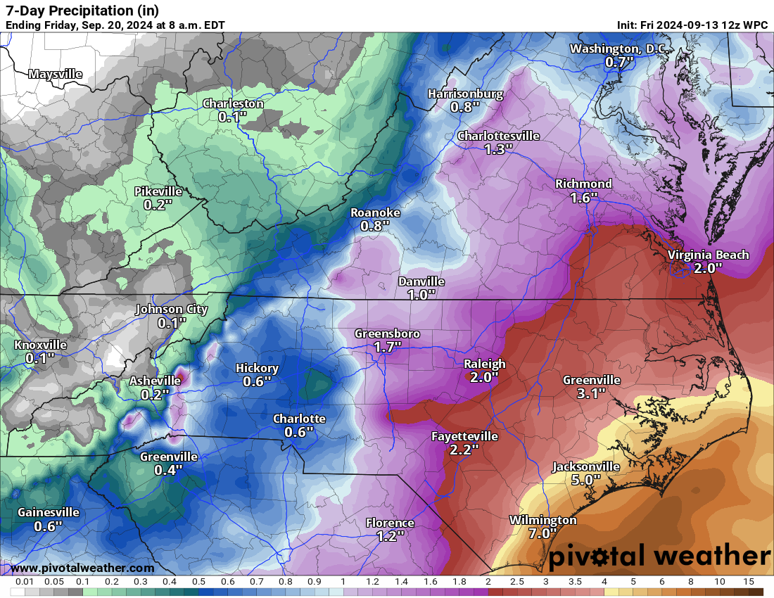
Rain totals were historic and exceptional across Brunswick County and portions of southern New Hanover County, NC. The gradient between Wilmington Airport (north of Wilmington) and Carolina Beach was remarkable. That’s about 16 inches difference over 16 miles. The isolated nature of some of these rain totals can really make a forecast tough. It’s just as plausible that this could have been closer to Wrightsville Beach than Carolina Beach. It’s just the nature of tropical systems.
Our thoughts are with the folks that were flooded yesterday that can hopefully clean up in a reasonable amount of time. We’ve seen a number of cases of extreme flooding this month: Myanmar, Europe, even parts of Manitoba, North Dakota, and Minnesota yesterday. All this is consistent with more extreme rainfall that is expected in a warming climate, though to what specific extent that is contributing is TBD. Most recently, August was the warmest recorded month in our historical record however.
Caribbean watch on for next week
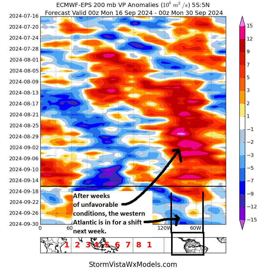
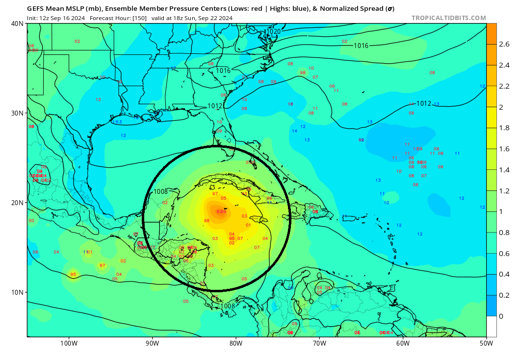
We’ve been discussing reasons why we expect Atlantic activity to tick up to close September. The most specific example we have of this is what is expected in the Caribbean next week. We’re beginning to see operational models more frequently go a little crazy with development there. But it seems consistent across most operational models. The GFS, Euro, ICON, and AI modeling from ECMWF all show tropical development in the northwest Caribbean with various tracks west or north. There is no consistency in track, but there is consistency in development. This tells me that we’re likely to see something happen next week.
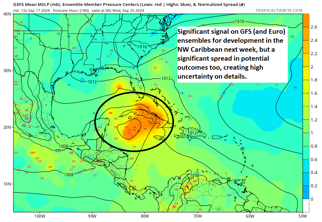
We see this on the GFS ensemble as well above, which shows a pretty healthy signal for development but also a significant spread in outcomes next Tuesday evening, with potential low pressure centers anywhere from Cuba to the Caribbean to the eastern Gulf of Mexico.
We have a lot of Texas and Louisiana readers here on the site since we’re based in Houston, so I want to make a quick comment about potential here. Right now, with a potential trough off the Southeast coast, no significant westerly steering component available, and the potential for a southward moving front in Texas or the Deep South, the most likely path of least resistance would probably be northward or northeastward.
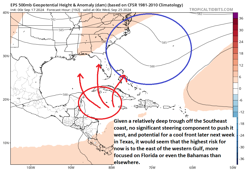
That’s not to say folks in Texas and Louisiana should ignore this; you should not. However, sitting here today, I’d be more likely to say the odds of impacts are greater in Florida than the rest of the Gulf Coast. We’ll see this sort of show itself a bit more in the coming days. Notably, given that this is developing off a Central American Gyre type circulation, there is historical precedent for high uncertainty in this setup, which is why I don’t want anyone to write this off yet. But I think Florida needs to watch this more closely than elsewhere, and I want to highlight that for our Florida readers.
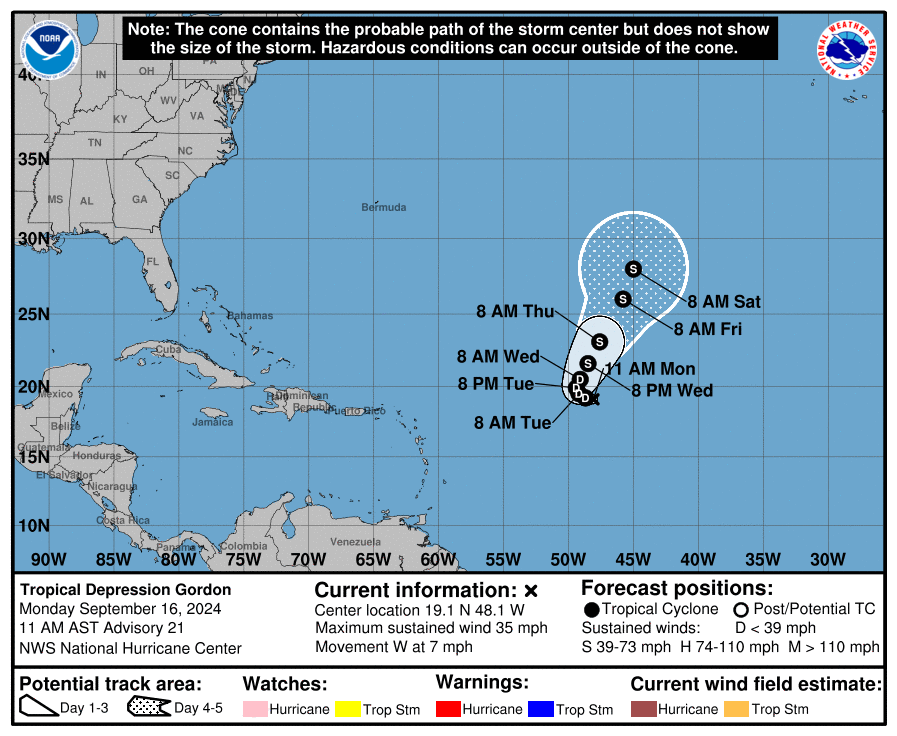
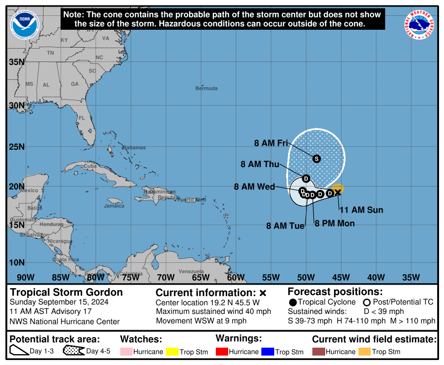
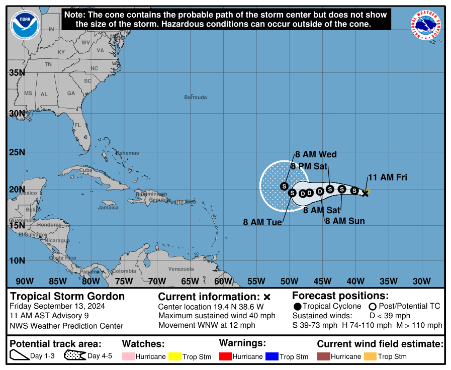
Elsewhere, there may be a signal for a new disturbance off Africa to form later next week as well, but that’s days away from any land and is not a concern right now. Gordon has degenerated into an open wave in the Atlantic but could reform at some point this weekend or so. Still, it’s no threat to land. So for now, the only system to concern ourselves with will be next week in the Caribbean.