In brief: Melissa has become post-tropical as it races toward Newfoundland, where it will deliver modest impacts tonight. The toll of devastation in Jamaica is just starting to come into focus. Details on that, and a link to yesterday’s Substack Live with Dr. Kristen Panthagani today.
Before we begin, I just want to offer up a link to a chat I had yesterday with Dr. Kristen Panthagani, of “You Can Know Things.” We talked about science communication, both in weather/climate and in public health and how similar our challenges are. We also talked about best practices in today’s new media environment and how it’s critical to get away from old school ways of doing business. Anyway, it’s an hour, but Kristen also has a wonderfully crafted AI summary of our discussion. AI is good for hurricane models and one hour conversation summaries!
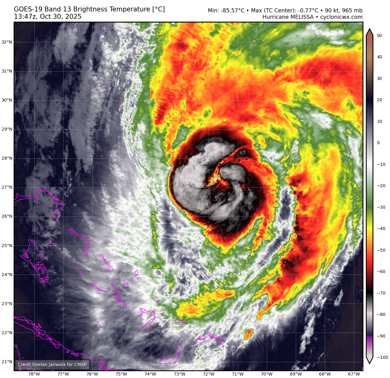
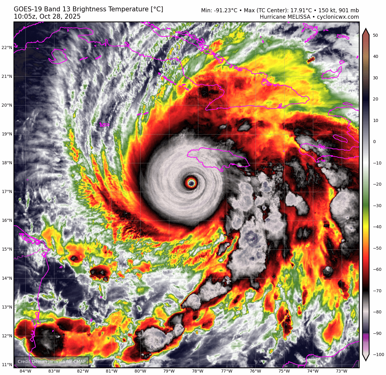
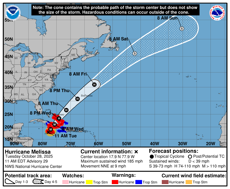
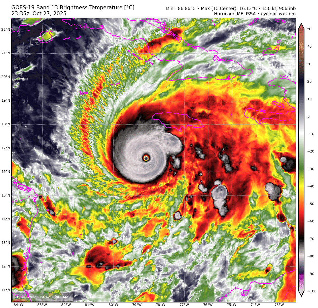
Hurricane Melissa is now officially a post-tropical cyclone, meaning it’s still a very big storm but it just does not have tropical characteristics to call it a hurricane.
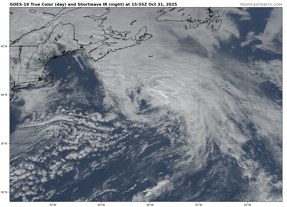
Anyway, Melissa swung by Bermuda earlier this morning. Wind gusts as high as 98 mph were reported at a somewhat elevated station on the island (meaning winds at ground level probably were not quite that strong).
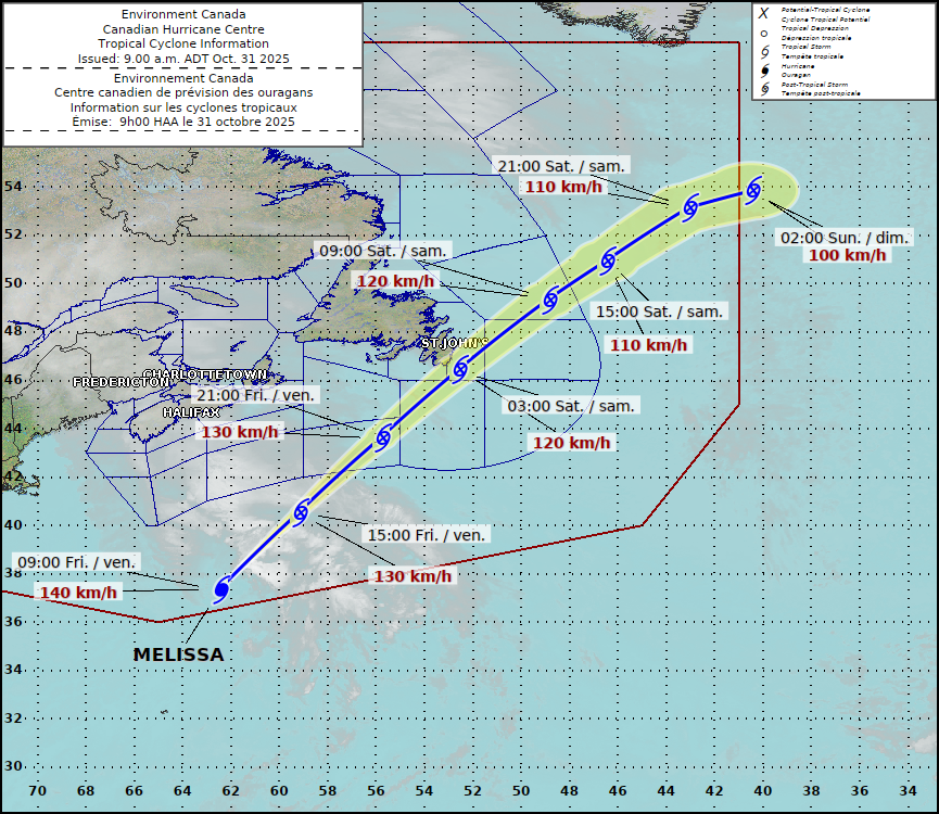
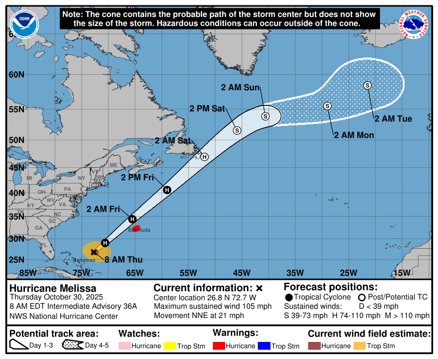
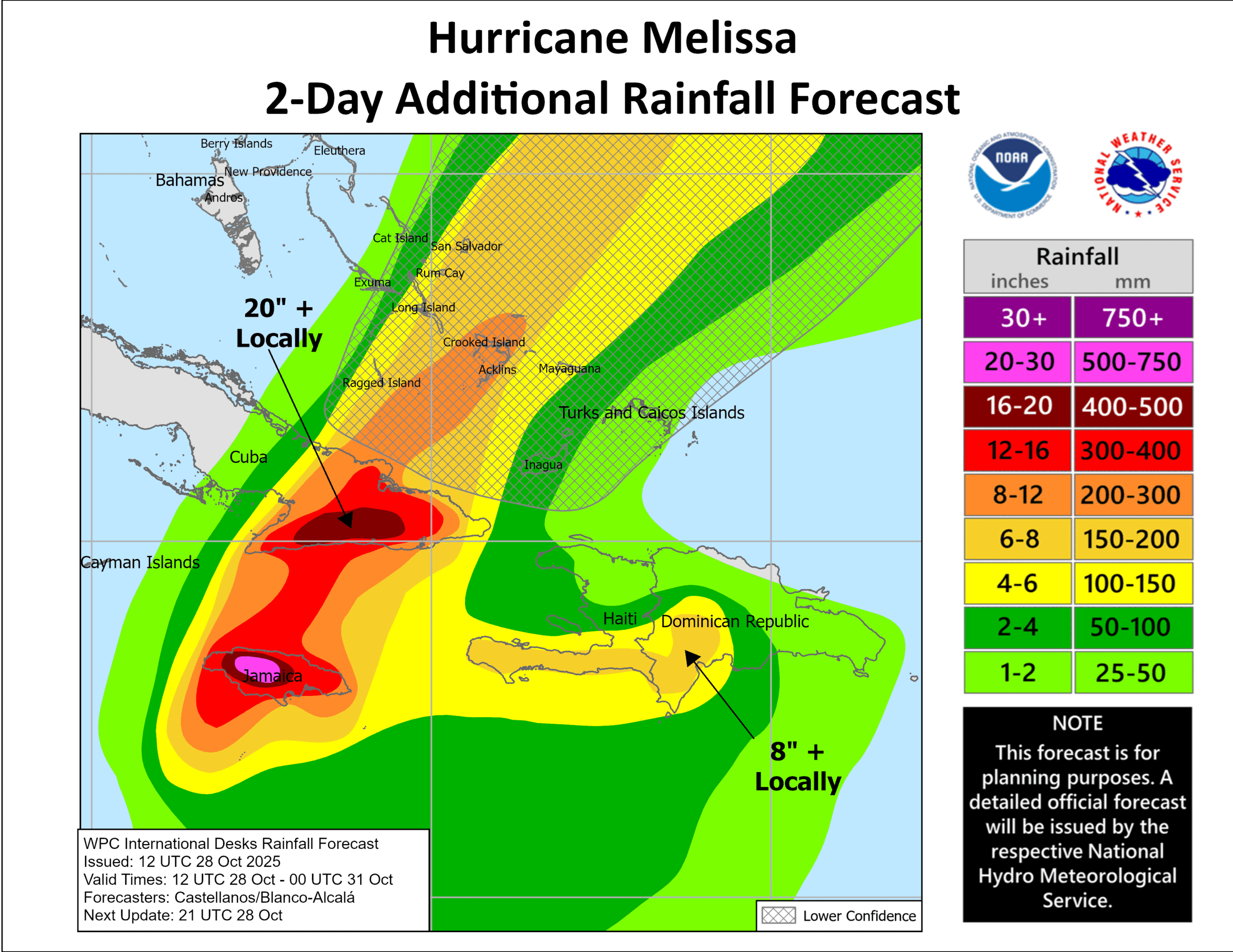
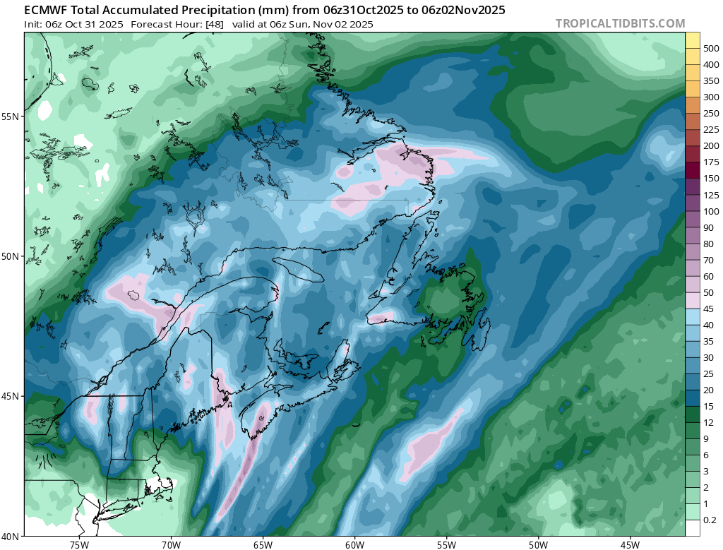
From here, Melissa will race off to the northeast, passing by Newfoundland tonight after midnight local time. Melissa should only deliver moderate tropical storm force winds to Newfoundland, along with high surf and rough seas. Some locally heavy rain is possible in Newfoundland as Melissa passes by, though modeling suggests roughly 20 to 40 mm for the Avalon Peninsula. A somewhat broader low pressure system over northern New England and Quebec will produce somewhat higher precipitation totals, up to 50 mm or so, especially in the Adirondacks, Green Mountains, and Laurentians.
Melissa exits stage right tomorrow, eventually settling just south of Iceland where it is absorbed into the semi-permanent Icelandic low.
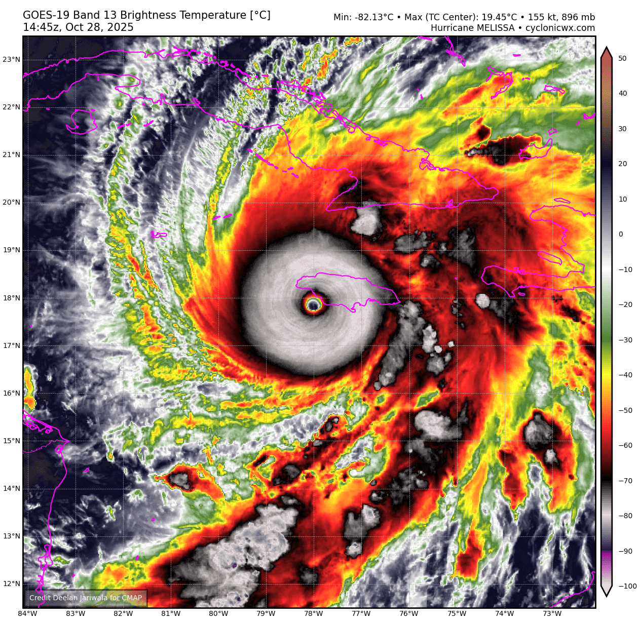
Melissa’s recovery is just beginning still in the Caribbean. As expected, the death toll has risen, up to about 50 now, including 19 in Jamaica. We continue to get some pictures and accounts of the storm filtering out of Jamaica, and it was as bad as it seemed.
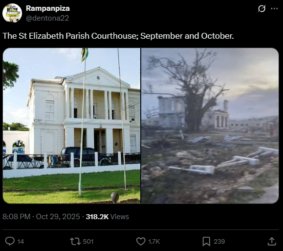
What has been impressive to me are some of the before and after aerial views that show the physical devastation, yes, but also the natural devastation. These were relatively lush, green parts of Jamaica, and the natural landscape has been absolutely shredded, as is consistent with past storms of this intensity we’ve seen in other places. These storms have such immense power.
Here are a number of ways you can directly help out relief efforts, pulled in part from an Associated Press article on the topic.
United Way of Jamaica will donate directly to Jamaicans in the affected areas.
The American Friends of Jamaica is a fund that has been active for decades helping Jamaica.
Give Directly will provide cash relief directly to those impacted by the storm.
I also want to shout out the Center for Disaster Philanthropy which is focused on medium and long-term recovery. When the media and volunteers all leave, there will still be enormous amounts of work to do to recover from a storm of this magnitude. CDP works to help fill that gap.
Another interesting note today: Jamaica is a very forward-thinking country when it comes to disasters, and it will pay off for them in the wake of Melissa. A $150 million cat bond will probably be triggered as a result of the work they did in the years ahead of Melissa. While this will only cover a portion of the losses incurred from the storm, it can allow for a much faster restoration of basic services in the impacts areas in ways that they would otherwise not have been able. The cause of and solution to recovery in disasters remains multi-faceted and complex. But thinking ahead is a good play.
We will be taking the next day or two off and come back Monday to reset the weather situation. Hope everyone has a safe Halloween.