In brief: Caribbean development odds from Invest 98L are increasing this week, but there are far too many questions than answers on its possible future in the Caribbean. We also take a look today at what could be a forthcoming significant pattern change for much of the Lower 48 just before Halloween, with an atmospheric river in the Northwest and the coolest air of the season so far in parts of the East and Central U.S.
Caribbean cruising with Invest 98L
The area we’ve been watching for the Caribbean over the last week or so is now up to a 60 percent chance of development and is classified as Invest 98L.
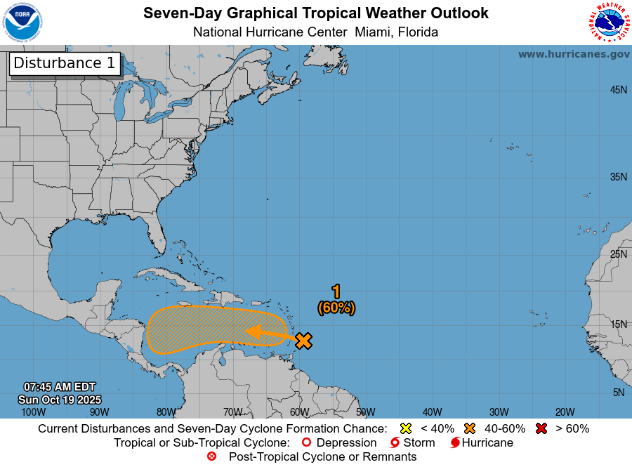
As this races into the Caribbean, it probably won’t develop. However, by the time it gets about halfway across the Caribbean it will begin to slam on the brakes. This is a fairly common behavior of a tropical wave this late in the season. Once it slows down, then all bets are kind of off. We could see slow development into a tropical storm or hurricane. We could see slow, erratic movement. We could see nothing happen at all.
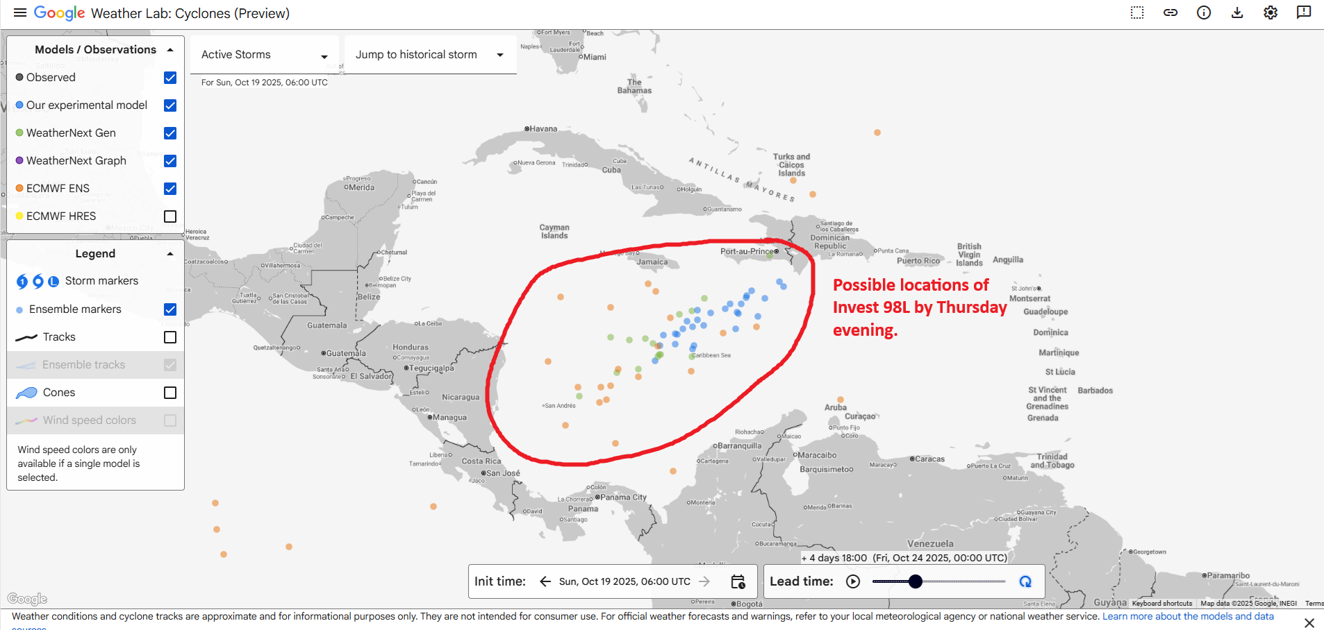
Based on the combination of Euro ensemble and Google AI modeling, it would appear that by Thursday evening, whatever Invest 98L will be is somewhere between the southwest Caribbean and Hispaniola. Some ensemble members keep hooking this north and northeast across Hispaniola or Cuba and out to sea. Others keep it buried in the Caribbean for a few days, eventually threatening Honduras or Nicaragua. Others still keep just drifting it northwest toward the far western Caribbean before eventually turning back north and northeast. It is unlikely to get into the Gulf given the time of year.
Given how warm the Caribbean is, and given the uncertainty of the track, it would be best for all folks from Nicaragua and Honduras up to Cuba, the Caymans, and Jamaica over to Hispaniola to monitor the progress of this disturbance through the week. Yes, large storms can form in the Caribbean in late October. Stay tuned
Major U.S. pattern change on the horizon?
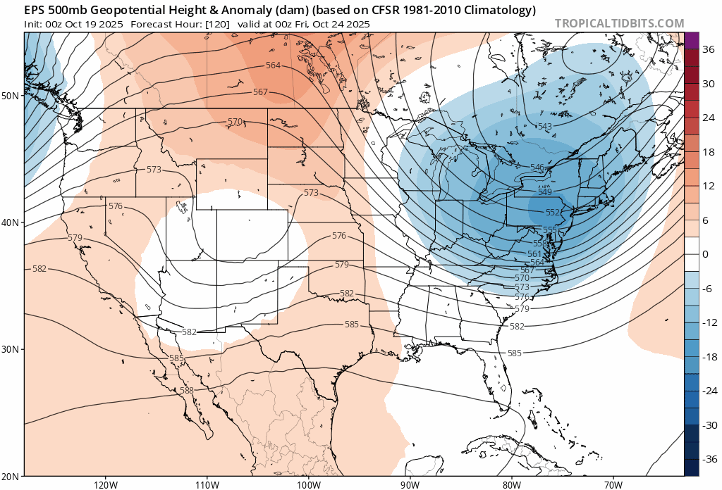
We’re starting to see signs of a major shift in the weather during Halloween week, so beginning in about 8 days or so. You can see the change in the upper air pattern when we look at the Euro ensemble about 20,000 feet up from day 5 through day 11:
The 8-to-14-day outlook is highlighting a major precipitation event in the West that seems plausible with that upper air pattern.
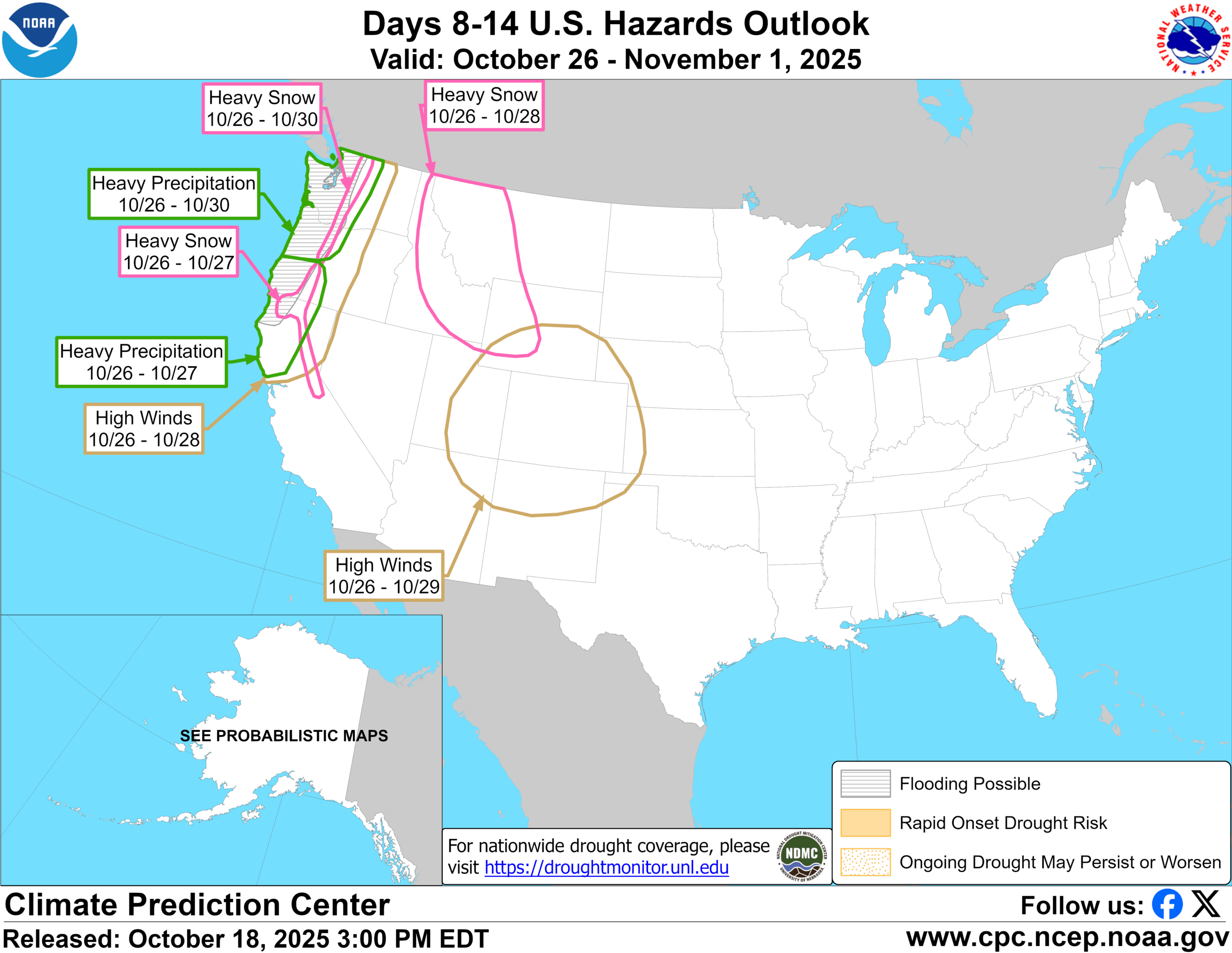
In fact, you can see that precipitation anomalies as forecast by the European model are much above average in the Pacific Northwest for the 7 day period ending on the evening of October 29th.
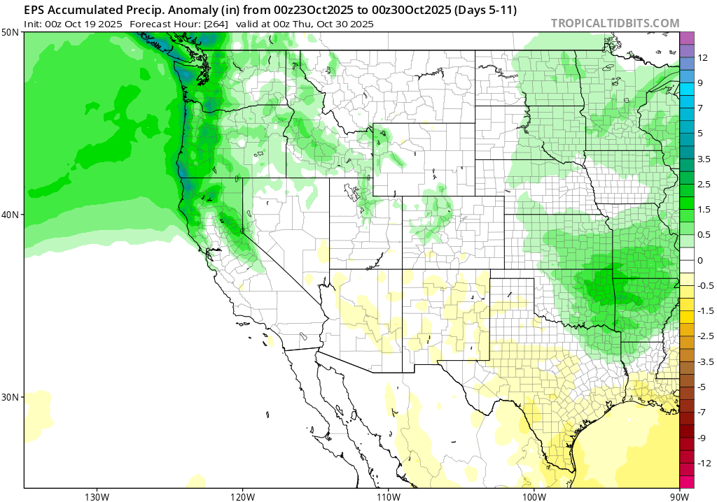
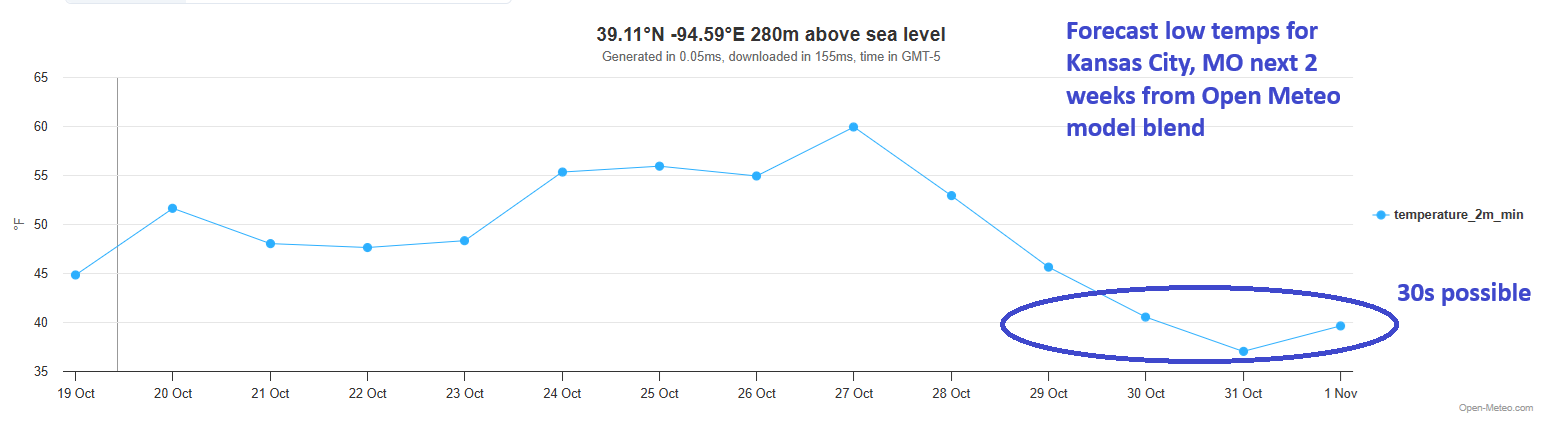
An atmospheric river will get things going here. Eventually, that will send a disturbance across the country, allowing for colder air to dump in from Canada. Much of the South has yet to have that “Wow, here’s autumn!” front yet, while much of the North has had some periodic colder temperatures. But it does appear that things will change next week with this system and cold front. Kansas City hit 43 this morning, their coolest morning of the season, but the current blended model forecast for Halloween is calling for 30s.
We’ll see just how far south and east this can get, but it’s possible we see 40s in Dallas and Atlanta as well from this front (though Atlanta will probably see 40s tonight as well for the first time). Either way, it appears that at least a temporary pattern change is on the way for the Lower 48. Whether that sustains into November or we fall back into a milder stretch again remains to be seen.