Headlines
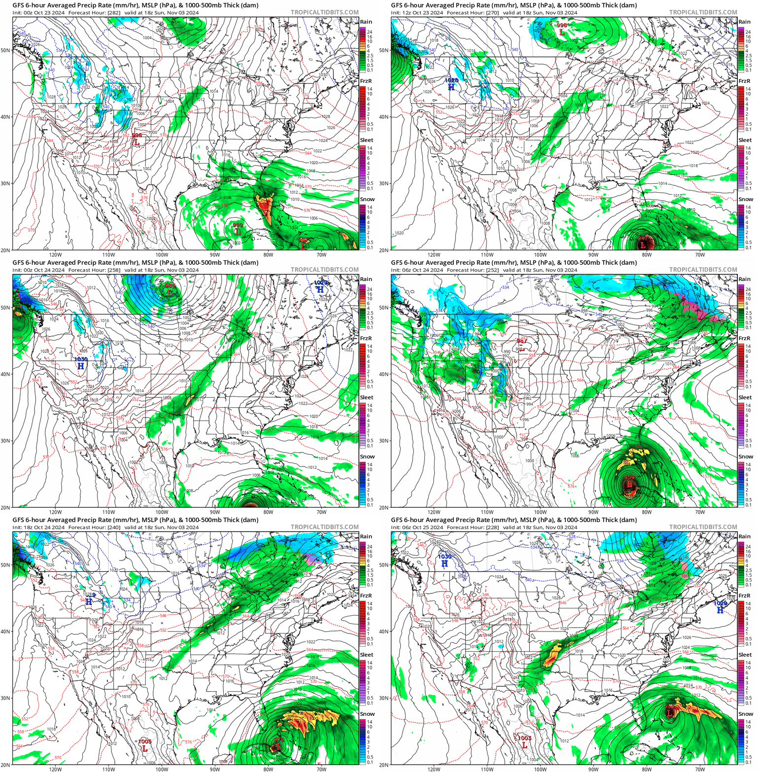
- Model “scareicane” season is in full force, with several unlikely GFS model outcomes showing up at times lately, a common late season bias of that model.
- But, tropical development is looking more and more possible in the western or central Caribbean late next week or weekend.
- Thank you to our Friday featured sponsor: Red and Black Banter!
Caribbean outlook
We continue to see at least hints of tropical development in the Caribbean in the next 8 to 10 days or so. This particular system caused a bit of a kerfuffle earlier this week when the GFS operational model, notoriously poor for handling tropical systems in the extended range showed a hurricane hitting the Florida Panhandle. Like a moth to a flame, the usual suspects on social media seeking engagement bait shared it with the masses under the veneer of either informing people of a low-probability outcome or just saying “wow.”
In reality, if you look at the last 10 GFS model runs, you can probably pick a point somewhere between the eastern Gulf and eastern Caribbean and it has been impacted by a modeled (read: not actual) storm. Again, the GFS has a notorious bias toward overdevelopment, particularly in the Gulf during the front and back ends of hurricane season. So it would be important to note that the likelihood of any given scenario is quite low.
In reality, here’s what we do know. We do know that the models are showing strong signals for development in the western or even central Caribbean now around next weekend. Here’s the European model for next Sunday evening.

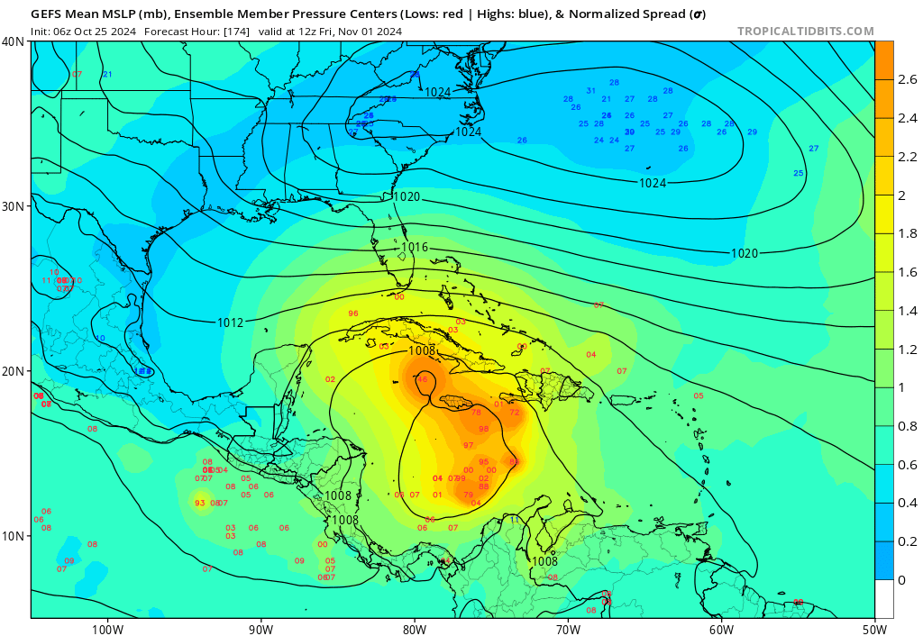
The GFS ensemble’s 30 members also show this outcome potential.

So both major model ensembles have a signal now. They’re both generally in the western or even central Caribbean with said signal as well. That’s really all we have to go on at this point.
Reading between the lines on various other data, there is support for a developing system in the same are from European AI modeling as well. That said, the overall setup is one that probably supports a system meandering within the Caribbean for a few days and then lifting north and northeastward into the Bahamas or Atlantic from this area. There’s a tremendous amount of wind shear in the Gulf, and I would not expect anything to make it there at this point in time. That said, we will continue to monitor the development risks and how they evolve over the weekend. We’ll check back in on Monday with the latest.
Friday featured sponsor: Red & Black Banter
Thank you to Red & Black Banter and all our sponsors for their support of The Eyewall this season!

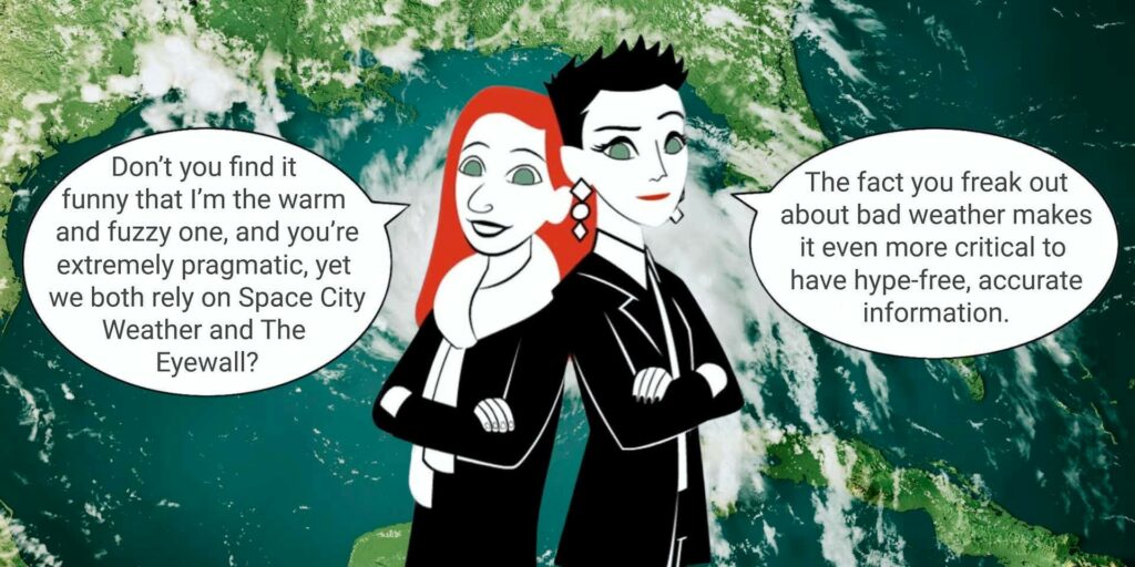
Red & Black Banter: “We’re real sisters with real stories about real life. And we’re not claiming to be experts about anything. So, why are we sponsoring The Eyewall?“
I love the cartoon they did for us as well.
It does speak to our mission. It was just noted yesterday that Russia has been leveraging recent hurricanes as an opportunity to continue propagating disinformation online. Much of what has been done here is in the realm of politics, which for everyone’s benefit we will not get into on our site. But there has been a significant uptick in misleading and flat-out false information spreading about how these storms form, how they move, so much so that NOAA even had to address it this week. It’s so important that you have trustworthy sources of information to turn to for extreme weather, like hurricanes.
It’s not just about getting good information; it’s about preserving your own sanity. If you looked at every GFS model run between May and November, I’m not sure you wouldn’t move to Alaska by late July. We’ve said in the past that we encourage folks shopping around for different “takes” on the forecast. But importantly, just make sure they’re credible, reliable, and measured. I think we’ve proven through our work in Houston and here the last couple hurricane seasons with The Eyewall that we do just that. Hype-free and accurate is the goal, but we try to be transparent when we miss, hold ourselves accountable, and learn from each opportunity. Thanks again for our sponsors’ support this season! And thank you for trusting us!


You do important work and I appreciate you!
You are the sane place to go for factual information about tropical weather. Keep up the good work!
Keep up the great work guys!
Why is the GFS still used? or at least operational?
Howdy and thanks for your excellent service.
Very odd. I just now visited the NHC website and tapped on “7 Day Tropical Outlook” … Response: “Tropical cyclone formation is not expected during the next 7 days.”.
That’s no hype. Wonder why in here looking beyond that typical timeframe for anything possible (?).
Anyway, I guess time will tell.