Headlines
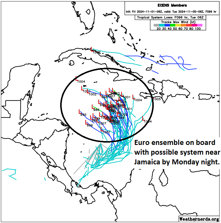
- We are getting a clearer picture of the Caribbean development potential this weekend and next week, with a disturbance possibly developing as it approaches Jamaica from the south Sunday or Monday.
- From there, it should turn west or west-northwest, threatening Cuba, the Cayman Islands, and perhaps the Yucatan as a tropical system.
- As it likely tracks into the Gulf next week, it will encounter hostile wind shear that should weaken it considerably.
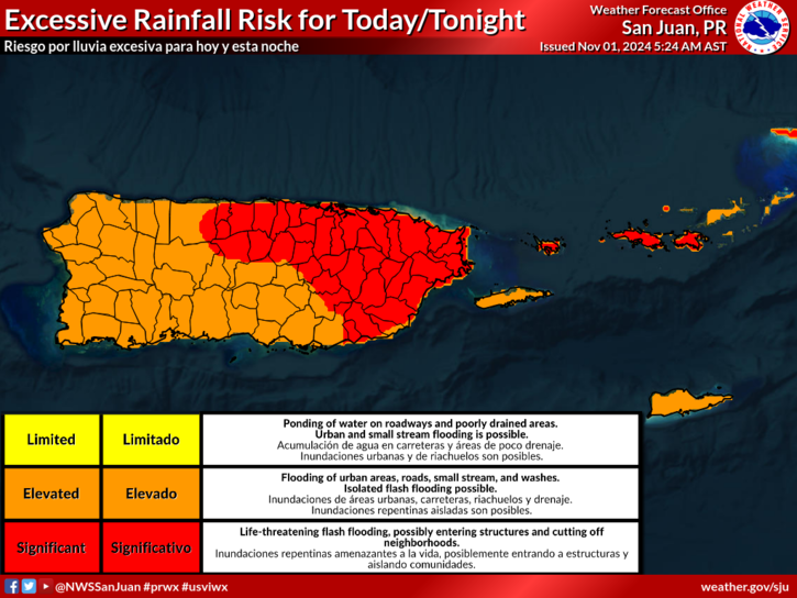
- A tropical wave is also producing heavy rain and flash flooding in Puerto Rico.
Caribbean system starting to come into better focus
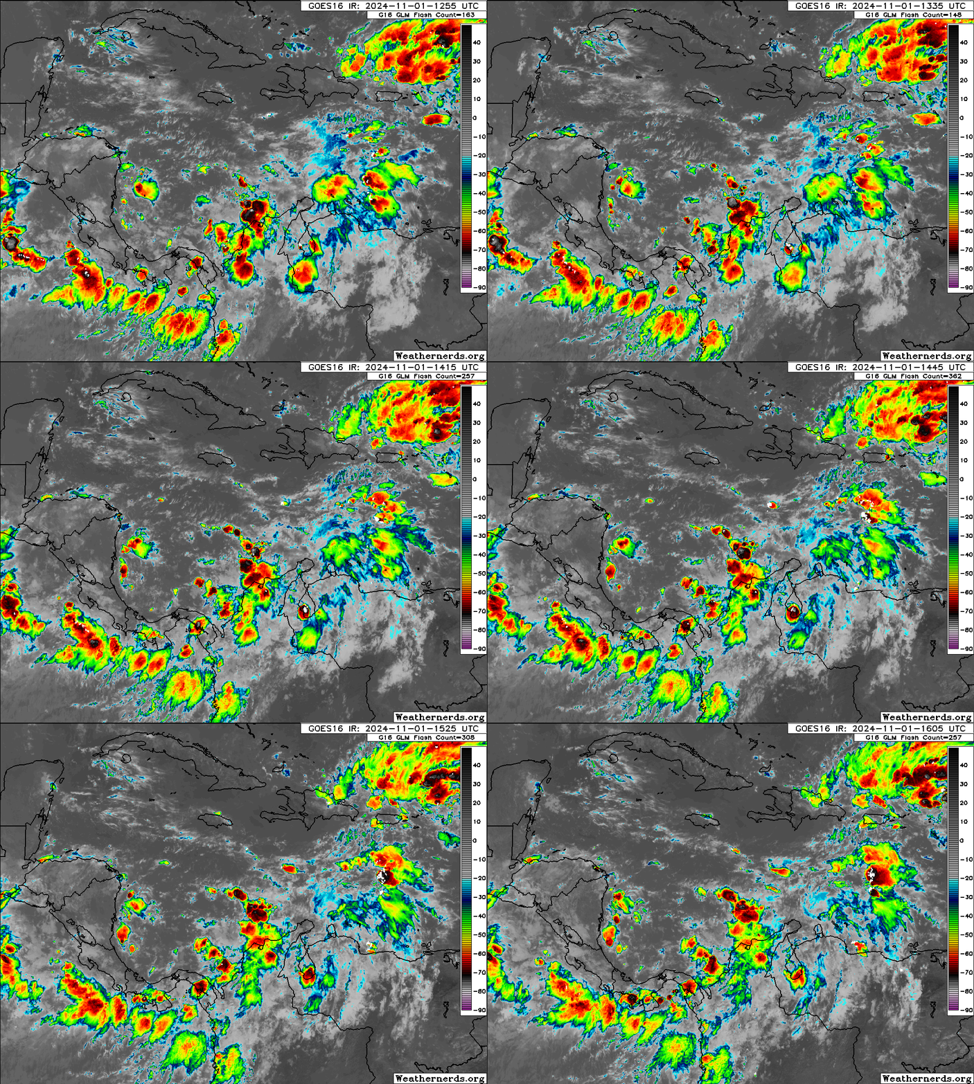
Our potential system in the Caribbean continues to see support grow for its organization. The NHC is up to 70 percent odds this morning, and it’s possible those increase further today.

Thunderstorms remain broad and disorganized today in this region, so I think we’ve got at least a couple days before anything happens here. Modeling seems to agree that a piece of the Central American Gyre (CAG) will break off north of Panama tomorrow and track generally northward toward Jamaica. I doubt we’ll see rapid development here, but it is possible that by Monday, we have a depression or something close to that near Jamaica.

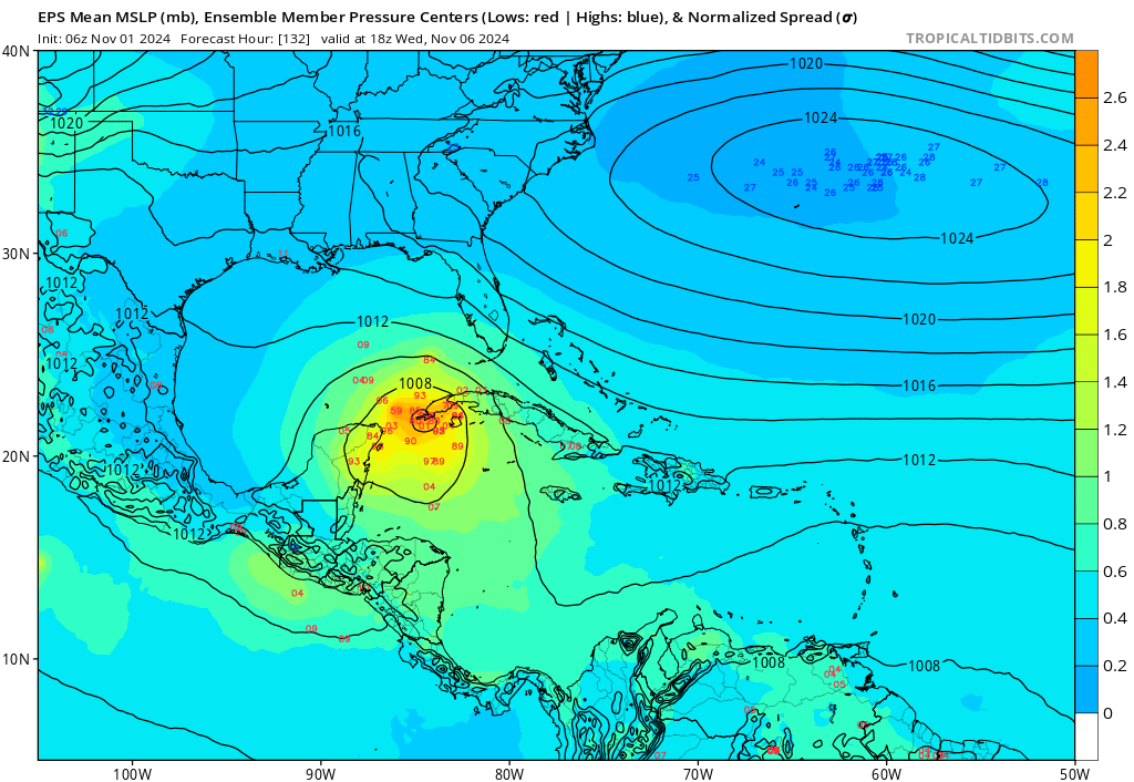
This is good model support, though the details and specifics are always tricky. But support from the ensembles and most operational guidance now exists on this as the most likely outcome through Monday evening. From this point, the system will likely begin to be steered by high pressure anchored over Florida. This should turn it northwest and then possibly due west toward the Yucatan. This will be the timeframe that is most critical in terms of potential impacts for Cuba, the Cayman Islands and Mexico. Most modeling keeps the system in check, only strengthening it a bit, but there are a handful of models that are aggressively intensifying this as it comes northwest.

By next Wednesday, we should have a tropical system somewhere between Belize and Cuba. From here, the future track of this system becomes uncertain. High pressure should allow the system to keep going west or west-northwest into the Gulf of Mexico. But by late next week, assuming it starts to turn more northerly, it’s going to get hammered by wind shear. So even if it does come northward toward the central or eastern Gulf of Mexico, it is likely going to deal with November headwinds which should keep its intensity in check. So, for now, we continue to suspect that this won’t be a big concern for the U.S. Gulf Coast. But you should check back in later this weekend or early next week just to make sure. For areas between Belize and Jamaica, including Cuba, this will be a system to watch closely through the weekend. We’ll keep you posted.
Elsewhere: Flooding in Puerto Rico
The NHC is highlighting two other areas, one north of the islands and one near the Azores. Neither has much more than a 10 to 20 percent chance of development and none are a serious concern, although heavy rain in Puerto Rico has been causing flash flooding concerns, and additional rain will continue to cause flash flooding in the eastern and northern portions of the island.

Most of this should hopefully ease up over the weekend.
I’m wondering why the focus on storm surge warnings is on depth instead of the fact that it is flowing water that weighs 1685 pounds per cubic yard and whose speed is determined by wind duration and geography. Depth did not decimate Bolivar during Ike, flow did. Yet the focus on government weather sites was “I’m six feet tall and an eight foot surge will be two feet taller than me” during Milton. Thoughts?
Hoping I won’t have to pull my Patty O’Furniture in…
(hehehe…)
Lol