In brief: The tropics will be quiet over the next 5 days or so before perhaps our next wave worth watching next week. Meanwhile. flooding risk perks up today in the Northwest, with Idaho in focus for locally heavy rainfall.
Tropics
Tropical Storm Fernand continues on its merry way.
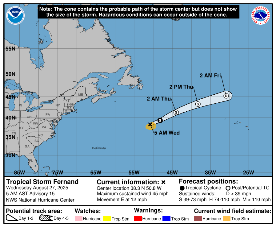
Maximum sustained winds are 45 mph, and while it looks better than it did 24 hour ago, it’s still not in great shape. Expect to see Fernand go post-tropical by the end of today.

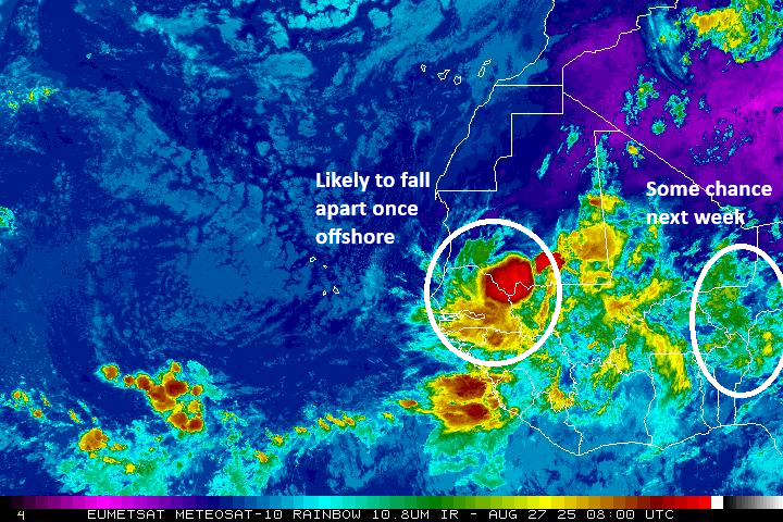
Behind Fernand, the Atlantic is quiet as a church mouse. While the next tropical wave to emerge off Africa looks kind of robust, it is going to likely fall apart once in the Atlantic.
The wave that’s moving west out of Nigeria seems to be one that is getting some attention on the weather models. The AI models in particular seem to like this one’s odds of developing sometime next week. Any development would probably be sluggish due to a still generally hostile background state in the Atlantic. Again, the hostile background doesn’t mean things cannot develop; it means they’ll probably struggle somewhat, however.
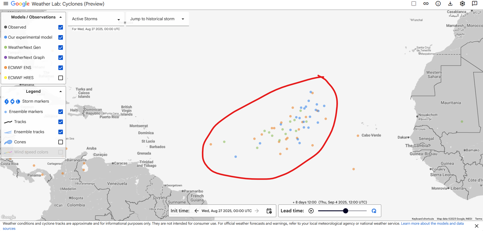
Aside from that, we don’t note any specific threats in the tropics over the next week or two. We’ll keep watching.
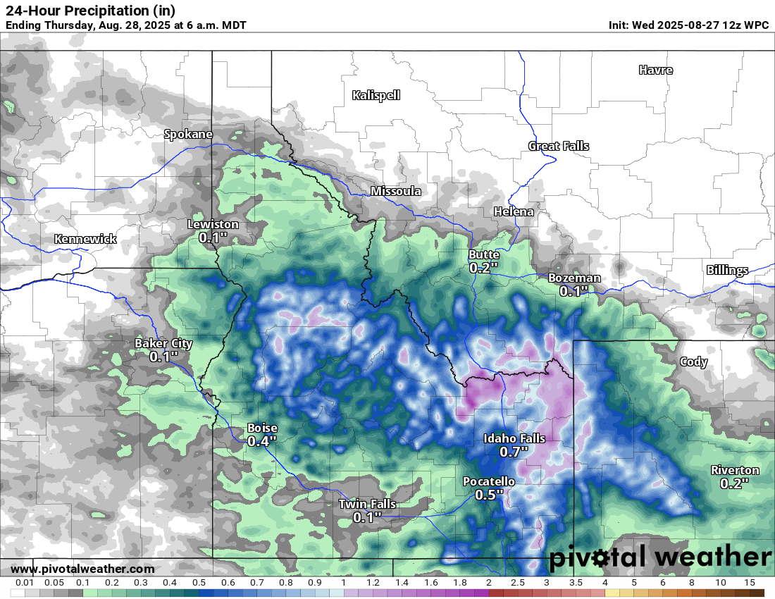
Elsewhere: Monsoonal flex in the Northwest
Today’s weather story will probably be in the West where abundant monsoon moisture will be in play in the Great Basin and Intermountain Region.
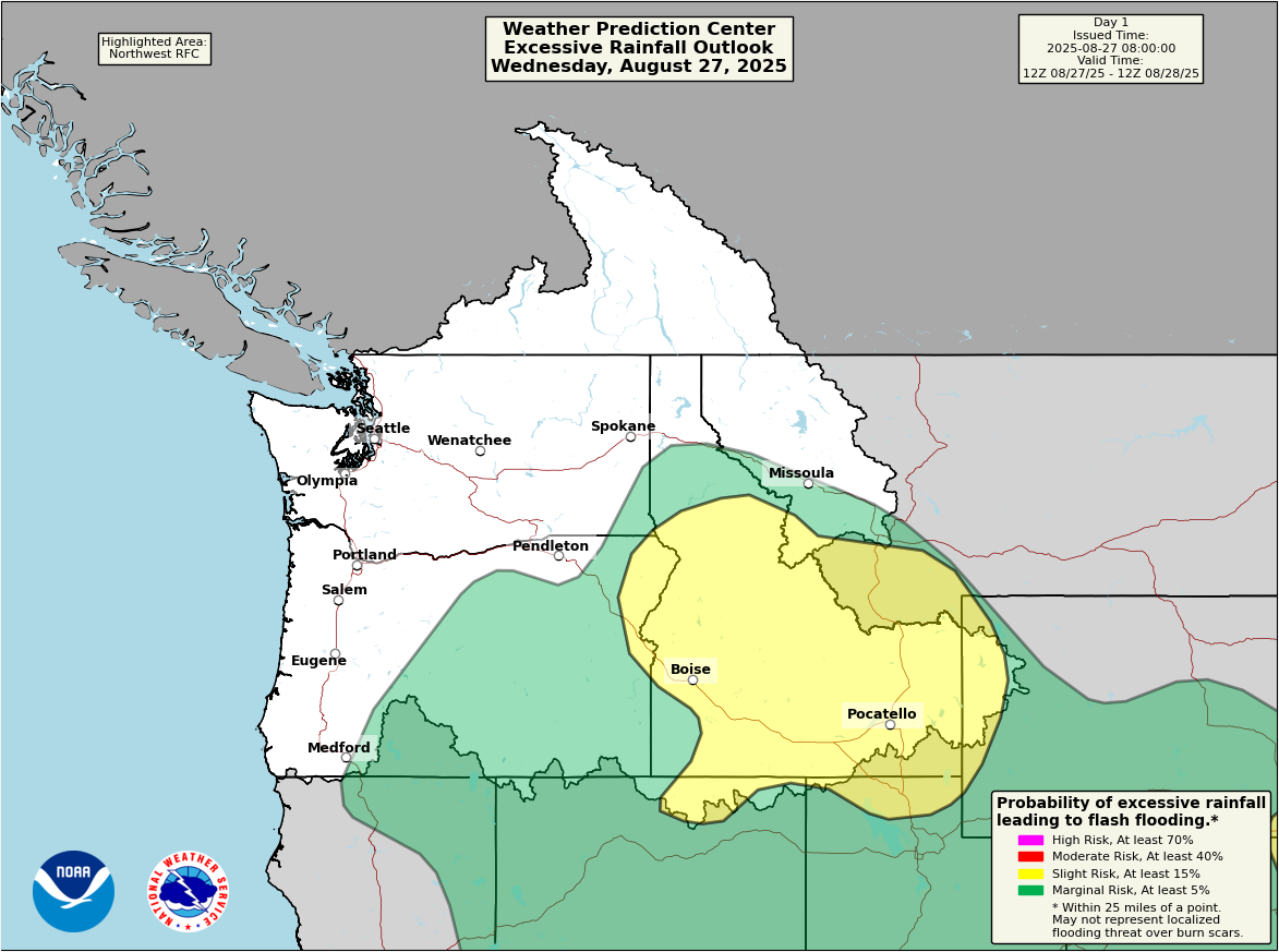
The focus of the heaviest rain may be on the Bitterroots and southern Idaho. Flood Watches extend from that area south into the Great Basin and northern Nevada. There’s a strong signal for 1 to 2 inches or locally higher amounts of rain in spots today, particularly in the Bitterroots. North-Central Idaho will also be in play for some of the heavier rain risk today.
The heavier rain risk focuses back into Oklahoma and Arkansas tomorrow.