In brief: Today we tie a bow on the heat wave from March, offer a quick El Niño update, and take a peek at Texas weather over the next few days.
Closing out the heat
With the March numbers finalized, I wanted to just tally things up for you. In March of this year, over 10,000 daily high temperature records were broken, along with nearly 1,700 additional records tied. 8,400 daily warm low temperature records were broken, along with over 1,500 tied. Over 2,500 monthly high temperature records and over 1,200 monthly warm low temperature records were also set or tied in March. Monthly records are those set that break the record for any day in the month.
For context, almost 51,000 daily high temperature records have been set over the course of the last year, so the March records represent nearly 20% of all those records. Meanwhile, 4,300 monthly high temperature records were set over the last year, so March represents approximately 60 percent of all monthly high temperature records over that time period. Really, a remarkable feat.
U.S. Weather Update
No real major issues of note over the next week in terms of temperatures. Now, in terms of precipitation and severe weather, we’ll be watching that a bit closely. More on that in the Texas section below.
Chatter has been building regarding the potential for a massive El Niño event later this year. Models seem to be on board. Ancillary evidence supports it. Not much else to say right now except watch and wait.
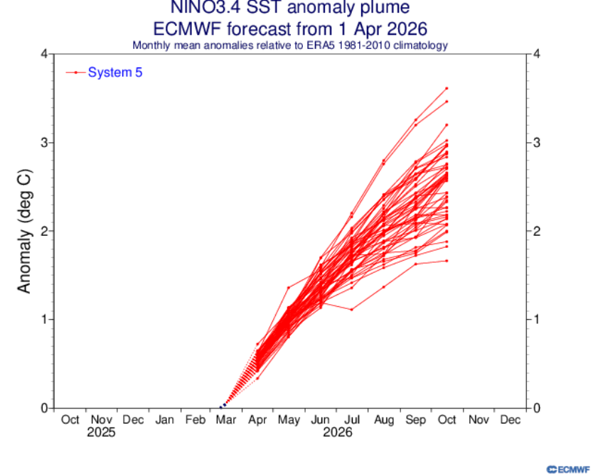
If we do end up in a developing El Niño heading into hurricane season, which certainly seems likely at this point, this would favor muted activity. There’s some speculation out there that it could be an exceptionally weak season, but I think it’s far too early to take comfort in that. We will be getting our first look at important seasonal outlooks soon. I’ll be curious to see how low they go. The reality is that while seasonal forecasts are generally alright, there are still plenty of ways they can fail.
Site note
I have been slowly working through a multi-post series reviewing the 2025 Atlantic hurricane season, with all the post-storm reports complete and such. I hope to drop that either later this month or early next month.
Texas weather outlook
Alright, let’s dive into Texas over the next several days. First off, a pretty good deal of precipitation is likely in the state, which is good news. Expect some showers and storms in West Texas today, South Texas on Thursday, East Texas on Friday, and much of Central Texas over the weekend. The sprinkling each day will add up with
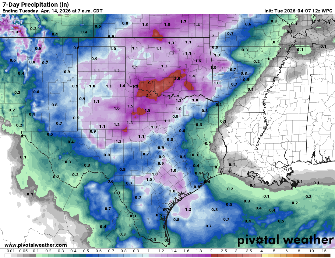
In addition to the rainfall, there will be a severe weather threat in Texas this week. Beginning on Thursday in the Panhandle, a marginal risk is in place (level 1/5). Parameters don’t look especially great, but we may see some isolated activity pop on the dryline out there on Thursday. By Friday, I would expect to see perhaps another marginal risk eventually somewhere in the state as storm chances float around. Over the weekend, however, much of North, Central, and parts of West Texas are highlighted in severe risks Saturday, Sunday, and Monday.
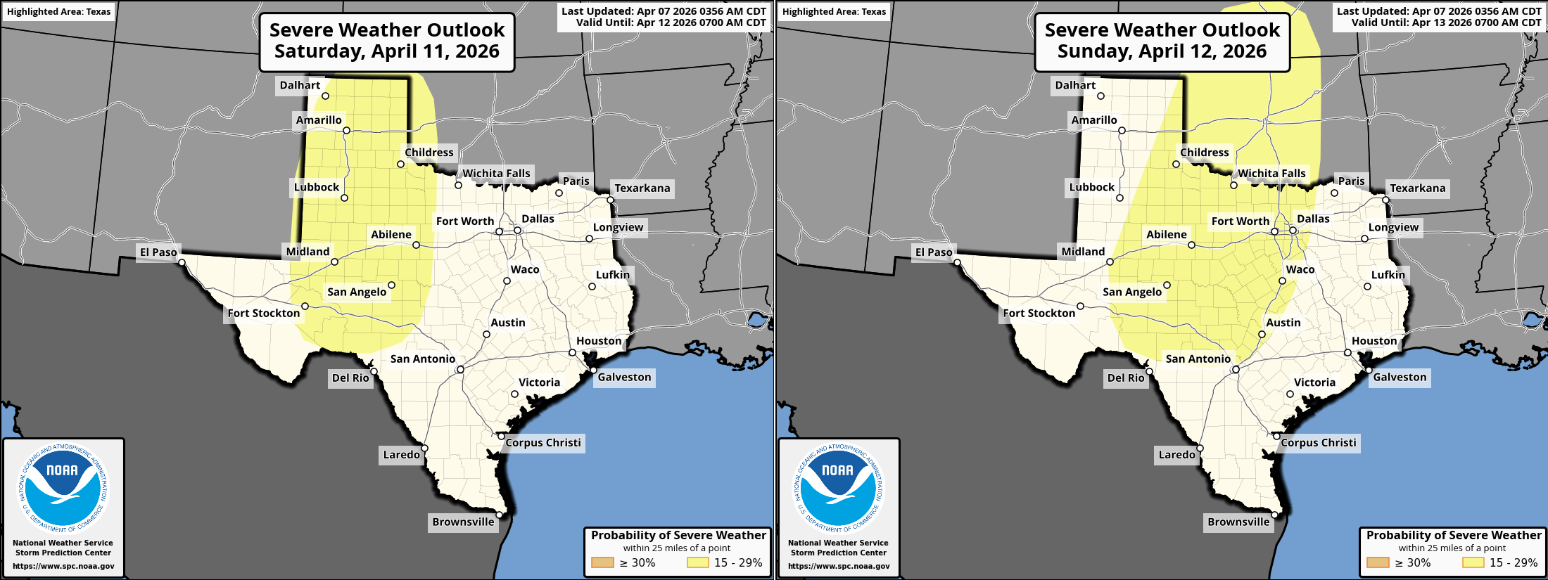
The risks are probably a bit higher Sunday and Monday rather than Saturday, but nevertheless there will likely be severe weather risk this weekend in the western 2/3 of Texas with hail, strong winds, and isolated tornadoes all possible.
Temperatures look to be near to slightly above normal. Nothing too crazy in the forecast heat-wise. Rain showers will likely temper daytime highs with clouds and humidity giving a slight boost to nighttime lows (more typical for mid to late May).
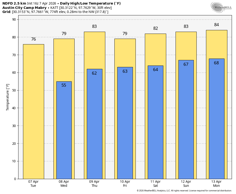
Some days may be cooler or warmer depending on rain coverage.