In brief: Imelda will have a complex journey to Bermuda over the next couple days, dealing with both external risks to intensification, as well as jet stream support for its intensification as it transitions into an extratropical storm. The end result: Significant storm impacts for Bermuda are expected, with strong winds and rough seas. Imelda and Humberto will continue to combine for rough seas, tidal flooding, beach erosion, and rip currents up and down the Atlantic Seaboard.
Hurricane Imelda
I feel like each day we’ve had some sort of new classification of Imelda. We went from PTC on Friday to depression on Sunday to storm on Monday to hurricane today.
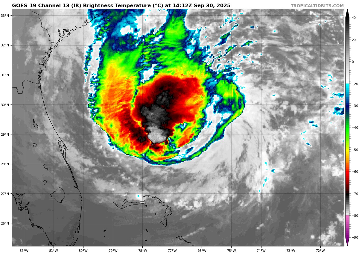
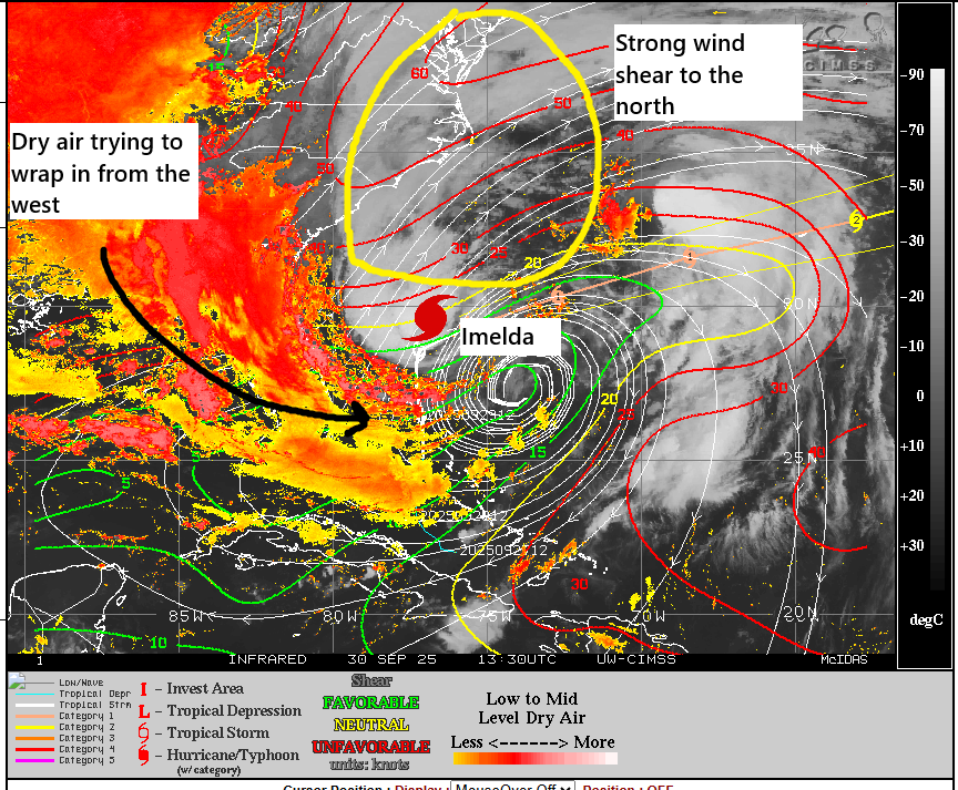
Imelda was upgraded to a hurricane earlier this morning, based on recon data. Further strengthening is expected, however like most everything with Imelda, it’s been complex. In Hollywood parlance: The system itself sits in a nice little cocoon, but it is surrounded by hostile forces seeking to attack and destroy it. Shear and dry air surround half the storm right now, and while it is currently able to strengthen over the warm water, what happens from here is questionable.
Intensification will probably be modest over the next 24 hours, which would slowly nudge it up the category 1 scale. Odds of significant rapid intensification have dropped today. And the odds of a major hurricane have also. But what is interesting is that as Imelda approaches Bermuda, it will begin to undergo transition to an extratropical storm. And sometimes, sloppy storms like this one just need that nudge from the jet stream to rev them up.
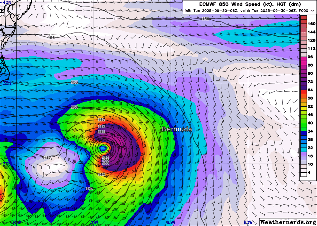
In fact, you can see the lower-level wind forecast from the European model for tomorrow into Thursday above. Notice how Imelda (approaching from the lower left) sees a burst of wind later tomorrow (winds over 100 mph down to about 5,000 feet based on this outlook). This is what could end up impacting Bermuda as it approaches late tomorrow and very early Thursday morning.
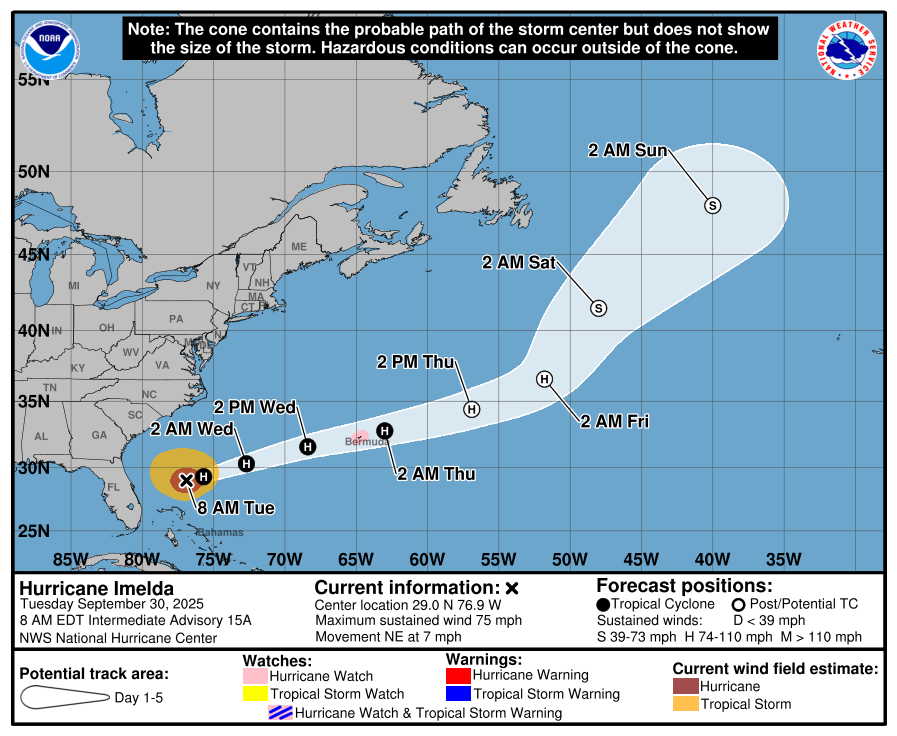
Hurricane Watches are posted for Bermuda, and I would expect those to get upgraded to warnings soon.
Track-wise, there is good agreement on a track that comes close to a direct hit on Bermuda. However, as you see above, the wind field from Imelda is going to be somewhat broad and potent, so the impacts may be similar regardless of the exact track in this instance. Rainfall of 2 to 4 inches is expected in Bermuda, which could cause some localized flooding.
On the U.S. East Coast, the northern shores of the Caribbean, the Bahamas, and parts of Atlantic Canada, there will continue to be rough surf, beach erosion, rip currents, and tidal flooding risk as a result of both Humberto and Imelda. This will take a couple days to subside. Caution is continued to be advised.
Elsewhere, Humberto is on the way out, as noted. We should have a breather after Imelda dissipates later this week. We’ll then turn our attention to whatever comes next, which may or may not be in the Caribbean. Model “noise” is inching up a bit late, but there remains no real signal. Good news for now.