-21 inches
-12 inches
-10 inches
-16 inches
Those are the approximate snowfall departures from normal this season as of Sunday for Minneapolis, Chicago, New York City, and Concord, NH. Much of the country is in a bit of a snow deficit right now, as evidenced by the snow cover departure map below from the Rutgers Global Snow Lab.
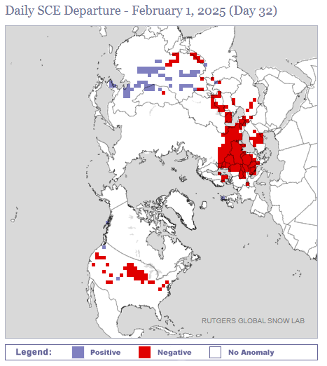
It’s been so bad that as of February 2nd, Chicago and Minneapolis both have only about an inch more of snow on the season than does Pensacola, FL. While this speaks more to the lack of snow up north than the surprise snow down south, it’s still a bit of a shock.
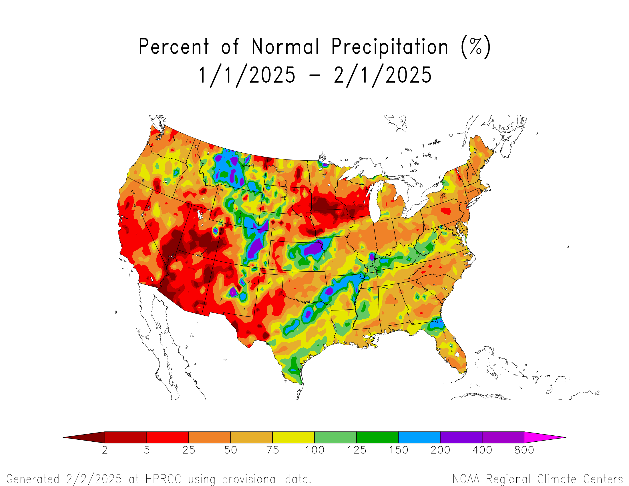
If you look at how January finished in terms of precipitation (not just snow, but all forms of precip), most of the country ended up drier than normal, taking the whole “Dry January” thing a little too far.
Last week we discussed La Niña and how it finally became established in December. It’s not uncommon for La Niña to generally produce drier than normal weather across the United States. So in theory, this makes sense.
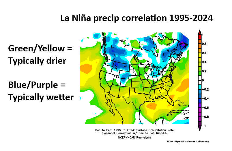
The conventional wisdom is typically that SoCal through Texas and Florida are usually dry in La Niña, but over the previous 30 years, the signal for dry does extend to cover much of the country. It surely does not guarantee dry weather, but it tends to skew the odds in that direction.
So, here we are, after a drier than normal January and with snow departures racking up all over. At some point it changes, right? It can. Usually as we transition toward spring, the stronger dry signals we see above start to break down more to “coin toss” territory. But what about in the shorter-term? Well, that brings us to the models.
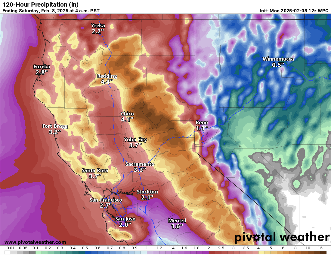
Over the next couple weeks, there are signs at least that a series of storms may cross the middle of the country. In my experience, when you have the type of clobbering we’re seeing in California right now, that usually produces something downstream. Over the next 5 days, northern California will indeed continue to cash in from an ongoing atmospheric river event with anywhere from 6 to 10 inches of liquid equivalent precipitation in the mountains. This should boost snowpack, which is running at a deficit this season.
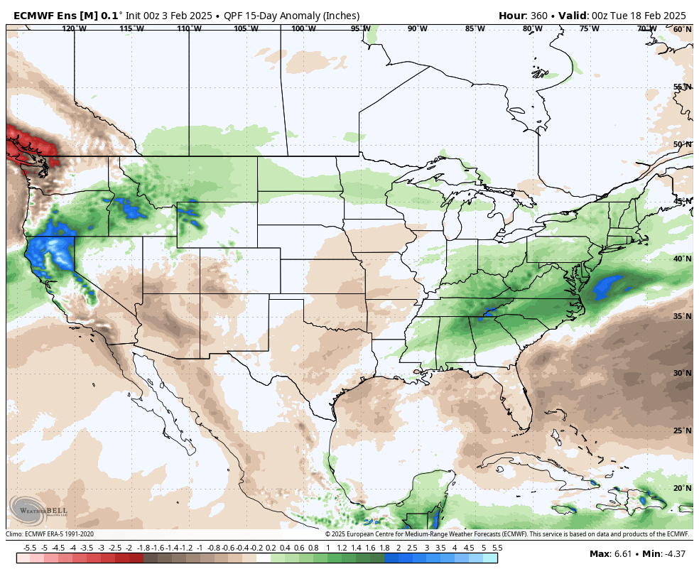
But notice on that Euro map a couple images up. There is definitely a signal of some sort change in the precipitation pattern we have seen thus far in 2025. Yes, the northern Rockies still look to cash in, but so will the Northeast, Mid-Atlantic, and Tennessee and Ohio Valleys. As well as the area near and north of the Great Basin. The question for folks east of the Rockies would be: Will it snow? And the answer appears to be “maybe?”
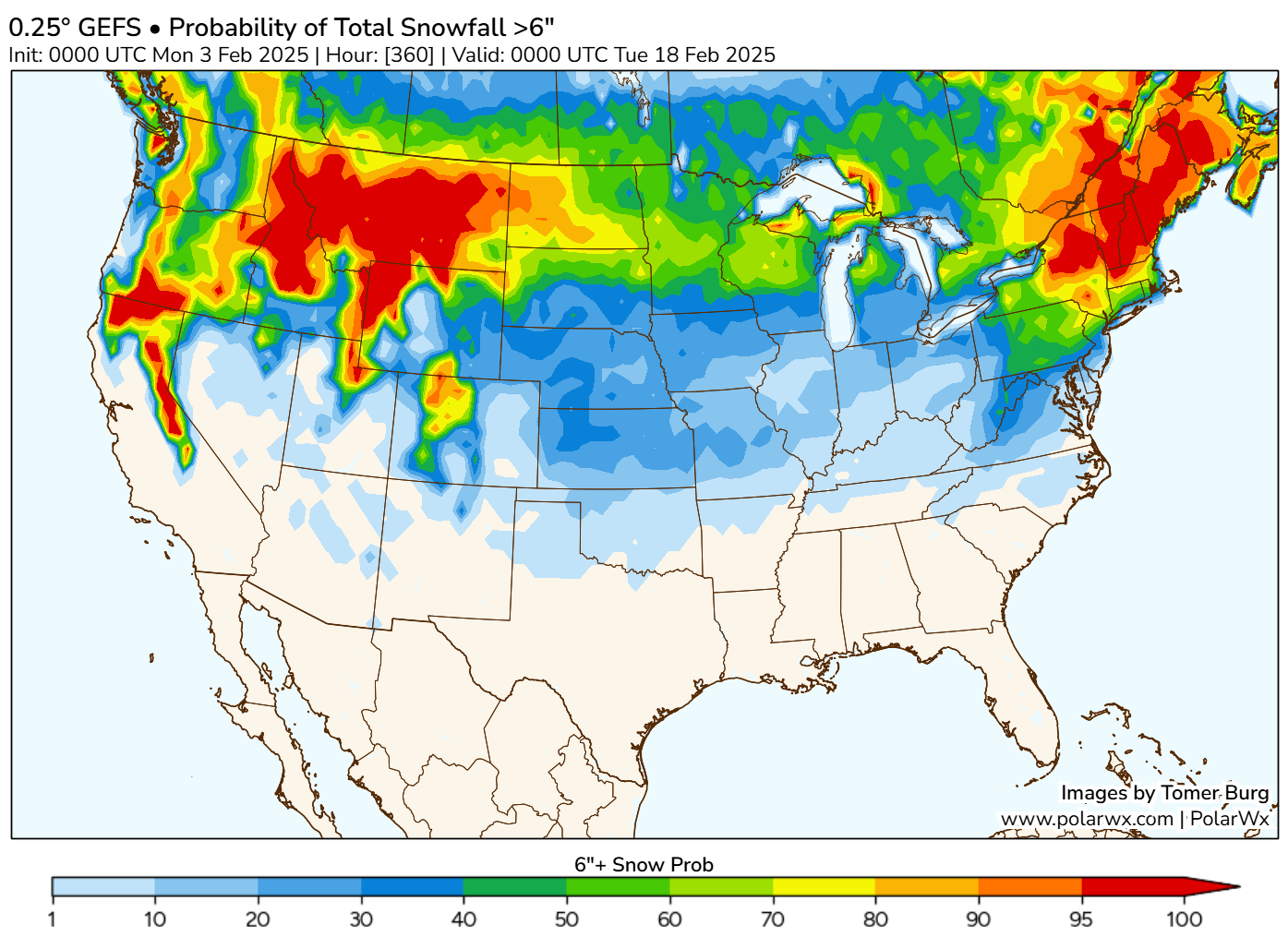
The map above shows the probability of 6 or more inches of snow over the next 15 days. And indeed some areas that have been experiencing a bit of a “snow drought” so far this winter may see some ability to cash in now. How this unfolds? It will come in waves. We’ll likely see a somewhat significant storm later this week, followed perhaps by another one this weekend and yet another storm or two next week, along with perhaps some colder air in the mix. While the details are far from clear at this point, the take home message is that we may be seeing a bit of a change in the pattern to help snow lovers out in spots. Not everywhere but that may be the best we can hope for in a winter like this.
As always, I appreciate the honesty in your evaluation for, let’s say, the coming month. I can deal with uncertainty much better than I can with “predictions”.
I sure hope CA gets some relief!
The snow deficit is startling, esp that FL is only one inch behind MN/IL.
Ty for the information 😄
Thank you and not enjoying the 80’s as it’s tooooooo soon! Fingers crossed for a few more cool/cold weeks!
Percent of normal is might be a good general way to look at a stat, but for California precipitation, it doesn’t provide useful information. During the dry season, normal is 0 or close to 0 precipitation. During the rainy/snowy season, normal might be 4 big storms. Is it normal for them to happen once a month? Or one in December and three in March?
This is to say that, we did have a dry January, but that’s not terribly unusual. Not 5% unusual. Maybe more like 1 in 5 years.
I don’t have a suggestion for a better stat.