In brief: Fernand will soon become post-tropical as it heads out to sea. Warm weather in Europe thanks in part to Erin’s remnants will soon end. Today, we also discuss how AI modeling fared during Hurricane Erin, as well as a massive haboob that descended on Phoenix, Arizona yesterday.
Tropics: Fernand, and Erin’s remnants in Europe
We are starting off Tuesday with essentially a clean slate. There are no current areas of interest with respect to the tropics. The only item out there is Tropical Storm Fernand. The storm should become post-tropical by later today or tomorrow as it scoots out to sea.
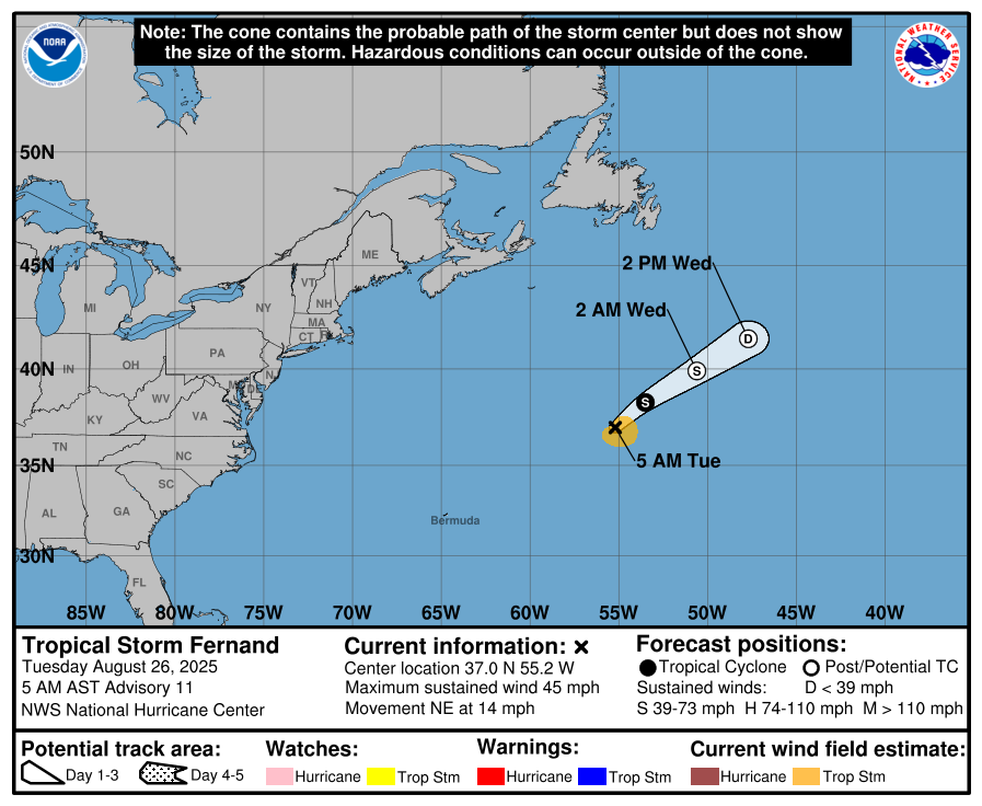
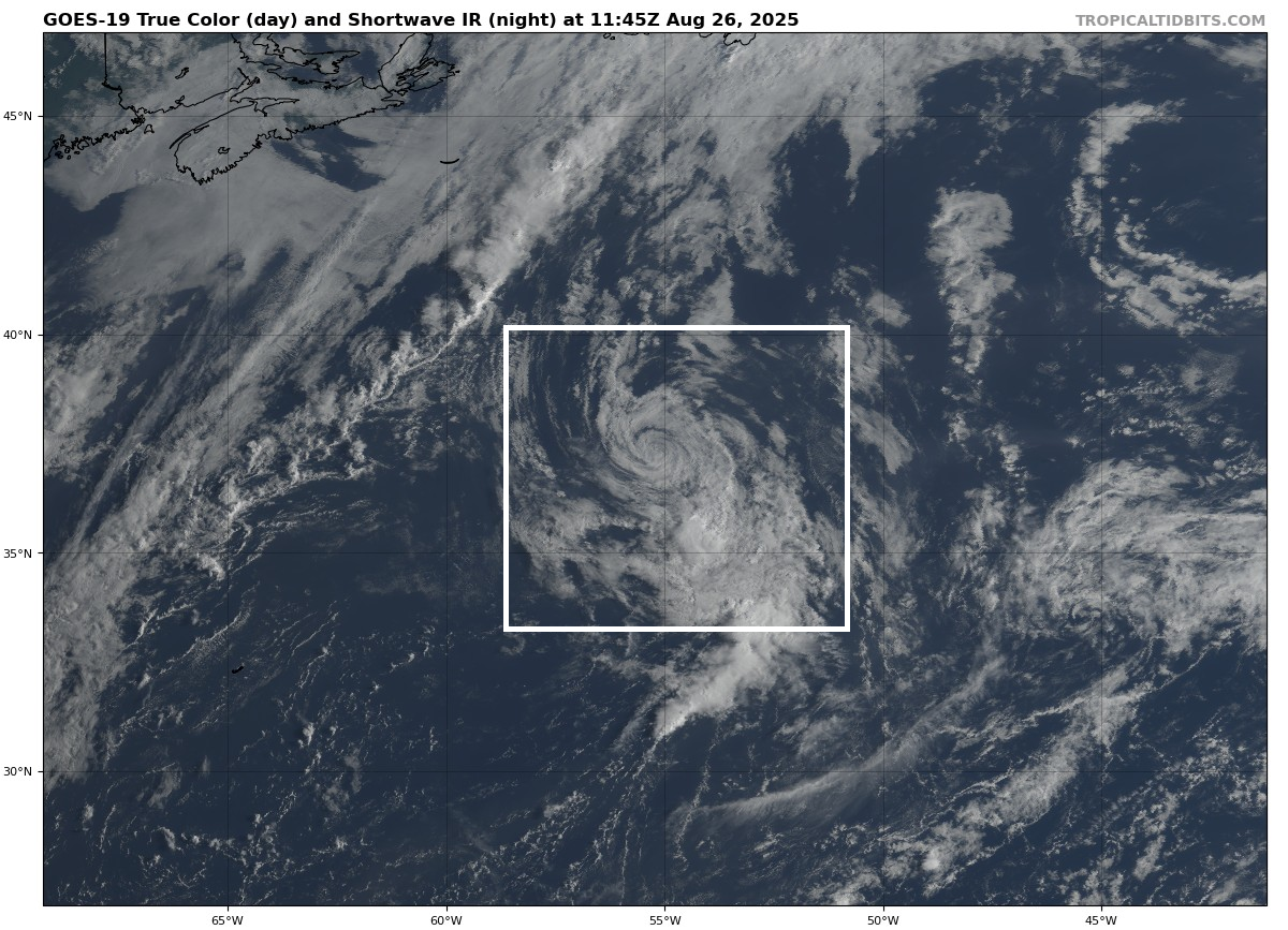
In fact, Fernand is kind of cool to look at on satellite imagery this morning. It’s become almost a “naked swirl,” as virtually all deep thunderstorm activity around the storm has vanished or been left behind due to wind shear.
Fernand will be funneled off toward Europe where it should be absorbed into the larger storm system that also contains the remnants of Hurricane Erin. Temperatures are running about 6 to 10 degrees above normal in western Europe with that storm system sitting just south of Iceland. The circulation around it pumps very mild air into Europe, particularly western Europe, and London has ended up with low 80s instead of low 70s for highs.
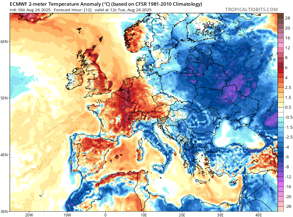
Somewhat cooler weather and some breezy unsettled weather is on the way to Europe as this storm system dislodges. Anyway, the point of a longer note than usual this morning is to show how even “fish” storms can provide interesting things to discuss.
There are no other tropical concerns today.
A feather in the cap for AI weather modeling
Speaking of Hurricane Erin, let’s talk briefly about verification. When it comes to writing our daily updates here, we are vehemently anti-AI. You’re always going to hear from a human when you read The Eyewall. However, when it comes to weather modeling, AI (or really, machine learning) is adding new, extremely valuable tools to the arsenal we have to forecast with.
Some of the initial results are in from Hurricane Erin’s forecast, and Google’s Deep Mind AI model scored a pretty significant win for these new tools. Between hours 12 and 72 of the forecast, the GDMI on the plot below (shared by former NHC Branch Chief James Franklin) outperformed the best tropical models and even the NHC. Notably the NHC also outperformed the models in that timeframe as well, a win for them.

After hour 72, the picture becomes a little blurrier for AI with the HAFS-B (HFBI) taking control. TVCN represents a consensus aid, and the GDMI from Google beat it all hours. I was more impressed to see how it handled intensity, truthfully, as AI modeling has tended to struggle a bit in that department.
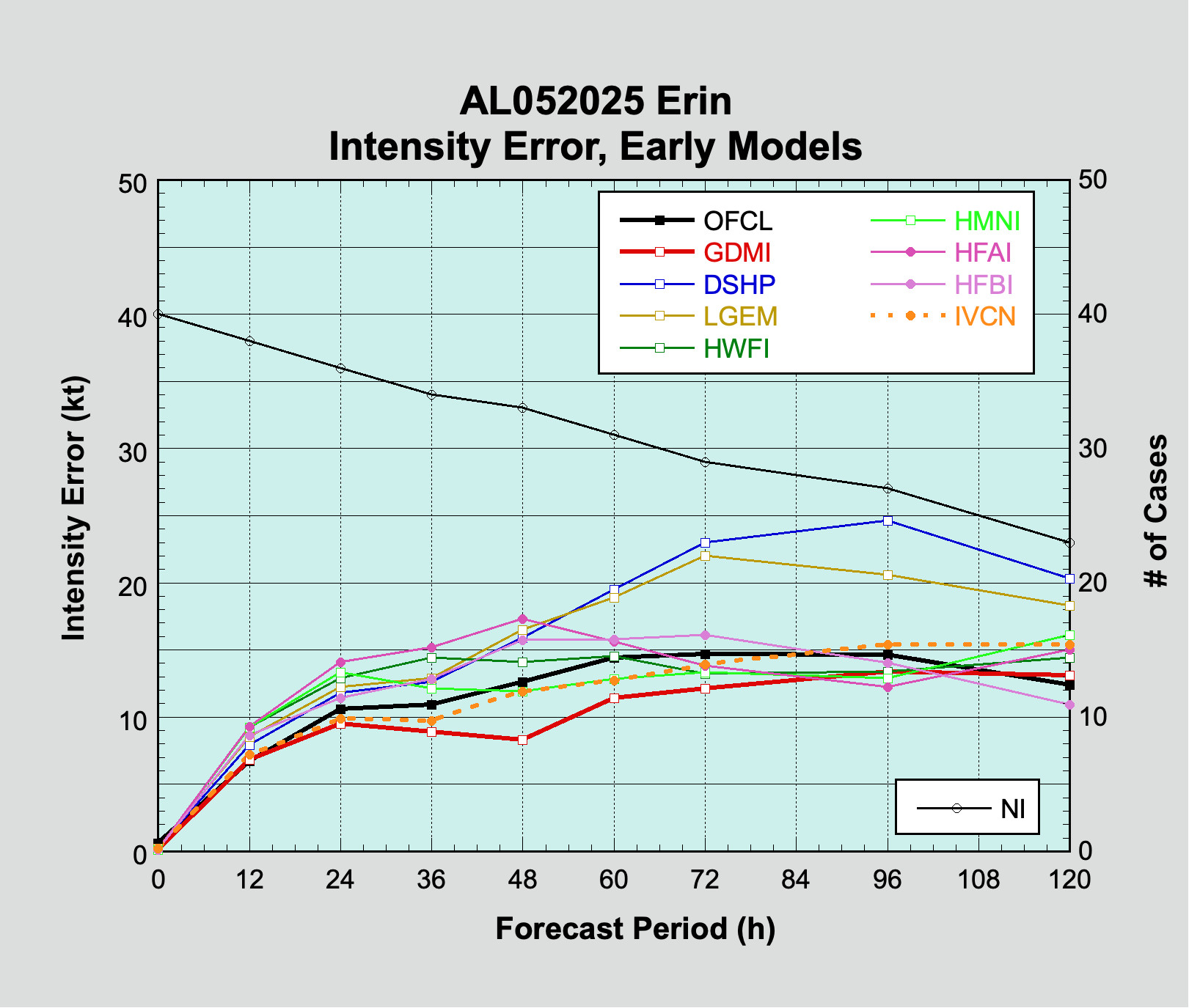
Again, Google’s Deep Mind outperformed virtually all traditional model guidance through 72 hours. Even later in the forecast horizon, it ended up in the top third of guidance.
So what can we really say here?
First off, let’s just call it what it is: Certain AI modeling, which require far less computational resources and take extraordinarily less time to run is able to perform essentially as good or better than traditional modeling when averaged over the life cycle of a major hurricane. That last part is important. It’s just one storm, yes, but this is something we have anecdotally noted since last year. AI modeling tends to be much more stable with respect to storm track, particularly in the first 3 days of the forecast, which is certainly important.
However, averages are just averages, and while the AI modeling performed outstandingly over the lifespan of Erin, there’s a difference between storm-life statistical average and operational effectiveness in real-time. Also, Erin’s forecast track frankly didn’t have a ton of major uncertainty in the 5-day time horizon. There were questions of exact turn timing and location, but short of that, it became more a matter of semantics than anything. The intensity forecast was really well done by AI modeling all things considered.
So it’s important to contextualize this. Google’s Deep Mind represents one AI model. Hurricane Erin was one storm. But AI modeling has proven time and again that it can hang with the best modeling, particularly with respect to track but also now in some cases intensity too. It’s also important to note that the National Hurricane Center outperformed most model guidance on track and intensity. The assumption here is that given the technical expertise that resides in the NHC, as these AI models become more proficient and get validated, those will be further incorporated into the NHC forecast process. And the NHC should continue to shine overall.
Haboob in Phoenix
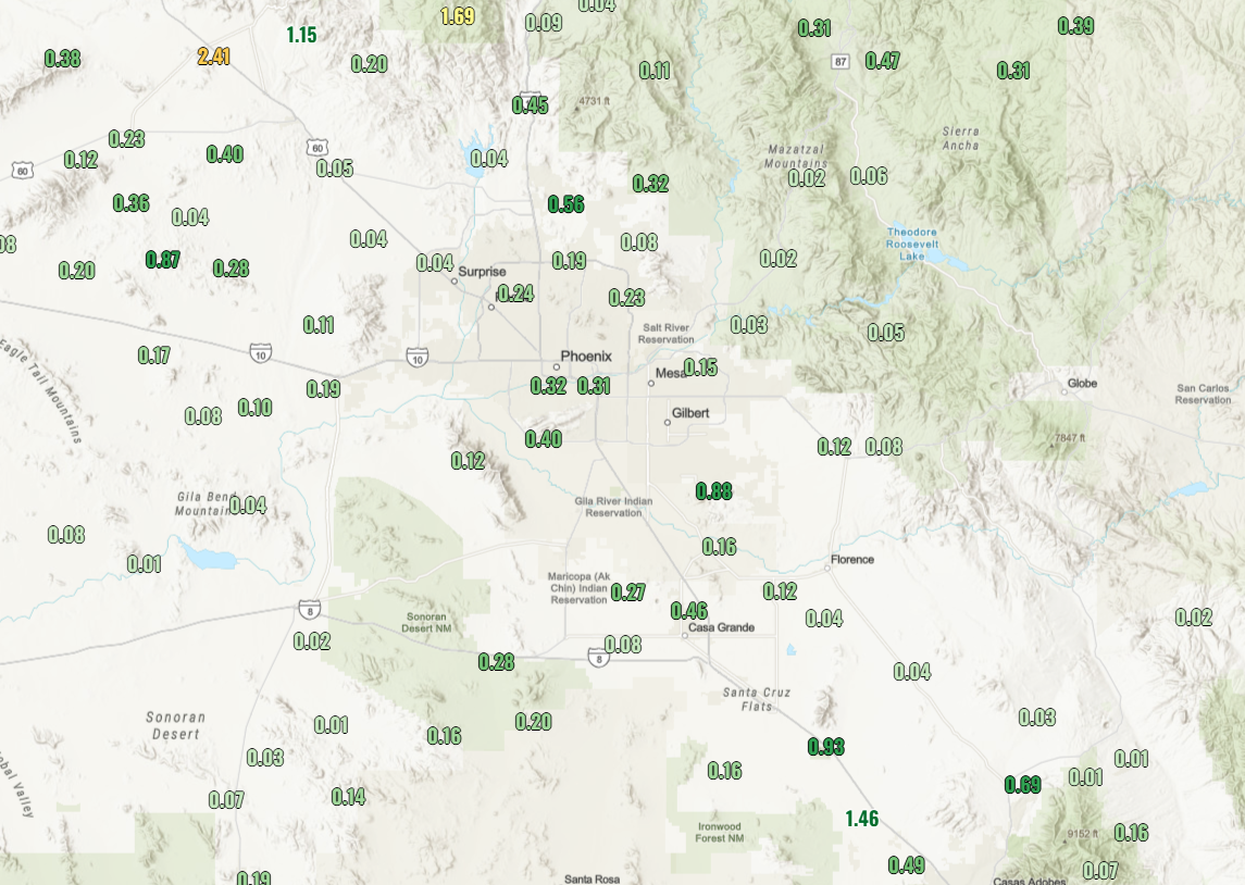
Shifting gears now, the Phoenix metro was overtaken by a massive haboob yesterday. What’s that? It’s a massive dust storm usually kicked up by the winds of strong thunderstorms moving over the desert or dried soil. And indeed, yesterday’s haboob in Phoenix was something else.

You can read more about the history and etymology of the term haboob here, but while these are somewhat common in the Southwest, one of this magnitude overtaking a major metropolitan area is pretty incredible to watch. The good news is that it wasn’t just all dust. Much of the Valley of the Sun and beyond saw some good rains as well yesterday.
A continued chance of isolated to scattered monsoon thunderstorms will be with parts of Arizona at least from today through Thursday.