In brief: Today we talk about the first dose of Arctic air this cold season, in addition to the chance of lake effect snow. We’ve also got a look at California which may shift quite a bit stormier later next week. Plus a lot of news to catch up on and the latest on NOAA/NWS challenges.
Big warm up, big cooldown
Autumn is going to autumn heading into the weekend. A big warm up is in store for the eastern half of the country ahead of a potent Arctic cold front. This will deliver a taste of early winter to much of the Eastern and Southern U.S. Houston, Austin, and San Antonio may threaten a record high temperature on both Friday and Saturday.
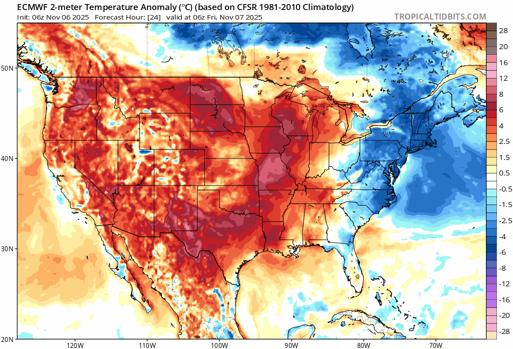
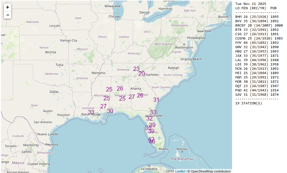
But a cold front plowing east on Saturday and Sunday will eradicate this warm weather and replace with the first real dose of Arctic air of the season. Morning lows on Monday and especially Tuesday will threaten records, mainly in the Southeast.
We will see frost and freeze make it all the way down close to I-10 to the east of Houston. Lows in the teens and 20s will be likely to the north from Tennessee into the Midwest. Chicago should be in the mid-20s on Monday morning, Minneapolis near 20, and Detroit mid-20s.
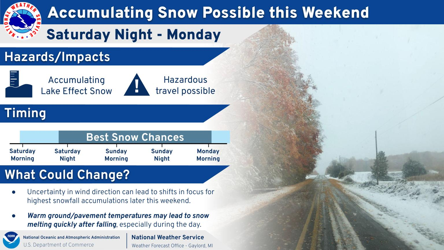
In addition, the first legitimate lake effect snow of the season looks likely behind this system. A few inches of accumulation could add up near the lakeshore in Michigan, parts of Indiana, and perhaps New York or Ohio. Not a major event right now, but it’s worth keeping an eye on. It’s that time of year.
Temperatures will warm up again next week.
West Coast storminess later next week
It’s a bit early to get into specifics, but it does appear that a significant shift south in moisture is going to occur next week in the West. This should allow for significant rain to impact California, as well as significant Sierra snow.
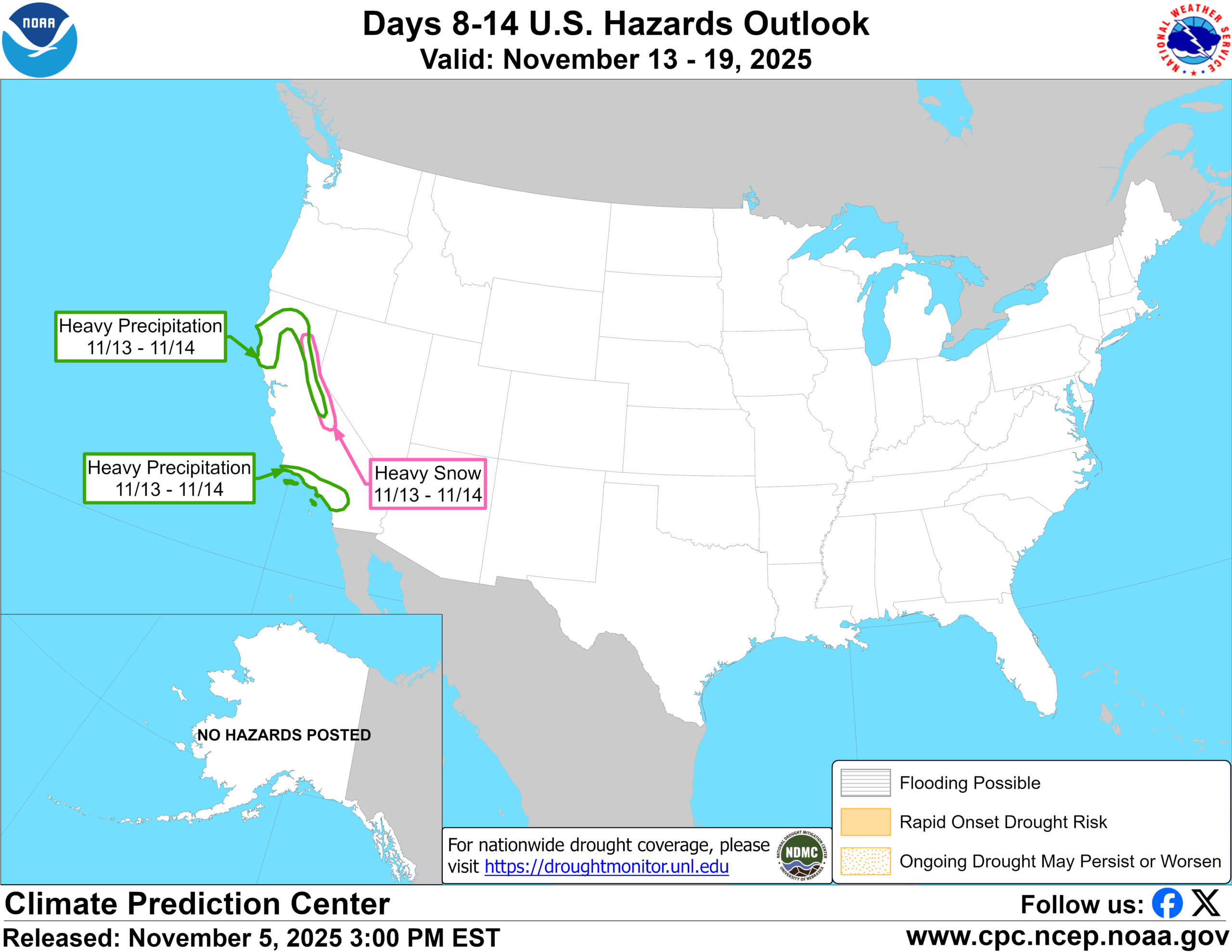
Again, it’s too early to get into details, but ensemble modeling seems to support up to an inch or so of moisture in SoCal and 1 to 3 inches in NorCal. Operational guidance, including European AI modeling suggests there is higher side risk to these totals as well.
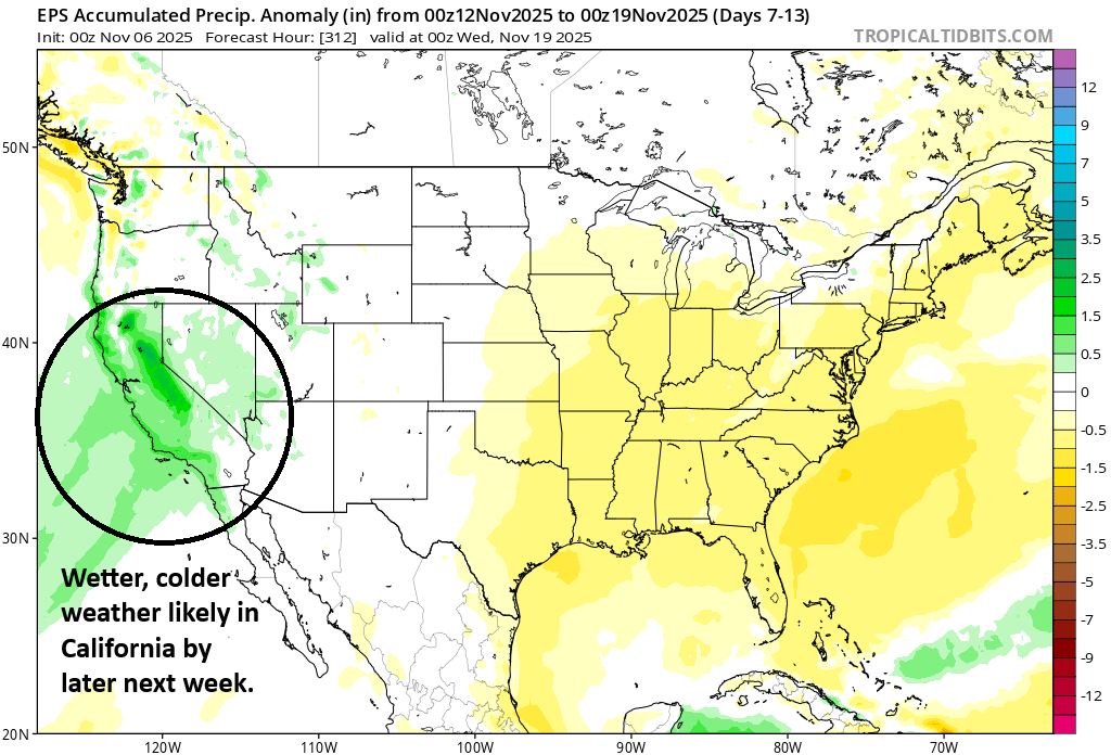
Bottom line: It looks like a substantial wet storm or series of storms may impact much of California by later next week.
Newsy bits
Help me close my tabs by checking out some news from this week.
Derechos: Cool news out of Oklahoma where researchers are embarking on a project to catalog derecho events (hundreds of miles of damaging thunderstorm winds, many in the higher end of 75 to 100 mph) back to the 1950s. The idea is to try and understand what the correct environment for derecho development may be, which would help improve forecast accuracy. (University of Oklahoma)
Roanoke, Virginia: It’s been 40 years since a terrible flood struck Roanoke in 1985, causing $200 million in damage and killing 10 people. Massive flood mitigation efforts ensued, and it’s been successful, though there is still much work to do. I strongly encourage you also read Kevin Myatt’s flood synopsis of that event and how Hurricane Juan did and did not cause it.
Chattanooga, Tennessee: In Chattanooga, the Tennessee Department of Transportation is assessing how their infrastructure performed during floods in August that damaged 309 homes or businesses. The rain that fell was a 400 to 500 year event which blew past the design thresholds. We read about this a lot. We are getting better data through NOAA’s Atlas 15 project, but even that may become somewhat outdated as atmospheric moisture is increasing, leading to more frequent heavy rainfall events. (WTVC)
Sullivan’s Island, South Carolina: In Sullivan’s Island, a location that is seeing more frequent coastal flooding, the town produced a 154 page mitigation plan. It included policy recommendations. Despite the fact that it addresses an obvious problem, some residents are skeptical. It boils down to property rights and taxes due to the cost of mitigation. One councilmember chastised the community for not speaking up during one of the 15 sessions the town had to question the experts behind the plan. Democracy is messy and requires participation. People need to involve themselves in these discussions. (Charleston Post and Courier)
Kipnuk, Alaska: In Kipnuk, one of the villages severely impacted by Typhoon Halong’s remnants in October, a $20 million grant was earmarked by the EPA to help protect its infrastructure from flooding. A few months before the storm, the EPA informed Kipnuk that the “objectives of the award are no longer consistent with EPA funding priorities,” and they canceled the grant. While it may not have helped during Halong, it’s a reminder of how much mitigation work needs to be done across the country and why grant programs like this are critical to villages like Kipnuk. (Alaska Public Media)
Milwaukee, Wisconsin: In August, southeast Wisconsin was battered by some extreme, historic flooding. Now, FEMA and the Trump Administration are denying flood mitigation funding for public infrastructure. As U.S. Rep. Gwen Moore points out, and as I heard former FEMA Director Deanne Criswell talk about yesterday here in Houston, state and local governments can’t do these things alone. The tactic since this administration took office has been to rip the band aid off without a viable alternative in place or giving anyone a chance to prepare for what happens next. “Oh well” is not a solution. (Wisconsin Examiner)
NOAA issues
Speaking of… I don’t want to overdo this section, but as has been the case for the last several months, we continue to have reasons to be concerned about NOAA in the current administration.
Volunteer work?
First, whether you blame Republicans or Democrats for the government shutdown that is currently gridlocking the country, it does not matter. In Washington it’s a chess match. To most average Americans, no one really cares who is responsible, they just want a solution. Alan Gerard’s “Balanced Weather” had a great post late last week on the heroic work that the Hurricane Hunters performed during Hurricane Melissa. Not only are these people not getting paid at the moment, they were flying into Melissa, an already hazardous mission, with extra volunteers and smaller than normal crews. They may have made some of their most dangerous flights in modern times doing this too. Let’s just repeat that: Volunteers. Doing arguably the most hazardous job in all of meteorology. Why is this? Because of the shutdown. And I am sure the fact that the Hurricane Research Division of NOAA is operating at half-capacity thanks to probationary firings earlier this year ordered by DOGE and the many retirements that were encouraged is contributing to this as well. This also comes after the administration’s proposed budget, a list of their priorities, would have scaled back hurricane hunter flights into storms.
We owe them a strong debt of gratitude for the work they do, and yes flying into a storm that is bearing down on Jamaica is part of their job responsibilities. Why? Because America has always been the leader in this space. It’s part of what has made American global science leadership great. I’m not sure relying on retired volunteers is a great way to ensure that continues, however. This administration’s handling of NOAA runs counter to the greatness mantra they regularly espouse. Anyway, read Alan’s post on this topic.