In brief: Invest 93L is ashore and not a development risk, bringing more rain and flooding risk to Louisiana and the Gulf Coast. More non-tropical flooding concerns exist today in Virginia and tomorrow in Indiana. And an end of the month heat wave for the Plains, Midwest, and Southeast is looking more and more likely.
Invest 93L: RIP
Shout out to all the purveyors of doom on social media (including some professional meteorologists!) that just had to hype up Invest 93L into something it would never be. Development odds are down to zero percent this morning because the system is over Louisiana now. It’s dead, Jim.
That said, it’s not exactly dead dead. It’s still producing rain, and it remains at least a slight flooding risk (2/4) for much of Louisiana, extreme East Texas, and parts of the Gulf Coast.
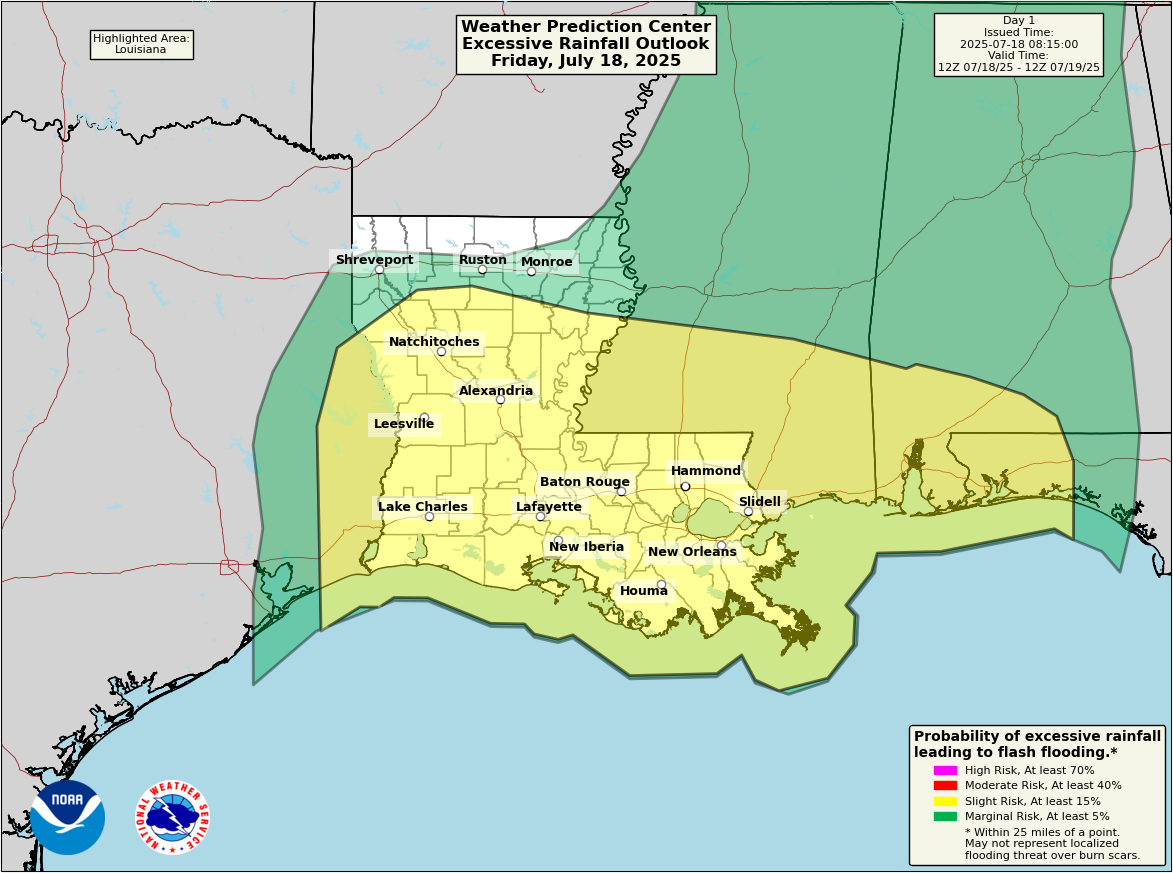
There have certainly been some locally impressive rainfall totals in Louisiana, including just shy of 10 inches in the last couple days in St. Charles Parish.
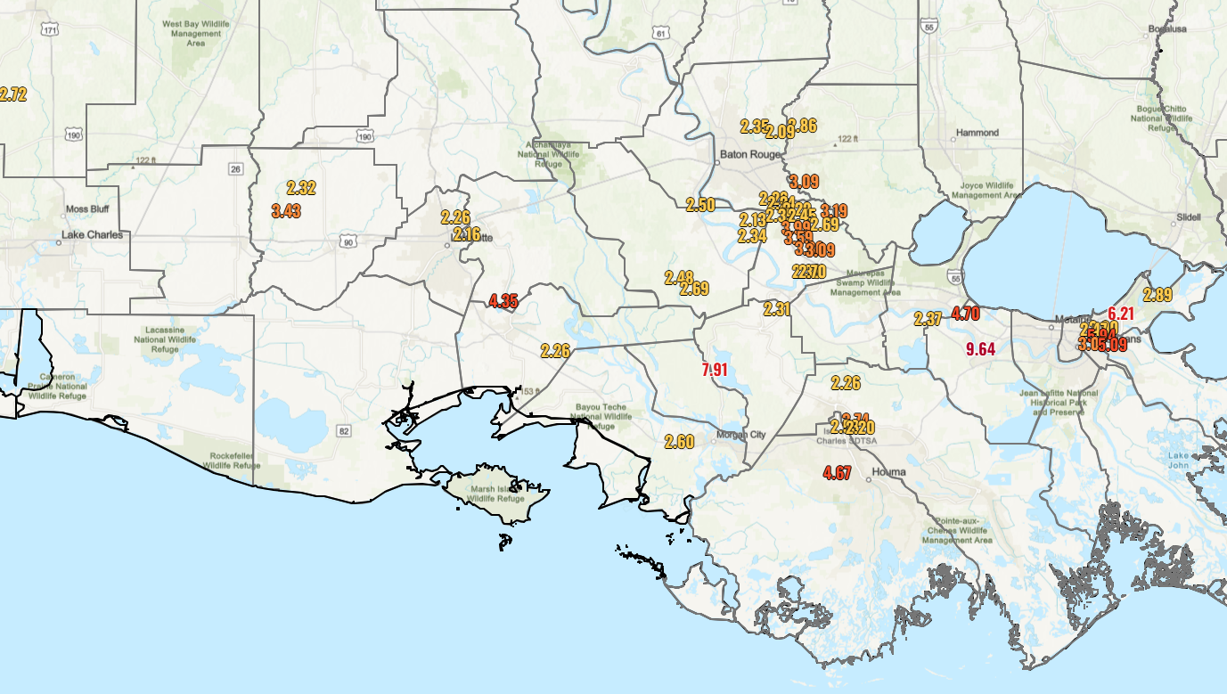
I have not seen any reports of major flooding, so that’s good. But let’s see how today unfolds. Some models are still a bit cheeky with rainfall totals in a few spots today, so never declare victory until the storm is officially over.
Rest of the tropics
It looks pretty quiet over the next few days. It is possible that we see something low-end and brief in the open Atlantic early next week, but there aren’t currently any land threats. It’s also possible that the remnants of 93L do a loop around the Southeast and re-emerge again in the Gulf later next week. I’d say that’s something to watch, but much like this week, proximity to land may hinder any development chances.
Flooding risk du jour
If you had northern Virginia on your Summer 2025 flooding Bingo card, congrats, and don’t forget the free space.
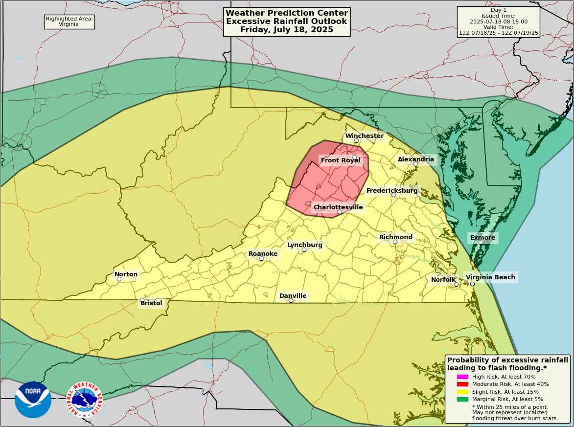
Parts of the northern Shenandoah Valley have seen 200 percent of normal rainfall so far this month, with some places seeing as much as 4 to 8 inches of rain since the start of the month. Heavy showers and storms are possible there later today, and this would be a definite area to watch for flooding today. A broad area of slight risk (2/4) surrounds that extending into parts of the Ohio Valley and south into Hampton Roads and the Outer Banks.
Flooding risk du jour Saturday
Tomorrow, I would watch Indiana closest. There is some modeling showing as much as 3 to 6 inches possible, mostly tomorrow in that area. Southern Indiana has seen anywhere from 4 to 8 inches of rain this month as well.
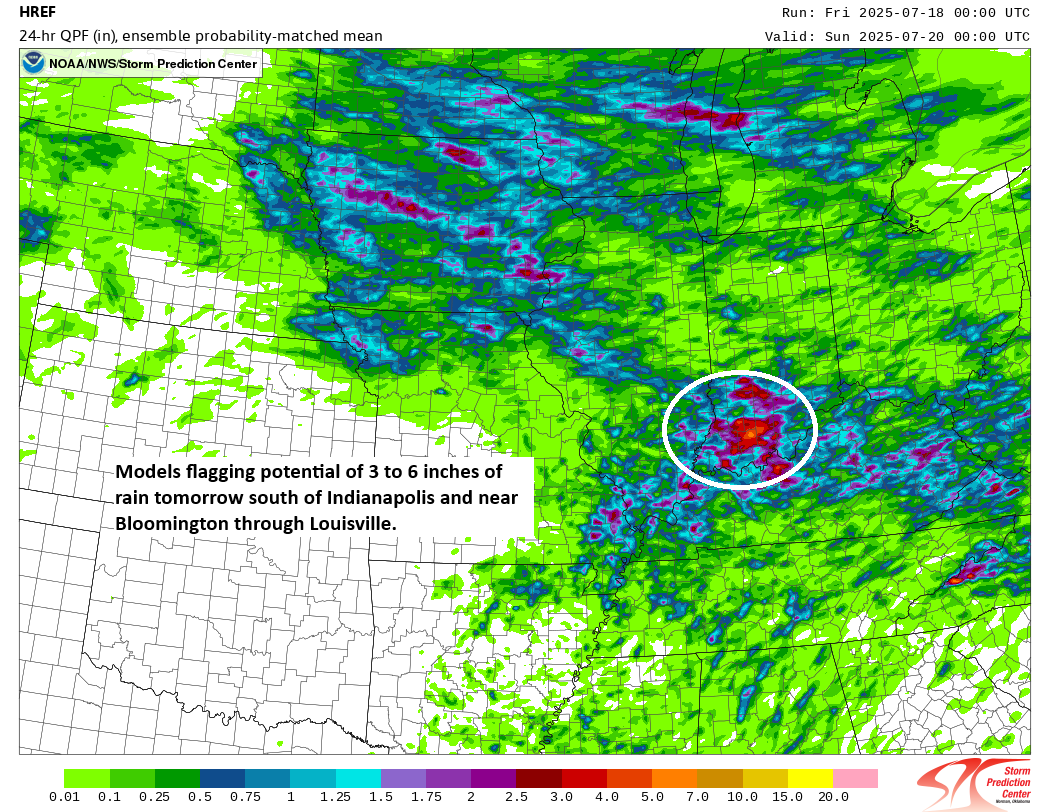
The HREF model in particular is a little excited about potential heavy rain. The probability matched mean product above suggests that rain amounts of 3 to 6 inches will be possible tomorrow in the heaviest storms mainly south of I-70 in Indiana. I’d pay particularly close attention in the Bloomington through Louisville corridor on Saturday.
Additional rain may follow Sunday and Monday, and flooding risk remains in place there.
Heat wave update
The European ensemble model continues to indicate a decent risk of a record strong ridge of high pressure in the upper atmosphere over the Plains in about 10 days or so.
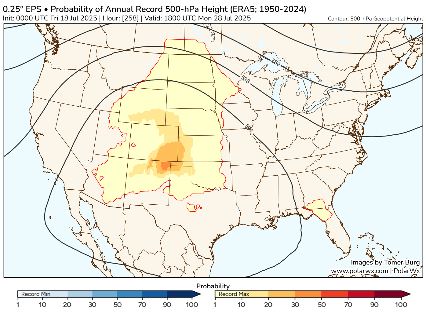
The Climate Prediction Center continues to indicate a risk of extreme heat starting around July 25th and continuing through the end of the month. There is also now some potential for drought to begin developing and expanding in parts of Kansas.
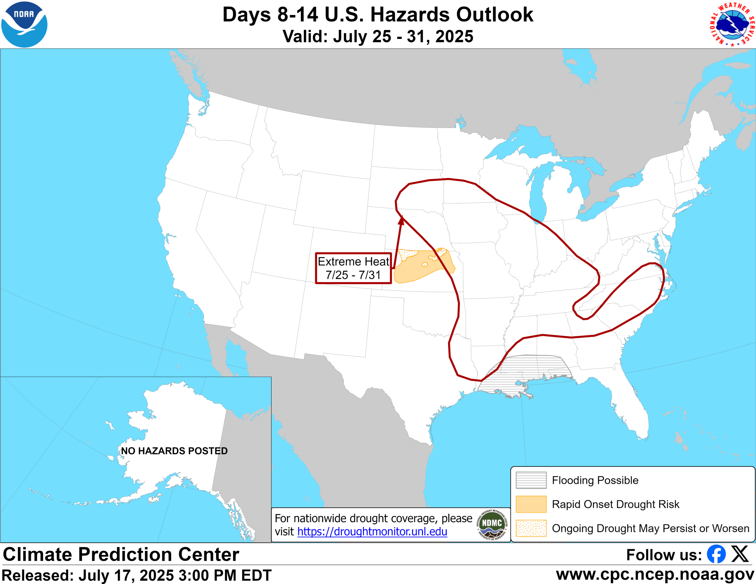
Overall, it appears the end of the month may be more about heat than flooding. But we will see.