Headlines
- Help continues to be needed in parts of Appalachia after Hurricane Helene. We have a first-hand account from a reader.
- Potential tropical development this week in the Gulf continues to look a bit tricky and possibly sloppy. Interests in the eastern Gulf of Mexico should continue monitoring things through the week.
- Tropical Storm Kirk is likely to become one of the season’s biggest storms in the open Atlantic this week, likely becoming a major hurricane far from land.
- No other serious tropical concerns to watch right now.
I want to just share an email we received from a reader who was in Asheville during Helene. It’s been tough to get a lot of great information out of this region because it’s so difficult to access right now. That will change in the next couple days, and we will likely be seeing and hearing of even worse devastation that we’ve seen thus far.
Our reader emails:
We were vacationing in the Asheville, NC area and have seen the devastation personally. Your note (of) this on the website is accurate and honestly a source of nightmares. What readers should understand is what makes this different in the Asheville area than what we see in Texas (or Gulf) storms is two (maybe 3 by this time) dams breached flooding out many of the poorest areas in the valley in the most destructive manner possible. I hope your readers take note of your words and choose to contribute.
There are ways you can help those in need even if you live far from the impacted areas.
Blue Ridge NPR has a good list.
The East Tennessee Foundation is a resource as well.
A Houston-based organization that specifically helps food and beverage workers (of which many were impacted) called the Southern Smoke Foundation is another one I personally support and recommend.
The Fuel Relief Fund specifically helps people with fuel.
Team Rubicon is on the ground as well.
Crowdsource Rescue is another org we’ve directly engaged with in the past that is doing incredible work right now.
The Cajun Navy is also doing rescue work in the region, and they’ve been a friend to us in Houston too.
As disaster expert Samantha Montano noted last night on Twitter/X, we’re probably looking at a 10 to 15 year recovery at least for this region. Every little bit of help matters.
A tricky Gulf forecast
The headline point today is that we continue to see decent odds that a tropical system will form in the Gulf later this week. But modeling remains extremely uncertain on track and intensity to a point where we may be looking at a sloppier setup than has been the case for much of this season.
With another disturbance poised to emerge from the Central American Gyre (CAG) formation, we will have another one to watch. As of today, it’s just a mass of clouds and thunderstorms east of Nicaragua and north of Costa Rica and Panama.
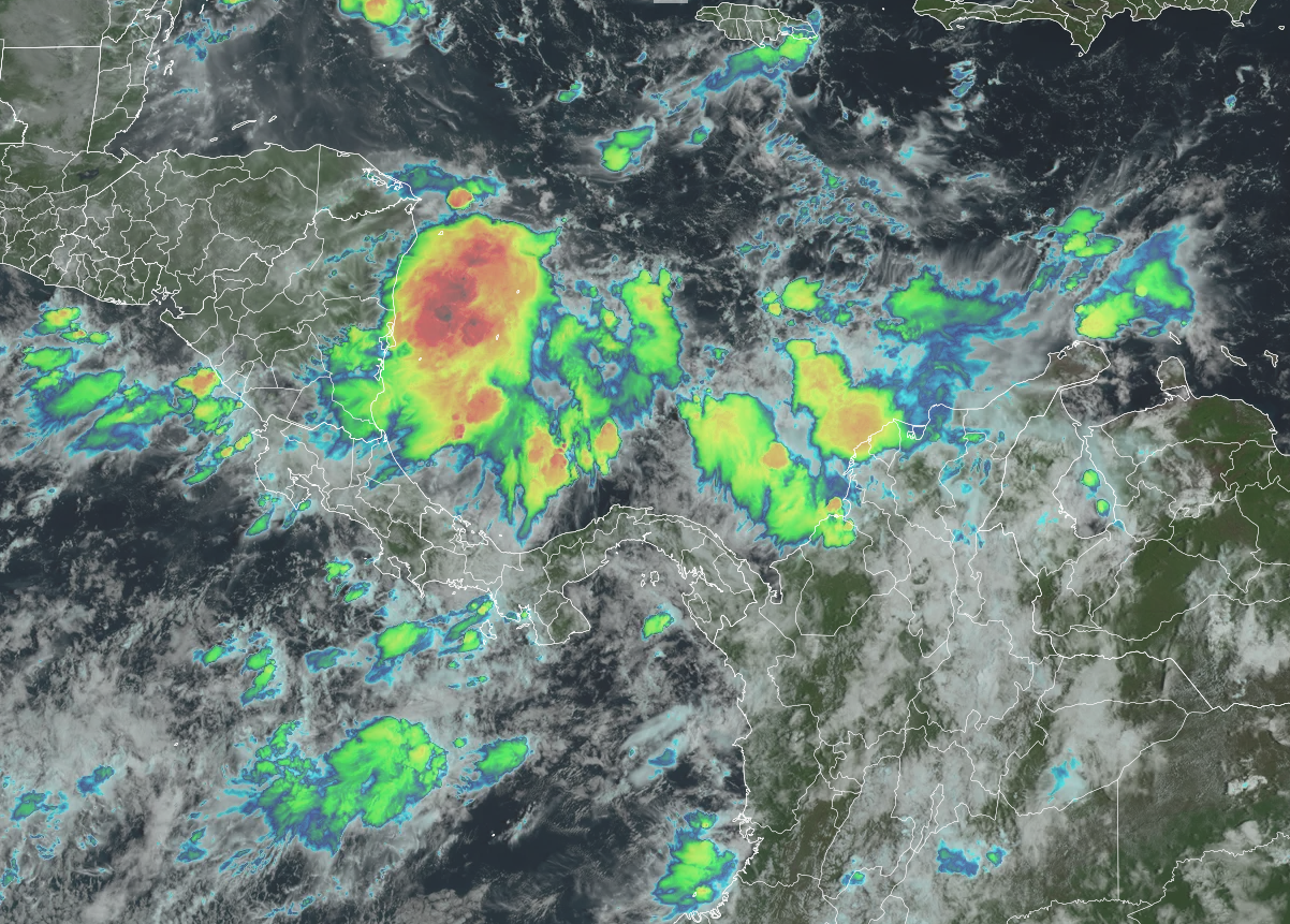
The NHC has actually lowered development odds versus yesterday, down from 50 percent to 40 percent. We can quibble on whatever those exact odds are, but I think the takeaway right now is that unlike Helene, this is not a slam dunk case where high-end development is highly likely. If anything, high-end development seems unlikely right now. But moderate development of something sloppy seems very plausible. Keep in mind that “sloppy” does not always translate to “good,” as a disorganized system coming out of a very warm Caribbean can still carry a bountiful amount of moisture. So once more, we may have to discuss flooding risks later this week or weekend.
Since we don’t yet have a defined disturbance, we have a bit of hand waviness going on in terms of forecasting. The models handled this element of Helene well early on, but they seem to be struggling with this one. That’s not uncommon. CAG systems tend to be more challenging to predict than waves off Africa. Helene was an exception more than the rule.

The current model guidance is sort of a mixed bag. I have the GFS shown above, with ensemble members ranging from well developed in the eastern Gulf (a minority) to poorly developed and hugging the Yucatan (a majority). This is sort of opposite of what we saw with Helene where the GFS ensemble led in showing aggressive development. This also has the support of the European AI (AIFS) model and the ICON model to a lesser extent.
There are a couple things that could happen here. If the system follows the minority, we get a tropical storm or hurricane that lifts north and northeast potentially across Florida at some point toward the weekend. Some rapid development couldn’t be ruled out, but in general the ceiling would likely be lower than Helene. If the system follows the majority, it may fester for a time near or off the Yucatan and eventually get pushed north and east by an approaching cold front early next week. That would time the system toward Florida or the eastern Gulf next Monday through Wednesday. That could also be a tropical storm or hurricane.
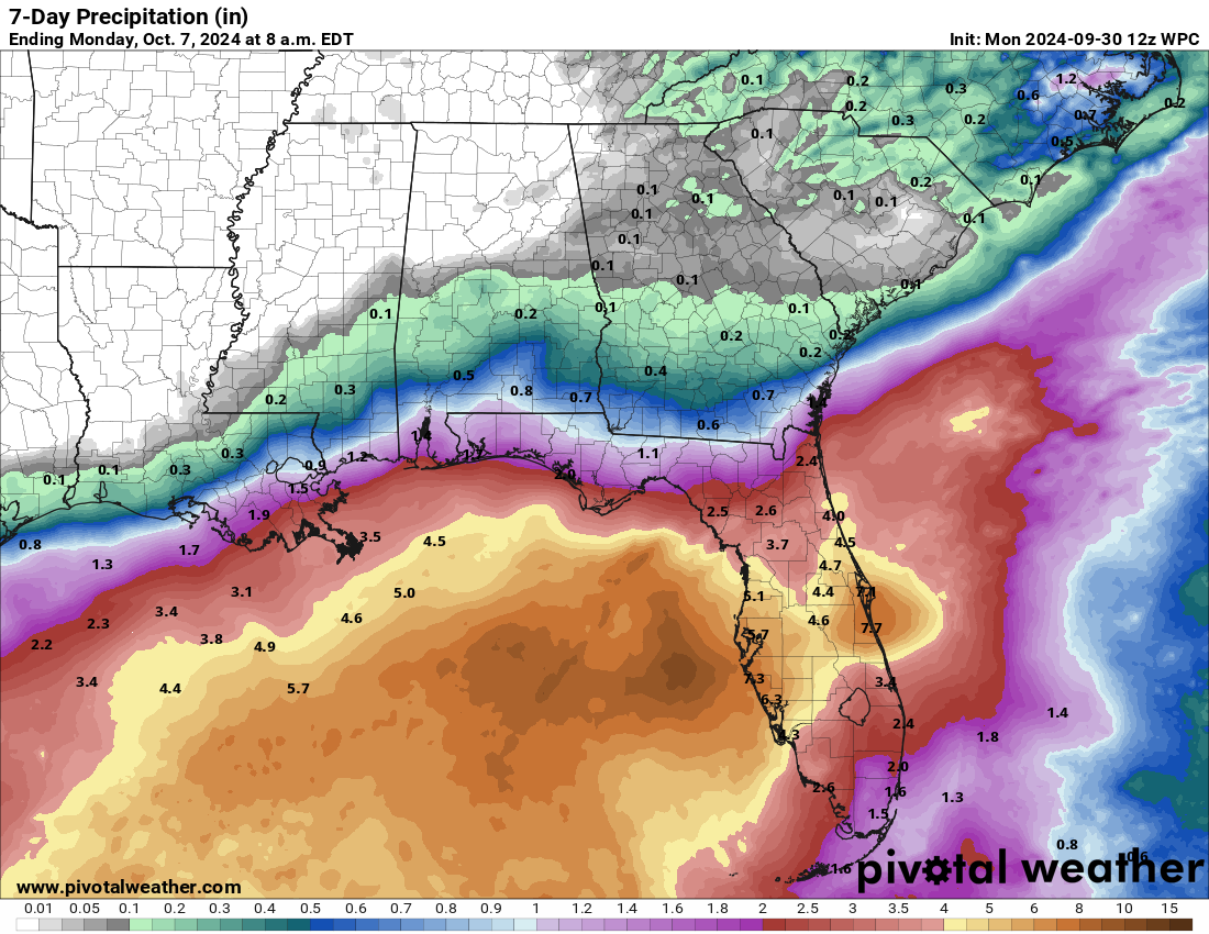
For now, we should expect an increase in rain chances and potentially heavy rain heading toward the weekend across the eastern Gulf Coast, including Florida. But details are highly uncertain right now. We’ll keep on top of things.
Kirk will light up the open Atlantic
Tropical Depression 12 has become Tropical Storm Kirk this morning. Kirk is expected to become a major fish storm. In other words, it should avoid land.
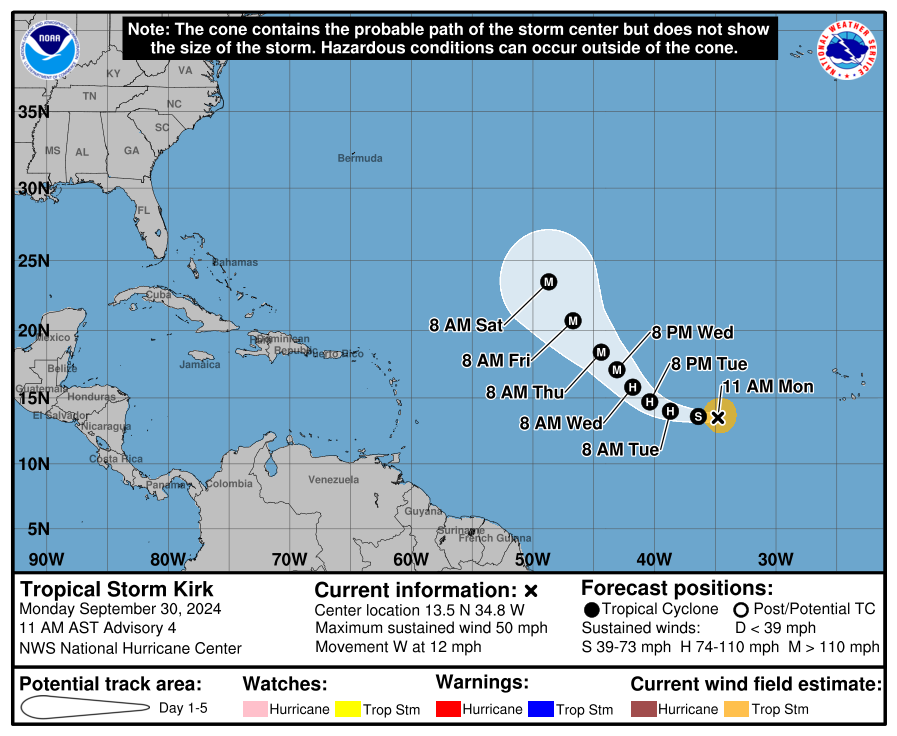
Kirk is expected to intensify rapidly. The NHC forecast currently shows it as a category 3 or borderline category 4 hurricane by Wednesday night or Thursday. Model guidance even shows that Kirk could become a higher end category 4 or even 5 storm if all the right ingredients came together. Again, thankfully Kirk’s forecast is fairly predictable and it will avoid land. Most shipping interests should also have ample time to get out of Kirk’s way. Kirk will also probably help Atlantic accumulated cyclone energy (ACE) to make up some lost ground.
Isaac & Joyce
Both Isaac and Joyce have now degenerated into depressions or post-tropical cyclones. Isaac looks to continue to get absorbed into a broader European storm later this week.
Another deep Atlantic system to come?
Model signals continue to indicate that yet another system could develop behind Kirk in the deep Atlantic. This one looks more likely to take a slightly farther south and west track, as it would likely be slower to organize, so it may merit some additional babysitting for the islands heading into next week. For now, it’s not a serious concern.
Thank you so much for sharing places we can donate. The images and video I saw this weekend out of NC and Tennessee were absolutely heart-breaking. Sending what I can to help.
Southwest Virginia (where I’m from) was hit pretty hard as well. Hopefully they will get some of the help.
Here is a list of orgs I found in our “CARE” portal (donation website):
American Red Cross: Providing water, food, emergency supplies and shelter until families can return to their homes.
World Central Kitchen: Serving hot nutritious meals to survivors of disasters.
Save the Children: Helping childcare and early learning centers to recover and reopen through the Children’s Emergency Fund.
All Hands and Hearts: Deploying the DART team to work alongside residents in helping families and communities to recover.
America’s Second Harvest of the Big Bend: Providing food, water and other essential supplies to those affected by Hurricane Helene.
SBP: Rebuilding homes, increasing preparedness and resilience to shrink the time between disaster and recovery.
Team Rubicon: On the ground, serving communities, and clearing roads for first responders.
Is Houston off the table for the current potential area of development in the Gulf/Caribbean?
Most likely, yes.
Right now there’s no clear indication of where storm is headed. Wait and see on development if any iccurs
It’s really too early, but what I’ve seen so far either has a system coming up the Gulf and dissipating, or heading toward somewhere along Florida.
What makes it so that Kirk becomes a major hurricane around the same area Joyce is forecast to dissipate?
Good Q! I think part of it is that it’s in a slightly more hospitable environment for tropical development. Another element of it is that the disturbance already had some heft to it. So there was an element of priming that had already occurred in this case.
So much for last week’s bold statement of
“no chance for any more tropical systems this season”
I’m sorry, but who said this exactly? Eric posted something on SCW about Texas being *unlikely* to see another threat. Which still holds up. But to my knowledge no one said anything to that extent. Normally I’d ignore this but if you’re going to make that claim, I’d hope you’d cite where it came from.