In brief: More flash flooding may occur today for parts of the Mid-Atlantic or New England, as well as back into much of Iowa. The tropics are quiet for now, but things may slowly tick up some by later this month, as we investigate below.
Note: Most of the data in these posts originates from NOAA and NWS. Many of the taxpayer-funded forecasting tools described below come from NOAA-led research from research institutes that will have their funding eliminated in the current proposed 2026 budget. Access to these tools to inform and protect lives and property would not be possible without NOAA’s work and continuous research efforts.
Wednesday flooding recap & Thursday forecast
A whole heck of a lot of severe thunderstorm and flash flood warnings were issued yesterday. The Durham area saw quite a bunch of street flooding on Wednesday. Flooding required some water rescues in Chadds Ford, PA as well. Even in Houston, where we know flooding probably better than anywhere else in America, we had some questionable decisions.
I don’t want to demean anyone for choosing to make a rash decision, but it’s so, so important to not drive through roadways when you are not 100% certain of the depth. And even then, you probably shouldn’t do it. And these overpasses in Houston are often well-marked in terms of water depth.
Anyway, rain totals yesterday were on the order of 2 to 4 inches across parts of the Carolinas and Virginia, as well as up into Maryland and southeast Pennsylvania. Another round of potentially heavy storms will be possible today, this time even a little farther south and east.
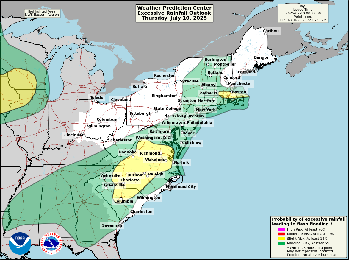
Isolated areas could see upwards of 3 or 4 inches of rain, but most areas will see a fair bit less.
The Midwest will also have the risk of some flooding today with slight risks from just west of Chicago into Iowa and the Plains.
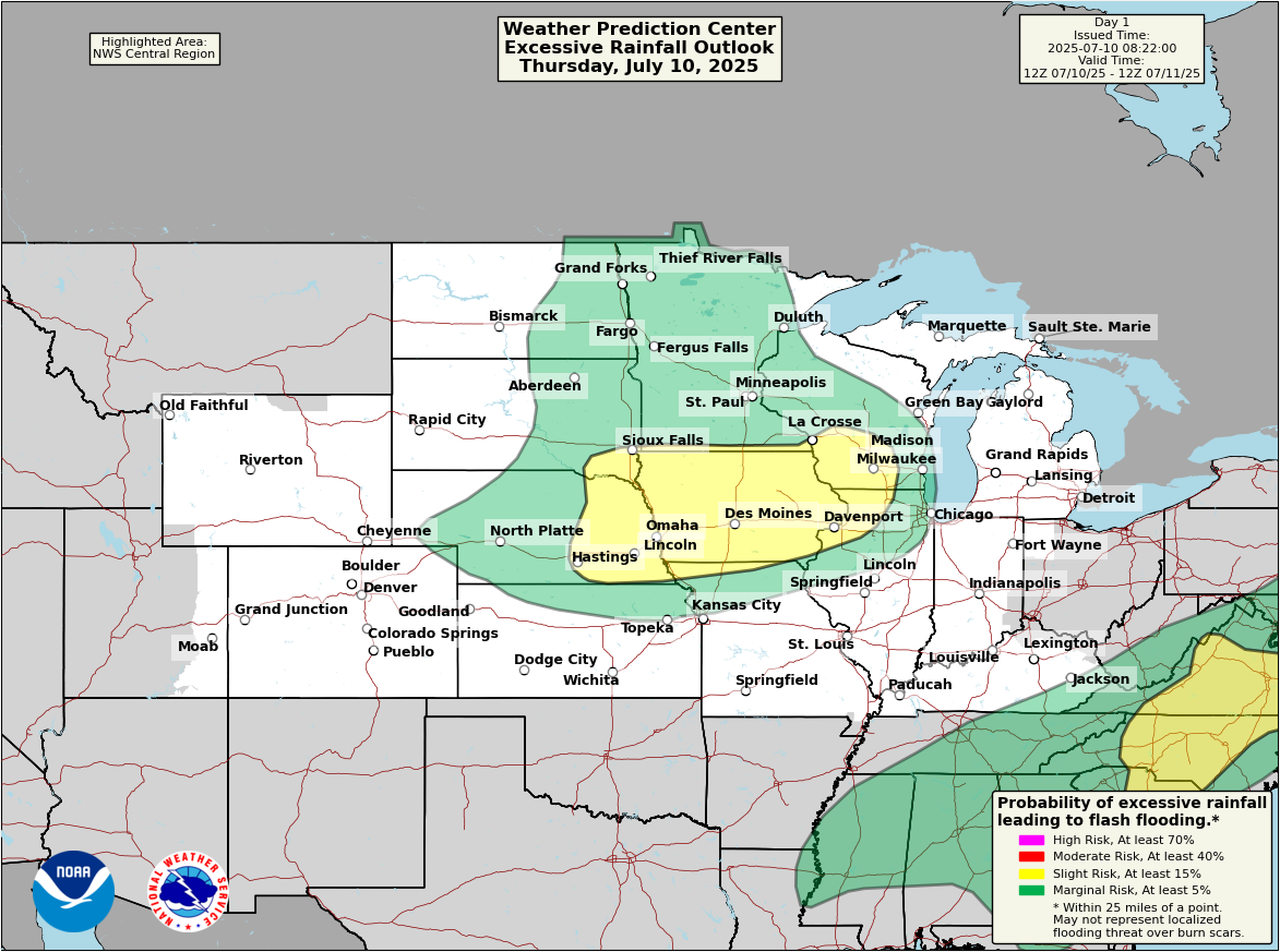
That slight risk area may see more of a widespread 1 to 3 inches of rain and locally higher amounts. More risks for heavy rain in the Midwest tomorrow.
Tropics
All is quiet for now. We continue to see some noise in the northeast Gulf or off the Southeast coast next week. But nothing has progressed any further along in the modeling to a point where there’s any additional concern. But we’ll keep watch.
Looking ahead
So, it seems like every day this post says “no tropical activity for the next 7 days.” I’m not sure anyone is complaining, but other than these 3 quick(ish) storms this season that have emerged on shorter notice, it has been pleasant thus far. This isn’t abnormal. In fact, by July 10th, we typically average roughly 1.5 storms. The second storm on average does not form until the 17th. Yes, we are three deep this season, but overall this season has behaved within the realm of normal.
To this point, the Atlantic has been filled with stable air, dust, and generally nothing of note. As we head toward later July, that pattern may ease up some, which may allow for slightly more favorable conditions for development — but I am not yet willing to say they will become truly “favorable.”
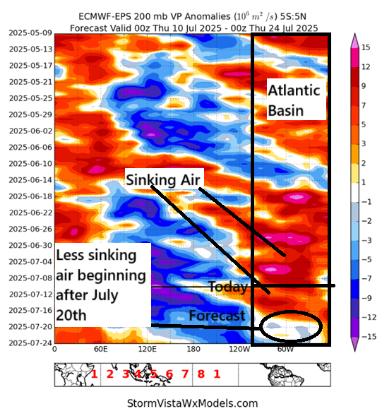
You can see from the annotated image above that there is a slight shift from sinking air broadly in the background of the tropical Atlantic to rising air, or at least less sinking. To get tropical systems, one ingredient would be some element of rising air in the background. It doesn’t always have to be that way, but it doesn’t hurt.
So will late July or early August be busy? History tells you that regardless of anything it should begin to get a little more active. That’s the “duh” answer. But if we look at the extended European model there is a bit of a tendency toward perhaps some chance at activity off the East Coast or in the middle of the deep Atlantic.
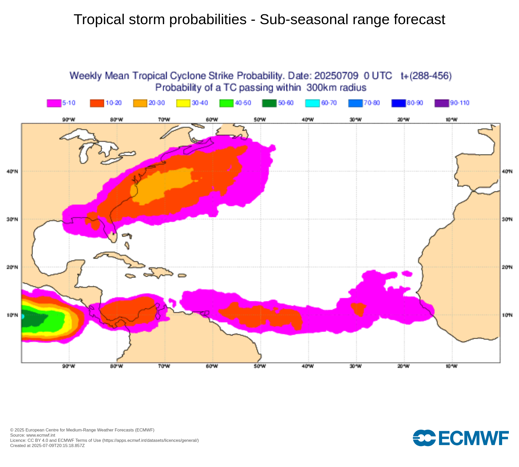
The probabilities are by no means high, but it’s not zero. But generally speaking, this is not an overly concerning look at this point. So we’ll see. Things can change quickly, but for now look for just a slight uptick in “noise” perhaps to close July.
On the CFS Monthly and NMME, I am seeing drier than average precipitation anomaly this season in a lot of the MDR and in the Caribbean. Is this encouraging for a quieter season?
Is it correct that this past two week period has put more moisture over Texas than the two weeks centered on Hurricane Harvey?