Editor’s note: PTC 5 is now Tropical Storm Ernesto, which has little to no impact on the discussion below, as this was expected today or tomorrow.
Headlines
- Potential Tropical Cyclone 5 will slowly organize itself over the next 2-3 days as it crosses into the northeast Caribbean islands and Puerto Rico.
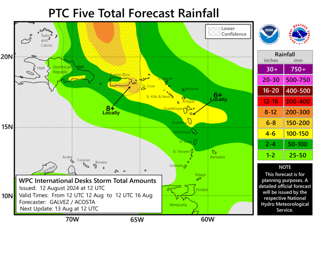
- PTC 5 is expected to deliver mostly modest impacts to the islands, with gusty winds, rough marine conditions, and heavy rainfall.
- As PTC 5 comes north in the Atlantic, it will strengthen and may ultimately threaten Bermuda.
- Quieter conditions should continue behind PTC 5.
PTC 5 will slowly get itself together
Potential Tropical Cyclone #5 was declared on Sunday, which allows the National Hurricane Center to issue watches and warnings before a storm becomes an actual storm. In other words, we are expecting a tropical depression or tropical storm soon although it’s not there yet, but we need to get warnings out. Thus, the slightly cumbersome PTC language.
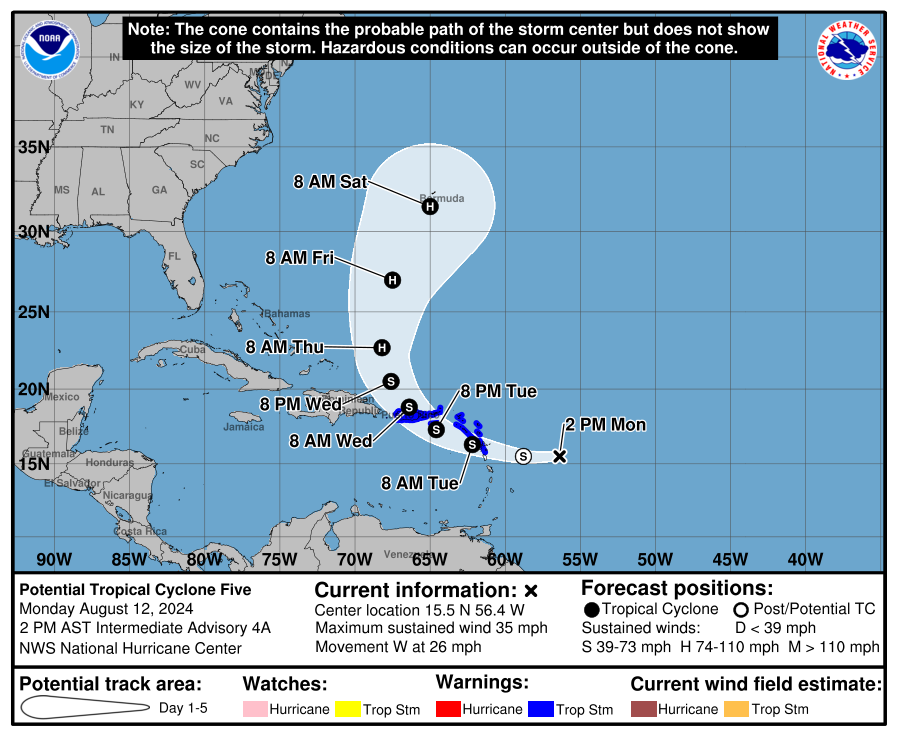
Whatever the case, we are definitely expecting this system to gradually organize as it moves into the islands. If there’s good news today, it’s that models continue to slow walk development initially, despite the fairly warm water across the northeast Caribbean. So a slow transformation into a tropical storm is expected in the next 24 hours. By tomorrow morning, we expect Ernesto and its center to be just west of Guadeloupe. Tropical storm warnings are in effect between Guadeloupe and Puerto Rico.
It would appear on satellite that PTC 5 is battling a good deal of wind shear. It’s not quite consolidating, and while it has a lot of thunderstorm activity overall, it’s generally disorganized.
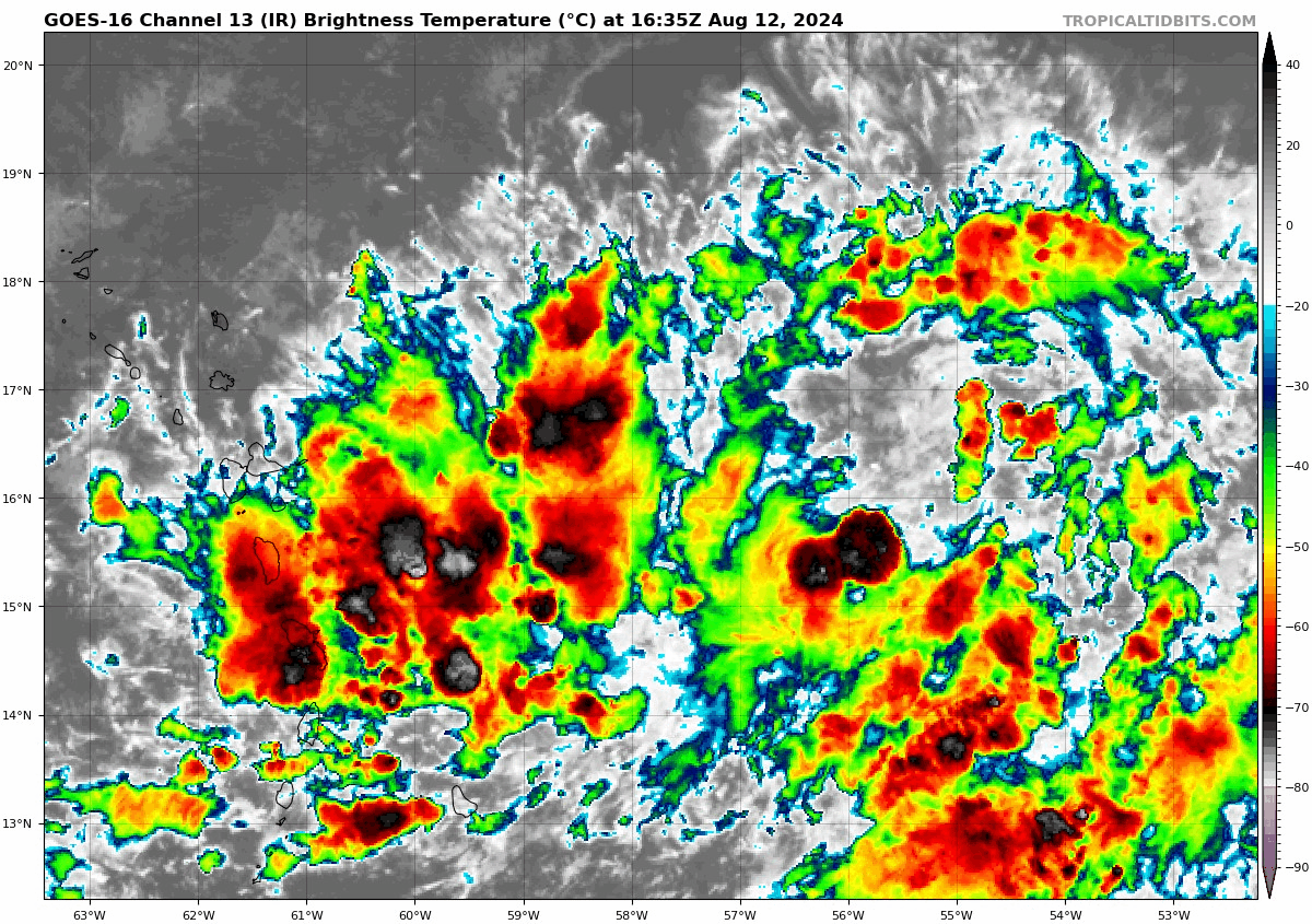
Modeling suggests that over then next 24 hours or so we won’t see a whole lot of change to this. In that time, we should see PTC’s nascent center move into the northeastern Leeward Islands. While certainly a bit breezy and with some heavy rain, impacts there will probably fall short of anything too terribly serious. Around that time, we should begin to see PTC 5 begin to make a run toward a little organization as it approaches the Virgin Islands and Puerto Rico heading into the 36-48 hour timeframe. This system’s size seems to make it unlikely to become a hurricane now as it moves into that area.
So at this point all signs seem to indicate that PTC 5 will only slowly organize as it impacts the northeast Caribbean islands and Puerto Rico, staying under hurricane intensity until it gets comfortably north of Puerto Rico. The islands should again prepare for heavy rain and gusty winds, as well as rough marine conditions, but overall this looks like a mainly modest impact to these locations.
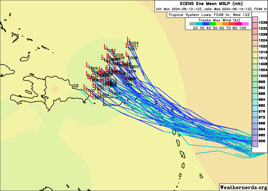
Beyond this point, PTC 5 will continue to likely curve northwest and northward, splitting the gap between high pressure over the Deep South and high pressure east of Bermuda. From here, we have two key questions: How strong does this storm get, and how close will it get to Bermuda? We can’t answer either one with a lot of certainty yet, but it’s pretty evident that this will be a very close call near Bermuda. We have a couple days to iron that aspect out.
In terms of intensity, the tropical models are all over the place, but they all show steady strengthening it appears.
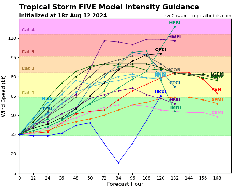
The NHC forecast is a fine place to be right now, which shows PTC 5 on the cusp of major hurricane intensity by day 5. So because of all this, it would be important for folks in Bermuda to monitor the progress of PTC 5/Ernesto closely. We’ll keep you posted.
Beyond PTC 5, we continue to see the Atlantic basically shut itself down for the next 7 to 10 days. Don’t get too excited about that quieter period, but let’s just say during a hurricane season like this that has a lot going for it, that is a very welcome thing in August.
Just checked the NHC website (16:50) … it now shows PTC5 as named Tropical Storm Ernesto … and thankfully, still destined on a north track.