In brief: Invest 91L in the Atlantic has seen waning model support for growth in the last 24 hours, but it remains a system to monitor for folks in the Caribbean islands. Meanwhile, Hurricane Kiko in the Pacific looks likely to impact Hawaii next week, though specific details are uncertain at this time.
Atlantic tropical wave – Invest 91L
Yesterday, the wave in the Atlantic got classified as Invest 91L. Since then, it has proceeded to do absolutely nothing.

There were some signs of circulation overnight, but the thunderstorms remain fairly displaced and sporadic. Basically, this thing is struggling. And in an interesting twist, the AI models have now completely lost 91L. Google’s Deep Mind ensemble is showing close to nothing at all. Support and enthusiasm from both the Euro and the Euro ensemble have faded as well. Odds remain 90 percent that something will develop over the next 5 to 7 days, but if I’m being honest, the data is struggling to support this a bit at the moment.
Given that we would still have a good 5 or 6 days for the system to get to the islands, we’ve still got time to watch and see. Maybe this will finally come around tonight or tomorrow and head for development. Who’s to say? Interests in the Lesser Antilles should continue to watch the progress of this to be safe. But for now, we’ve got a lot of speculation and few specifics to work off of. We’ll continue watching this through the weekend.
Pacific Hurricane Kiko
Kiko remains a major Category 3 hurricane this morning. It continues to track off to the west but will shift more to the west northwest today. The environment around Kiko remains generally favorable for another 18 to 24 hours, so it’s possible that Kiko could come out of an eyewall replacement cycle here and re-intensify some.
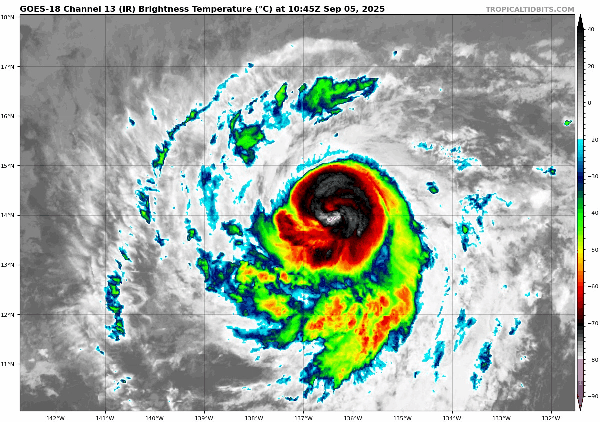
From there, Kiko will hit some cooler water, which should allow for weakening. By the time Kiko approaches Hawaii, it is expected to be a tropical storm.
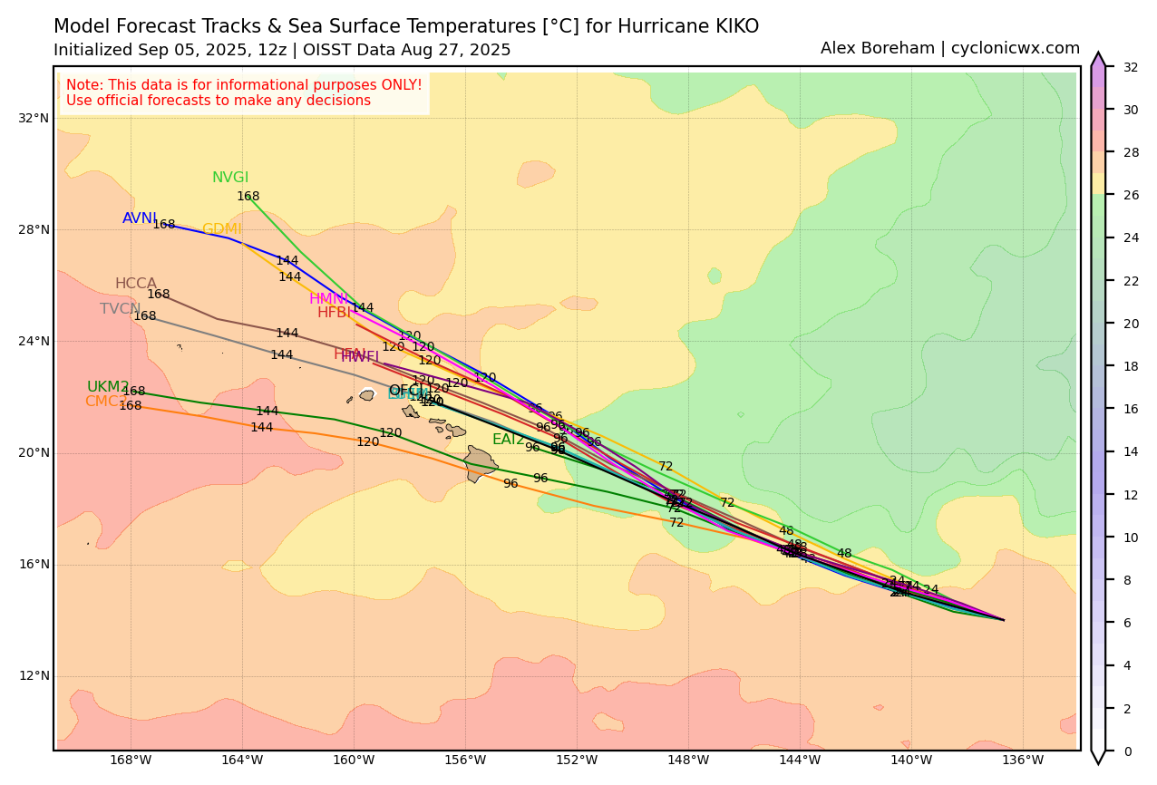
As of now, modeling generally wants to keep Kiko north of Hawaii, which would probably mean that the strongest part of the storm misses north as well. That said, there remain a couple outliers that do drag it southward a bit. The general consensus though appears to be very near the OFCL (NHC forecast) above. We have about 5 days to watch before it arrives there, but we know that there should be some rain and wind impacts likely based on the current forecast, particularly for the northwestern islands. We will continue to monitor this through the weekend as well to see how the specific impacts in Hawaii begin to shape up.
We’ll give it a pause there for today. Lorena has dissipated into a post-tropical system and will actually turn left back out to sea. Though that system’s impacts in the Southwest look to remain limited, there are flash flood watches today for burn scare areas in New Mexico, including Ruidoso, so just something to be aware of outside of the tropics but still somewhat related.