In brief: Invest 95L in the Atlantic is a ways from developing yet, and it currently looks to track north of the islands later this week. Still, we expect development eventually. Meanwhile, Tropical Storm Priscilla in the Pacific is worth watching in about a week or so for potential heavy rain in the Southwest.
Invest 95L
The Atlantic seems to be settling a little bit. That said, we have one very clearly defined system to watch this week. It is now known as Invest 95L.
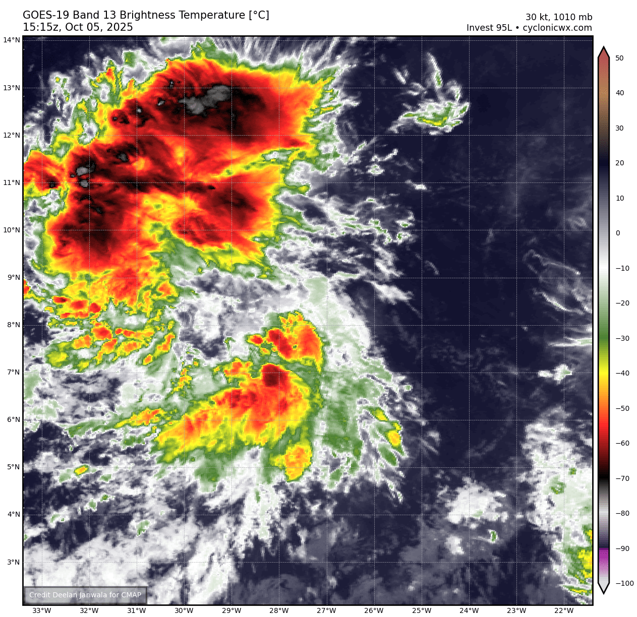
From here, 95L will be slow to organize, but it should eventually hit a tipping point in a few days and probably form a tropical depression. From there, it will continue off to the west and west-northwest.
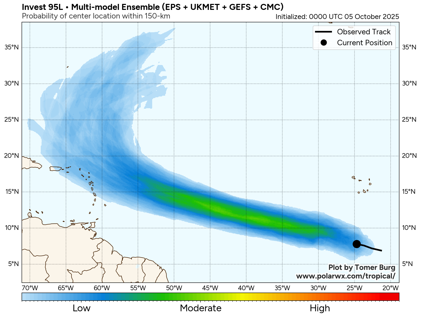
Model agreement on this general theme is actually strong; there’s a little less uncertainty with this system than there has been with various systems of late. At this point, it seems likely that Invest 95L is going to turn north into the Atlantic before it gets to the Caribbean islands, but interests in the northeast Caribbean from Puerto Rico to about Martinique should continue to at least follow the progress of 95L this week. You can see from Google’s AI ensemble that over 90 percent of model forecast tracks stay north of the islands by Thursday night, but there are 1 or 2 that stay fairly close.

One other note: Unlike some other systems this year, this one is going to be booking it west northwest, and its closest pass to the islands should occur by Thursday.
So, at this point, there’s not a whole lot to worry about with 95L, but it remains an item to monitor this week as it tracks off to the west-northwest.
Pacific Priscilla impacts on the Southwest?
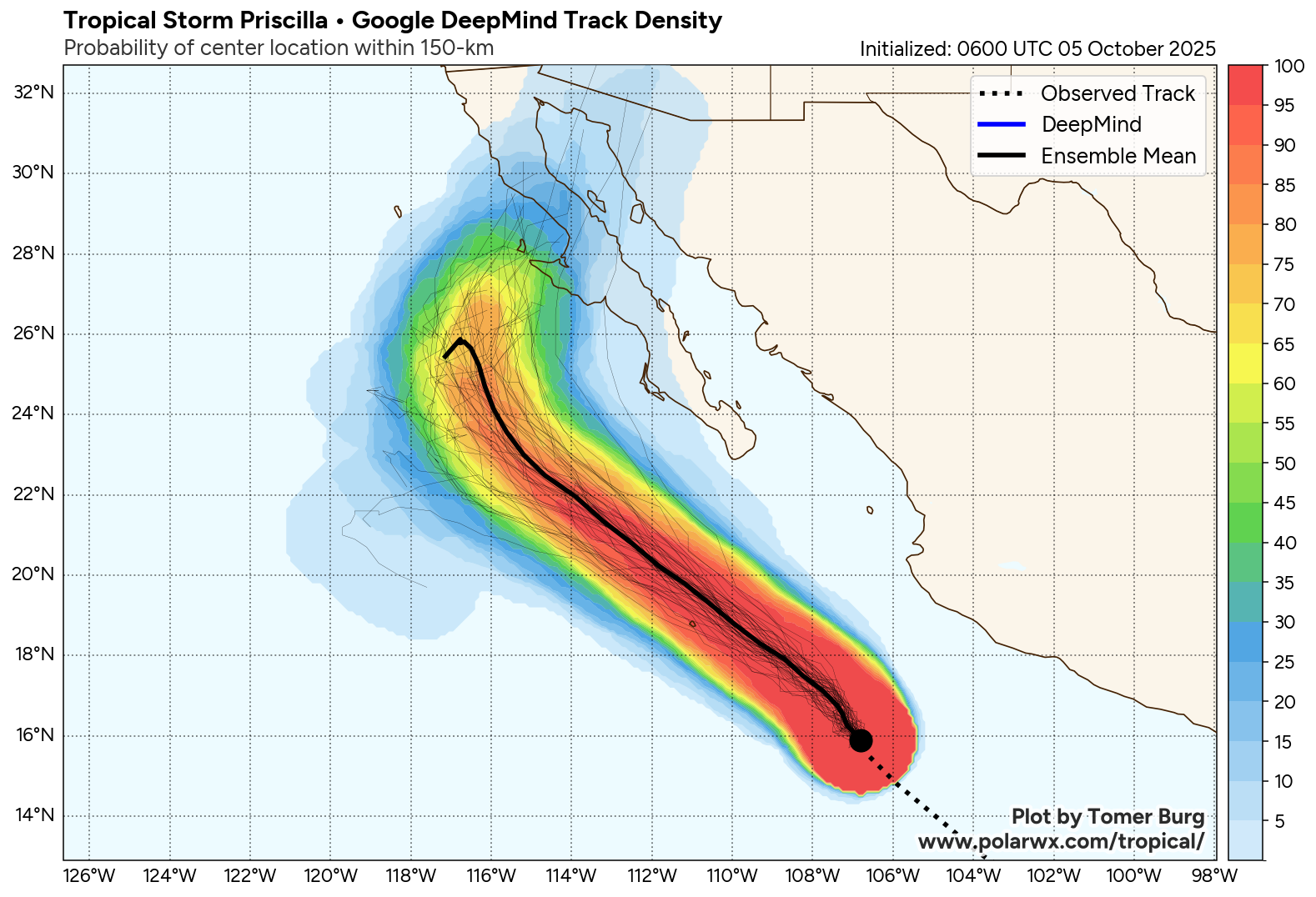
One other item we’ll be tracking through the week is the potential that Tropical Storm Priscilla in the Eastern Pacific could direct a bunch of moisture into the Southwest U.S. sometime next weekend or so. While Priscilla itself should not be a huge concern for land, the remnant moisture and all that comes with it will be what is watched. Current track forecasts for Priscilla keep it comfortably off the coast of Mexico as it strengthens into a hurricane this week. Once northward, it will begin to weaken, but it may also bend back to the northeast some.
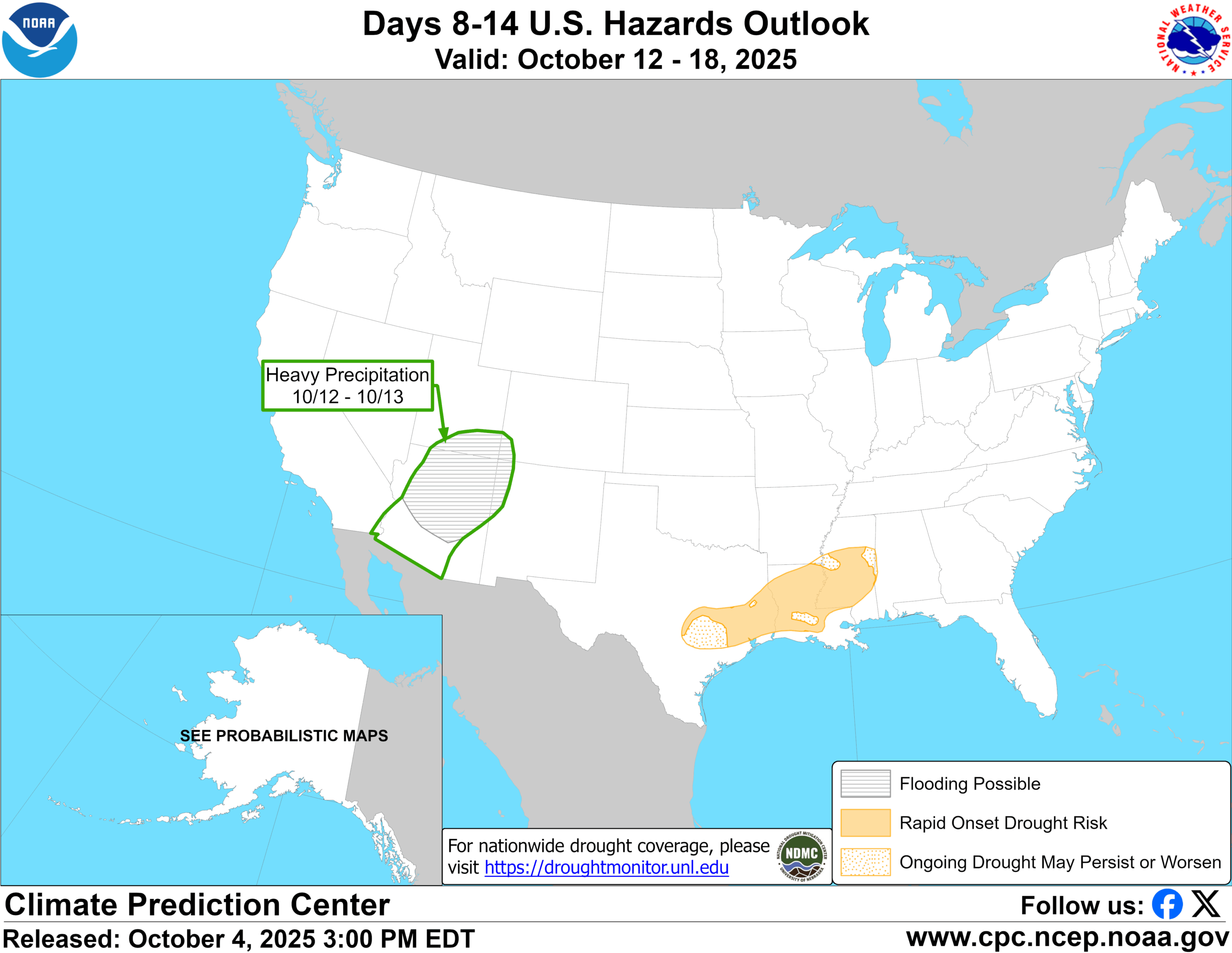
If this does happen, we could see it merge with an incoming trough of low pressure in the upper atmosphere around next week in the Rockies. That would draw most of the remnant moisture north and into the Southwest bringing some potential for locally heavy rain. This is highlighted on the Climate Prediction Center’s 8 to 14 day hazards outlook from Saturday.
Not something to worry over or anything, but it’s something on our radar to watch for the next 7 to 10 days. We’ll keep it updated!