In brief: Invest 98L is looking healthy this morning. We should probably anticipate a depression or tropical storm by later today or tomorrow. From there, it may stay buried in the Caribbean — or as Google’s AI modeling suggests, it will stall and intensify and come northward toward Hispaniola. Whatever the case, 98L bears close watching in the Caribbean this week.
Invest 98L in the Caribbean
Invest 98L remains a rather robust tropical wave this morning, probably the most impressive Caribbean wave this year.

I don’t know that this is yet a depression or storm, but let’s just say we’ve seen lesser systems be upgraded this season. I wouldn’t be shocked to see something happen here before the end of today.
For now, NHC odds are up to 80 percent. It’ll be interesting to see what happens here. The general rule of thumb is that a system that intensifies quicker will be more apt to turn poleward (to the north) faster. A weaker system would be more likely to remain buried in the southern Caribbean. If this is indeed intensifying and forming, we could quickly see a tap on the brakes, stall out for a bit, intensify, and turn due north or north-northeast back toward Hispaniola. You can see the split in model guidance this morning, with Google’s AI ensemble stronger and turning more northward faster than many European ensemble members that are generally weaker.
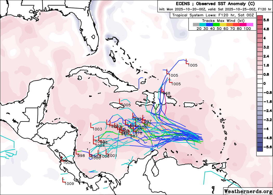
The AI ensemble may have the edge here given the satellite presentation of 98L this morning, because it’s been the best performing model this season, and from what we’re seeing in SHIPS guidance today, showing over 4 times greater than average risk of rapid intensification in the 72 hour forecast timeframe.
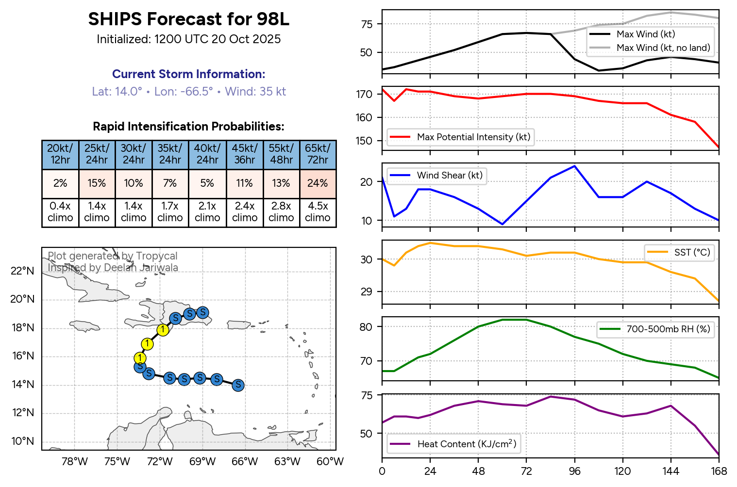
While the idea of a weaker, farther south and west tracking system is valid, I think the odds definitely favor the potential for a much stronger system right now. The big question is whether the fair bit of westerly shear it is experiencing right now will fundamentally hold back the system from developing rapidly. Something like lots of bark and a little bite. In that instance, the system could also turn north as well, but it would be sloppier and more ragged.
Whatever the case, it is prudent right now for Hispaniola to begin taking this system quite seriously. While none of the explicit modeling forecasts a major hurricane right now, we know from history and observation of the current warm water in the Caribbean that intensity forecasting could be underdone, perhaps significantly. This will continue to bear close watching over the next few days.
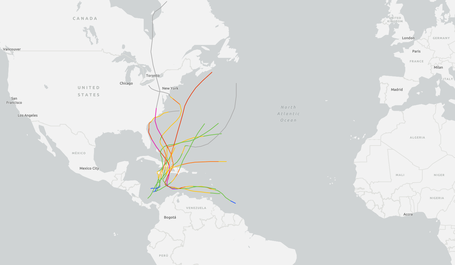
This is not an uncommon pathway to impact. We’ve seen memorable storms come out of this part of the Caribbean this time of year, including Sandy in 2012, Matthew in 2016, Hazel in 1954, and Tomas in 2010. Obviously, when noting Sandy and Matthew and Hazel, some folks on the East Coast may get jitters, but at this point in time, we expect this system to follow some of the eastern-most tracks on the map above, keeping it away from the East Coast.
We will continue to monitor Invest 98L and its potential impacts and have another update for sure tomorrow and perhaps this evening if necessary.