In brief: We’re in the peak weeks of hurricane season in the Atlantic now. Thankfully there are no serious concerns on the radar for the next week or so. We discuss the setup and pattern, as well take a look at some other odds and ends of note today.
Thanks for indulging us in a couple days off this weekend, as we rest up for the final marathon stretch of hurricane season between now and October. From an accumulated cyclone energy standpoint, the next month and a half accounts for about half of the hurricane season’s average total on average.

This time of year, tropical systems can form basically anywhere in the Atlantic Basin. The Gulf? Yep. The Caribbean? Sort of, but yes. The southwest Atlantic? You bet. Between Africa and the islands in the MDR? Oh yes. Basically, we’re watching everything in early September.

Today’s satellite image shows a couple stand out areas of note.
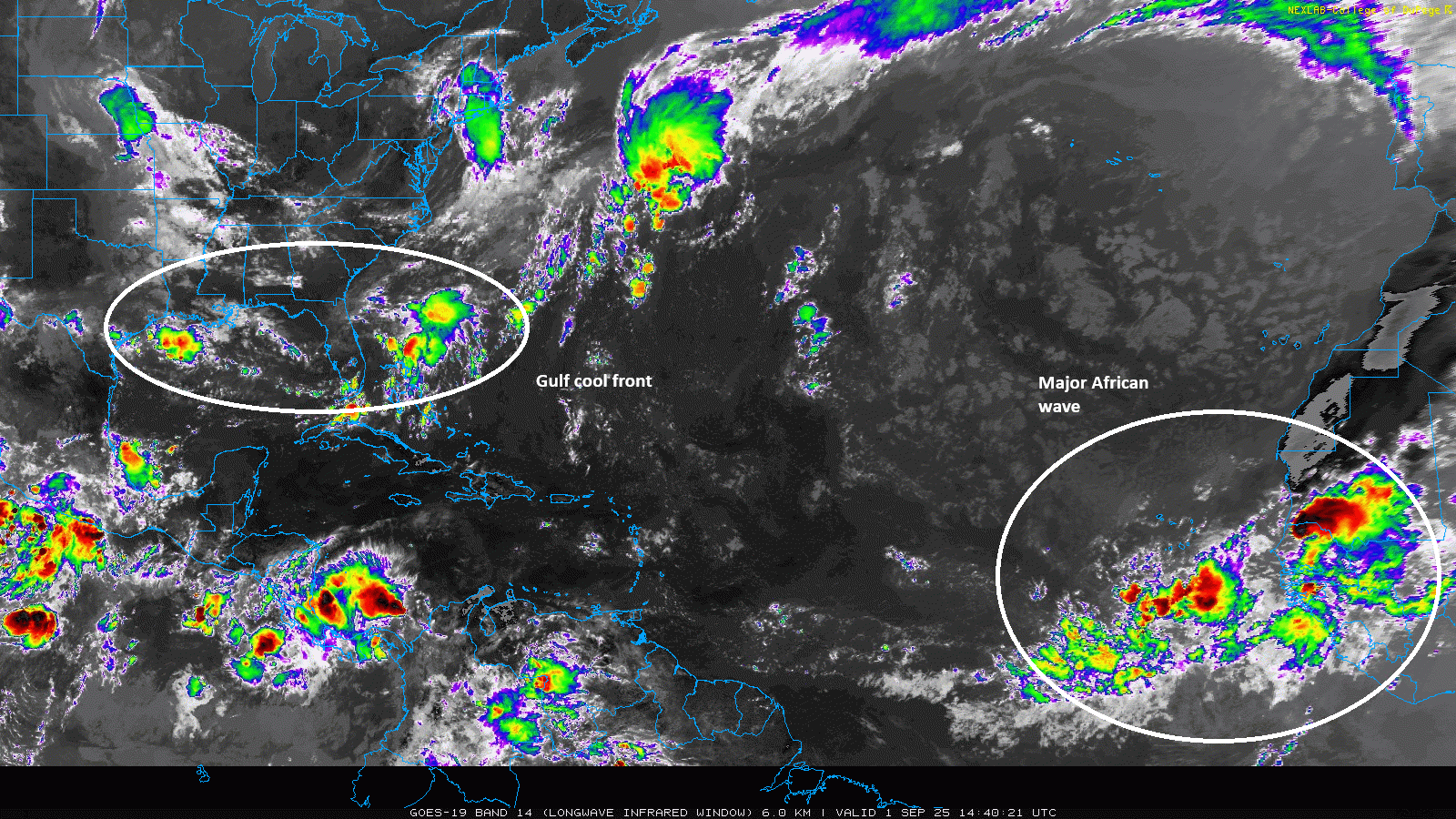
First, closer to home, there is a cool front draped across the Gulf this morning, an oddity for this time of year but not unheard of.
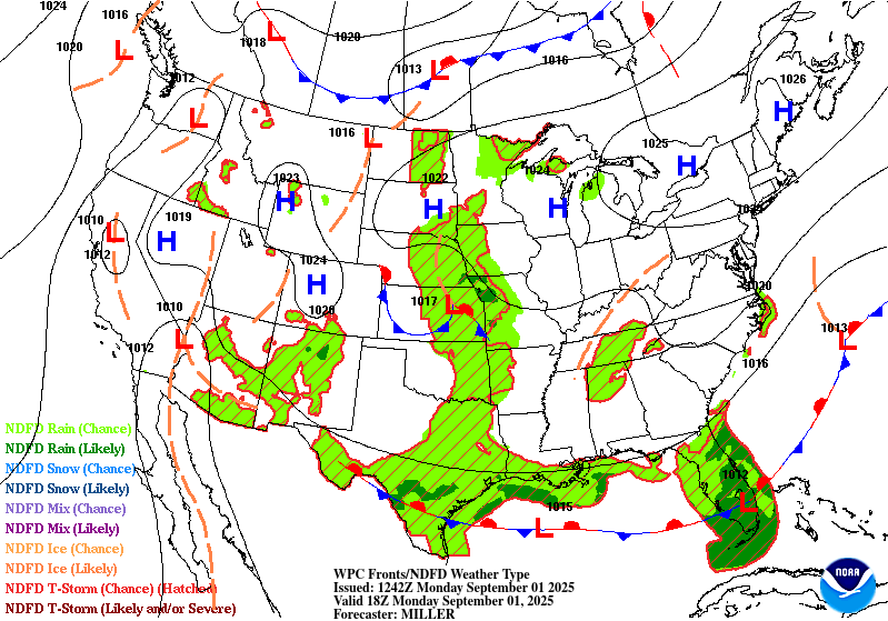
There will be showers and thunderstorms that fire up near or north of that frontal boundary that may work their way into the eastern Gulf or toward Florida. As the week progresses and the front dissipates, it’s not out of the question that one of these thunderstorm clusters acquires a low probability of development. Its track would quickly scoot into the Atlantic from the Gulf, reducing both any time over water, as well as any real land impact concerns. Basically, nothing is expected, but don’t be shocked if you see an area of interest pop up in this region briefly. This weather pattern is actually important in the medium range, however, as just a boatload of dry air is going to be deposited into the Gulf thanks to this early season front and another this weekend and next week.
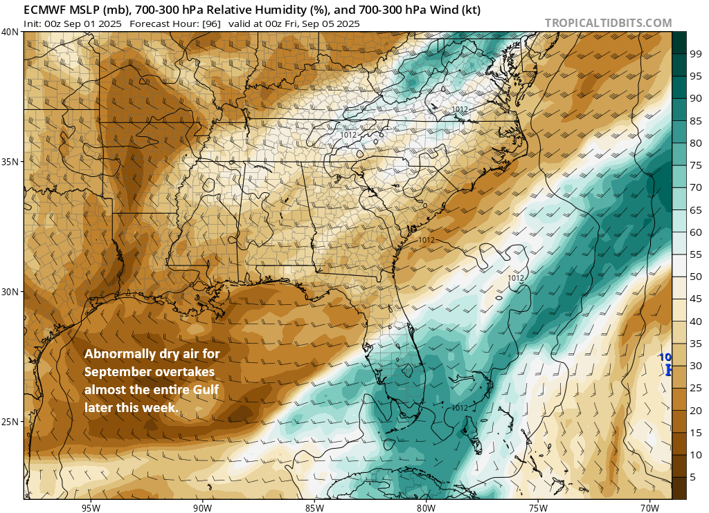
This dry air would probably inhibit both the development or maintenance of any tropical disturbances over the next 7 to 10 days near the Southeast. It’s rather robust for early September.
Wave off Africa
The other area to watch is out in the Atlantic emerging off Africa.
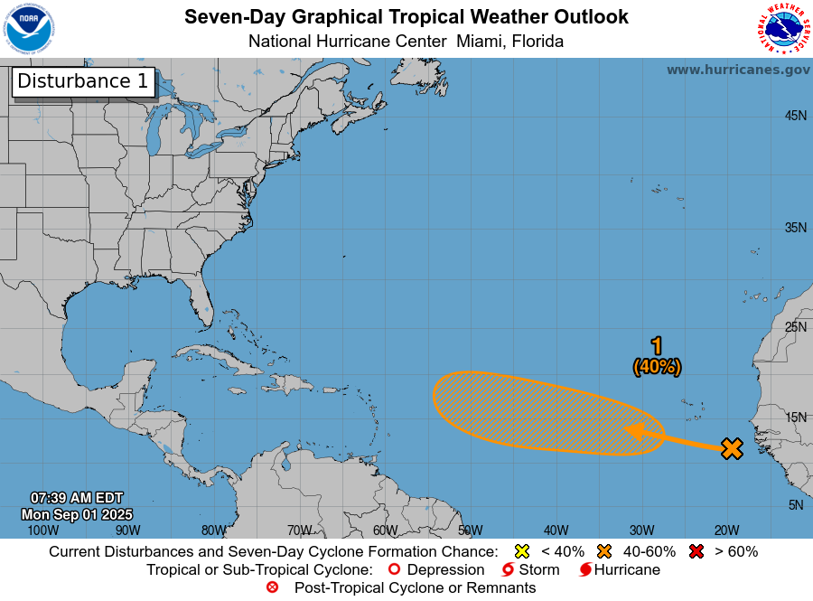
This area is fairly complex. Basically, you’ve got a large tropical wave with a couple areas of concentrated thunderstorm activity. The wave itself is southeast of the Cabo Verde Islands with heavy thunderstorms just south of the islands. Another cluster of heavy storms over Africa was going to exit near the same latitude as the Cabo Verde Islands. Over the next 2 to 3 days we’ll see this wave try to consolidate a bit as it tracks south of and just west of the Cabo Verde Islands. I don’t think we’ll see any development in that time.

Once it begins to establish itself west of the Cabo Verde Islands, we’ll begin to watch for possible development later this week or weekend. Once we get there, model agreement is pretty good that something should begin to develop. You can see below that the Euro ensemble a plethora of Google AI modeling shows good agreement on a system somewhere in the middle of the Atlantic. Where the models disagree and what matters most right now for future track developments is where this will be. A slower, slightly farther north system would be apt to turn out to sea quickly. A faster, somewhat farther south system could make it to the islands before beginning to turn.
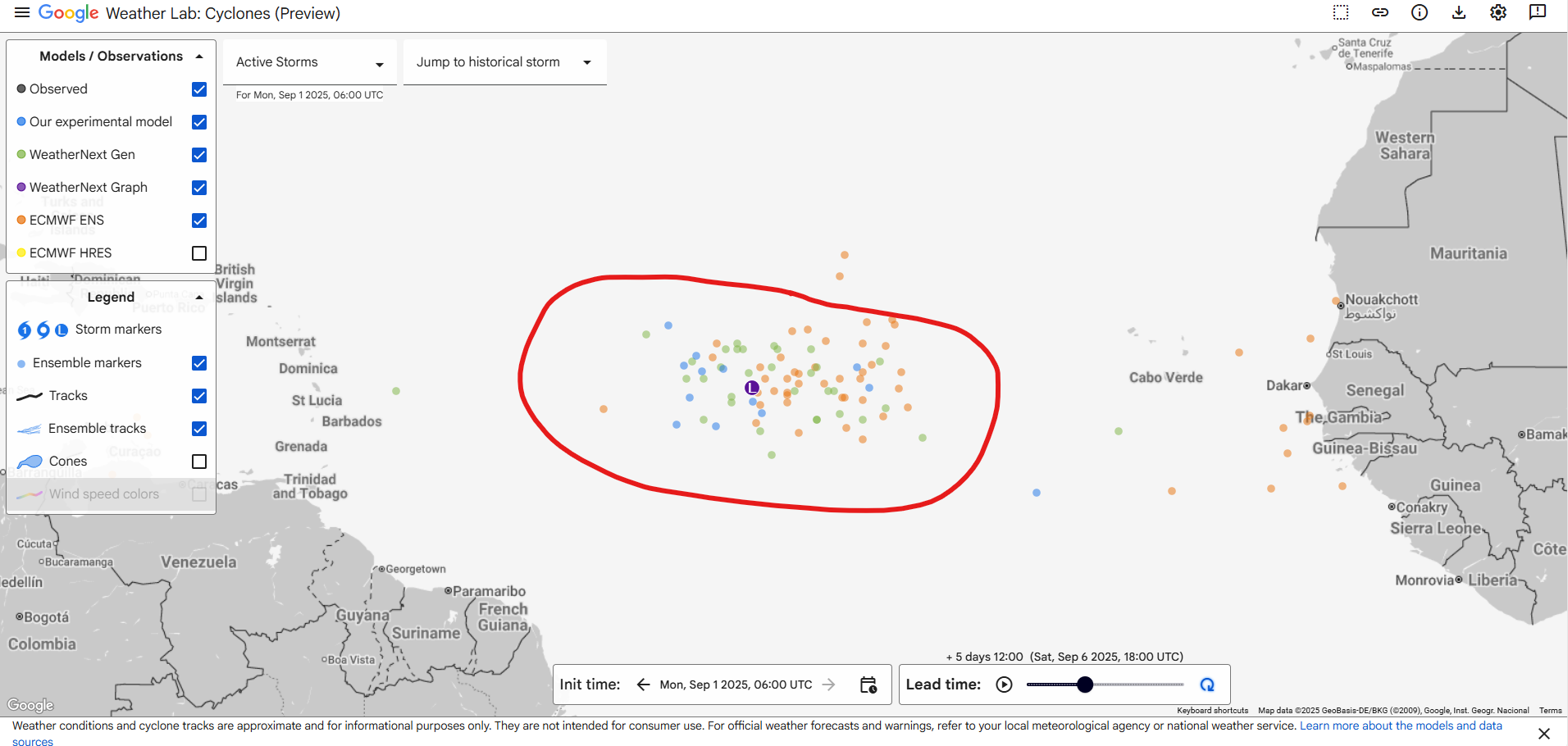
One thing I do see some pretty decent agreement in with the models is that very few are intensifying this system in any haste. In other words, they seem to be expecting that the basin will be hostile to tropical developments. I think this wave has an above average chance of developing but perhaps a below average chance of becoming a hurricane. A lot of modeling just disintegrates the system once near the islands as it turns northward. Bottom line: We’ll watch it like we do everything in September but right now concerns on this one are pretty minimal.
Other odds and ends
I wanted to point out a couple interesting things I’ve read since late last week.
First, Michael Lowry has a nice retrospective on Katrina.
So does Alan Gerard at Balanced Weather.
Alan also has an important post on some global issues ongoing. Ocean Heat Content is insanely high globally right now. It seems to be dominating the northern Pacific Ocean at the moment, including in Japan where multiple locations have already smashed their all-time September high temperature record today. Alan’s post also touches on the very (scientifically) intriguing and (personally) troubling potential collapse of the Atlantic meridional overturning circulation (AMOC) which is higher than we previously thought. Keep in mind that when reading this that this isn’t necessarily likely to happen today or next year or over the next 10 years, but the odds are being pushed uncomfortably high. When you assess risk, you’re assessing the chance that something happens. There’s a pretty significant difference in risk posture for when something has a “non-zero” chance of occurring versus something having odds pushing up to 25 percent. A story to continue to watch.