We hope everyone has had a safe and pleasant holiday weekend thus far. This time next week, we’ll officially be in hurricane season. So, we figured today was a good opportunity to just run through the situation as it looks today. We’ll discuss NOAA’s seasonal outlook, the overall state of the Atlantic right now, a forecast for the next week to 10 days, and a reminder that intensity doesn’t always equate to impacts.
Seasonal forecast finales
First, the National Oceanic and Atmospheric Administration (NOAA) pushed out their hurricane season forecast on Thursday morning. They are calling for a slightly more active than normal season, with a 60 percent chance of active and 30 percent chance of “average.” They predict 13 to 19 named storms, 6 to 10 hurricanes, and 3 to 5 major hurricanes.
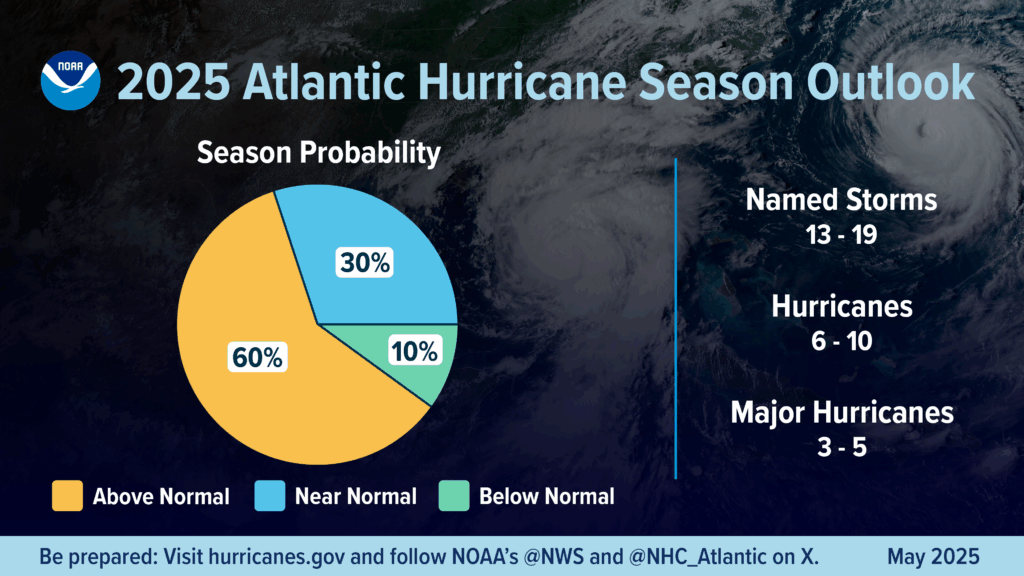
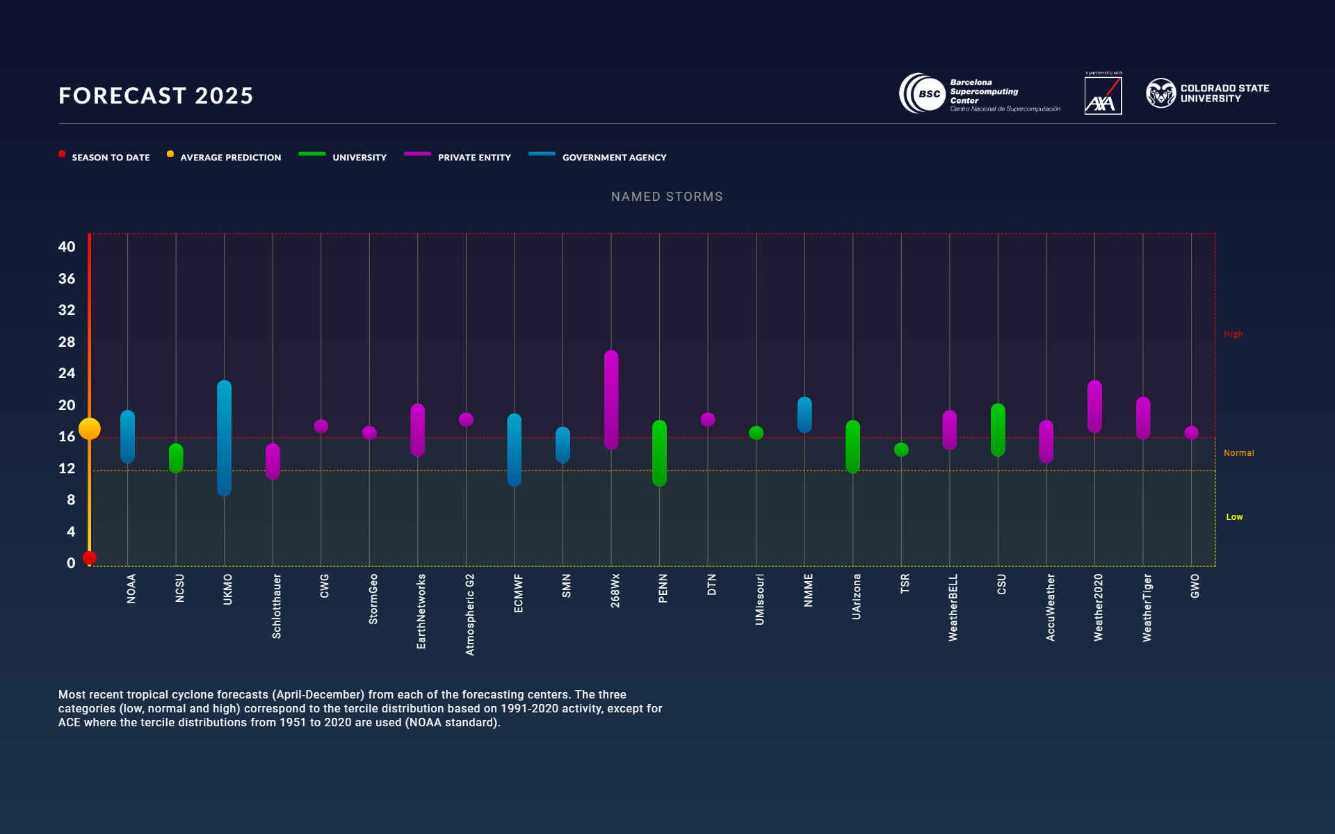
This is right in line with what I think most of us expected, and this is a perfectly reasonable hurricane outlook for this year. The consensus now among most academic and government agencies calls for an average to above average season.
Last year, I took a look at how NOAA’s outlooks tended to perform (based on the midpoint of their forecast ranges). To recap:
- 2024: Forecast 21/11/6 and verified with 18/11/5
- 2023: Forecast 14/7/3 and verified with 20/7/3
- 2022: Forecast 18/8/5 and verified with 14/8/2
- 2021: Forecast 17/8/4 and verified with 21/7/4
- 2020: Forecast 16/8/5 and verified 30/14/7
- 2019: Forecast 12/6/3 and verified 18/6/3
Overall, in the last several years, NOAA has tended to do quite well with respect to hurricanes and major hurricanes (2020 excepted) and has had some mixed results with named storms. A reminder than aside from their seasonal outlooks, the National Hurricane Center is coming off their best forecasting year yet in 2024.
State of the Atlantic & Pacific
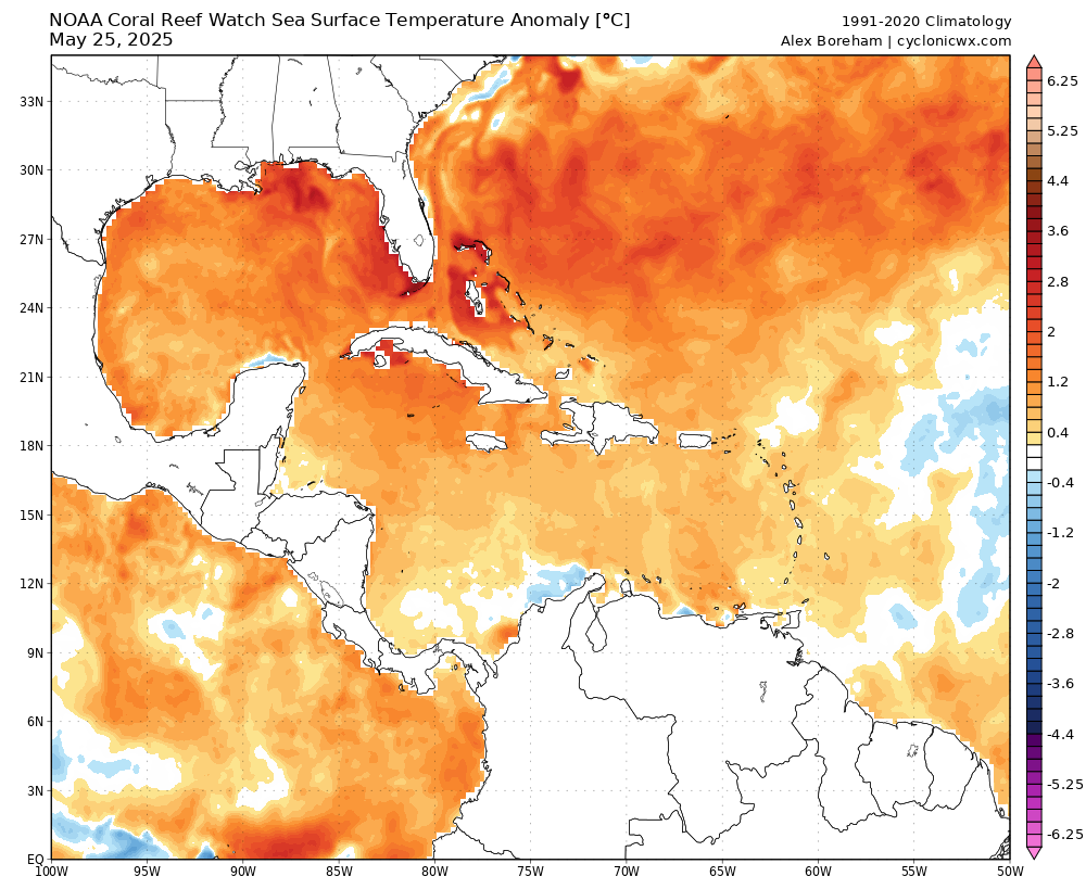
Water temperatures heading into the season are at slightly warmer than average levels in the Tropical Atlantic as a whole. The main development region, which includes much of the Caribbean is running a slight fever this year but nothing like the extreme one we saw last summer.
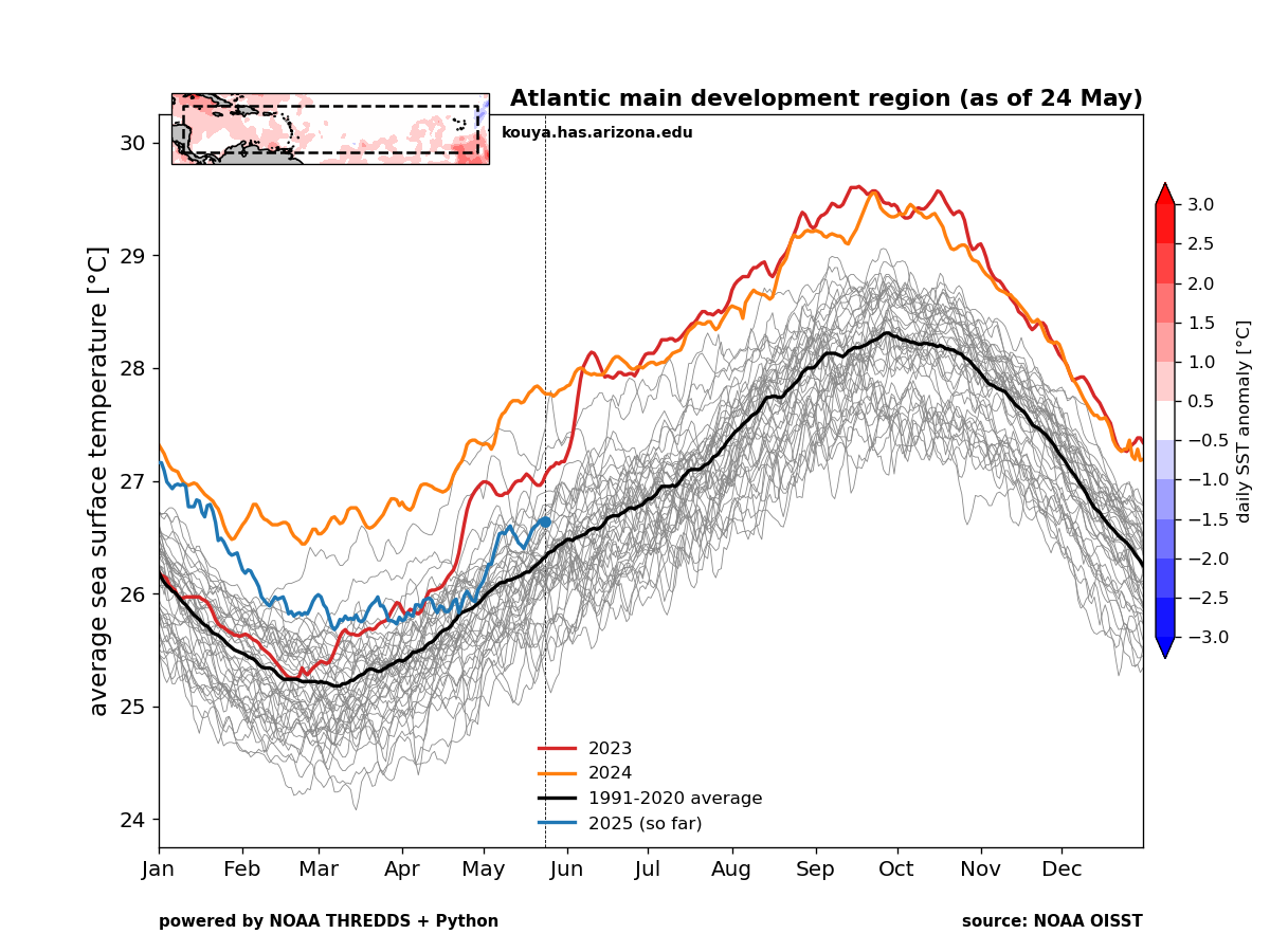
As for the Caribbean and Gulf? Well, the Gulf is in line with 2024’s readings at this time, while the Caribbean is running alongside 2023’s readings. Those, of course are the two warmest readings in the dataset of water temperatures we have for those bodies of water. Over the last 30 days, the Gulf has warmed about 0.8°C, while the Caribbean has warmed north of 16°N latitude and cooled south of there. Basically, the northwest Caribbean and Gulf are as warm as they’ve ever been measured to start the season.
For the last few months, we’ve been hinting at the idea that there would be minimal signal from the Pacific Ocean this year, as we would see ENSO neutral, or La Nada conditions there. Last year’s forecasts were so dire because in addition to the warm waters, we had the signal for a developing La Niña, colder Equatorial Pacific water which tends to relax wind shear in parts of the Atlantic. We did enter a brief La Niña, but that has since faded and we’re back to neutral conditions now.
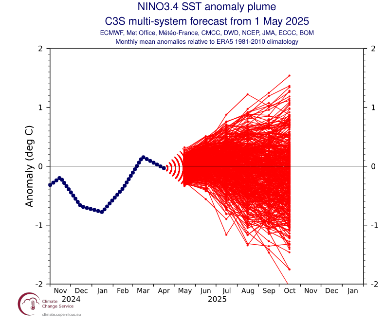
At this point, there’s no change in thinking that the Pacific’s state (El Niño or La Niña) should not be a major influence this hurricane season. Other factors will drive the forecast.
With all this put together, a normal to above normal hurricane season seems like the best forecast one could produce right now.
Forecast for the early days
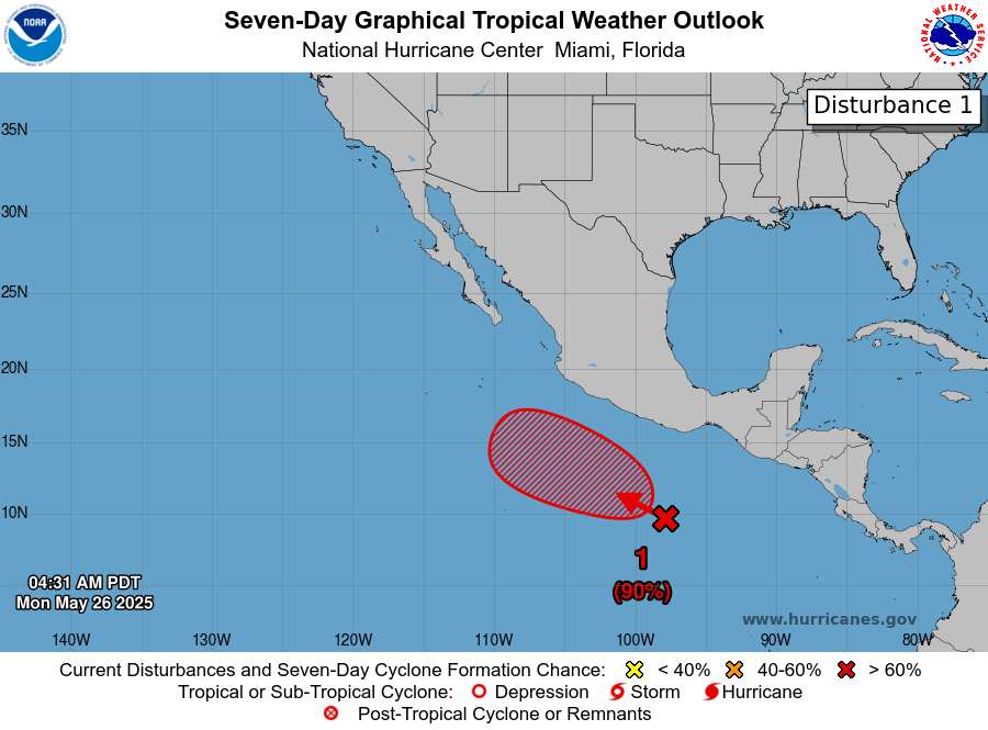
Initially, the Atlantic looks mostly quiet. We don’t see any real signs of anything meaningful at this time. Typically, you’d watch the southwest Caribbean this time of year, particularly if you can get some early season gyre activity around Central America.
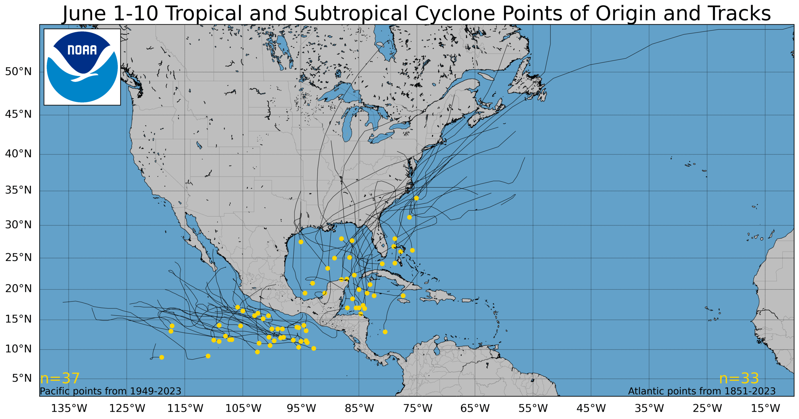
These systems tend to favor tracks due north or northeast into the eastern Gulf of Mexico or the southwest Atlantic. The Pacific tends to be active in early June, and we have a possible system already there. The first name on the Pacific list is Alvin (Alllllllllllllllviiiiiiin!).
In the Atlantic, our first three names are Andrea, Barry, and Chantal.
The unfortunate case of Imelda
One final note today on this year’s storm name list. Imelda will reappear for the first time since this list was used in 2019. For those in parts of southeast Texas, Imelda is a name that may have been worthy of retirement. Imelda killed 7 people, left $5 billion in damage, and flooded people out of homes they had only just recently moved back into after Harvey in parts of Texas. The hardest hit areas were from just northeast of Houston into the Beaumont area, where over 44 inches fell in Fannett, TX.
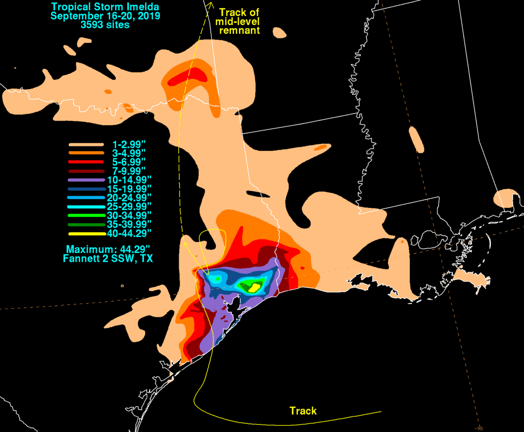
While this will bring back some bad memories for folks, in 2025 it will be a new name for a new system that hopefully goes nowhere near southeast Texas. This also serves as a reminder that storm intensity doesn’t equate to impacts. Imelda, barely a tropical storm by definition was a catastrophic rain-producer in some areas.
Thank you so much! My anxiety about hurricanes goes up in June. Your calm explanations help to put everything in perspective. I’ve lived here all my life but I still never get used to hurricanes. So I’ll hang onto your coattails for the foreseeable future. I appreciate you!
Jeannie Allemand
Very informative, as usual.
Imelda was the straw that broke the camel’s back for my parents. It was the 6th flood in their house so they finally took a buy out and their house was razed.
Has the defunding of so many government agencies like NOAA and the layoffs of numerous scientists and support staff impacted their ability to forecast tropical storms and hurricane activity this season? How will this affect SCW going forward?
Has it impacted them? Yes. Will it be a negative impact on the season’s forecasts? TBD. We’re running a bit of a reckless experiment by understaffing an already understaffed critical agency during a critical time of year. From our perspective as forecasters and communicators, little has changed for now. But given reduced upper air balloon launches, there is risk that hurricane forecasts will be negatively impacted. In that case, buckle up. Regardless, the staff at Gulf Coast and East Coast offices may begin to get a bit overworked if it’s a busy season.