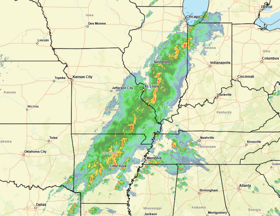
Thunderstorms are cranking up as anticipated this afternoon all across the Mid-South all the way north to northern Indiana with a bunch of severe thunderstorm warnings about 7 tornado warnings at the time I am writing this.
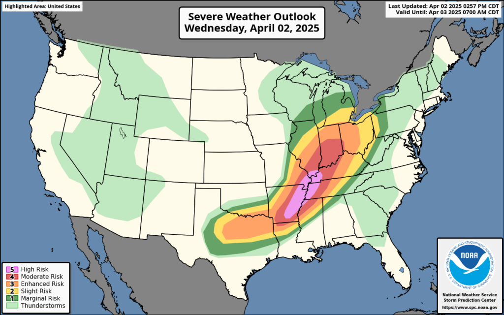
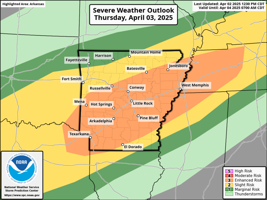
A “high risk” for severe weather was issued from eastern Arkansas to just south of Evansville, Indiana today. The reasons included the potential for strong tornadoes, very large hail, and very strong wind gusts. Basically, it’s about as optimal a broad-scale severe weather setup as you could reasonably look for. It could also end up being a tornado outbreak day as well. We’ll see what happens over the next few hours, but as these storms march east, it’s likely that all severe threats will increase this evening.
We’ve been discussing the rain risk the last few days and the potential for catastrophic flooding to emerge in these areas. Round one tonight will start that process. We can get a sense of the potential for rain over the next several hours looking at the HRRR model, which is a high-resolution model we use for thunderstorm forecasting. It shows a bullseye of 3 to 6 inches showing up between now and 7 AM CT on Thursday in western Tennessee, just east of Memphis.
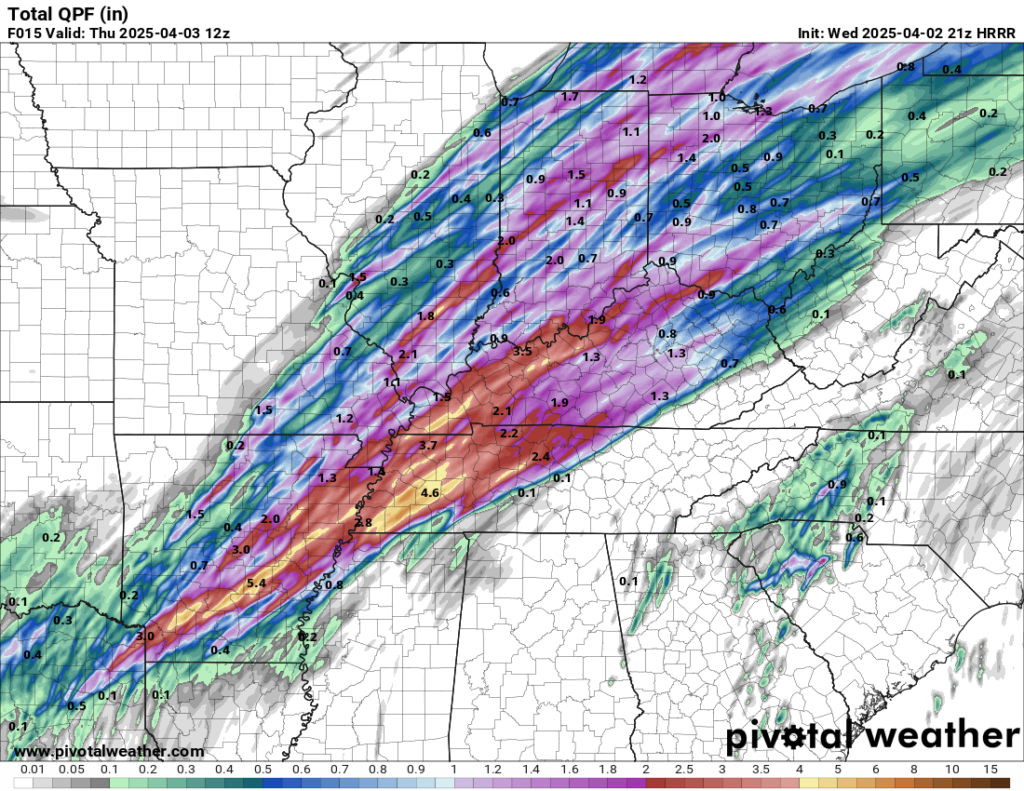
That area between Jackson and Dyersburg, TN may be at highest risk for flooding from this first round of rain. Once the severe weather exits tonight, the front will basically stall out over or just north of the Tennessee Valley. As that happens, the severe weather threat for tomorrow will shift back south and west some into northeast Texas, Arkansas, and western Tennessee.
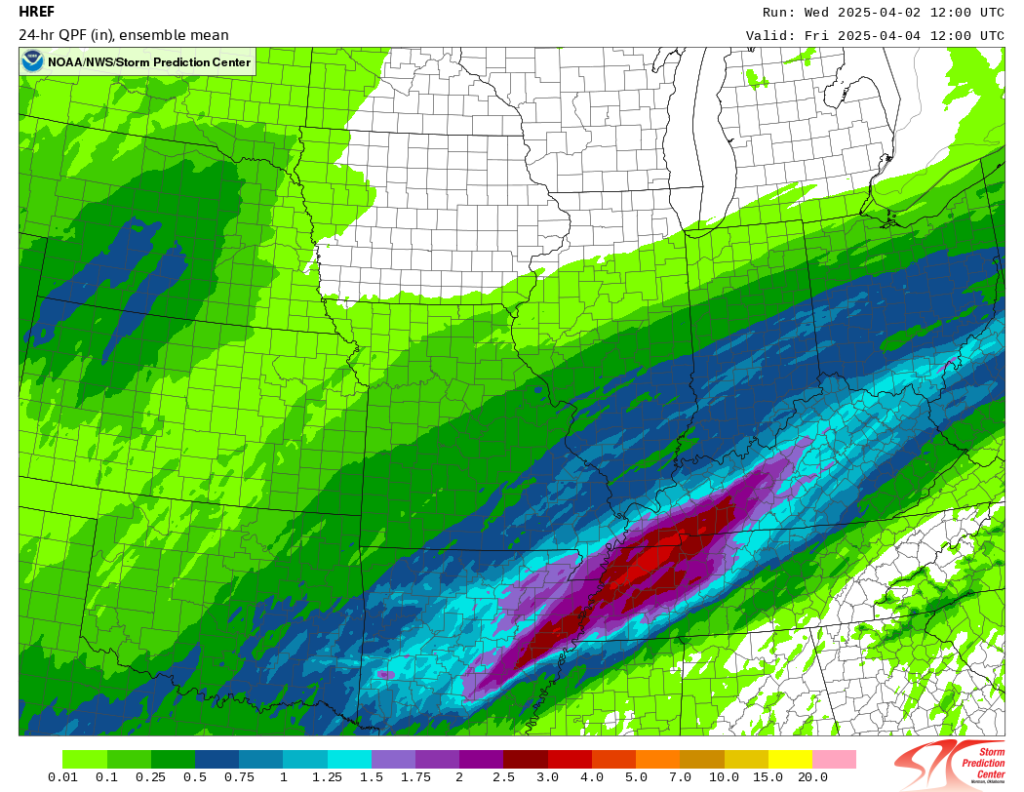
What about the rain? Tomorrow’s heaviest rains are going to focus near or just north of where tonight’s heaviest rains will occur. According the Storm Prediction Center’s high resolution ensemble forecast, the average rainfall tomorrow will peak around 2 to 4 inches in northwest Tennessee, between Dyersburg, Martin, and Clarksville. There is some degree of uncertainty in how much exactly falls and where it falls. So all of western Tennessee should be on guard.
Arkansas should also watch this, particularly between Pine Bluff and Memphis, TN. Some of the “under the hood” guidance indicates that as much as 5 to 8 inches of rain could fall in these areas. As such, a high risk (level 4 of 4) exists for these general areas tomorrow for flooding rainfall.
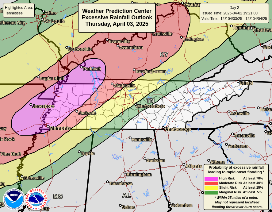
High risks for flooding are important to denote because they are extraordinarily well correlated to damaging, deadly flooding. The vast majority of the worst flooding we see in this country occurs on these high-risk days. So tomorrow could be the first volley in a very bad series of them.
Beyond tomorrow, the general trend will be to lift the rain north on Friday into the Ohio Valley or even farther north before it slowly, painfully slowly sags back south and east on Saturday, finally exiting Sunday morning. This period will probably see additional bad flooding spread to the north and then back south again. Again, this appears to be an extremely rare, catastrophic flood event that will unfold over multiple days beginning tomorrow across Arkansas, Tennessee, Kentucky, and portions of Illinois, Indiana, Ohio, and Missouri. Additional “high risks” are likely to come.
Thanks. We have family in Memphis and in Kentucky plus friends in Arkansas. I am forwarding your weather predictions to all of them in hopes they can be safe.
Is Houston area so dead we need to look 500 miles away for trouble?
Bill, you do realize that the scope of Eyewall extends far beyond Houston right? Many of us do not live in the Houston metro (I’m based in STL) and appreciate that Lanza & Berger spend time focusing on inclement weather other parts in the country.
That’s a horrible comment.
Thank you for the information. Many people have family in those areas and/or may be traveling through. As one who travels to Kansas to visit family, it is good to know the probability of severe weather.