In brief: Hurricane Melissa is one of the 4 strongest Atlantic storms on record, and it is making landfall in Jamaica as I type this. Horrific impacts are expected there, followed by significant impacts in Cuba later today and tomorrow. Our thoughts are with our Caribbean neighbors.
Very few places in the world have ever experienced in modern times what Jamaica is going through or about to go through this morning.
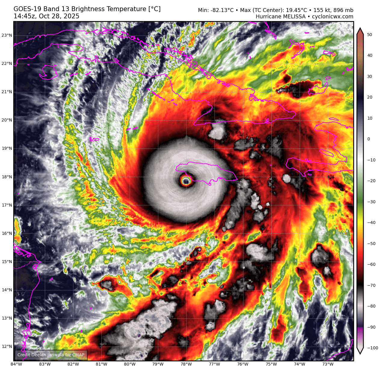
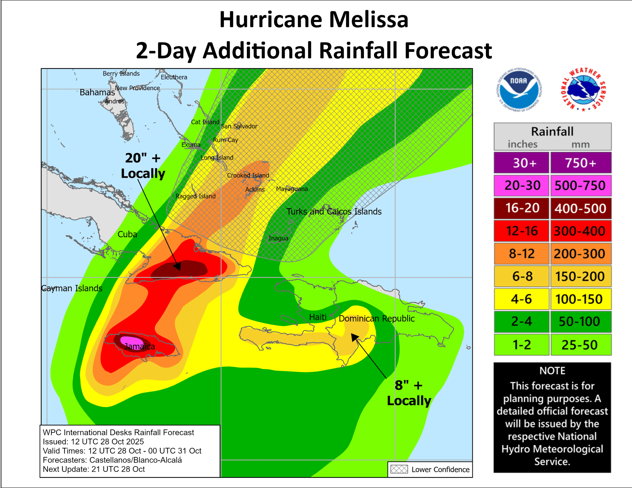
Massive hurricanes and typhoons do occasionally make landfall, but at this level of intensity it is rare. Melissa is essentially undergoing another round of rapid intensification as it approaches landfall in Jamaica. As of this writing, the barometric pressure was as low as 892 mb, tied for third strongest on record in the Atlantic with the 1935 Labor Day hurricane, just behind Gilbert in 1988 and Wilma in 2005. It has maximum sustained winds of 185 mph. Notably, the maximum sustained winds only extend out about 10 miles from the center, so the worst damage will be concentrated within about 10 to 20 miles of the eyewall’s path. On an island that’s Jamaica’s size however, that’s a substantial swath of area.
Melissa’s appearance is more similar to that of a western Pacific typhoon. This merits another post down the line, but there are really only two areas where such storms could occur in the Atlantic: the Gulf of Mexico and the Caribbean Sea. These types of storms look like buzzsaws on satellites; their structure is meteorologically perfect.
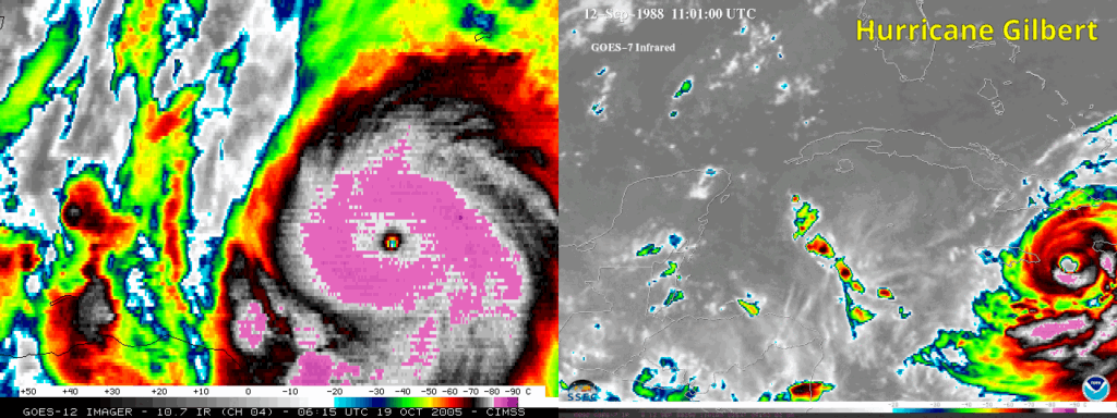
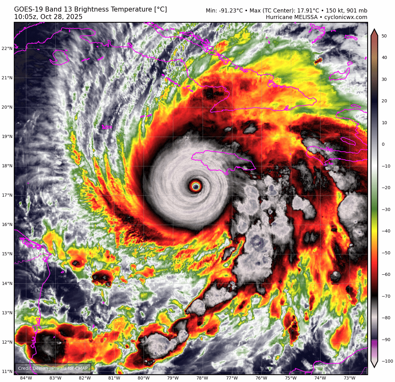
Even when comparing this to Gilbert and Wilma, the two strongest satellite era companions to Melissa, it does appear that Melissa may have the most pristine structure. Satellite resolution has improved dramatically since 1988 and 2005, but even in those cases, it would seem that Melissa has the more meteorologically perfect look. Wilma did have that pinhole eye, of course, which can also be reminiscent of a Pacific typhoon. Whatever the case, all we can do is hope and pray right now that Jamaicans are as safe as possible. While that is a hurricane battle tested location, there is no place in the world, even America, that is truly adequately prepared to handle a top 5 storm on record.
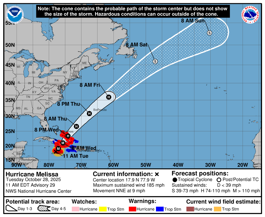
From here, the next stop is Cuba, and we continue to see strong support for a landfall just to the west of Santiago de Cuba, the second largest city in the country. Jamaica will take a big bite out of Melissa for sure, though the center should pass just west of the highest terrain and over a relatively narrower part of the island. I would anticipate that a category 3 or 4 storm is likely to hit Cuba tomorrow morning. As previously noted, this looks worse than Sandy and potentially the worst on record in eastern Cuba. The worst winds should pass to the west of Guantanamo Bay. But heavy rain and significant flooding are likely with over 20 inches more rainfall possible there.
Once across Cuba, Melissa will weaken a little more, entering the southeast Bahamas likely as a category 2 storm. The center of the storm and worst wind will likely pass near Long Island and Crooked Island, while impacts will be felt over a wider area, including for portions of the Turks and Caicos Islands. Thereafter, Melissa accelerates off to the northeast and starts to slowly turn extratropical in nature. This should allow Melissa to sustain as a hurricane all the way to Bermuda, where it will make a close pass on Thursday night and Friday morning. Bermuda will find itself likely on the east side of the storm, so significant rain and wind are likely there, but the impacts will be more muted in nature than in the Caribbean islands or even the Bahamas.
Melissa is a historic storm, and it’s almost guaranteed to have its name retired in the offseason, adding to a litany of “M” storms in the Caribbean that have inflicted so much pain and suffering, like Mitch and Maria. Our thoughts are with the affected areas, and we will provide some links on how to send financial help to those areas once the storm passes.