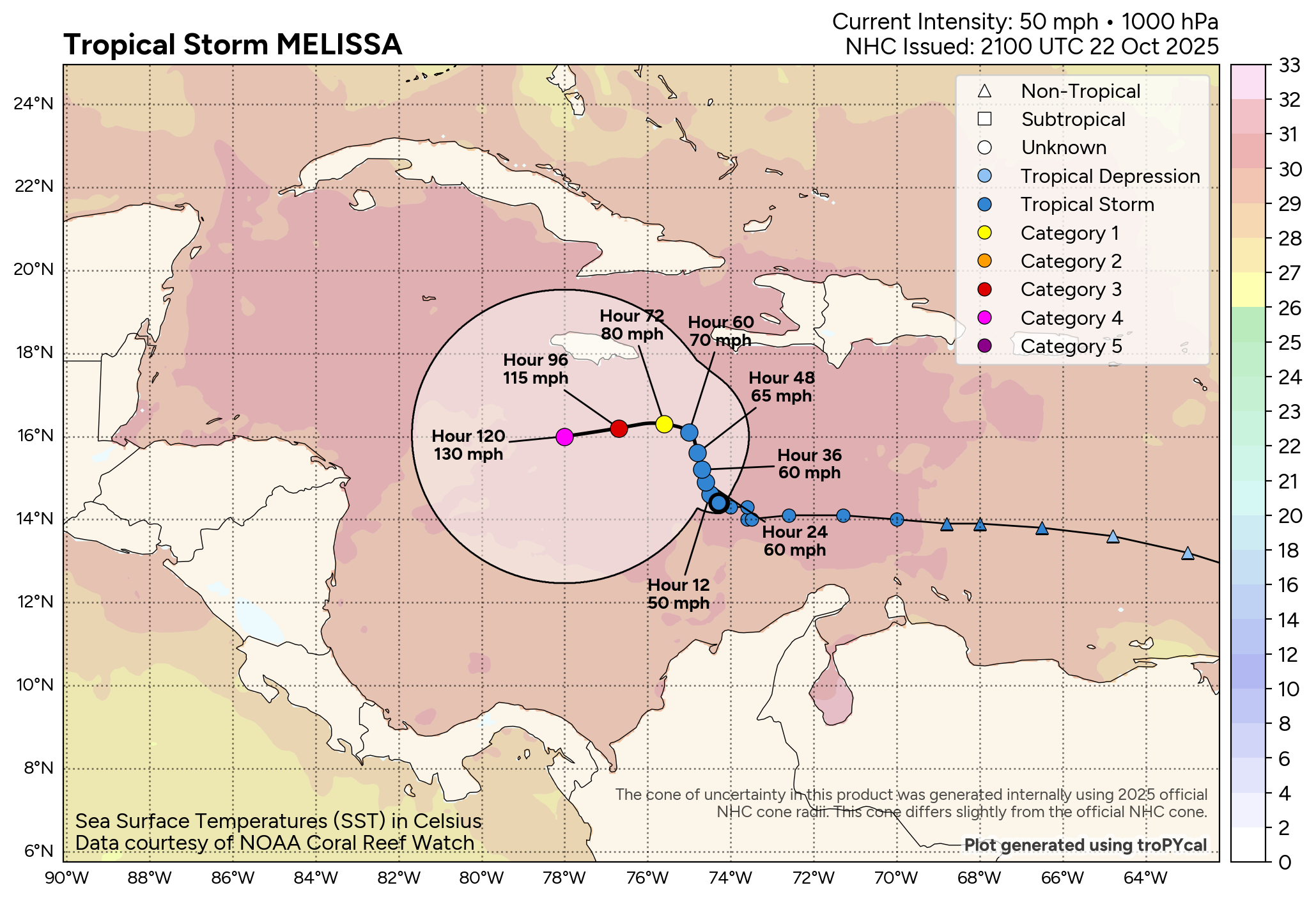
In brief: Melissa’s intensity has held today, increasing the odds that it will remain in the Caribbean through the weekend, eventually finding a more hospitable environment for rapid, possibly explosive intensification this weekend. Significant impacts are likely for parts of the central Caribbean, particularly Jamaica, and Melissa may stick around well into next week. Eventually the storm will be picked up and carried northward into the Atlantic, but probably not before becoming a powerful, destructive storm in parts of the central or western Caribbean.
Tropical Storm Melissa is continuing to absolutely crawl west at a whopping 1 mph this evening. Melissa has not gained any strength today, and that’s not shocking. One of the problems with Melissa is that its general lower-end intensity early on is causing it to miss one exit ramp that it could otherwise take that would perhaps spare some of the central Caribbean a truly bad storm.
In the meantime, with some 20 to 30 kts of shear buffeting the storm, it’s going to remain loosely organized. Reconnaissance aircraft are investigating the storm this evening, so we’ll see what they find.
Forecast-wise, not much has changed since this morning. The requisite tropical storm and hurricane watches remain posted. Melissa’s future track depends heavily on its structure. If the storm remains fairly disorganized, as expected by AI modeling and the European model, we will continue to see this drift northwest or west-northwest. If it can suddenly pull itself together, it will quickly feel the westerlies to the north that will pick it up and grab it and lift it out of the Caribbean and into the open Atlantic. The GFS model tends to favor this. Given the current disorganization, odds seem to favor the weaker, more time over warm water scenarios, eventually putting Melissa in extraordinarily warm waters with lower wind shear.
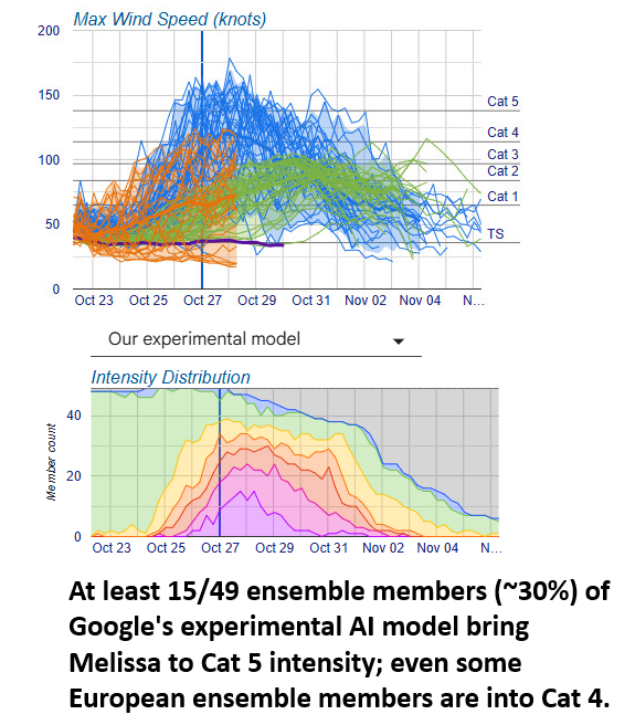
Once it gets there, the sky is the limit. As we noted earlier today, extreme levels of oceanic heat content will be around to fuel Melissa for a longer time than a typical slow-moving storm. This likely means that we’re looking at a high-end major hurricane eventually by late this weekend or early next week. Its proximity to land will determine just how bad the impacts get, specifically for places like Jamaica, eastern Cuba, Haiti, or even Central America. But suffice to say, it looks ominous right now.
It will take a very strong upper level trough exiting the U.S. to pick up Melissa and pull it out of the Caribbean next week.
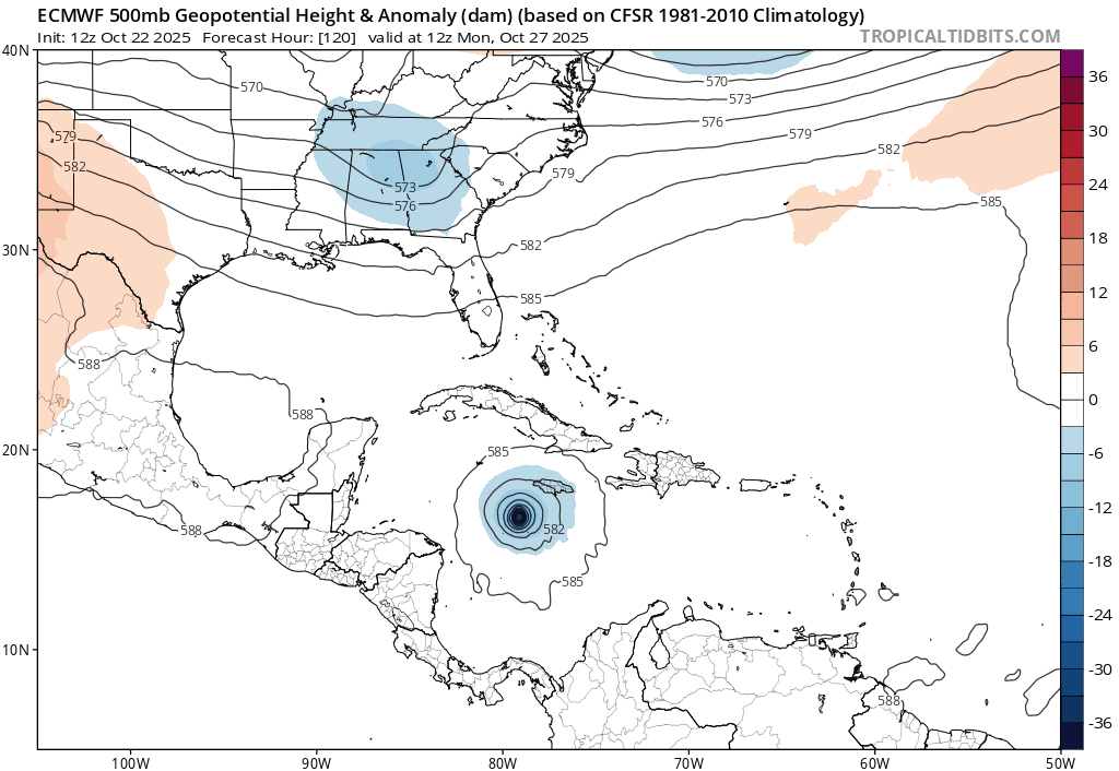
Theoretically, this should be a straightforward exercise: Trough digs into the East, captures Melissa on its way off the coast, and the storm exits. There’s still a fair bit of uncertainty on that last point, and we’ll want to watch how that trough progresses in the days ahead. Folks in eastern Cuba, the Bahamas, Turks and Caicos, and even Bermuda should be following Melissa’s progress closely next week. Folks on the East Coast don’t need to worry right now, but as noted, we should continue watching things.
More tomorrow morning.