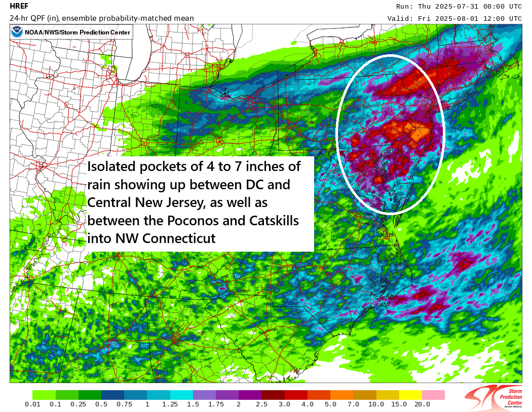
In brief: A moderate risk (3/4) remains posted today for flooding between Washington, DC and northern New Jersey with isolated 4-to-7-inch totals expected. The tropics remain quiet, and heading into the first half of August, it’s not apparent that things are going to dramatically increase. We’ll keep watching.
Fairly brief update today, but let’s get to it.
Flooding risk in the Mid-Atlantic
There continues to be a moderate risk (3/4) of flooding today in the Mid-Atlantic region.
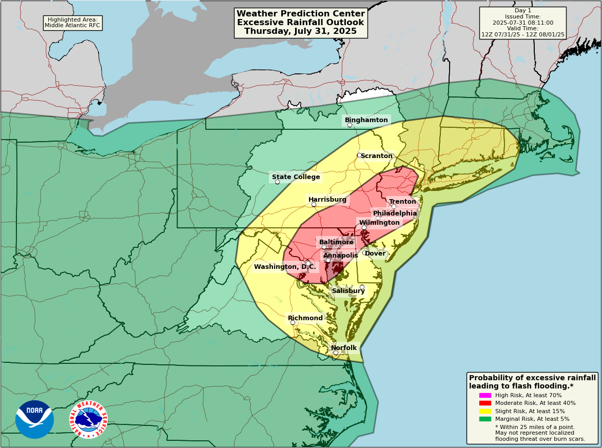
Modeling continues to strongly suggest the potential for isolated pockets of 4 to 5 inches or more of rainfall across the moderate risk area. Potential does exist for perhaps up to 7 inches of rain in some really isolated spots. Many areas will be fine today, but the entire region is at risk for something a little more serious, hence the moderate risk.
Basically, it’s a good day to make sure that you plan around the rain in the region. Maybe hang tight at your location for a bit if it’s raining heavily. Have a way to receive flash flood warnings. And do your best to never drive through a flooded road, as the water is often deeper than you realize.
Tomorrow’s rainfall risk shifts southward into the Southeast, mainly the Carolinas.
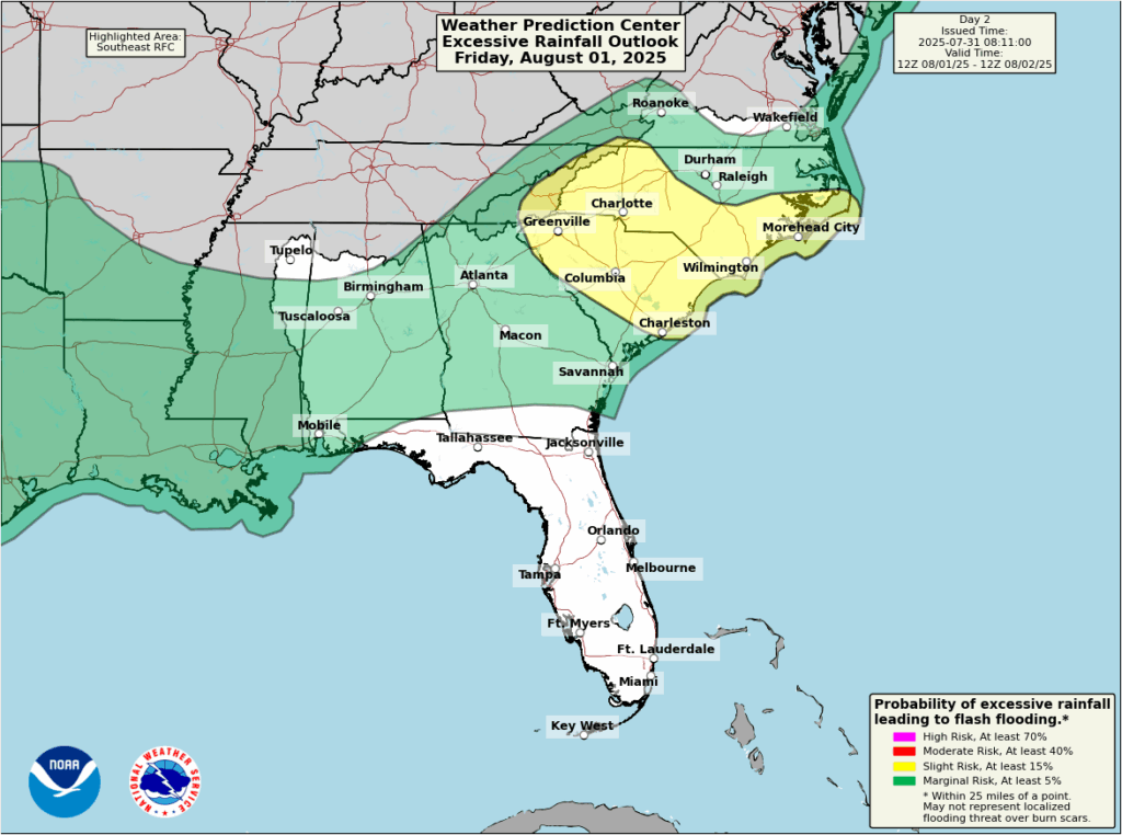
That risk will probably hold steady in that area for Saturday as well.
Tropics still mostly benign
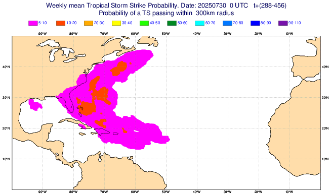
Another day with no tropical threats on the map from the National Hurricane Center today. As all the thunderstorms in the Southeast begin to push offshore, there is a very, very slight risk that something may try to briefly spin up and head out to sea from there. But those odds look quite low.
Overall, the Basin looks about average for this time of year right now. Over the next couple weeks, I’m not convinced it’s going to get more favorable. Of course, given that climatology begins to ramp up in August, that should still mean we see something at some point in the next 2 to 3 weeks. That’s just a given. But in terms of getting a lot of activity, significant activity, etc., I’m not sure I see the background state of the Atlantic cooperating in a significant way right now.
If you want to look out far in time, we can grab the European model’s subseasonal outlook for tropical storms.
The odds of a tropical storm in mid-August (we’re looking at the week of August 11th here) aren’t exactly strong. Some European model data suggests perhaps something could emerge off the Eastern Seaboard, but the odds at this point remain below 30 percent, or close to normal for this time of year. Conditions may become a smidge more favorable by later August, but again, that should be expected in a normal hurricane season.