In brief: Flooding continues to impact Missouri, where some areas have seen 10 to 15 inches of rain this month. More flooding is possible today, along with severe weather, primarily in Minnesota. The tropics remain calm for now, but there are still things to watch this week.
Happy Sunday! Today we’ll bring you up to speed on more places impacted by flooding. We’ll obviously also take a look at the tropics.
Flooding in Missouri
Lincoln County, Missouri is where we’ll start today. The area received as much as 5 to 10 inches of rainfall in the last 24 hours. A state of emergency was issued there.
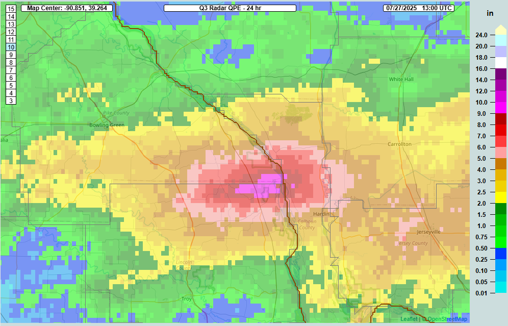
Actual totals are sparse in this area, but over 6 inches fell in Ellsbury, with over 4 inches in Hardin, Illinois. All this water is expected to lead to minor flooding along the Mississippi River north of St. Louis.
Northern Missouri has been whacked this month with heavy rainfall. Some areas have seen north of 300 percent of their average rainfall over the last two weeks. Since the beginning of July, some spots near Kansas City have had 12 to 15 inches of rain, while pockets across northern Missouri have registered 11 to 14 inches of rain (including Ellsbury as noted above, which is over 14 inches now).
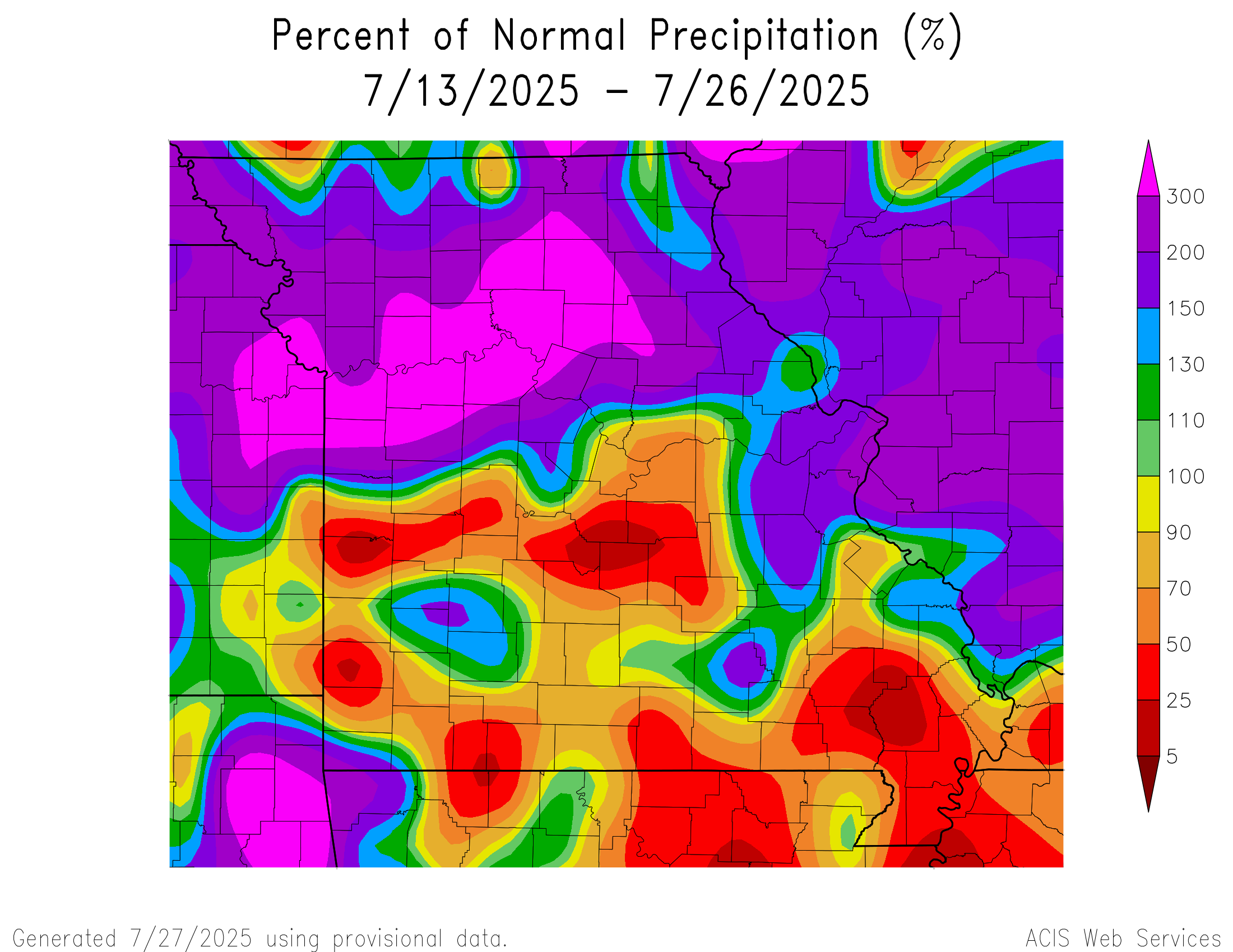
Officially, it’s the 9th wettest July on record so far in Kansas City, but in some areas it’s probably above that.
It’s been a summer, and it continues today. Flooding risks continue today with a few slight risks (2/4) drawn on the map.
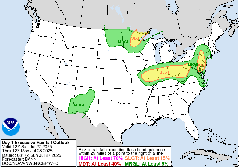
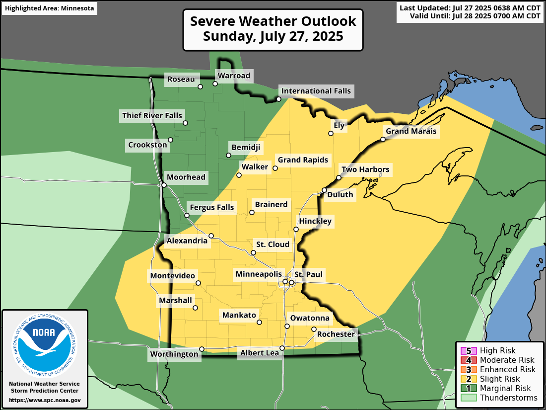
I would watch eastern Pennsylvania and northeast Minnesota perhaps closest today. In addition to flash flooding, there is a decent severe weather risk in Minnesota today too, including for isolated tornadoes.
Additional flash flooding risks will continue this week across various parts of the country.
Updating the Atlantic
The National Hurricane Center continues with a blank slate today of no concerns over the next 7 days. Support for a deep Atlantic system has dropped some this week. At least the initial idea that we discussed last week that focused on something just east of the islands by later in the week has. We still have some support for development chances but little support for significant organization.
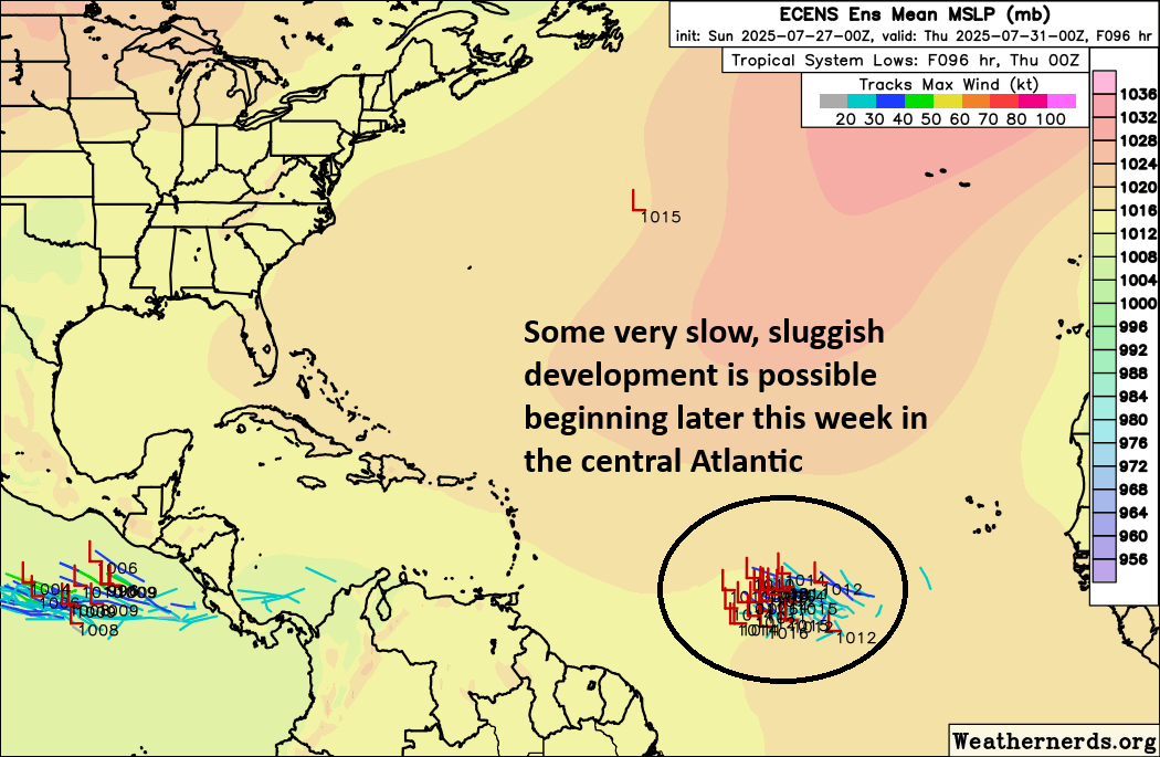
I’d suspect we are on our way to an Invest here with this look from the European ensemble. So I would expect the NHC to add at least a chance of development soon. Is that more than 10 to 20 percent right now? I doubt it. But we’re working toward at least something identifiable.
From here, the system would probably either succumb to wind shear in the Caribbean or maintain very loose organization toward the Bahamas or off the Southeast coast by the week after this one. Exactly what that looks like and what it means, it’s a little too early to say. There hasn’t been much consistency on any risks with this possible wave, so I’m not willing to say much more than “let’s keep watching.” But the “noise” level off the Southeast coast has definitely increased since last week, though that does not mean a land threat. It will be what we watch this week though.