In brief: A couple areas to watch in the tropics seem unlikely to develop much. Flash flooding hit just outside of DC yesterday and in Iowa overnight. The main flooding threat today will be across central Illinois, Indiana, and southwest Ohio.
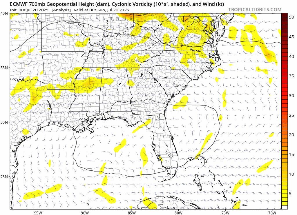
Central Atlantic wave not a threat to land
The National Hurricane Center continues with a tropical wave highlighted on their outlook map this morning, but odds of development have fallen to 10 percent. This appears to be unlikely to do much of anything at this point.

It’s just not in a prime spot for development, and it’s quite a bit far south. So ultimately, this will likely meet its demise before arriving in the Caribbean as it encounters strong wind shear. Perhaps we’ll see some increased shower chances for some of the Lesser Antilles, but that would be all.
Gulf disturbance next week
Models continue to show that the remnants of 93L will reorient into a new disturbance and do a very similar thing to Invest 93L. A true meteorological deja vu. The new disturbance should emerge in the Gulf by about midweek this coming week. It will then likely track close to the Gulf Coast toward Louisiana or even Texas before coming ashore.
Because of how close this will again be to land, it seems highly unlikely that it would develop. Again. Still, this may produce another round of locally heavy rain for the central and eastern Gulf Coast, which you can again see on the rainfall forecast map from the NWS for the next 7 days.
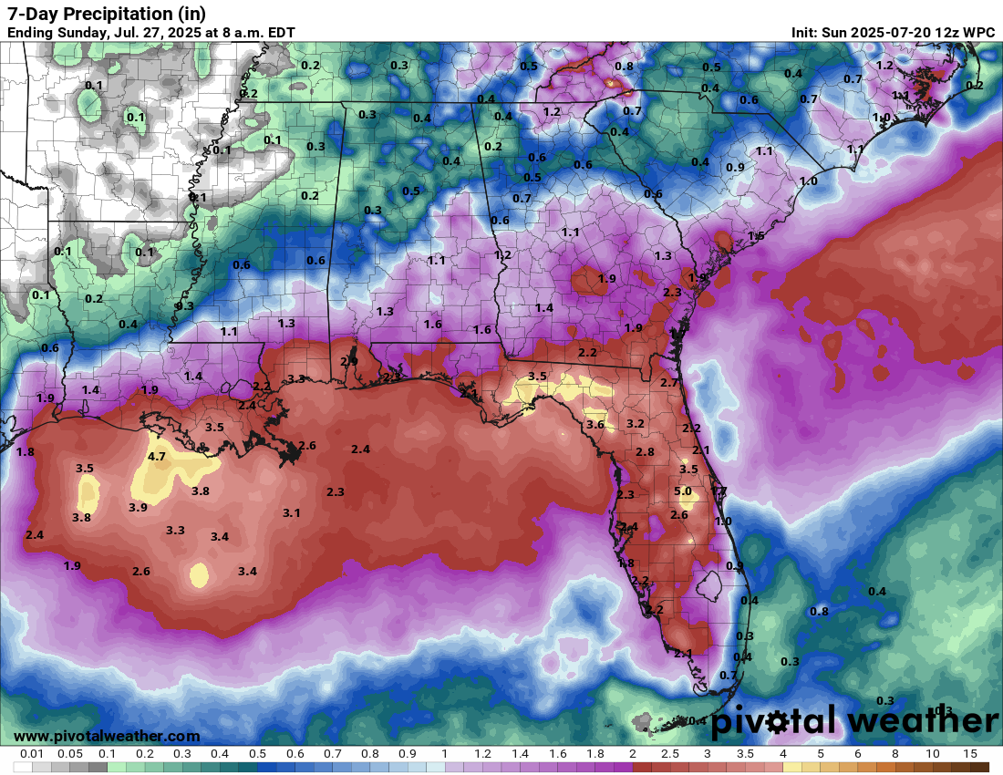
Certainly something to keep an eye on, but this once again seems like a rain event more than anything.
Flash flood emergency outside of DC on Saturday
The latest in a spate of flash flood emergencies this month occurred in Montgomery County, Maryland, just outside of DC on Saturday afternoon. Rainfall totals of 3 to 4 inches or more, much of which fell in a short time led to widespread significant flooding in the area.
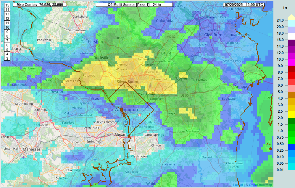
Some of the pictures are certainly a bit scary for this area. The runoff caused a very rapid rise on Sligo Creek, which runs through Takoma Park and dumps into the Anacostia River near Hyattsville. The creek set a new record, though it appears that its records only date back into the early 2000s.
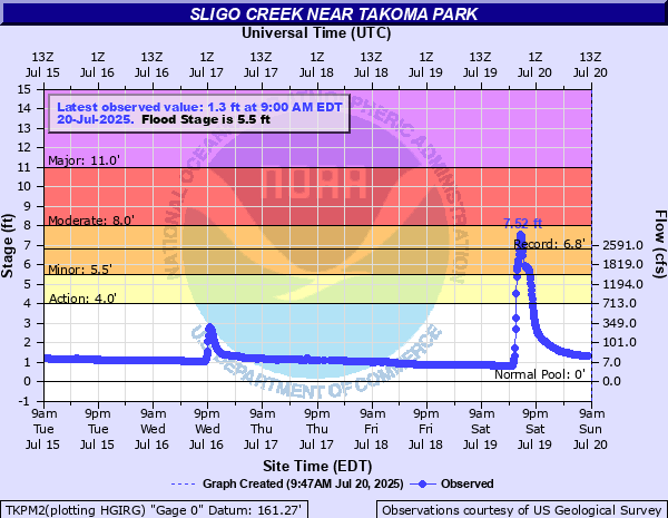
But again, notice the rapid rise there. In a little more than an hour, the creek went from about 20 cfs to 3,000 cfs and rose 7 feet. And while this was certainly a heavy rainfall, it was not the heaviest we’ve ever seen in this region. It just speaks to how quickly flash flooding can overwhelm drainage and watersheds.
Rain chances today
A number of flash flood warnings are currently in effect across Iowa where heavy rain fell overnight to the tune of 3 to 6 inches south of Des Moines.
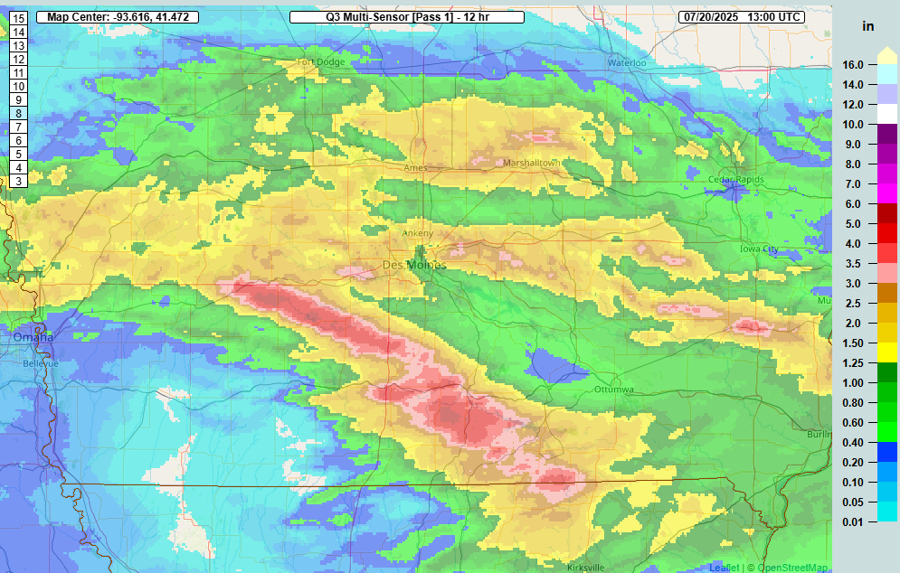
Those thunderstorms have now pushed into Illinois, and as the day goes on, we could see heavy storms develop with daytime heating across Central Illinois and Indiana. A moderate risk (level 3 of 4) for excessive rain is in place from about Terre Haute, Indiana through Springfield and Decatur over to Quincy, Illinois.
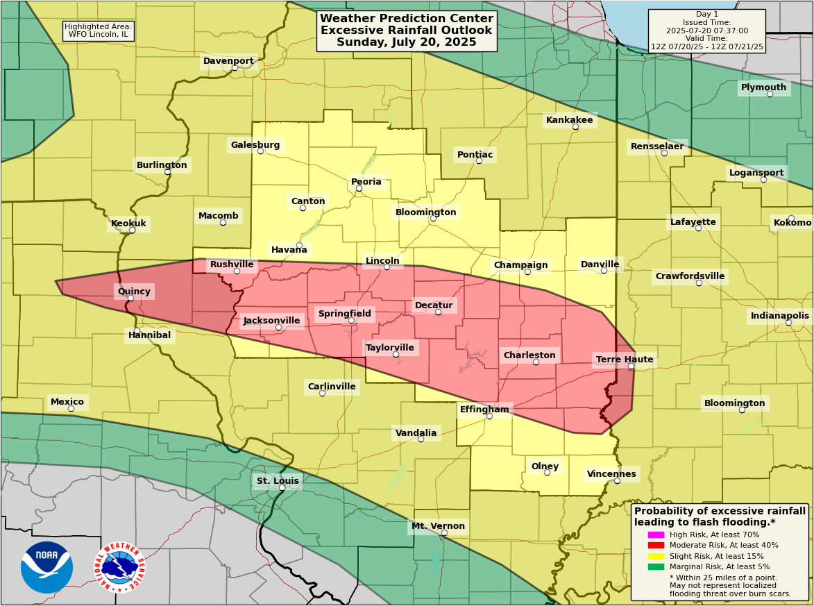
While flash flooding may not be as widespread as it was in Iowa, it does look like we could see isolated pockets from northern Missouri into the Indianapolis, Cincinnati, or Louisville areas that see anywhere from 3 to 5 inches of rain later today. This could produce rapid onset flash flooding in spots. It’s a good day to be alert if you live there or your travels take you to those areas.
You can see the combination of a building heat wave (extreme heat warnings in effect in Kansas and Missouri south to near Memphis) bumping up against flooding risks (green indicating flood watches) in the Midwest. A very hot, swampy type situation for much of the middle of the country today.
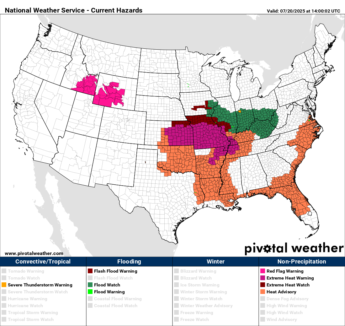
Heat advisories ring the Southeast today from Oklahoma, Arkansas, and Louisiana, along the Gulf Coast to Florida and up into eastern North Carolina. Expect to see advisories and excessive heat messaging for the next 7 to 10 days across much of the country.