Headlines
- As of 7 pm CT, Francine has become a hurricane in the Gulf of Mexico with 75 mph sustained winds
- The storm will likely make landfall as a Category 1 or Category 2 hurricane on Wednesday afternoon near Morgan City or Houma
- The center of the storm will likely pass between Baton Rouge and New Orleans, bringing its strongest core of winds there and to the east
- New Orleans should fall on the right side of the storm, facing the most significant storm surge from Francine
Francine status
At 7 pm CT Tuesday evening, Francine was moving to the northeast at 10 mph. The hurricane has seen both its winds increase as well as its central pressure fall to 982 millibars. The later pressure fall is an indication that further strengthening is possible during the next 16 to 20 hours before Francine reaches the Louisiana coastline.
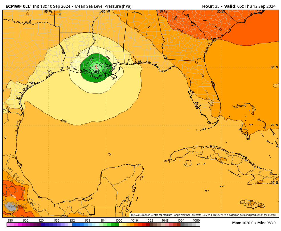
Confidence is high in the track forecast for Francine, with all of our best available models in agreement that the center will come ashore and then likely split the difference between Baton Rouge and New Orleans. While some minor track changes are possible, at this late hour they are likely to be modest. In terms of intensity, most of our guidance points to a Category 1 or 2 hurricane. However, our confidence in intensity at landfall is lower than the track forecast.
Given all of this, a hurricane warning is in effect for the Louisiana coast from Cameron eastward to Grand Isle. A hurricane watch is in effect for Lake Maurepas and Lake Pontchartrain, including the New Orleans metro area.
Francine impacts
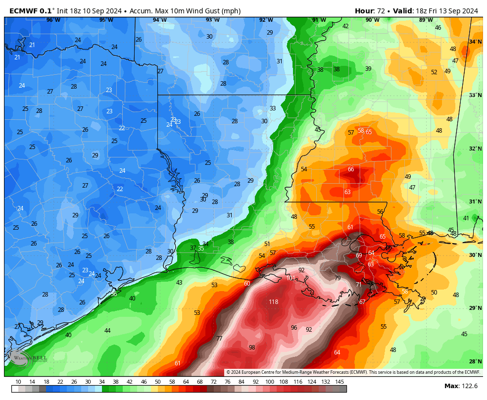
The hurricane will bring all three major components of storm damage to southern Louisiana: high winds, inland rainfall, and storm surge. Staring with winds, it is likely that the core of strongest winds will now pass near, or even directly over the New Orleans area. This map of maximum wind gusts from this evening’s run of the European model gives an indication of where the strongest winds will occur.
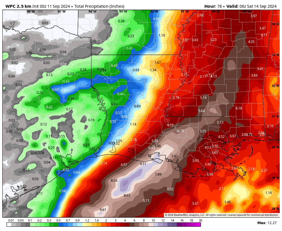
In terms of rainfall, the heavier rains may fall a bit west of New Orleans, which would help with flooding issues in the city. Nevertheless, predicting precisely where the most intense rainfall will occur during a hurricane is an impossible task. The only good news I can offer is that Francine will have a healthy forward motion, and will be exiting the area to the north by late Wednesday night. This should help provide an upper limit on inland rainfall and associated flooding.
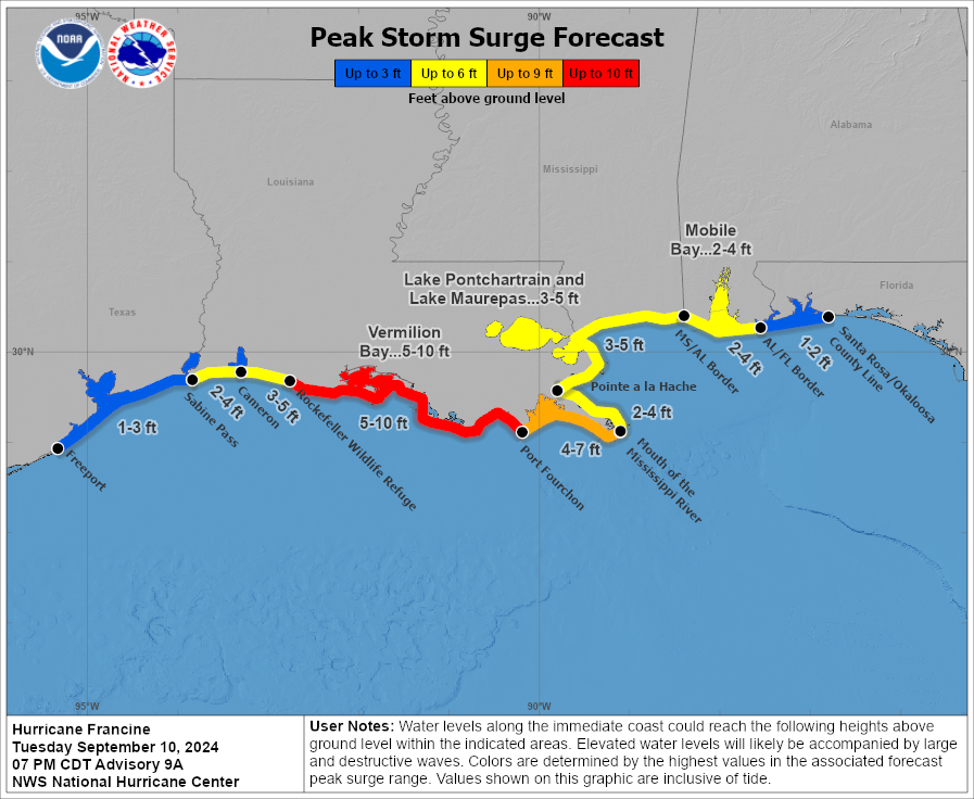
The following storm surge map is based on the National Hurricane Center’s forecast, issued at 4 pm CT on Monday. I would expect the surge levels for the Mouth of the Mississippi River and Lake Maurepas and Lake Pontchartrain to increase a bit in subsequent forecasts. However, these do not appear to be surge levels that will promote catastrophic flooding in the New Orleans metro area.
In summary, this certainly will not be the worst hurricane to ever strike the Louisiana coast. However, even Category 1 storms are unpleasant. Wednesday and Wednesday night will be a time to take shelter in the region.
We will have a comprehensive update on Hurricane Francine early Wednesday morning.
Thanks Eric ⚘
You need some serious nice 💤s. Definitely earned them.