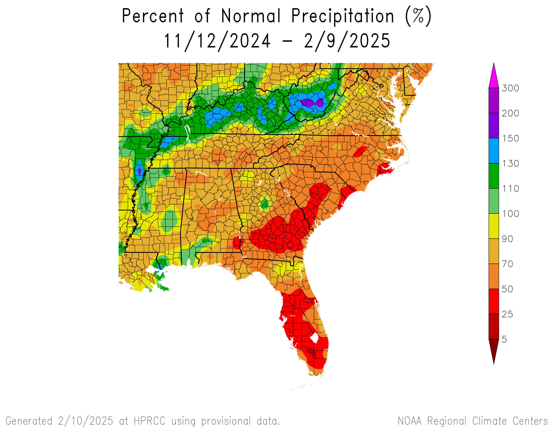
We’ve been talking about this shift to a very active weather pattern across the Eastern U.S. for a while now. It’s been mostly in the context of wintry precipitation which has panned out with mixed results overall. Well, the signal now is pretty clearly that wave after wave of storminess is going to lead to a pile up in rain totals over the Southeast at large, specifically from about West Virginia through northern Louisiana. We’ve already seen some flooding in portions of West Virginia recently.
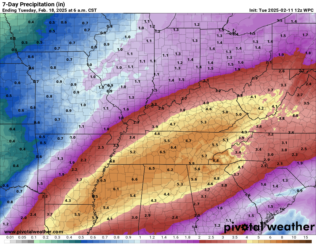
The first round of storminess arrives today with a second round tomorrow. A third round is penciled in for Saturday. Each round will bring widespread rainfall with embedded thunderstorms that produce even heavier rainfall. The forecast rain over the next 7 days is pretty impressive. NOAA’s Weather Prediction Center shows roughly 4 to 7 inches in a very broad area between southern West Virginia and northern Louisiana, with a bullseye from northern Mississippi into Tennessee.
Because of the antecedent conditions (or what ground conditions are like currently), a lot of this rain will be welcomed and absorbed into drier ground, with the exception of portions of West Virginia. That said, there will still likely be areas of flooding, and there are currently flood watches posted for some areas.
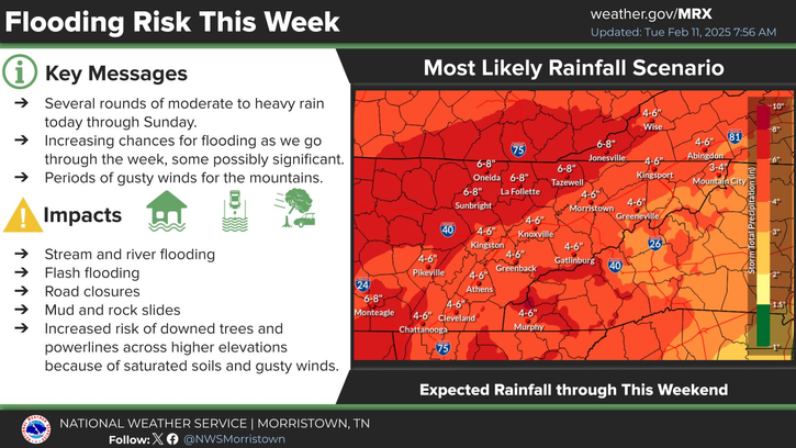
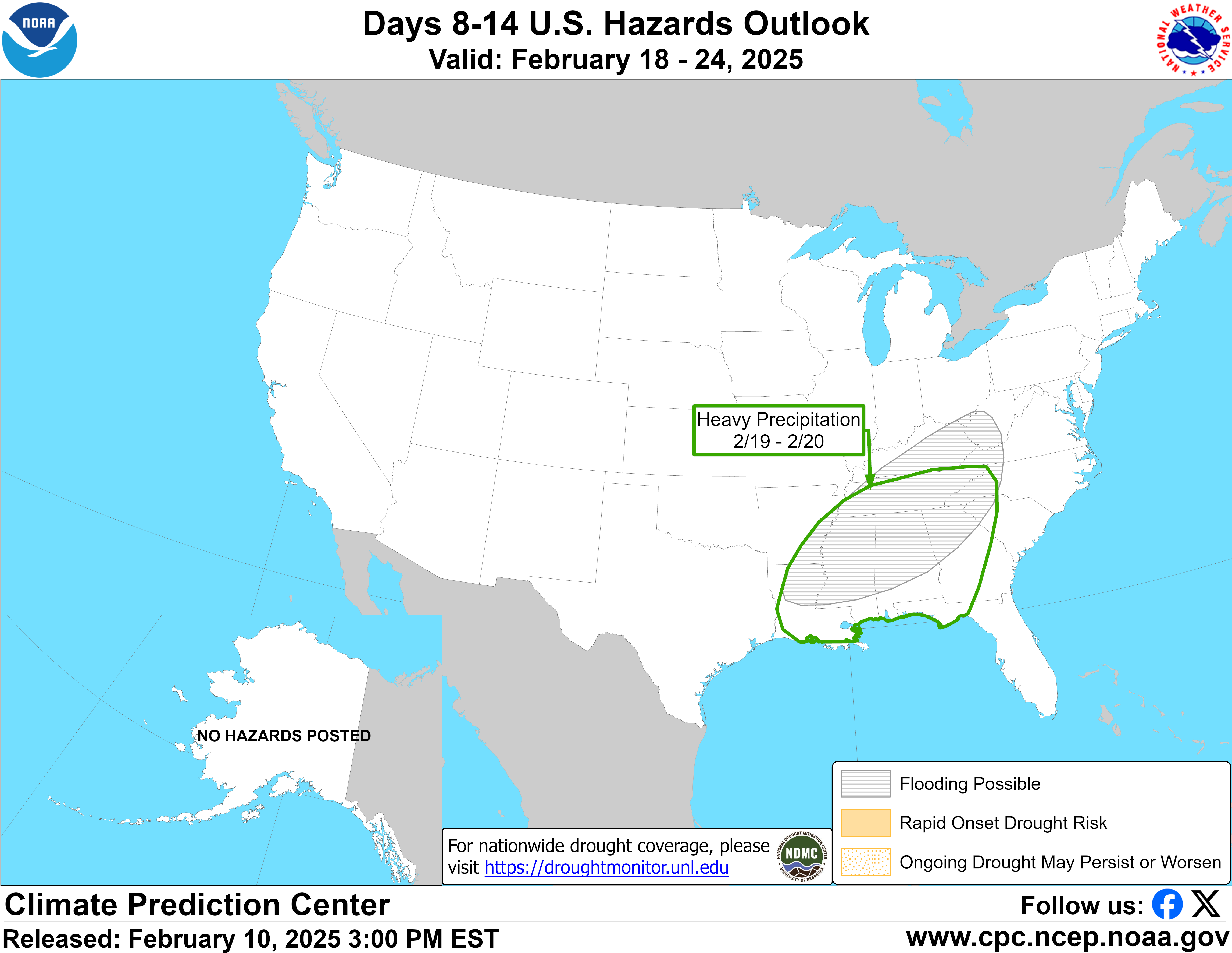
There can indeed be too much of a good thing, and it’s another round next Wednesday or Thursday that will probably be another one to watch. Models actually disagree on storm track and potential for wintry precipitation so there’s a lot here to unpack still. That said, it was enough to get a notation on the day 8 to 14 hazards outlook yesterday, with flooding possible.
I think the main takeaway here is that, while a lot of focus will be on the wintry weather to the north of these storms, the highest impact weather will likely be from multiple inches of rain that fall in the next 7 to 10 days or so across parts of the Southeast and the potential for flooding.
Southern California
A significant rainstorm is going to impact Southern California beginning later tomorrow and especially on Thursday. There is already a moderate risk (level 3/4) for excessive rain and flooding, but especially mudslide and debris flow concerns over recent burn scars. The trouble is less the total amount of rain but how quickly it falls. Especially on Thursday, there will be the potential for torrential rains in parts of the LA Basin, perhaps accumulating at the rate of an inch an hour or even a bit more in spots. If you live on the Gulf Coast, that may sound like weak sauce, but the reality is that type of rain over fresh burn scars and in a city with terrain can cause some pretty bad flooding issues.
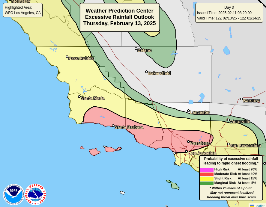
Total rainfall should be on the order of 1 to 3 inches with higher amounts likely in spots, especially in the foothills and mountains. Debris flows are a long-term concern after fires like the ones experienced around Los Angeles this year, so unfortunately the next couple years in particular will be challenging in those areas trying to recover.