In brief: Invest 98L should become Tropical Storm Melissa by later today. It is going to slam on the brakes and meander in the central Caribbean for several days, with potential to become a strong hurricane. It will also be a tremendous rainmaker for somewhere, depending on exactly where it stalls out. Interests from Jamaica and Cuba, across Hispaniola, and into western Puerto Rico should continue monitoring Invest 98L.
Invest 98L is on the cusp of becoming a defined entity this morning.

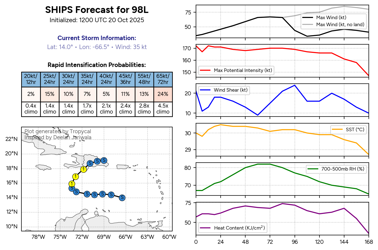
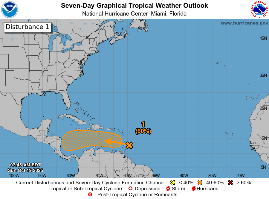
NHC odds are up to 100 percent for development, which based on the 4 semesters of Calculus I took in college, don’t get any higher.
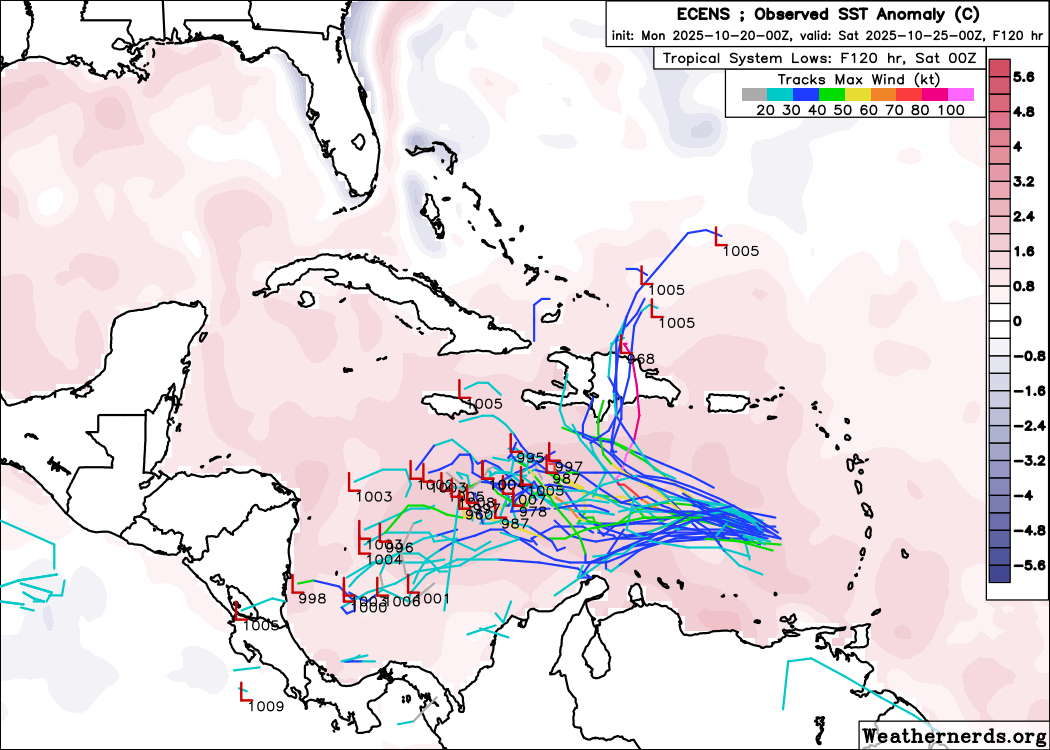
Over the next few days there should not be a whole lot to interfere with 98L’s organization. In general, we should see slow, steady development. There’s been no real significant change in SHIPS model guidance for rapid development, showing about a 4.5x chance of that compared to climatology over the next 3 days, mostly unchanged from Monday.
One inhibiting factor to 98L’s growth and development may be the presence of dry air on the west side of the system.
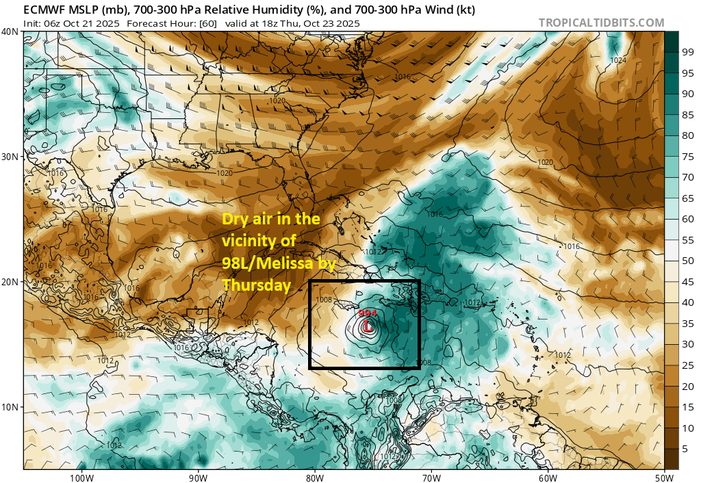
I guess the question is whether the core of 98L can insulate itself enough from this to more rapidly develop, whereas the broader circulation of the system may be a little lopsided and skewed to the east of the center. We’ll see about that.
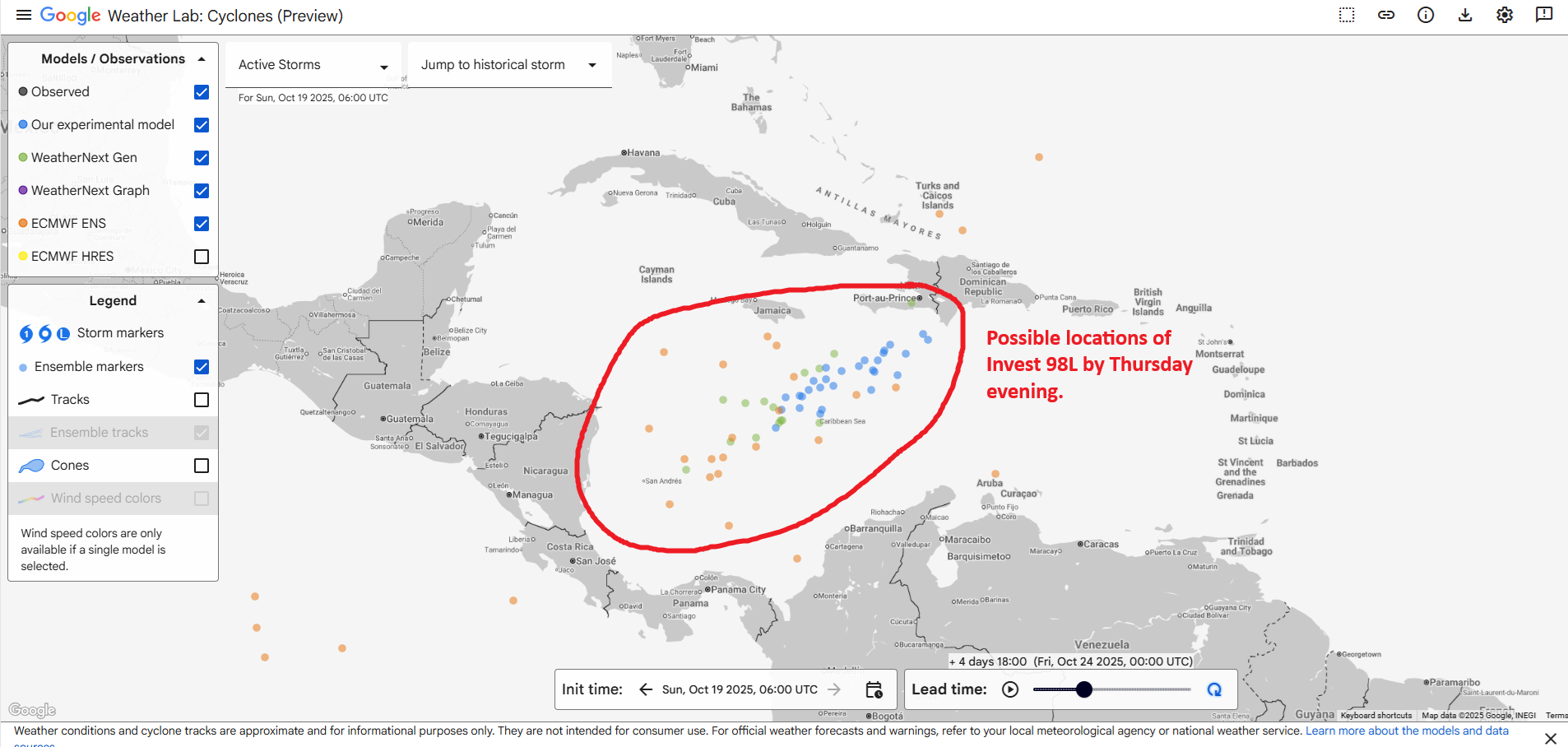
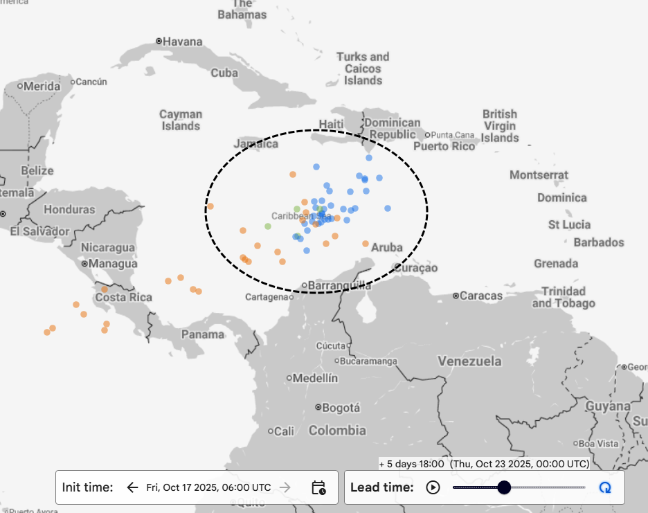
So with all that being said, what happens here? In terms of track and path forward, it appears that slower guidance may win out. Steering currents look meager at best, and 98L will probably be drifting westward now. Over the next 36 to 48 hours, agreement is decent in having a developing system drifting west or west-northwest to a position a few hundred miles southeast of Jamaica. From there, we stretch things out.
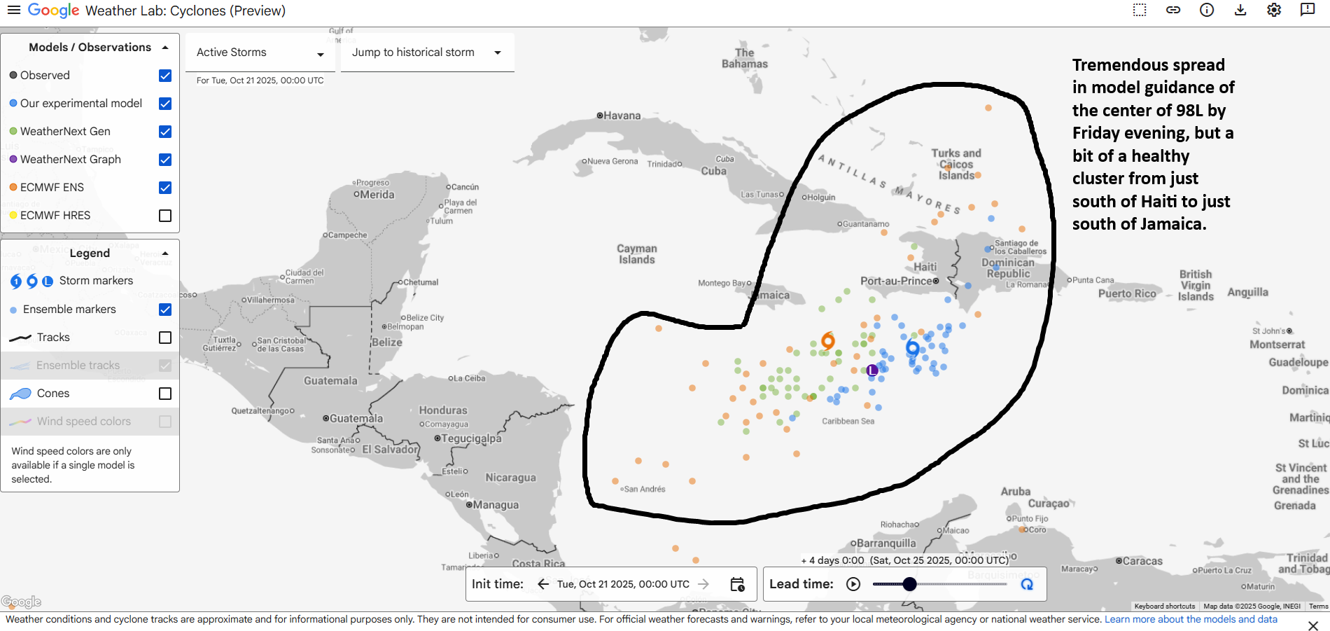
Now, that said, the red hot Google AI model seems to favor a position mostly south of Haiti, while the historically decent European ensemble is much more strung out between the Colombian isle of San Andres and the Turks and Caicos Islands. But even the AI modeling sees a widening spread in outcomes beyond Friday. A couple things do stand out in the model guidance today, the signal in the noise if you will. First, slow movement. The system is going to meander it appears, and I think the idea of a rapidly turning and moving storm into the Turks and Caicos by Friday or Saturday is unlikely at this point. Second, intensification. It would seem that with slower movement over a toasty Caribbean will produce steady intensification over the next 5 days. Rapid intensification is possible. We could be looking at a major hurricane by the weekend sitting somewhere south of Hispaniola or southeast of Jamaica.
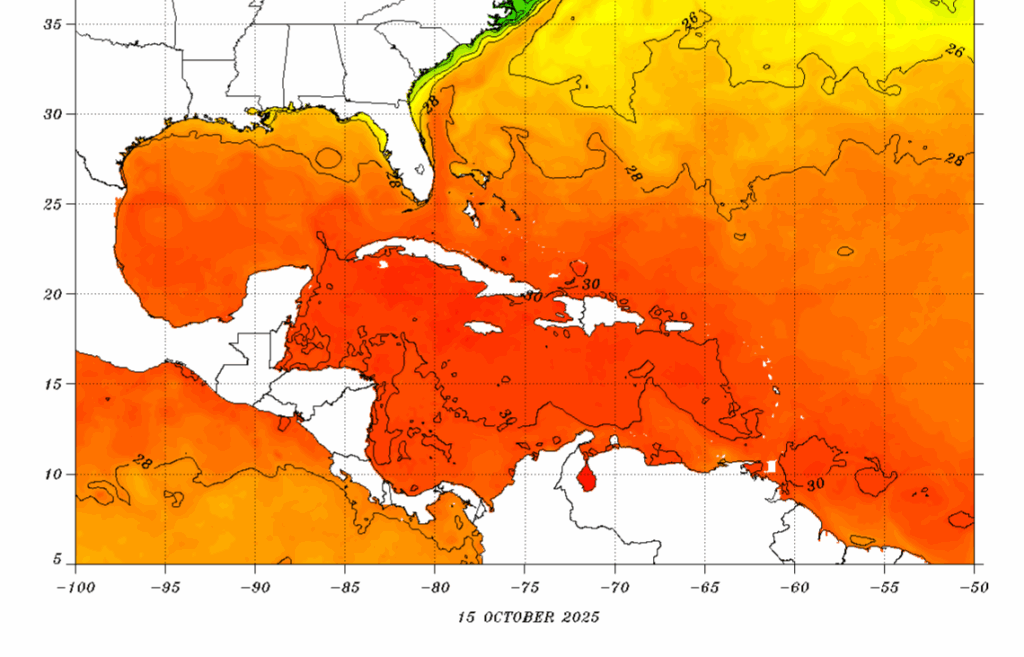
An aspect that needs to be addressed? Rainfall. The stall position will have a tremendous impact on how much rain falls in parts of the Caribbean. For example, the European model stalls the storm east of Jamaica and drifts it west through day 7. Thus, you see a substantial amount of rain (8 to 12 inches or 200-300 mm) in eastern Jamaica, southern Haiti, and the southern Dominican Republic. If the storms stalls closer to Hispaniola, you could be talking 15 to 20 inches of rain or more in spots there.
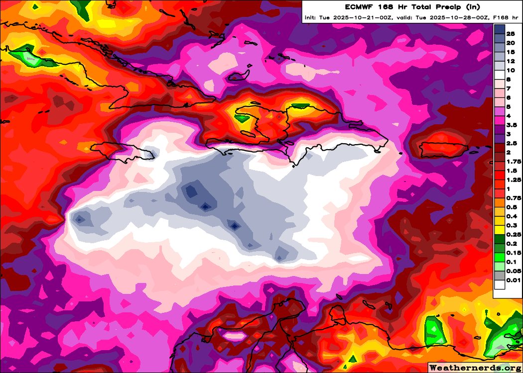
So, I think we need to prepare for the potential for severe flooding and mudslide issues in parts of the central and western Caribbean by this weekend.
Bottom line today? Expect a tropical storm (Melissa) by later today. A slow moving storm is likely in the Caribbean. It is possible that a major hurricane can form from this. Regardless of development, major rains are possible, if not likely in portions of the Caribbean, particularly for eastern Jamaica, eastern Cuba, and Hispaniola. Eventually, this system should track north and east out of the Caribbean and into the open Atlantic, but that may not be until next week sometime.