In brief: Gabrielle is looking better this morning, as it begins to slowly develop and organize in the open Atlantic. It should pass east of Bermuda but still bears some watching. Plus, today we dig in on the Caribbean battle in about 10 days between AI models and traditional weather models.
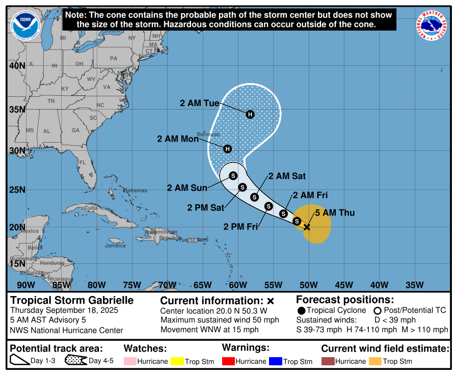
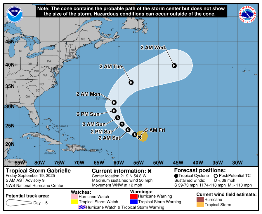
Tropical Storm Gabrielle
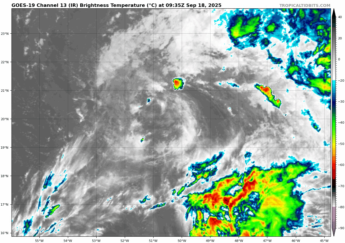
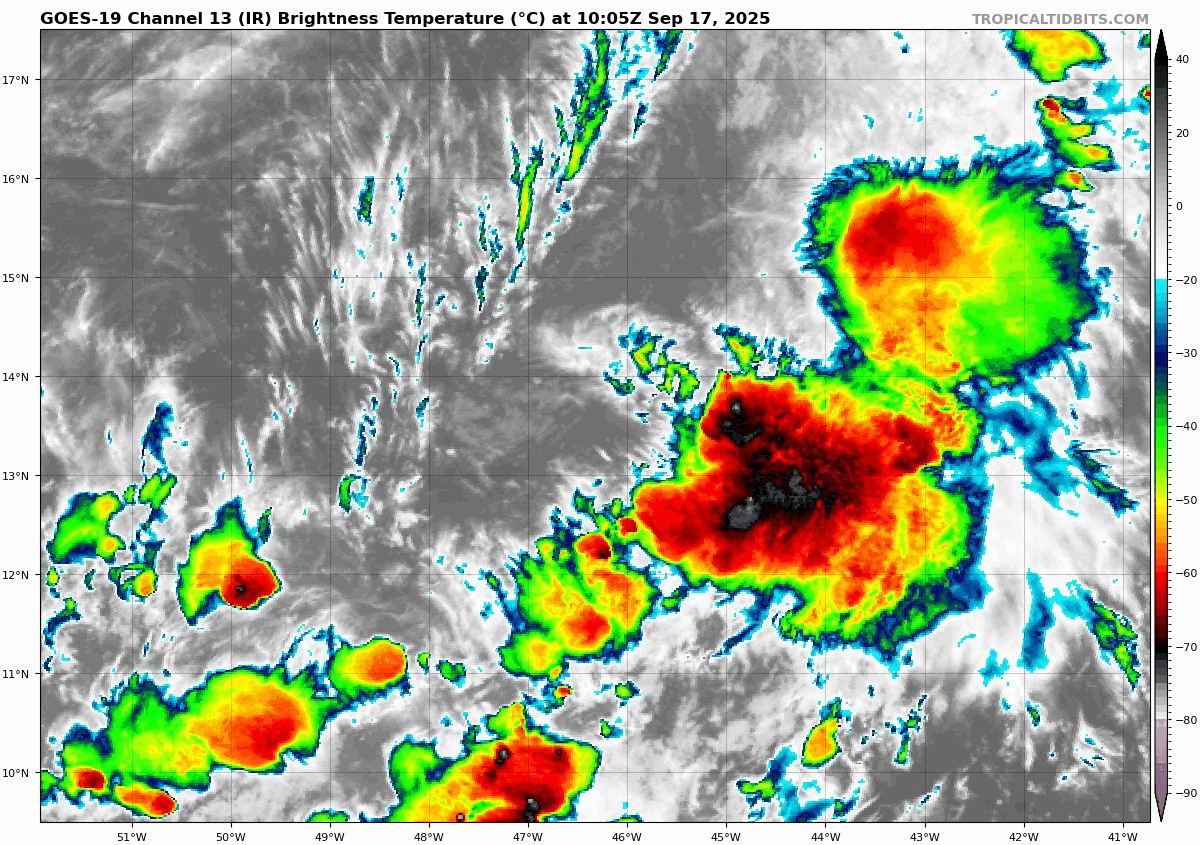
Compared to yesterday at this time, Gabrielle looks phenomenal. It seems to have fought off most of the serious dry air issues. Now, it’s dealing with some lingering shear. So it’s still a bit “blobby” in nature, but that area of significant thunderstorms just east of the center has been persistent, usually a sign that a storm is trying to get better organized.
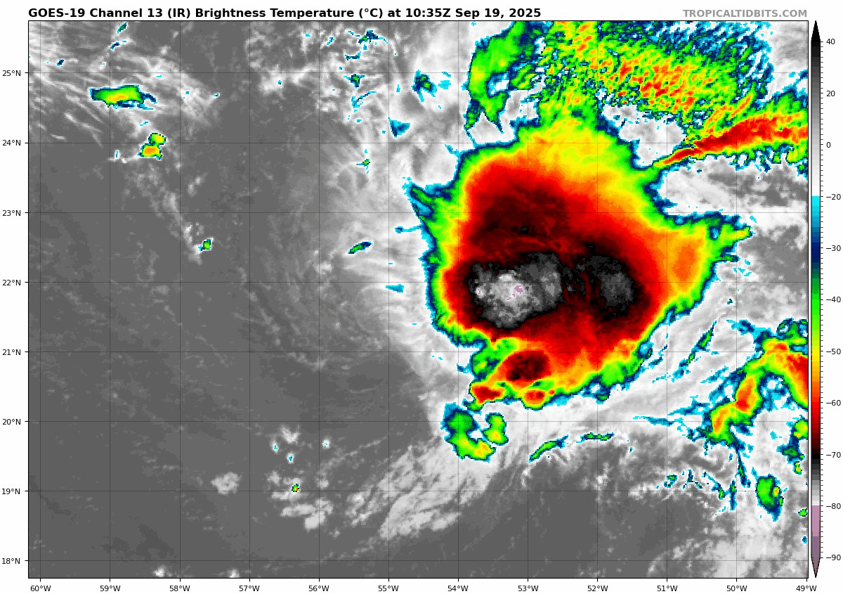
When you look at the satellite loop above, I mean, you can still very clearly see the wind shear issues it is putting up with. But that shear is expected to slowly ramp down as Gabrielle finds its way northwest over the next couple days. This should lead to organization and intensification, and Gabrielle is forecast to become a hurricane by Sunday. There is a slight chance that Gabrielle may even make a run toward major hurricane intensity by late Sunday or Monday. In fact, SHIPS model guidance is over 4 times higher than climatology for rapid intensification of a 75 mph wind increase to occur over the next 72 hours. We’ve seen higher odds before, but that’s still rather healthy, all things considered.
In terms of track, the NHC track is close in line with the vast majority of model guidance that currently keeps the storm east of Bermuda. You should still be monitoring this system if you have interests in Bermuda. But right now, it does appear to be a swing just east. More to come on this.
Elsewhere
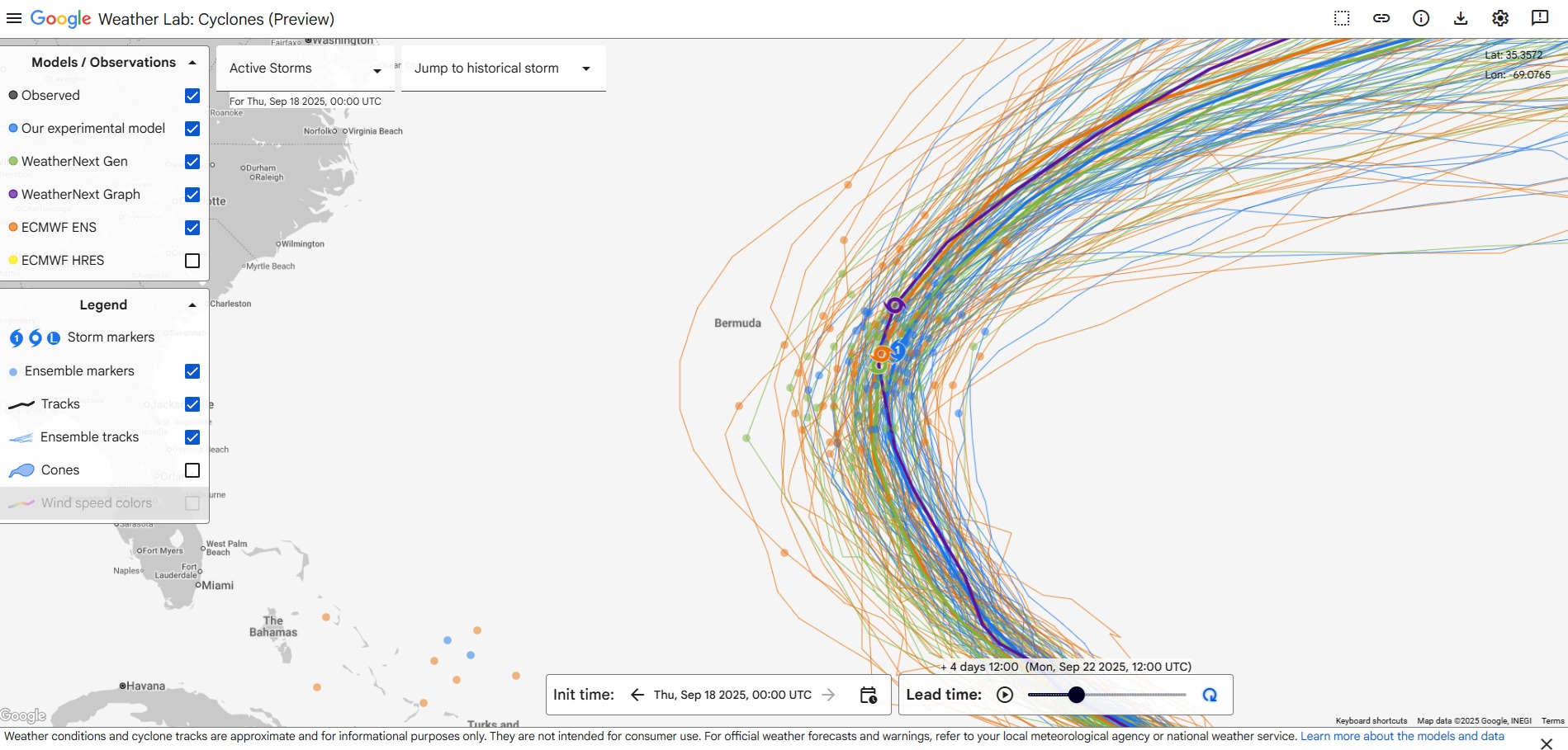
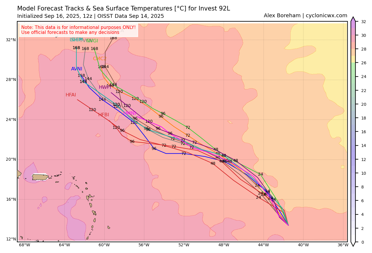
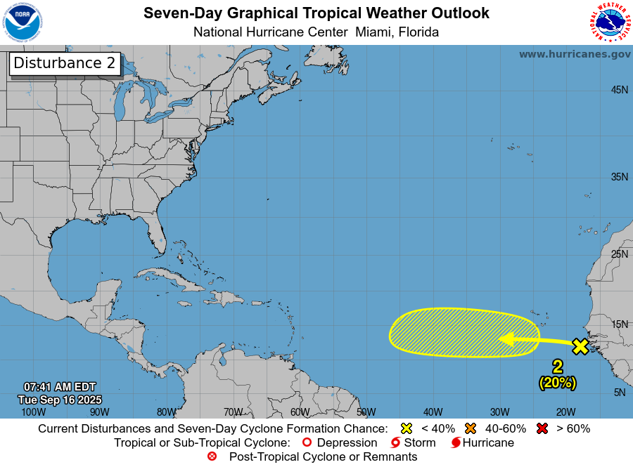
The wave behind Gabrielle with 20 percent development odds is of minimal interest right now. What is more interesting is this battle that’s playing out between AI modeling and classic, physics-based modeling for next weekend and beyond in the northwest Caribbean. If you look at the two model ensembles (Google Deep Mind vs. the European ensemble), you can see a clear deviation in excitement around September 29th.
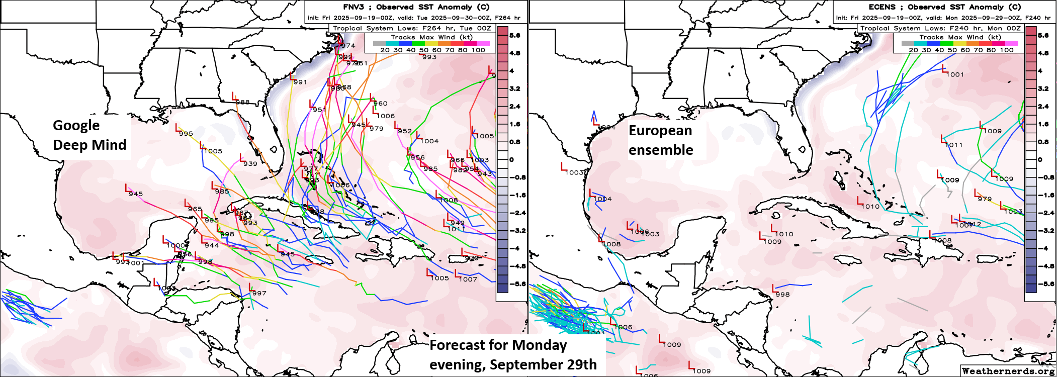
The AI model suite is very, very excited about potential development in the northwest Caribbean to close September. I show Google Deep Mind above, but if you look at other AI modeling, including the European AIFS ensemble, you get a similar pulse of enthusiasm. Traditional, physics-based models are not as enamored with this setup and keep any developments confined to a couple rogue ensemble members.
I will say, if AI modeling has had a bit of a mixed bag of results this summer, it has come with “genesis” forecasts like this; where you can’t quite determine the specific disturbance that will develop but the models are very excited. They have had some moments, but they have also had a rather high genesis false alarm rate. Climatology changes in late September and October, and this is a favored area to watch, so from that point of view, you have to at least consider it may be seeing something. Or perhaps it’s a little too overzealous based on history, which is the bread and butter of AI modeling and wants to get things started with a bang. For now, this is not really an area to worry about or even monitor closely. But it’s an area we’ll be watching, and we’ll be very curious to see how the AI tools handle this as verification rolls forward.
Going to leave it there today. More to come this weekend!