In brief: Invest 94L has bitten the dust in the Atlantic. A Gulf tropical disturbance shouldn’t develop, and it will be only a modest rainmaker for the Gulf Coast. Flooding risks focus on the Duluth area today with additional heavy rain chances on the periphery of the heat wave heading into next week.
Invest 94L outta here
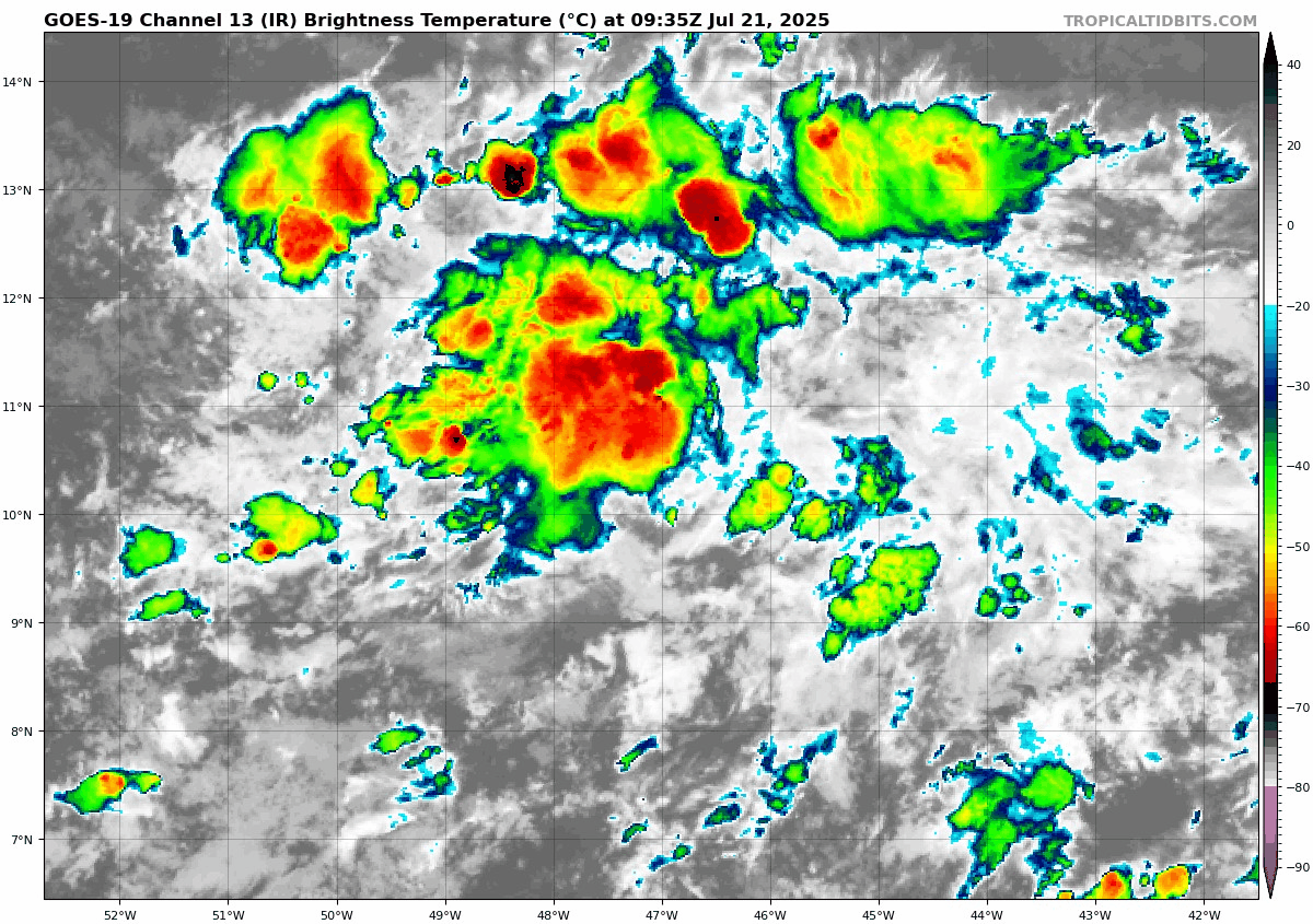
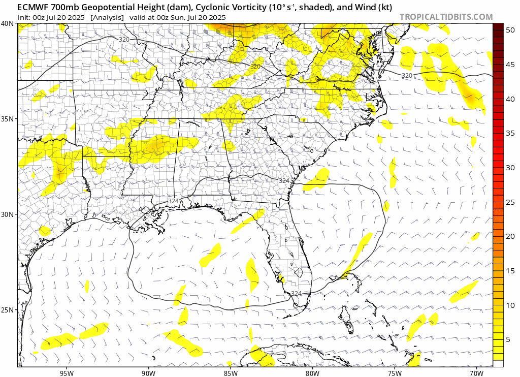
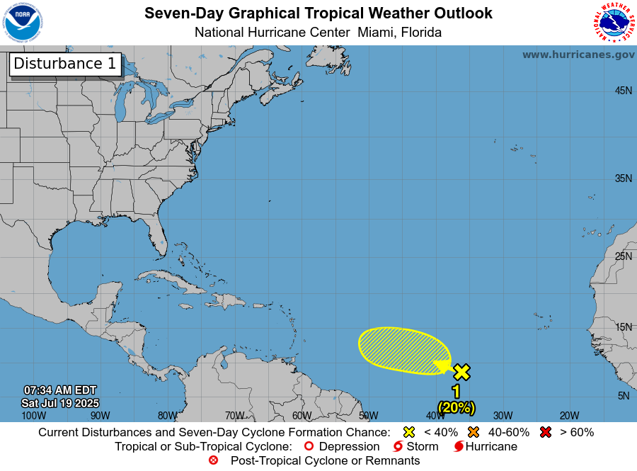
In the tropics, Invest 94L is out of time in the open Atlantic. It’s been declassified, and the NHC has removed it from their outlook map this morning. It will soon run into a much too hostile environment for development, and at worst we’re looking at some added rain showers in the Windward Islands today and tomorrow. With that, we’ll close the book on Invest 94L. Thanks for playing.
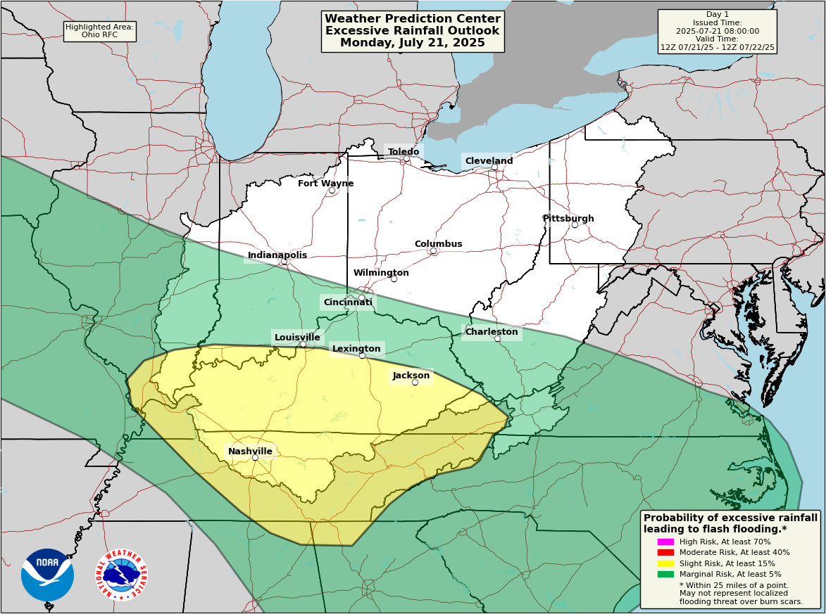
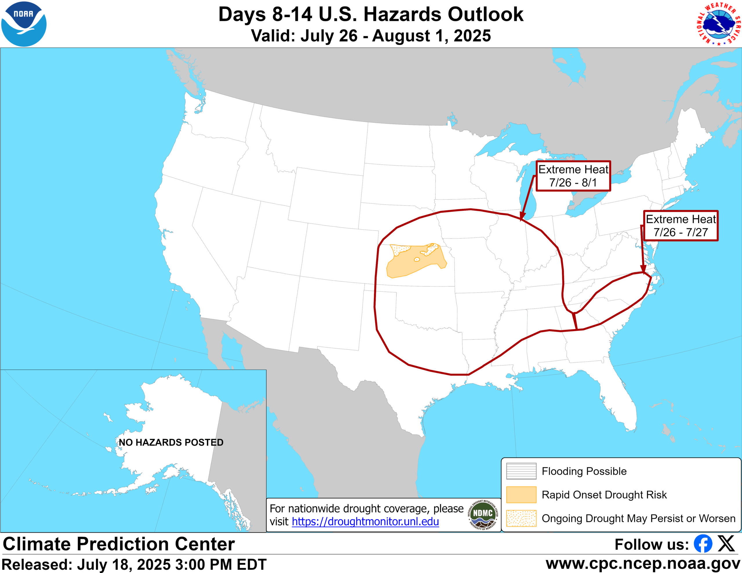
Gulf tropical disturbance a modest rainmaker
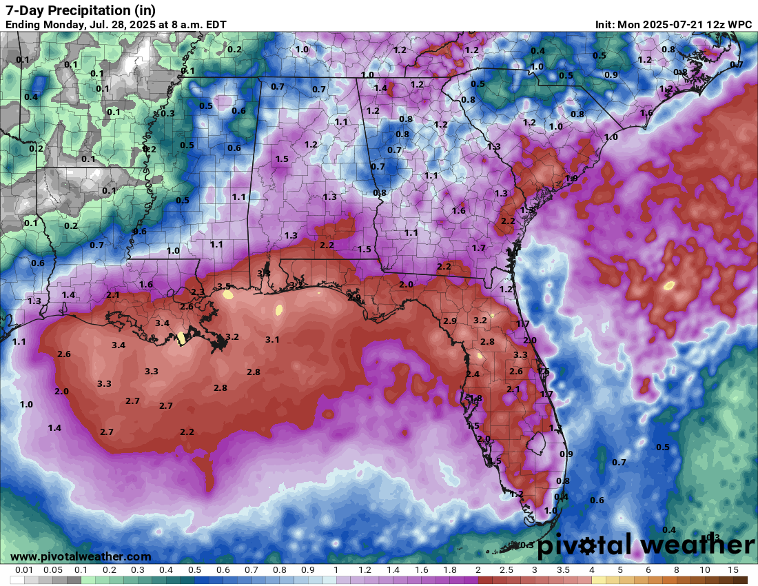
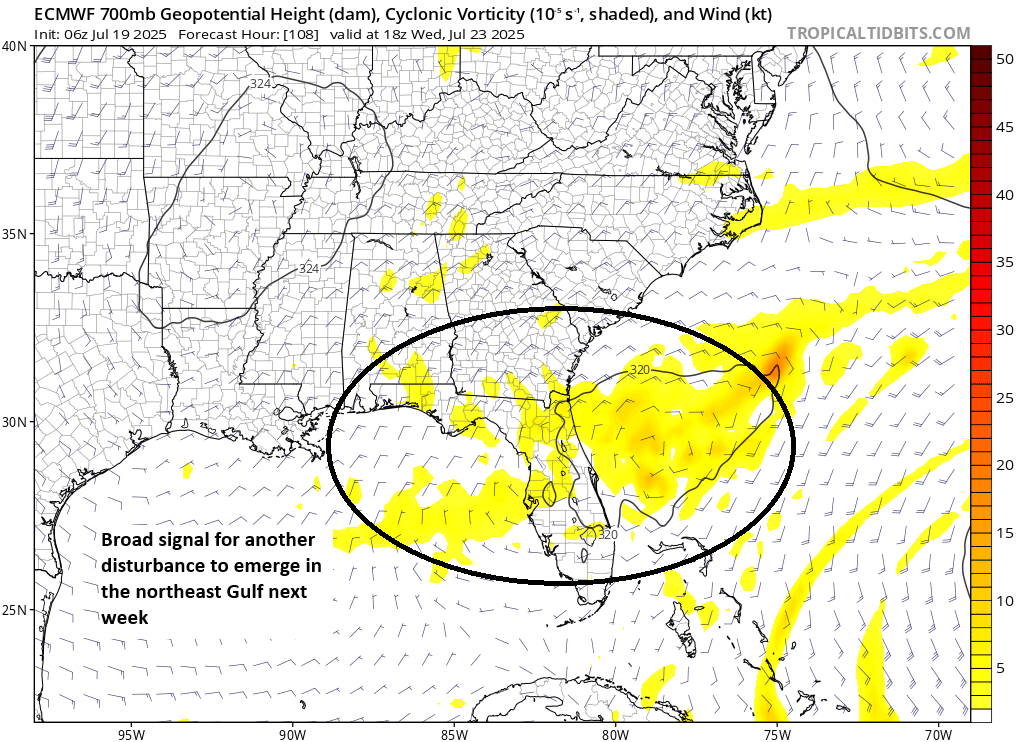
The odds of a Gulf tropical disturbance becoming anything are so low right now that the National Hurricane Center isn’t even tagging it on their daily tropical weather outlook. But we’re focused on impacts, and while the impact from this disturbance won’t be substantial, it will bring a fair bit of rain to the Gulf Coast and Florida.
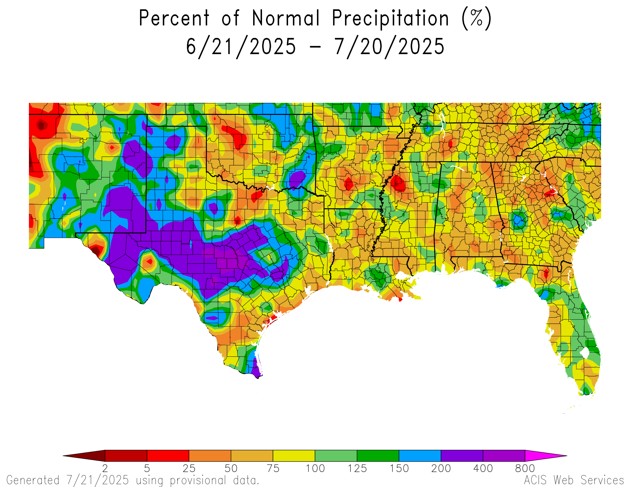
While Louisiana has certainly seen a good bit of rain in the last week or so, and isolated pockets of Florida have been hit good, the majority of the region between Corpus Christi and Pensacola have been fairly blah over the last 30 days with nothing worse than isolated pockets of locally heavy rainfall. Rain totals increase some if you go back about 60 days, but still. Although there’s a good chance of some decent rain along the entirety of the Gulf Coast as the resurrected disturbance circles back in, there’s also a fair bit of breathing room to accommodate that rainfall in most cases. This should keep flooding concerns not at zero levels but relatively low.
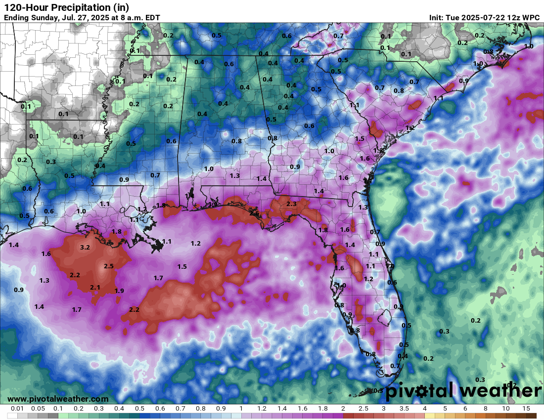
The disturbance should barge into Texas at the end of the week, cooling down the Houston area and bringing widespread rain chances to East Texas and possibly some inland locales. Some of this moisture may survive all the way across Texas and get lumped in with the monsoon pattern in the Southwest, perhaps adding a small dose of extra precip for places like New Mexico next week.
Upcoming Central U.S. flooding risks and the “ring of fire”
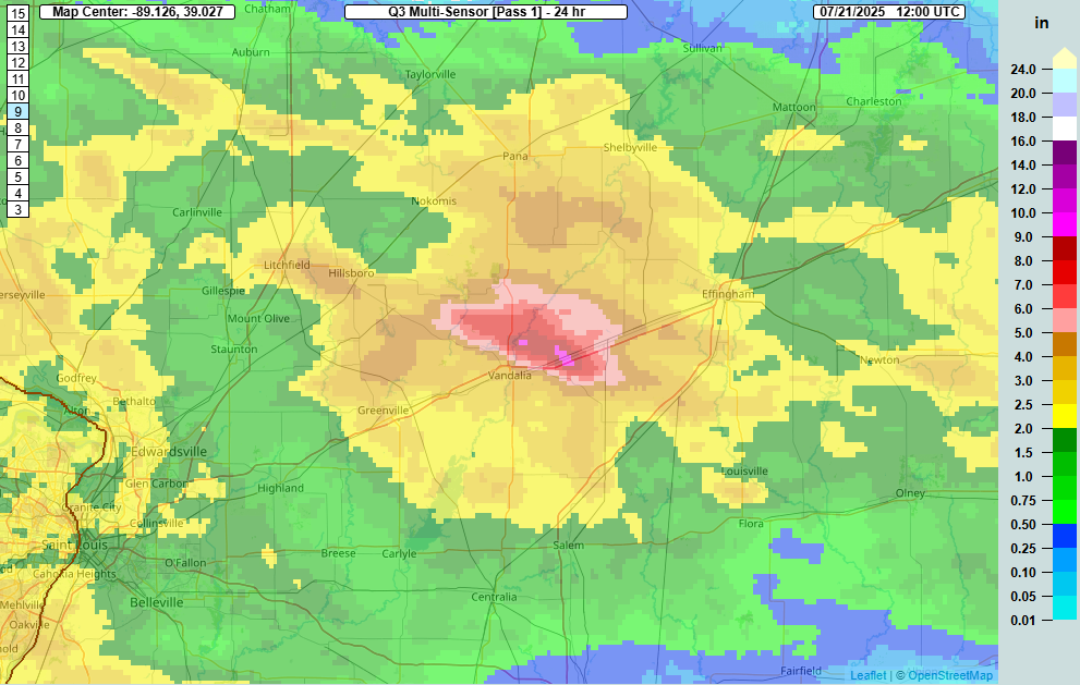
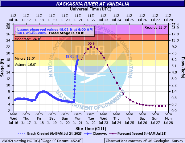
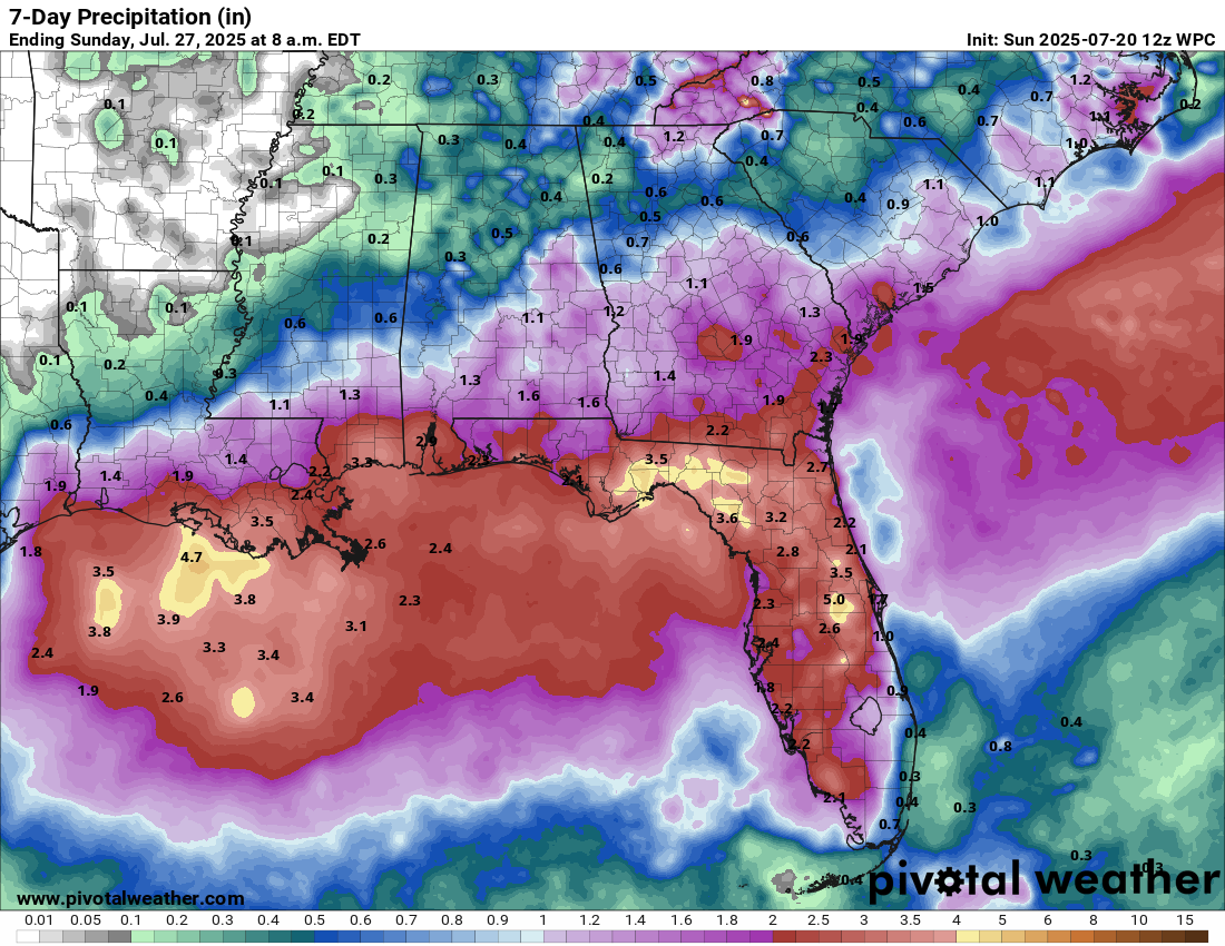
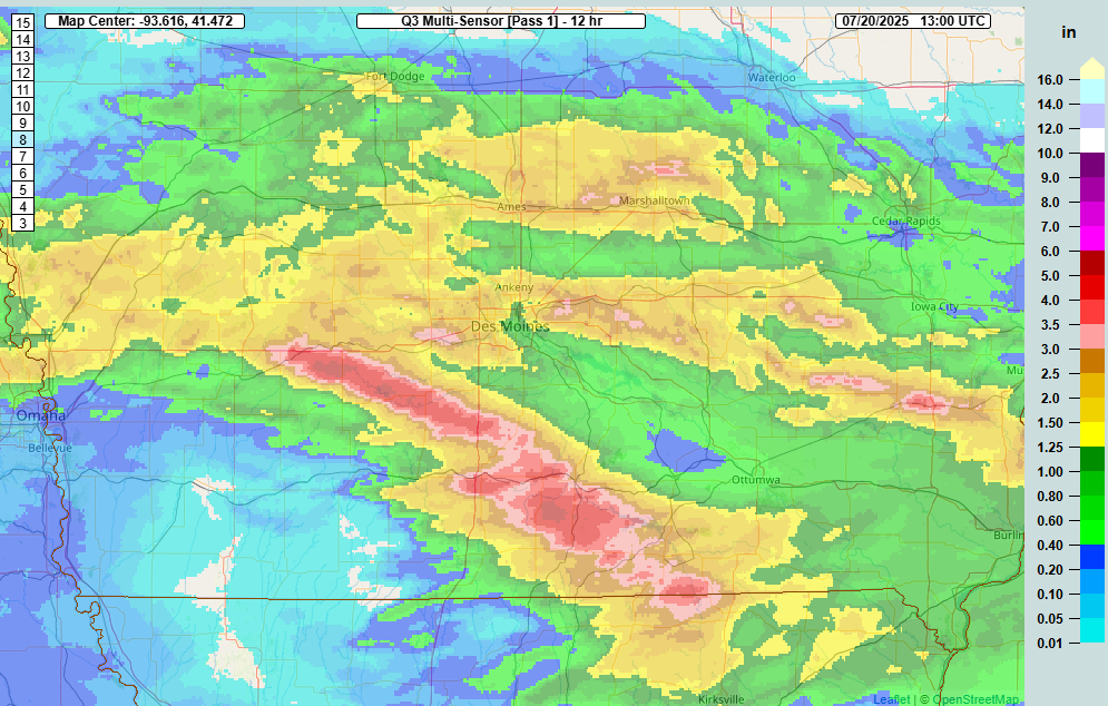
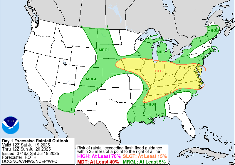
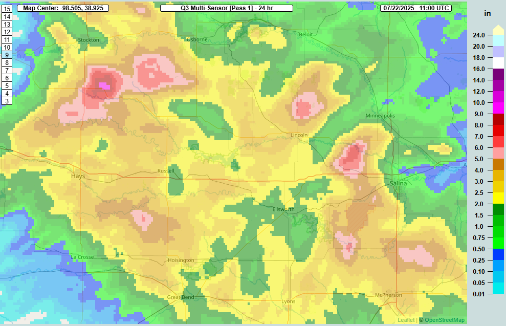
Even as dry weather is expected to take firm hold in the Southern Plains next week, Kansas got smacked with heavy rainfall yesterday, as rainfall estimates hit 3 to 7 inches or more from north of Hays to west of Salina.
As ridging builds into the Southern Plains next week, look for the axis of some of these soaking rain events to shift northward, more into Nebraska or the Dakotas, particularly South Dakota. We’ll have to watch adjacent locations like Iowa and northern Missouri as well for flooding, as they have seen some substantial rains in the last few weeks.
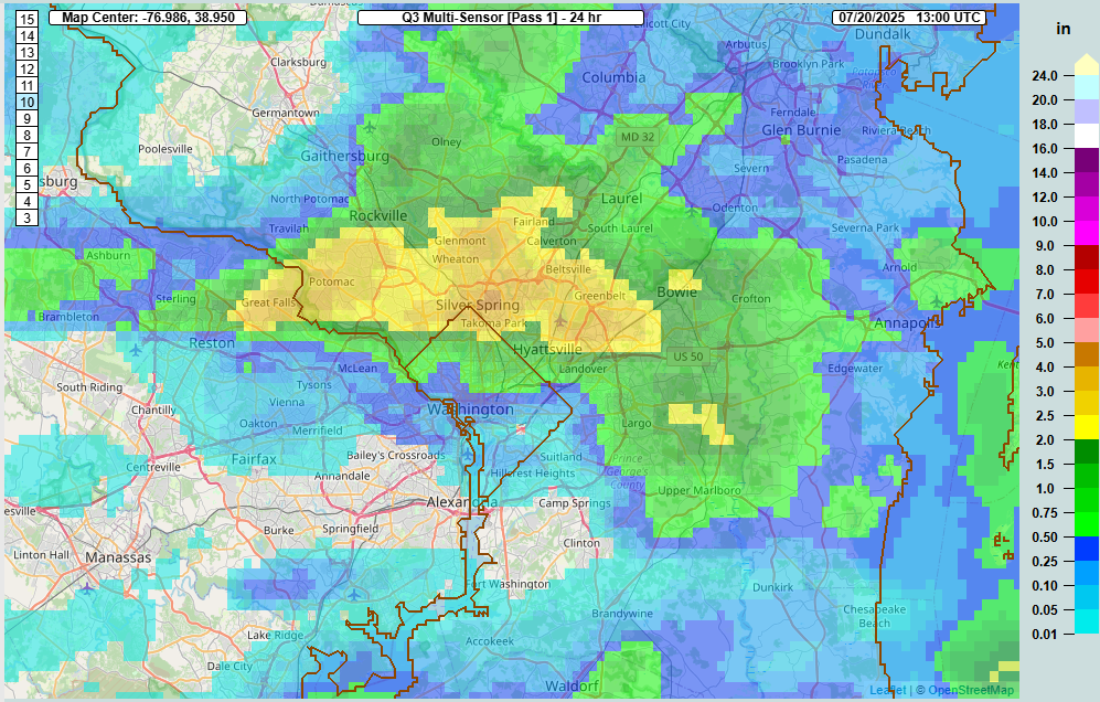
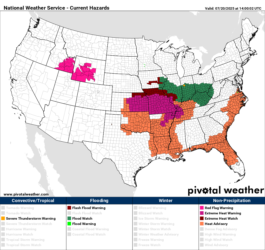
We may actually get an initial preview of this perhaps in Minnesota today and tomorrow, where weather models are pretty bullish on rain totals. Flood watches have been hoisted to include the Duluth area.
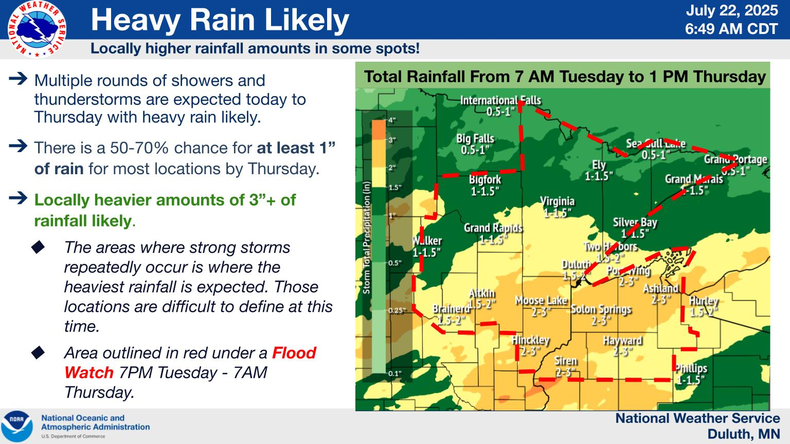
Storms will come in a couple waves between today and tomorrow up there. The flood story is not quite ready to go away.
Basically, the setup for the heat wave continuing into next week will help initiate the storm chances on the periphery. Thunderstorms will tend to follow the northern fringe of the ridge, what we often refer to as a “ring of fire” in meteorology. Look for this to be the case next week as the ridge blossoms in the Plains.
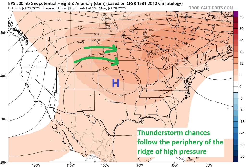
Thus, we could be talking both about some severe weather and a flooding risk in some of those areas.