Headlines
- A tropical disturbance and wave in the Atlantic may very slowly develop this week or next weekend as it comes west.
- There is no imminent concern of rapid development or risks to land at this time.
- Still, check back in on this through the week to ensure nothing has changed.
- No other development risks are seen at this time.
Tropical wave in the dust
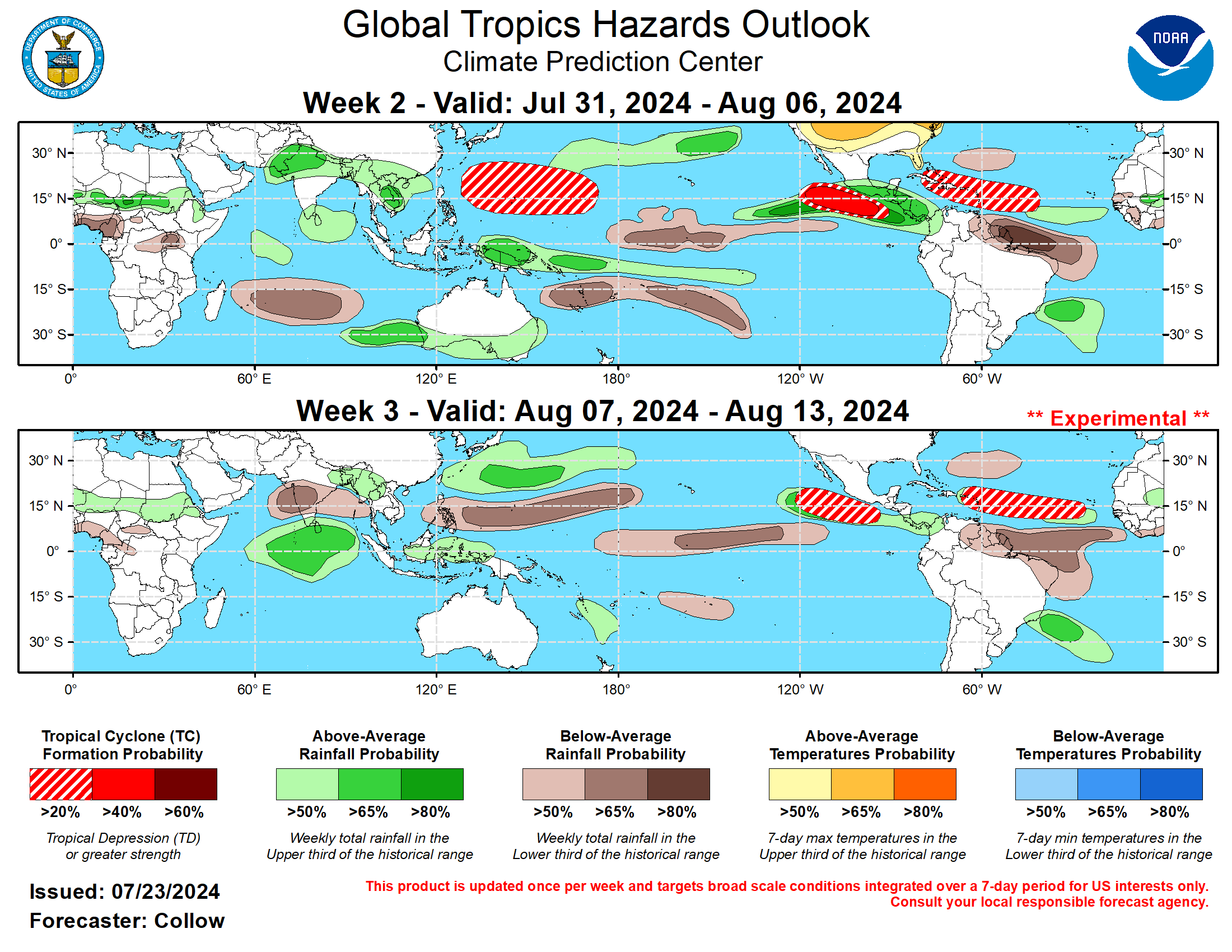
Rumors are swirling and hype is beginning around a tropical wave in the Atlantic that several models have shown developing into a system later this upcoming week or weekend. In fact, after my Friday post, the National Hurricane Center had it on their tropical outlook. Today, they’ve got chances bumped up to about 40 percent over the next 7 days.
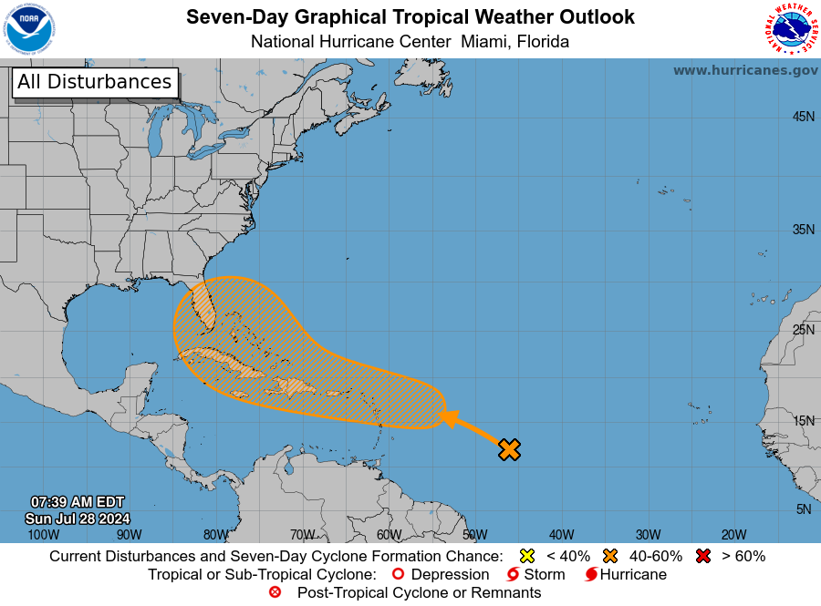
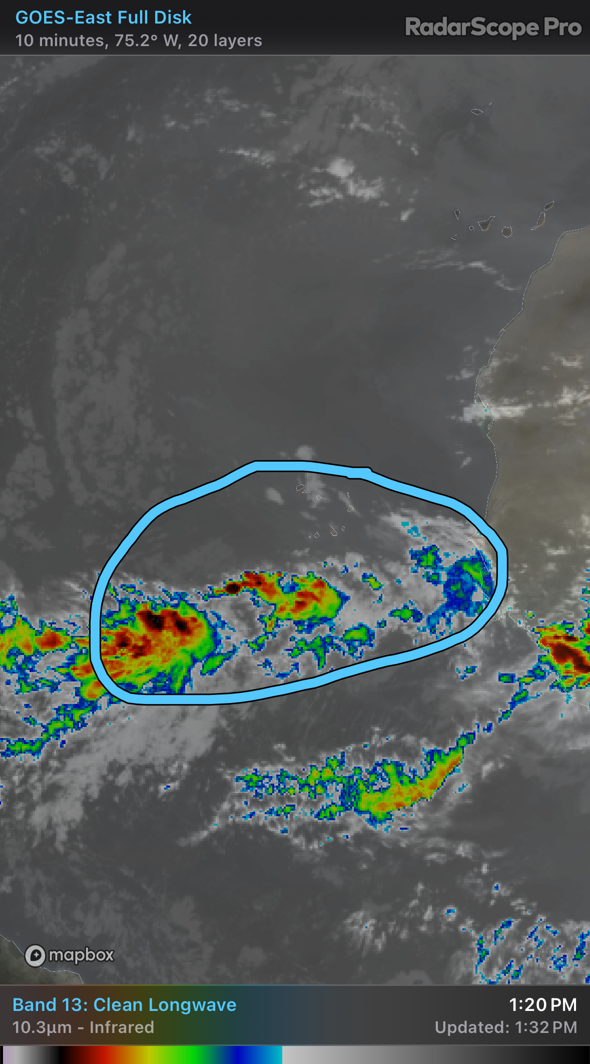
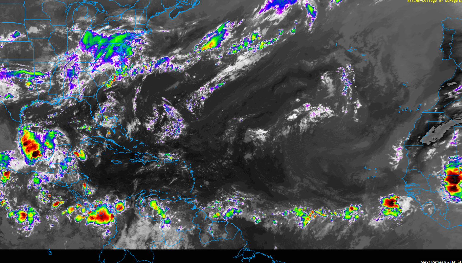
So what is it that we’re watching? Well, it’s this wave in the Atlantic, just southwest of the Cabo Verde Islands.
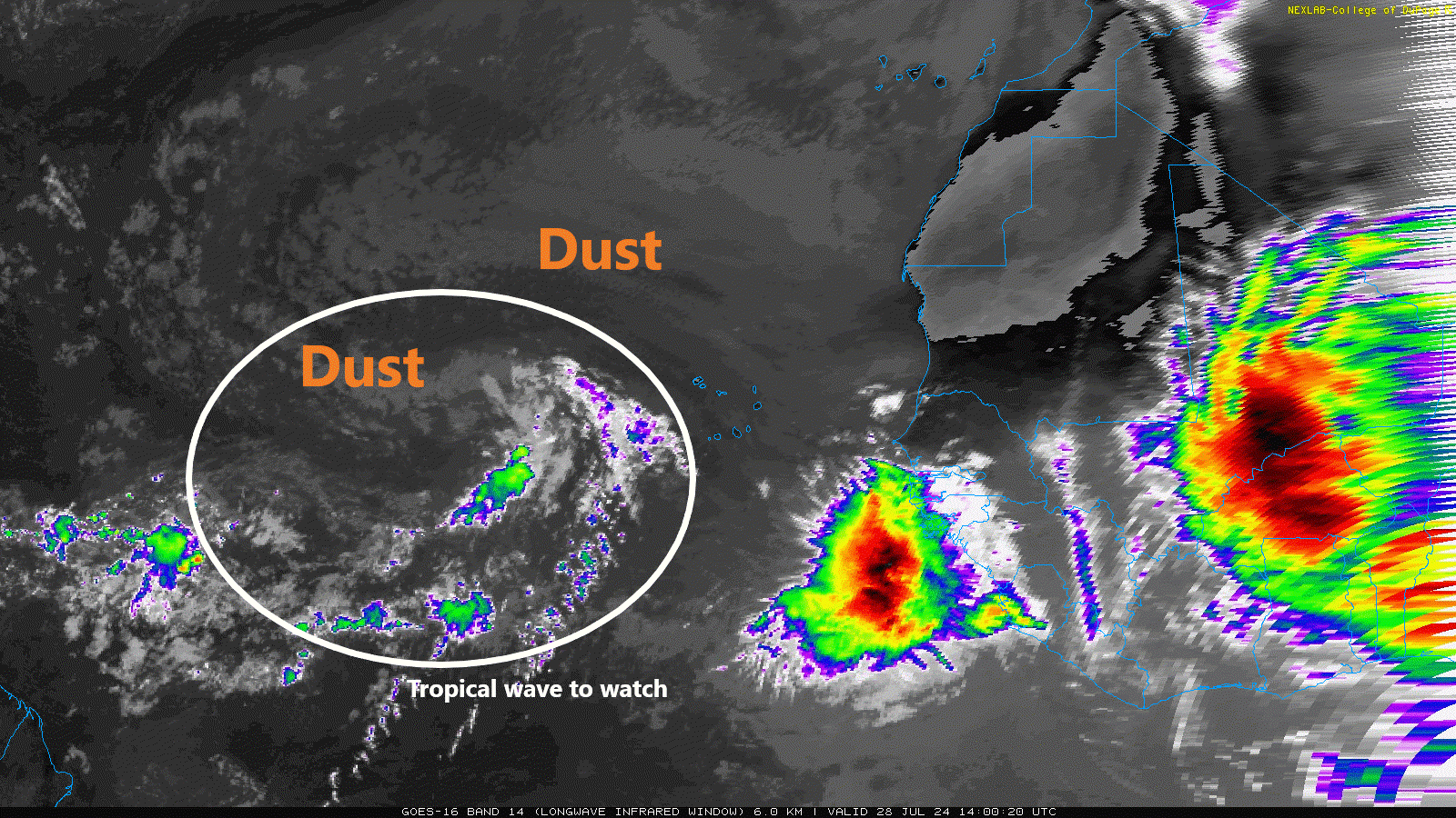
Admittedly, this doesn’t look like much at all. It’s being choked by Saharan dust right now, and it has little to no thunderstorm activity surrounding it for the most part. In fact, the wave emerging off Africa to its east looks far more impressive, though that one is likely to fizzle in the coming days. Meanwhile, this wave will migrate westward. By Tuesday evening, it should be just east of the Leeward Islands, still unlikely to have developed much at all.
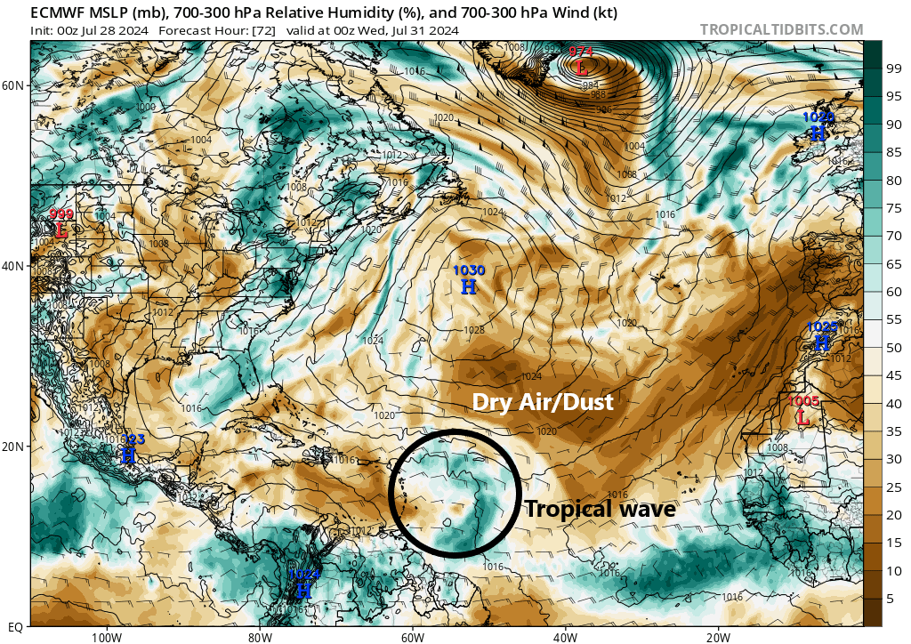
The system will still be essentially surrounded by dry air. It will also have to contend with a bit of wind shear. All in all, through Wednesday, it seems unlikely that this wave will develop much, and for the Lesser Antilles, Virgin Islands, and Puerto Rico this will not be one to create significant impacts.
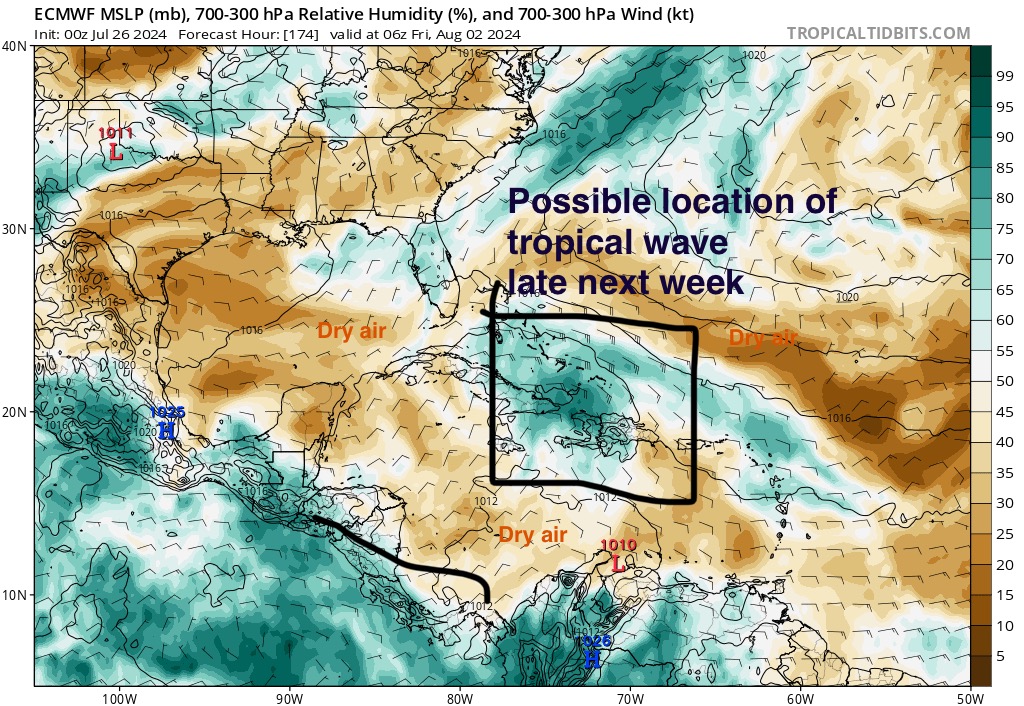
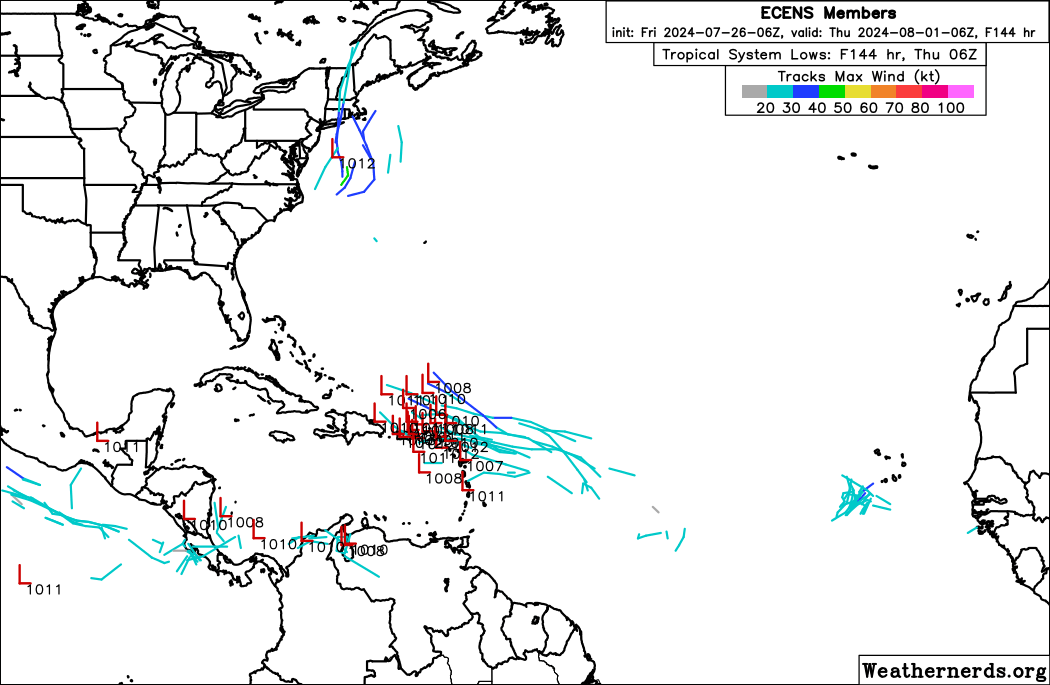
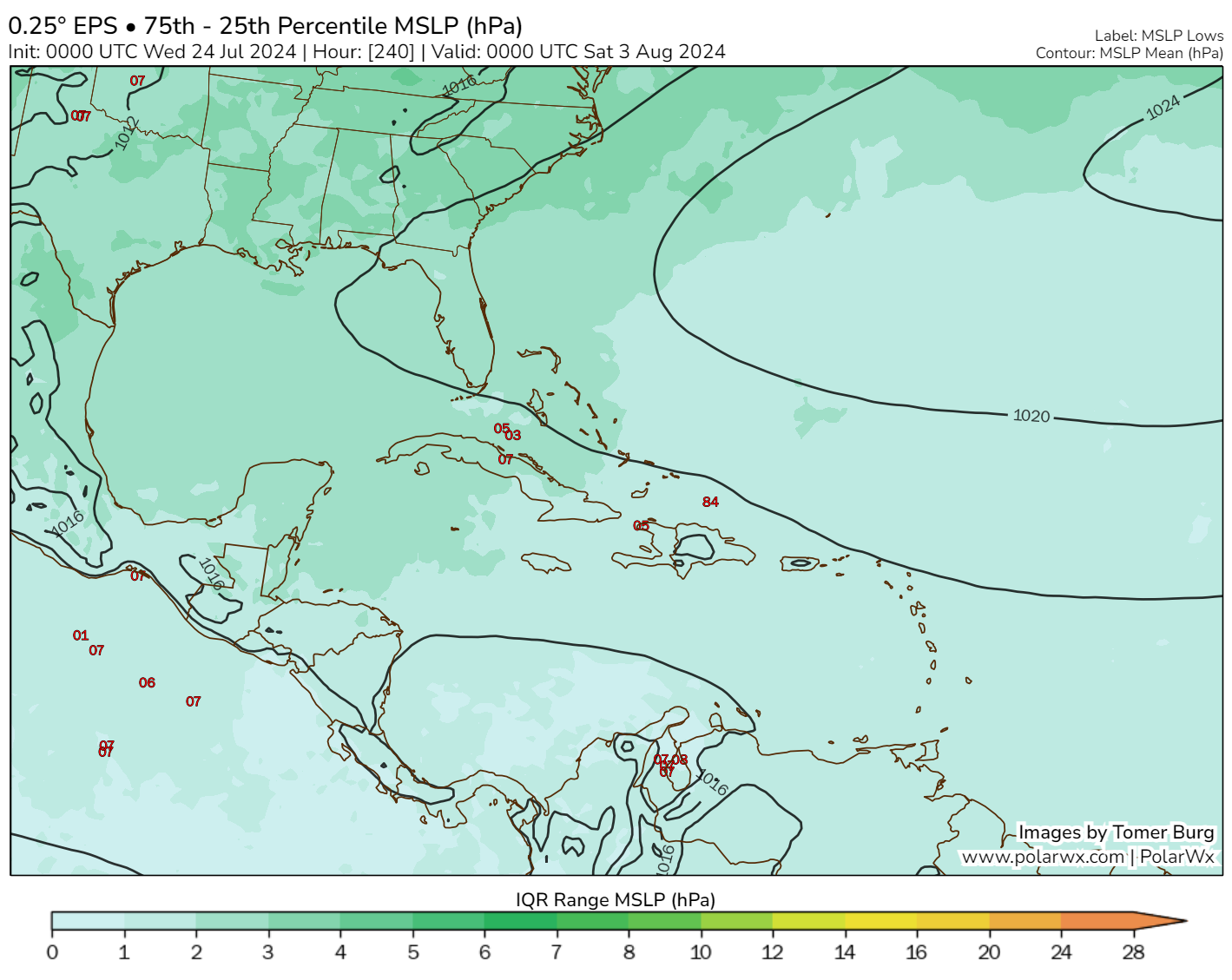
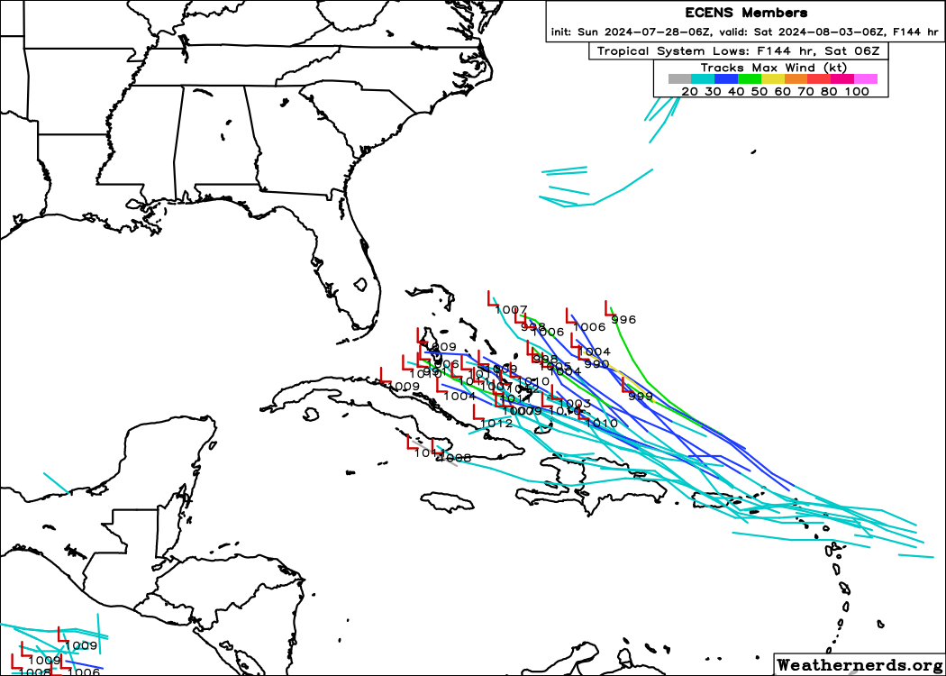
Beyond midweek there will be a little less dry air and slightly more favorable atmospheric conditions for development as it approaches the area between the Bahamas and the Florida Straits. Through hour 144 (Friday night), about half of the European ensemble’s 51 members develop this system into a formal low pressure, and none do so significantly.
So based on all this information we have, here’s what we can say about this tropical wave:
- Development should be slow to occur and probably wouldn’t even begin until very late in the week, if not the weekend.
- The wave should track generally harmlessly through the northeast Caribbean and end up somewhere between Cuba and east of the Bahamas by the weekend.
- Dry air is likely going to play a significant role in the development (or lack of development) of this wave.
- The 40 percent odds as posted by the NHC is a perfectly fine place to be right now.
Beyond the weekend, bets are off. We’ve seen some models track this toward the Southeast, some out to sea, and some not even develop the system at all. The GFS ensemble currently favors the latter outcome, with few to no ensemble members developing this. So for now, it’s just good to keep an eye on this one and wait and see. There’s clearly nothing here yet that is definitive, and there’s no reason to get too worked up about things right now. More to come.
Beyond this one, there are no specific signs of anything to follow. Perhaps after August 10th we’ll see our next potential candidate in the Atlantic.