Tropical Depression 10 expected to impact Florida as a hurricane on Tuesday or Wednesday

One-sentence summary

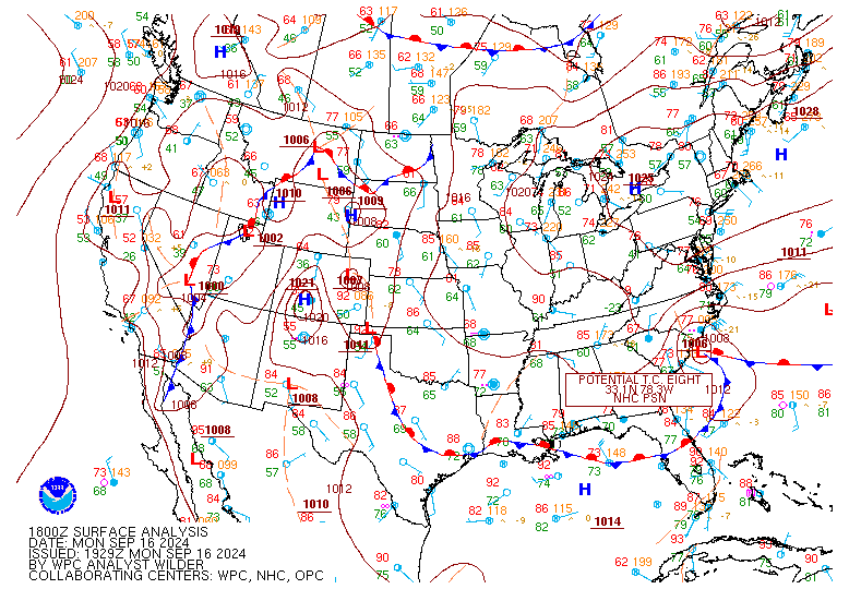
Invest 93L was upgraded to Tropical Depression 10 this afternoon, and it is likely to impact the west coast or Panhandle of Florida as a hurricane on Tuesday or Wednesday.

Tropical Depression 10

As of Saturday evening, Tropical Depression 10 was spinning in or just south of the Yucatan Channel and off the coast of the Yucatan.

Tropical Depression 10’s circulation is evident on satellite imagery. It is located just north of Cozumel and off the coast of Cancun in the Yucatan. (Tropical Tidbits)

TD 10 has a well defined center it appears and a pretty healthy circulation about it as it spins, mostly in place due to the absence of any real steering currents in this area. Heavy thunderstorms are displaced well east of the center over western Cuba and the Isle of Youth.

At present, we have tropical storm warnings from Rio Lagartos through Cancun and Cozumel south to Tulum on the Yucatan, and there are tropical storm watches in effect for the Isle of Youth and Pinar del Rio in Cuba. Warnings mean tropical storm conditions are likely, while watches mean they are possible. We are still a day or so away from watches being issued in Florida I believe.

Tropical Depression 10 should become a tropical storm tomorrow and a hurricane by Tuesday as it tracks generally northward. (NOAA NHC)

Tropical Depression 10 will stay in place much of tomorrow before drifting northward on Monday and then picking up the pace Tuesday. Broadly, it still is expected to track toward Florida, be it the Panhandle or the west coast. Modeling is focused on this tracking close to the NHC map above, near the Big Bend of Florida. However, given that there is a bit of uncertainty in terms of how the center behaves in the next day or two, everyone from the Alabama coast through the Keys and Cuba should be monitoring Tropical Depression 10’s progress. The next name on the list is Idalia.

In terms of intensity, the NHC forecast above explicitly shows a 75 mph category 1 storm heading into the Panhandle or Big Bend. However, there is reason to believe that modeling and forecasts may be somewhat underdone. Water temperatures along the path of TD 10 will be very, very warm and that warm water is very deep as well, so this will have much fuel to feed off of. If wind shear or dry air get involved, this could limit the storm’s intensity some, but probably not entirely. Land interaction is also a wild card over the next day or so near the Yucatan, so the intensity forecast is a bit uncertain. I would anticipate at least a low-end hurricane, however, on the Florida coast by Tuesday night or Wednesday morning.

Not all tropical models are made equal, but several of them are showing at least category 1, if not borderline category 2 intensity by the time it approaches the Florida coast. (Tomer Burg)

In addition to tropical impacts on the Florida coast, this is looking like a healthy rainmaker for Florida and the Southeast. Anywhere from 4 to 6 inches of rain are possible along and to the east of the path of TD 10 in Florida, and higher amounts are likely in some places depending on exactly how things play out. The rainfall distribution may change some once the storm ends up in the Southeast, with a widespread heavy rain possible, if not likely for parts of Georgia and the Carolinas. Details on this will get ironed out in the coming days.

Very heavy rain is expected along and to the east of of TD 10’s track in Florida, with more widespread rain expanding across the Southeast once it moves inland. This is a good opening forecast, but I would anticipate changes, with locally higher amounts embedded in the days ahead. (Pivotal Weather)

Again, like much of everything regarding TD 10, you can anticipate forecast changes to the above map.

The bottom line:

  • Tropical Depression 10 is forecast to impact the Florida Panhandle, Big Bend, or west coast as a hurricane this coming week.
  • The intensity of TD 10 at landfall is highly uncertain, but folks in Florida in the cone should be preparing for at least category 1 type hurricane impacts.
  • The exact landfall and track remain uncertain.
  • Heavy rain will likely follow TD 10 northward, potentially leading to some flooding issues in parts of the Southeast from Florida into Georgia and the Carolinas.

We will have another update on Tropical Depression 10 and the rest of the tropics by about midday Eastern time on Sunday.

Florida will want to closely watch Invest 93L as it evolves this weekend with impacts there around midweek

One-sentence summary

Invest 93L near the Yucatan is expected to develop and intensify over the coming days before lifting north or northeast toward Florida on Tuesday or Wednesday, and all interests on Florida’s west coast and Panhandle should monitor the situation.

Invest 93L should be watched on Florida’s west coast & Panhandle

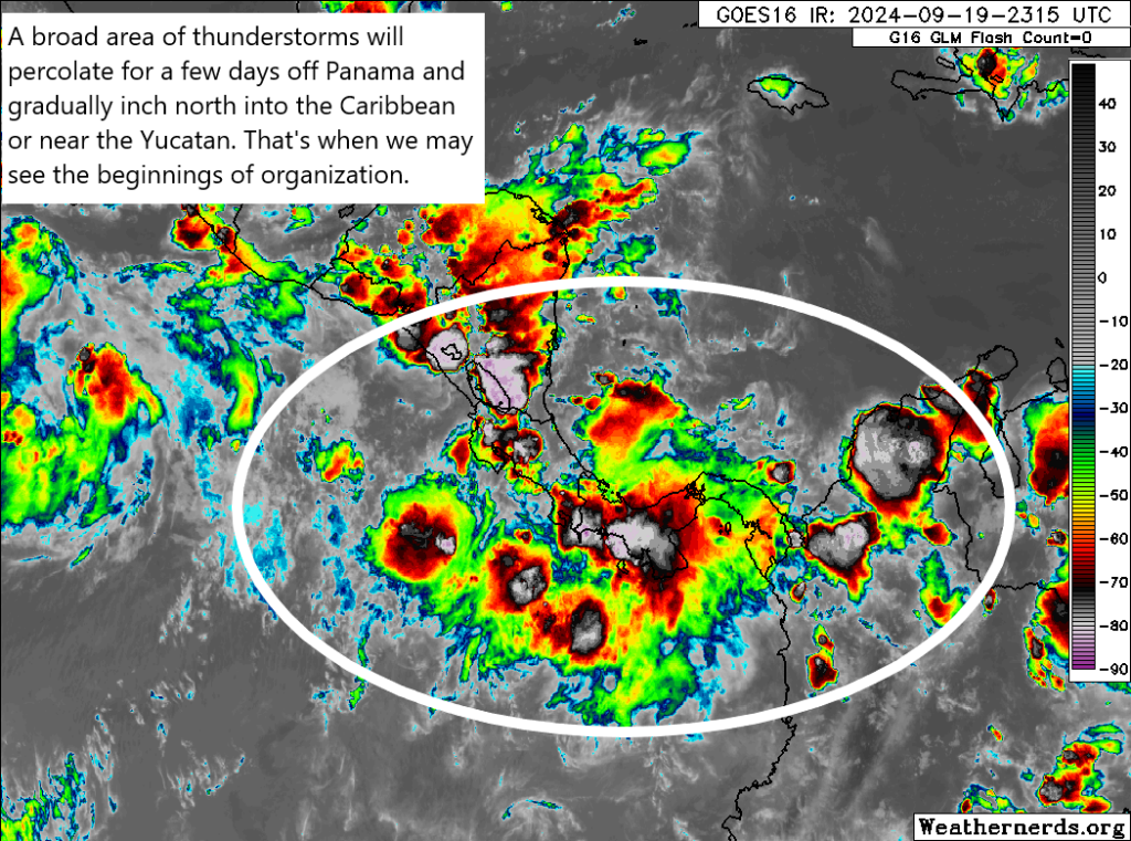
Yesterday afternoon, the tropical disturbance near the Yucatan was dubbed Invest 93L, allowing meteorologists to access some new details and information on the progress of this system. This morning, Invest 93L looks disorganized but coherent near the Yucatan.

Invest 93L looks coherent this morning near or just off the Yucatan, but it still lacks organization. That may change later today or tomorrow. (Weathernerds.org)

There’s no true low-level center yet it seems, but there’s enough thunderstorm activity over the Yucatan Channel off the coast to have me at least slightly concerned we could see development start sooner than later. At the moment, 93L is in a decent spot for development, with its proximity to land being the only real inhibiting factor. Over the next few days, this environment should remain fairly healthy for organization. If this can get off the ground later today or tomorrow, it will have a chance to become a formidable system as it comes northward. One big reason why? Water temperatures. All summer we have discussed how warm the Gulf is, and this remains the case today.

As 93L comes north, it will have this water to utilize for strengthening. We need more than warm water for tropical systems, but this is a key ingredient. If it becomes an organized entity sooner than later, there’s a chance it will be able to more effectively use this warm water. If it stays disheveled coming north, it may not be able to use this as considerably. That’s why the next 36 hours or so are important.

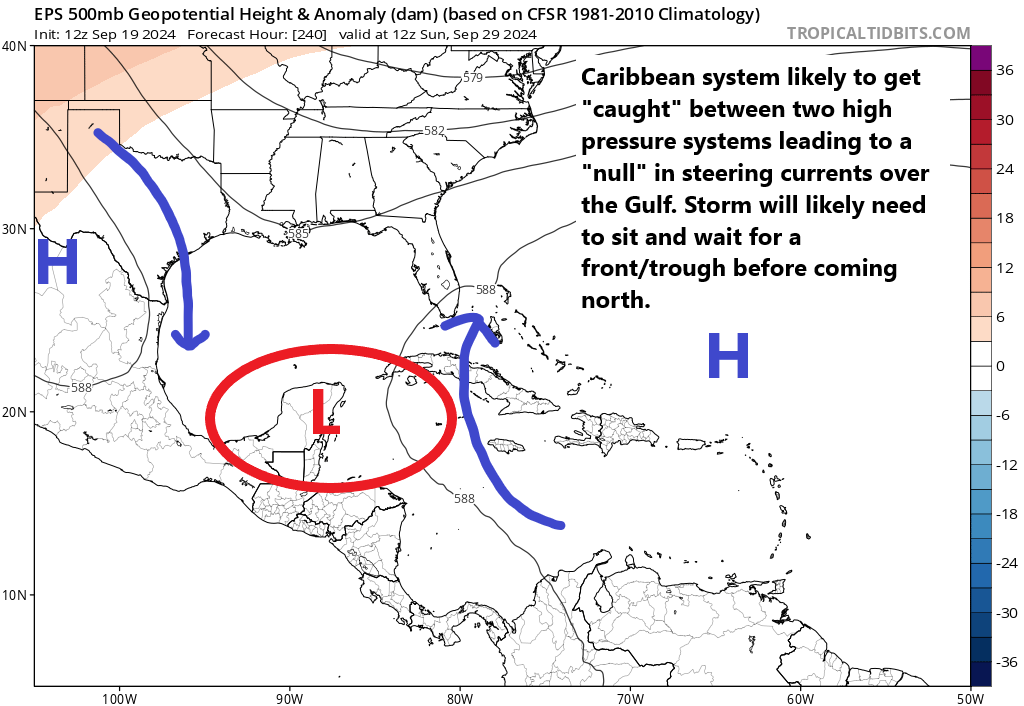
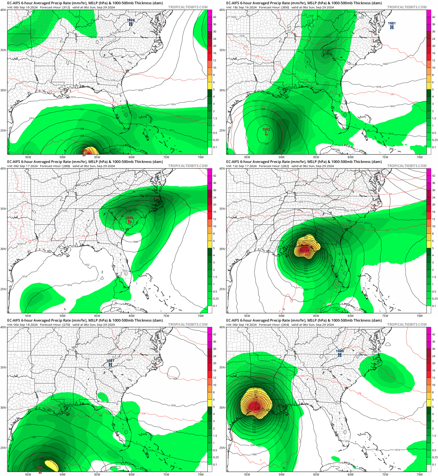
In terms of track, Invest 93L will basically just percolate for the next 36-48 hours off the Yucatan. There’s nothing right now to really move it along. So that’s one reason we’re concerned about strengthening. By the time we get to Monday and Tuesday, it will finally get a push north and, broadly, it will move north or north-northeast toward Florida.

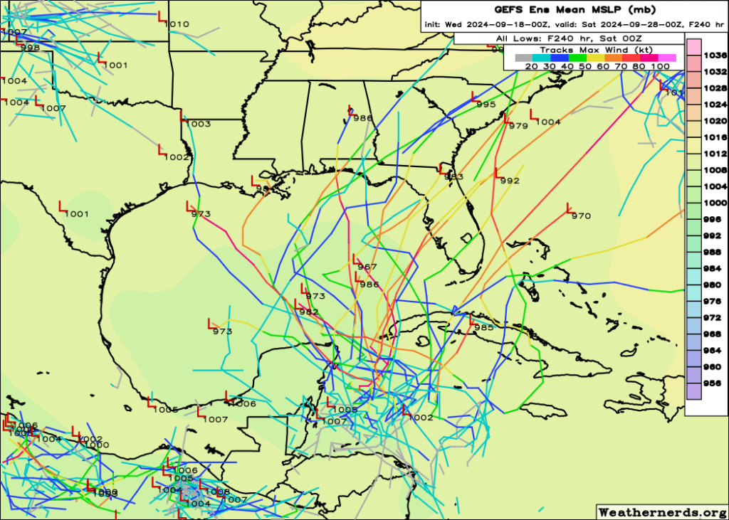
A look at all the ensembles over the next several days and where 93L may track shows the highest current odds are leaning toward the eastern Panhandle or Big Bend, but all interests between SW Florida and Mobile, AL should be watching 93L’s progress. (Tomer Burg)

The current highest odds aim toward the Big Bend region of Florida or toward Apalachee Bay. However this is going to likely maneuver around some in the coming days as we see what 93L’s intensity does.

So we don’t know a whole lot other than, broadly, what 93L should do: Steadily strengthen and work toward the west coast or Panhandle heading into next week. What we do know is that 93L looks coherent this morning, it’s over some of the warmest, deepest warm water in the Atlantic Basin in and environment that should be conducive for strengthening if it can avoid too much land interaction. I am a bit less skeptical of this system today, and it really does bear close watching for anyone on the west coast or Panhandle of Florida. Interests in western Cuba as well as the Mobile/Pensacola area should also be keeping an eye on this one as well. We’ll see how things go today and have more either later or on Sunday morning.

Quick note: We know some people have travel in or will be traveling to Cancun or Cozumel or in this general area. No serious impacts are currently expected there beyond rough surf and some added rain. If, however, 93L can catch a heater and develop quickly, some more impacts may occur on the immediate coast. We’ll keep tabs.

Hurricane Franklin

Franklin just became the second hurricane of the 2023 season this morning. Since yesterday, it has gotten its act together quite nicely.

Hurricane Franklin will turn northwest today and eventually north, pass west of Bermuda, and then clip Newfoundland on its way out to sea. (Tropical Tidbits)

Franklin has 75 mph winds and is moving north-northwest around 7 mph. Franklin should pass comfortably west of Bermuda before turning back northeast. As it turns out to sea, there is still some chance it clips Newfoundland on the way out, so interests there should monitor Franklin’s progress over the next 2 to 3 days.

Franklin is expected to become a major hurricane as it passes southwest of Bermuda, but other than perhaps clipping Newfoundland on the way out to sea, no land impacts are expected. (NHC)

Franklin should become a major hurricane tomorrow or Monday as it passes southwest of Bermuda. No direct land impacts are expected from Franklin, but rough surf and rip currents are likely along the East Coast and in Bermuda this week as Franklin passes offshore. Please use caution if you’re getting a jump start on Labor Day Weekend.

Otherwise, we’re good for now, and the majority of our attention will remain on the eastern Gulf of Mexico. More later or tomorrow. Check our social sites for a video update later today.

Facebook
Instagram
TikTok
Twitter
Threads
Bluesky
Mastodon

August 25, 2023 Outlook: Continued signs of development next week in the eastern Gulf of Mexico

One-sentence summary

We continue to expect a system to try and develop in the eastern Gulf of Mexico next week, but it will face some difficulties getting there.

Gulf development chances

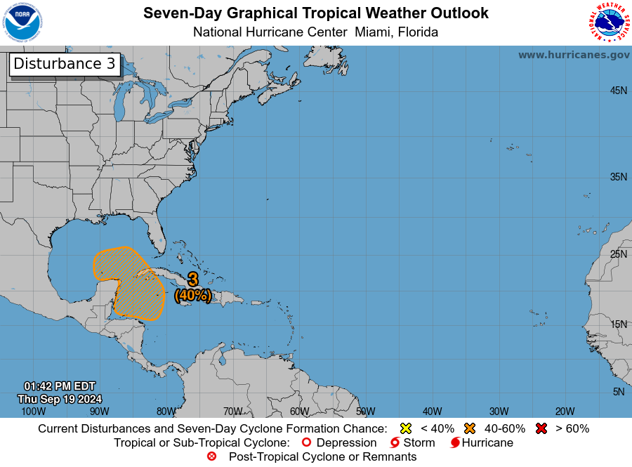
The National Hurricane Center is now giving the area that’s predicted to form in the northwest Caribbean or Gulf next week about 70 percent odds of development today.

Odds of development are 70 percent now for next week’s Gulf disturbance. (NOAA NHC)

We are beginning to see a little model consensus today on this area. What are we seeing? A quick moving system that form off the Yucatan next Tuesday-ish and comes north toward the Panhandle or west coast of Florida by Wednesday. I think there are some notable questions beyond that for folks on the East Coast, whether this system goes up the coast or hooks a right out to sea. At this point, it seems like it will turn out to sea off the Carolinas, though it may sit offshore for a few days. We’ll see about that. But in terms of the first phase (a generally modest tropical system heading toward Florida), that seems to be the preferred forecast solution right now.

Much like Harold, this system will probably move fairly quickly, so it may only get 48 hours or so over water. Granted, it’s extremely warm water, but there are three issues. First, that limited time over water. Second, there will be dry air (and potentially a lot of dry air) in the vicinity of the system as it moves into the northeast Gulf. Tropical systems do not like dry air, as they can disrupt intensification and organization, especially early on. Last, wind shear is not expected to be completely shut down, so this will also be battling a bit of that as well.

The European model forecast for mid-level relative humidity shows dry air on all sides of this system, something it will have a difficult time completely avoiding. (Tropical Tidbits)

The combination of all these factors may (should?) help cap the intensity potential of this system and hopefully keep it a disorganized, steady moving rainmaker for parts of Florida and the Southeast. Given that we still have about 5 days or so before this really starts organizing, we should obviously keep an eye on it for these areas. But our initial read on this one has us optimistic it will not be a very serious storm. We’ll keep you updated this weekend.

Tropical Storm Franklin

Meanwhile, out in the Atlantic, Tropical Storm Franklin continues to struggle with substantial wind shear.

Despite a healthy looking area of thunderstorms on satellite, Franklin’s center is located much farther away, indicating that this is a heavily sheared and generally unhealthy system. (Weathernerds.org)

If you look closely enough, you can actually see the wind shear impacting Franklin. Despite a robust area of thunderstorms north of Puerto Rico, the center is almost completely exposed on the northwest side of all this. In other words, this is not a healthy storm. Franklin is expected to continue dealing with this shear today and tomorrow before things relax. Thereafter, it will have a chance to become our second hurricane of the season.

(NOAA NHC)

Franklin will continue to fester into tomorrow before turning back northwest, passing west of Bermuda and heading off to the northeast next week. Folks in Atlantic Canada will want to continue monitoring Franklin’s forecast, particularly in Newfoundland I think. Though Franklin is expected to weaken as it comes north, there is still some uncertainty on the exact track and intensity of it as it comes that way.

Elsewhere

Emily’s remnants are now *not* expected to develop, with odds down to 20 percent. Invest 92L still has about a 50/50 shot at development. Neither will impact land. Heading deeper into next week, we do not see anything of any real concern or note. We’ll see if any signals start showing up, but for now, it seems as if we are and remain in a fairly hostile pattern for healthy tropical systems. Good news in most cases.

August 24, 2023 Outlook: Franklin drifts north, while eastern Gulf development odds increase

One-sentence summary

While the Gulf or northwest Caribbean may see action next week, Tropical Storm Franklin is on its way away from the Caribbean islands and will meander north over the next few days.

Tropical Storm Franklin maneuvering north

Franklin has exited Hispaniola and is on its way north today. It is slowly trying to get its act together.

Franklin has moved north of the islands and will slowly gain strength in the coming days. (Tropical Tidbits)

Maximum sustained winds are 50 mph, and you can see from satellite that there’s a pretty healthy burst of convection (or thunderstorms) indicated by the deep red cloud tops showing up north of Hispaniola. That said, Franklin is not yet really organized, as almost all of these thunderstorms are to the east of the center of circulation.

Franklin will drift northeast over the next few days before being shunted back to the west a bit. It may

Franklin’s track is interesting but makes meteorological sense. It will continue north and turn northeast, but as high pressure builds west a little over the Central Atlantic, Franklin will slow down and turn back northwest or north, before continuing north and northeast and eventually out of the picture. The challenge regarding Franklin is that exactly where this maneuvering occurs will determine what sort of impacts are experienced on Bermuda — and for that matter, Atlantic Canada. Model consensus overnight shifted Franklin’s track a little farther west; good news for Bermuda. Folks in the Maritimes will want to monitor Franklin’s progress as it comes north next week. Anyone on the East Coast should probably expect a bit of rough surf and rip currents to become an issue later this weekend or next week as well.

We’ve seen most storms struggle this year, and Franklin has been no exception to date, but as we go into the next few days, Franklin should find a more hospitable environment in which to organize, which should lead to it becoming the season’s second hurricane.

Gulf & western Caribbean mischief

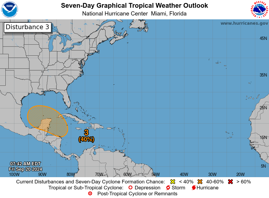
Yesterday evening, the National Hurricane Center dropped a lemon (20% development odds) on the map for the potential of development in or near the Gulf of Mexico next week. Today, that’s an orange, with a 50 percent chance of development over the next week.

The National Hurricane Center now gives the Gulf area a 50 percent chance of development over the next week. Keep in mind that the “hatched” area on the map above indicates where a system may form, not where it will track. (NOAA NHC)

As noted in the caption, it’s important to remember that when the NHC posts these hatched development regions, they are showing what region they believe a system may form, not where it will track.

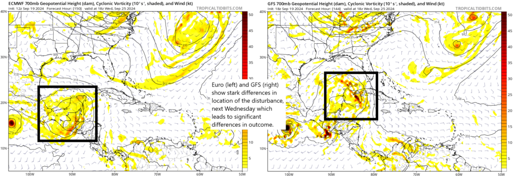
Models have been oscillating back and forth on this area for days now. The overnight GFS operational run delivered a sheared, disorganized batch of moisture to Cuba and Florida. No organization. The overnight operational European model brought a tropical storm-type system north of Tampa.

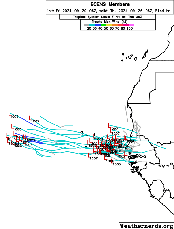
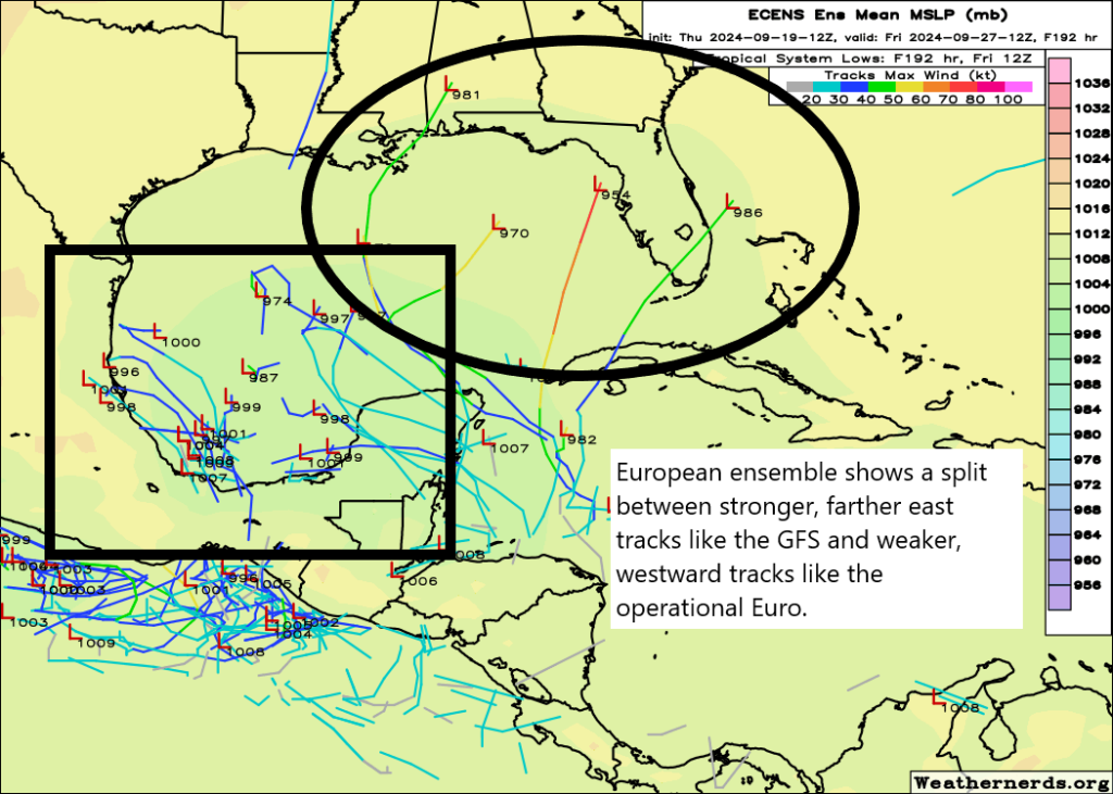
A look at the ensembles this morning shows some decent consensus that is not that different from the operational guidance: The GFS ensemble is unenthused overall, while the European ensemble is excited, though generally low-end on intensity. Remember, ensembles run each model 30 to 50 different times with some tweaks to produce a more realistic “spread” of outcomes. We need them because single deterministic (operational) models give us no real forecast uncertainty gauge. You need that, especially with tropical storms. The map below shows the two ensemble groupings and their spreads so you can get a sense of what we’re looking at.

A look at the two ensemble spreads for next Wednesday evening shows that most GFS ensemble members (right) struggle to develop this, while most European ensemble members develop it in some capacity, though they disagree on intensity and obviously the exact track. (Weathernerds.org)

Based on those maps, what we see in operational guidance, and what we know about the Gulf and northwest Caribbean, what can we say today?

Well, for one, we are fairly confident that whatever happens will track north and/or northeast. The weather pattern next week favors west to east or south to north moving winds over most of the central and eastern Gulf of Mexico. This should steer whatever develops (if anything) to the north and/or the northeast. So for folks in Texas and Mexico outside the Yucatan, keep tabs, but this is probably not going to be a big concern. For folks from eastern Louisiana eastward and especially in Florida, it is a good idea to continue watching. Perhaps it’s just an uptick of rain chances instead of an organized tropical system that you see next week, but it’s far too early to say which outcome is more likely right now. We will keep you posted.

Elsewhere

The good news is that there are no other items of concern for land anywhere on the board right now. Emily’s remnants continue to look likely to regenerate into a tropical storm over the open Atlantic, west of the Azores. Invest 92L still has an outside shot at developing over the next 5 to 7 days.