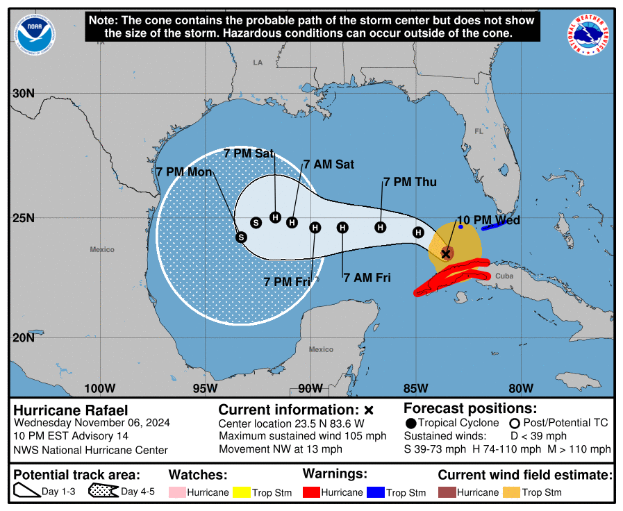
Hurricane Rafael hammered Cuba earlier on Wednesday, and it is now on its way west across the Gulf of Mexico.
There have been significant forecast changes since yesterday, and it now appears we have two very distinct camps regarding Rafael’s future. Camp 1 takes Rafael northward toward the central Gulf Coast by next week or meanders it in the northern Gulf. Camp 2 takes Rafael west and then southwest around the periphery of a ridge of high pressure over Florida and the Deep South.

It is too early to know which camp is correct, but clearly the NHC forecast near the top of this post is on board with something more like the second camp.
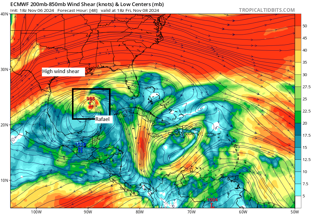
The good news is that there seems to be a clear signal in modeling that the storm will weaken as it transits the Gulf. This is not August. It’s November, and although the waters remain fairly warm, the reality is that wind shear and dry air usually play a big role in November storms. This case should be no different.

This should allow Rafael to begin to wind down after Thursday, slowly weakening back to category 1 strength and then tropical storm strength this weekend.
From that point of view, any threats to land from here seem limited. However, folks in Mexico and on the central Gulf Coast should continue to watch Rafael’s progress to see if anything changes.
Apologies for the extremely late update on Rafael today. A sick kid and a day full of obligations will do it!
Valdosta flood emergency
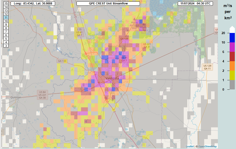
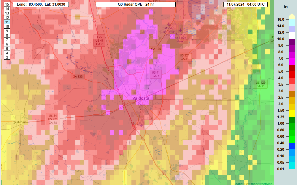
The Valdosta/Lowndes County area of Georgia is being blasted by rainfall this evening with a flash flood emergency in effect. Streamflow values are extreme right now over Valdosta itself.

Return periods on some these rainfall values are in the 250 year or higher range, meaning this is an exceptional event for Valdosta. Rain totals are in the 6 to 10 inch range as estimated by radar for Valdosta today.
We have been warning of potentially localized flash flooding in Georgia or South Carolina for a couple days now, and that’s indeed what has happened. Numerous other flash flood warnings are in effect across the region, including some serious ones not far from Valdosta right now also. Thankfully, the rains should hopefully wind down in the next 2 to 4 hours.


Define ” a bit ” .
Is there a Houston scenario where it sits in the western Gulf then comes here?
The 9pm (Central) spaghetti models on tropicaltidbits-dot-com imply that it would be difficult to produce that scenario. Apparently high pressure and wind shear are still in convenient places for us too (spaghettimodels-dot-com).
Hey, it’s @Matt J, my favourite weather troll. Where ya been, buddy?
(BTW, your question has already been addressed in previous posts, but you already knew that, didn’t you?)
Oops, didn’t mean to step into anything. Have a great evening you guys.
Matt Lanza will you still be operating this website with your new job?